 Block
Martinsville, Indiana
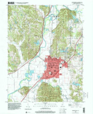
18 topographic sheets cover this place, the earliest surveyed in 1942 and the latest in 1998. It stands in Washington Township. It lies in ZIP code area 46151. It lies near Lincoln Hill. The Survey maps it on the Martinsville quadrangle. 11,932 people lived here at the 2020 count. It stands 604 feet above sea level.
Research this city
On record in Martinsville
Buildings and businesses the archive holds for this place. Each opens its own page, with the source record it came from.
On the National Register 12 of 17 shown
 Blackstone House and Martinsville Telephone Company Buildinglisted 1997
 Bradford Estatelisted 1989
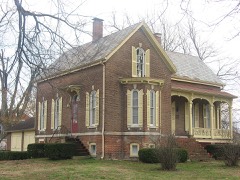 Crawford-Gilpin Houselisted 2008
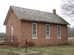 Cross Schoollisted 1983
 East Washington Street Historic Districtlisted 1997
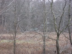 Elm Spring Farmlisted 2001
 Grassyfork Fisheries Farm No. 1listed 2012
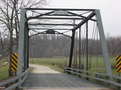 Lamb's Creek Bridgelisted 2000
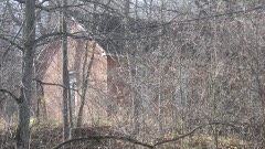 Long Schoolhouselisted 1999
 Martinsville Commercial Historic Districtlisted 1998
 Martinsville High School Gymnasiumlisted 1981
 Martinsville Northside Historic Districtlisted 1997
Population over time
2 figuresMartinsville grew from 11,828 to 11,932 between 2010 and 2020. These are the recorded population figures Wikidata holds for this place, reached through the Geographic Names Information System number this page is keyed on rather than by name, so they belong to this place and not to another of the same name. Most are census counts, but not all are: an early figure may be a founding or settlement estimate, and an estimate published within five years of a census is left out. The change column is computed, and is left blank where more than 20 years separate a figure from the one before it, because a gap that long is not a change between two counts.
| Year | People | Change |
|---|---|---|
| 2010 | 11,828 | |
| 2020 | 11,932 | +104 (+1%) |
Topographic sheets covering this place
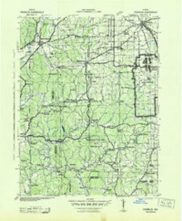
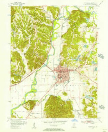
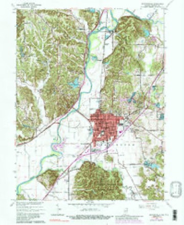
9 surveys from 18 printed sheetsMatched by testing this settlement's coordinate against the published boundary of every sheet in the United States Geological Survey's historical collection. Each opens the scanned sheet at the Survey.
- 1942 USGS Franklin quadrangle1:125000
- 1953 USGS Indianapolis quadrangle1:250000, 4 printings
- 1955 USGS Martinsville quadrangle1:24000
- 1956 USGS Indianapolis quadrangle1:250000
- 1957 USGS Indianapolis quadrangle1:250000, 2 printings
- 1962 USGS Indianapolis quadrangle1:250000
- 1965 USGS Martinsville quadrangle1:24000, 4 printings
- 1986 USGS Bloomington quadrangle1:100000, 3 printings
- 1998 USGS Martinsville quadrangle1:24000





In the county-history sources
36,316 words on this townshipCounties of Morgan, Monroe, and Brown, Indiana. Historical and Biographical, published 1884 names this settlement in its chapter on Washington Township. These are the passages that mention it, exactly as the scans read.
Two villages have been founded in Washington Township : The first, Wayport, was laid out on Sections 28 and 33, in April, 1851, by Isaac Gillaspy, Thomas Gillaspy and G. W. Smith, proprietors, and James Washburn, surveyor. Sixteen lots were laid out. One store, a blacksmith shop, a post office, etc., sum up the history of the town. Hindo- Btan was laid out in June, 1853, on the northeast quarter of the northeast quarter of Section 14, by Charles G. Gorr, proprietor, and James Woodbum, surveyor. Twelve lots were laid out on the Martinsville & Bloomington State Road, and just north of the Columbus & Gosport State Road. One store, a few shops and offices also sums up the importance of this little hamlet.
Passage source: Counties of Morgan, Monroe, and Brown, Indiana. Historical and Biographical, published 1884.
Machine-read from a century-old scan, so expect the errors a machine makes: misspelled names, dropped words, stray characters.
Mines and quarries near this place
9 within 5 milesRegional context, not property-specific evidence. The federal mineral resources record lists 9 workings within 5 miles of Martinsville: 5 past producers, 4 producers. 4 still produce. What was taken out: Sand and Gravel, Construction, Fire Clay (Refractory), Clay, Stone, Clay. Distance is straight-line from the map coordinates, so a quarry counted here may appear on a neighbouring settlement's page as well.
| Where | Site | Commodity | Status | Recorded |
|---|---|---|---|---|
| Cardinal Clay Products Inc. | Clay | Producer | ||
| Martinsville Mine | Clay, Stone | Producer | ||
| Martinsville Brick Plant | Fire Clay (Refractory) | Past Producer | ||
| Martinsville Plant | Fire Clay (Refractory) | Past Producer | ||
| Thomas Moulding Plant | Fire Clay (Refractory) | Past Producer | ||
| Jones Sand and Gravel Pit | Sand and Gravel, Construction | Past Producer | ||
| Martinsville Aggregate Dredge | Sand and Gravel, Construction | Past Producer | ||
| Morgan Co. Hwy. Dept. | Sand and Gravel, Construction | Producer | ||
| Morgan County Plant | Sand and Gravel, Construction | Producer |
Storms near this place
60 of 106 shownRegional context, not property-specific evidence. The National Weather Service names Martinsville in 106 storm reports between 1993 and 2026: 55 thunderstorm wind, 30 hail, 10 flash flood, 4 lightning. The reports record 28 injuries. Each account below is quoted exactly as the forecast office filed it, from the NOAA Storm Events Database, and each date opens the federal record of that event.
| When | Event | Place named | Harm | What the report says |
|---|---|---|---|---|
| September 2002 | Tornado (F3) | Martinsville | 28 hurt, $15,000,000 | no account filed |
| July 2004 | Lightning | Martinsville | $500,000 | A business was destroyed by a lightning induced fire. |
| January 2008 | Thunderstorm Wind | Martinsville | $350,000 | A large section of the roof on the county courthouse was blown off due to damaging thunderstorm winds. Some of the brick walls were knocked loose and some of the support trusses were also damaged. |
| June 2023 | Thunderstorm Wind | Martinsville | $250,000 | Numerous trees and powerlines downed by thunderstorm wind gusts. Over 6000 power outages were caused by this storm. |
| June 2008 | Flash Flood | Martinsville | $200,000 | Martinsville had hundreds of homes flooded due to heavy rain that caused flash flooding. Railroad tracks were washed out near Paragon. |
| September 2005 | Flash Flood | Martinsville | $100,000 | Heavy rain of 3 to 5 inches from slow-moving thunderstorms over Morgan County caused flash flooding over Centerton and Blue Bluff Roads near Martinsville. The heavy rain caused mudslides in at least two locations on Blue Bluff Road. One mudslide occurred near a home, damaging two vehicles. Damage amounts are estimated. |
| December 1998 | Thunderstorm Wind | Martinsville | $100,000 | A roof was blown off a Super 8 Motel along State Road 37 on the south side of Martinsville. Also, a sign was blown off a pizza parlor damaging 30 autoimobiles at an auto dealership. Winds were estimated at 70 mph. |
| August 2000 | Lightning | Martinsville | $100,000 | no account filed |
| December 2013 | Flash Flood | Martinsville | $50,000 | Seventeen homes were reported to have been evacuated in Martinsville. |
| June 2010 | Thunderstorm Wind | Martinsville | $50,000 | Trees were reported down on multiple homes in the Lake Edgewood area due to thunderstorm downburst winds. Multiple large trees were uprooted as well. |
| June 2008 | Flash Flood | Martinsville | $30,000 | At least one home was damaged on Blue Bluff Road north of Martinsville when flash flooding triggered a mudslide. |
| June 2008 | Flash Flood | Martinsville | $20,000 | Water rescues were undertaken near State Road 37 and Liberty Church Road due to flash flooding caused by heavy rainfall. State Road 67 was also flooded. |
| June 2008 | Flash Flood | Martinsville | $20,000 | Washington Township Fire Department reported multiple water rescues from rising streams and water over the roadways. This flash flooding was due to extremely heavy rainfall. |
| May 2022 | Thunderstorm Wind | Martinsville | $15,000 | Thunderstorm winds downed trees and large branches in the Martinsville area, including a tree onto a house. |
| September 2014 | Thunderstorm Wind | Martinsville | $15,000 | Several power poles were snapped and power lines were down along the State Route 39 Bypass in Martinsville due to damaging thunderstorm wind gusts. Numerous trees were also reported down on county roads between Paragon and Martinsville. |
| June 2010 | Thunderstorm Wind | Martinsville | $15,000 | Several trees were reported down at 1949 and 1959 Bluebluff Road due to thunderstorm downburst winds. |
| January 2008 | Thunderstorm Wind | Martinsville | $15,000 | A metal building was blown down due to damaging thunderstorm winds. |
| April 2000 | Thunderstorm Wind | Martinsville | $15,000 | no account filed |
| January 2008 | Thunderstorm Wind | Martinsville | $12,000 | Half of the roof of an apartment building was blown off due to damaging thunderstorm winds. Trees were also reported down in the area. |
| January 2008 | Thunderstorm Wind | Martinsville | $12,000 | A semi was blown over on the Indiana 39 Bypass just south of West Morgan Street due to damaging thunderstorm winds. |
| July 2015 | Thunderstorm Wind | Martinsville | $10,000 | Power lines and numerous trees were down due to damaging thunderstorm wind gusts. |
| January 2008 | Thunderstorm Wind | Martinsville | $10,000 | A garage was blown down due to damaging thunderstorm winds. |
| June 2010 | Thunderstorm Wind | Martinsville | $6,000 | A half dozen, 6 to 8 inch diameter trees were reported down due to damaging thunderstorm wind gusts. |
| April 2015 | Thunderstorm Wind | Martinsville | $5,000 | A few trees were downed on to power lines in and around Martinsville due to damaging thunderstorm wind gusts and saturated ground. |
| January 2008 | Thunderstorm Wind | Martinsville | $5,000 | Metal signs along the Indiana 39 Bypass were destroyed due to damaging thunderstorm winds. |
| June 2008 | Flash Flood | Martinsville | $5,000 | Roadways were covered and previous flooding conditions were exacerbated due to heavy rainfall that caused renewed flash flooding. |
| June 2008 | Flash Flood | Martinsville | $5,000 | Roadways were covered and previous flooding conditions were exacerbated due to heavy rainfall that caused renewed flash flooding. |
| August 2000 | Lightning | Martinsville | $5,000 | no account filed |
| June 1998 | Thunderstorm Wind | Martinsville | $5,000 | no account filed |
| June 2025 | Thunderstorm Wind | Martinsville | $2,000 | Trained spotter estimated thunderstorm wind gusts around 60 mph. Thunderstorm wind gusts downed 8.5 inch diameter tree limbs. |
| July 2020 | Thunderstorm Wind | Martinsville | $2,000 | Trees downed across the road due to thunderstorm wind gusts. |
| January 2008 | Thunderstorm Wind | Martinsville | $2,000 | Minor damage occurred to the roof and a window at a church due to damaging thunderstorm winds. |
| June 1995 | Thunderstorm Wind | Martinsville | $2,000 | Trees and power lines were downed. |
| May 2011 | Thunderstorm Wind | Martinsville | $1,500 | Power lines were downed near the intersection of Cherry and Mitchell Streets due to damaging thunderstorm wind gusts. |
| July 2023 | Thunderstorm Wind | Martinsville | $1,000 | Thunderstorm winds downed a tree at 240 East Pike Street. |
| June 2013 | Thunderstorm Wind | Martinsville | $1,000 | A large tree split and was blown down possibly due to damaging thunderstorm wind gusts. May have been due to lightning. |
| July 2006 | Thunderstorm Wind | Martinsville | $1,000 | Power lines were downed. |
| July 2017 | Flood | Martinsville | $750 | The Martinsville High School parking lot was flooded due to heavy rainfall. Ditches along Highway 37 were full to road level. Other roadways in town were also flooded. |
| June 2015 | Thunderstorm Wind | Martinsville | $750 | An eight-inch diameter tree was broken due to thunderstorm wind gusts estimated at 60 mph. |
| June 2010 | Thunderstorm Wind | Martinsville | $250 | An 8-inch tree limb was reported down in the downtown area of Martinsville. |
| March 2026 | Thunderstorm Wind | Martinsville | - | A 59 mph thunderstorm wind gust was measured at this location. |
| April 2026 | Thunderstorm Wind | Martinsville | - | A 61 mph thunderstorm wind gust was measured by the public. |
| April 2025 | Thunderstorm Wind | Martinsville | - | A 65 mph thunderstorm wind gust was measured at this location. |
| April 2017 | Hail | Martinsville | - | This report originated from a TV viewer. |
| May 2017 | Thunderstorm Wind | Martinsville | - | Thunderstorm wind gusts in this location was estimated at 60-plus mph. |
| July 2015 | Thunderstorm Wind | Martinsville | - | An estimated 60 mph thunderstorm wind gust was observed in this location. |
| May 2009 | Flood | Martinsville | - | Lowland flooding occurred along the White River in/near Centerton, Indiana. The river crested 2.4 feet above flood stage on May 14th at a reading of 14.4 feet. Damage costs are grossly estimated. |
| July 2008 | Thunderstorm Wind | Martinsville | - | Trees were blown down by thunderstorm winds at scattered locations around the county. |
| July 2008 | Thunderstorm Wind | Martinsville | - | Trees were blown down by thunderstorm winds over a large part of the county. |
| June 2008 | Heavy Rain | Martinsville | - | Measured rainfall of 6.52 inches was reported. |
| June 2008 | Heavy Rain | Martinsville | - | Measured rainfall of 8.80 inches was reported. |
| June 2008 | Thunderstorm Wind | Martinsville | - | Three to six inch tree limbs were down near Browns Crossing due to damaging thunderstorm winds. |
| June 2008 | Heavy Rain | Martinsville | - | Measured rainfall of 6.10 inches was reported. |
| July 2008 | Thunderstorm Wind | Martinsville | - | Thunderstorm winds blew down numerous trees countywide, including on Musgrave Road, Big Bend, Crooked Creek, and Abraham Road. |
| July 2008 | Thunderstorm Wind | Martinsville | - | Thunderstorm winds blew down multiple trees and branches. |
| June 2008 | Thunderstorm Wind | Martinsville | - | A large tree limb was down due to damaging thunderstorm winds. |
| April 2007 | Thunderstorm Wind | Martinsville | - | Trees were reported down due to damaging thunderstorm winds. |
| June 2006 | Thunderstorm Wind | Martinsville | - | Trees were downed. |
| May 2006 | Thunderstorm Wind | Martinsville | - | A large tree was downed. |
| May 2005 | Flash Flood | Martinsville | - | Sater Ditch in Martinsville flooded, spilling onto roadways in Martinsville and threatening three homes, one of which had to be sandbagged. |
Nearest settlements
The eight closest, with where each one stands in the county. Distances are straight-line, computed from the Geographic Names Information System coordinates.
| Map | Place | Distance | Sheets |
|---|---|---|---|
| Elk | 1.2 miles | 18 | |
| McDaniel | 1.3 miles | 18 | |
| Champlin Meadows | 1.5 miles | 18 | |
| Laveianan Court | 1.5 miles | 18 | |
| Fewell Rhoades | 1.6 miles | 18 | |
| Wolff | 1.8 miles | 18 | |
| Woodcrest | 1.9 miles | 18 | |
| Shelburne | 2.0 miles | 18 |
Elsewhere
Matched on this settlement's Geographic Names Information System number rather than its name, so it cannot be a different place of the same name in another state.
| Wikipedia article on Martinsville | An encyclopaedic summary. Its text is share-alike, so it is linked here rather than copied. |
| Wikidata item Q1077102 | The structured record the population and elevation above come from. Public domain (CC0). |
Provenance
This settlement is recorded in the Geographic Names Information System as feature 438684. The sheet list is computed by point-in-boundary test against the United States Geological Survey's historical topographic inventory. Both are works of the United States government and carry no copyright under 17 U.S.C. 105.
Mines and quarries. USGS Mineral Resources Data System (MRDS) https://mrdata.usgs.gov/mrds/ A work of the United States government, no copyright under 17 U.S.C. 105.
Storms. NOAA National Centers for Environmental Information, Storm Events Database https://www.ncei.noaa.gov/stormevents/ A work of the United States government, no copyright under 17 U.S.C. 105. Narratives are quoted verbatim from the National Weather Service report and are not edited or summarised.