 Block
Merrillville, Indiana
14 topographic sheets cover this place, the earliest surveyed in 1953 and the latest in 1992. It stands in Ross Township. It lies in ZIP code area 46410. The Survey maps it on the Crown Point quadrangle.
On record in Merrillville
Buildings and businesses the archive holds for this place. Each opens its own page, with the source record it came from.
On the National Register 2 records
 Morgan-Skinner-Boyd Homesteadlisted 2010
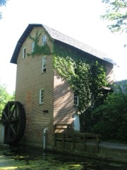 John Wood Old Milllisted 1975
Topographic sheets covering this place
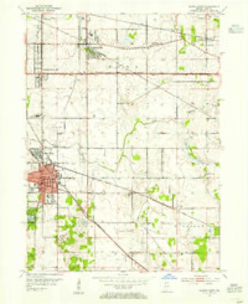
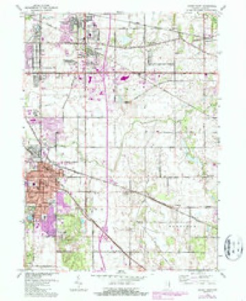
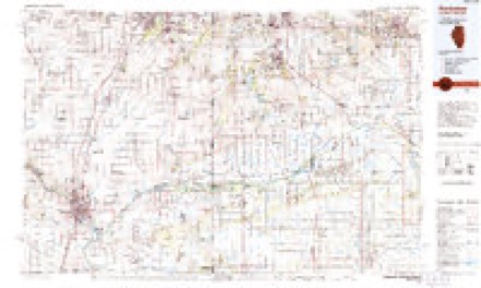
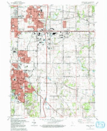
7 surveys from 14 printed sheetsMatched by testing this settlement's coordinate against the published boundary of every sheet in the United States Geological Survey's historical collection. Each opens the scanned sheet at the Survey.
- 1953 USGS Chicago quadrangle1:250000, 5 printings
- 1953 USGS Crown Point quadrangle1:24000
- 1957 USGS Chicago quadrangle1:250000
- 1962 USGS Crown Point quadrangle1:24000, 4 printings
- 1984 USGS Kankakee quadrangle1:100000
- 1991 USGS Kankakee quadrangle1:100000
- 1992 USGS Crown Point quadrangle1:24000


Fires near this place
5 since 2001Regional context, not property-specific evidence. The federal wildfire occurrence database lists 5 fires within 5 miles of Merrillville between 2001 and 2020, burning about 32 acres in total. None started naturally. None was recorded as arson. Distance is straight-line from the map coordinates, so a fire counted here may appear on a neighbouring settlement's page as well.
| Reported cause | Fires |
|---|---|
| Missing data/not specified/undetermined | 2 |
| Recreation and ceremony | 1 |
| Debris and open burning | 1 |
| Misuse of fire by a minor | 1 |
The most recent of them, most recent first, with the day each was reported and the service that recorded it.
| Date | Cause | Size | Reported by | Name on the report |
|---|---|---|---|---|
| 11 May 2007 | Missing data/not specified/undetermined | under an acre | Indiana Dunes National Lakeshore | HOBART |
| 26 April 2001 | Misuse of fire by a minor | 25 acres | Indiana Dunes National Lakeshore | LAKE |
| 8 March 2020 | Recreation and ceremony | 7.0 acres | Indiana Dunes National Lakeshore | GEORGE |
| 24 March 2003 | Debris and open burning | under an acre | Indiana Dunes National Lakeshore | LIVERPOOL |
| 10 November 2010 | Missing data/not specified/undetermined | under an acre | Indiana Dunes National Lakeshore | BIKE TRAIL |
Settlements close enough to share some of these fires:
Mines and quarries near this place
1 within 5 milesRegional context, not property-specific evidence. The federal mineral resources record lists 1 working within 5 miles of Merrillville: 1 producer. All of them still produce. What was taken out: Stone. Distance is straight-line from the map coordinates, so a quarry counted here may appear on a neighbouring settlement's page as well.
| Where | Site | Commodity | Status | Recorded |
|---|---|---|---|---|
| Lake Co. Hwy. Dept. | Stone | Producer |
Storms near this place
28 since 1996Regional context, not property-specific evidence. The National Weather Service names Merrillville in 28 storm reports between 1996 and 2025: 12 hail, 12 thunderstorm wind, 2 tornado, 1 flash flood. The reports record 3 injuries. Each account below is quoted exactly as the forecast office filed it, from the NOAA Storm Events Database, and each date opens the federal record of that event.
| When | Event | Place named | Harm | What the report says |
|---|---|---|---|---|
| August 2001 | Tornado (F1) | Merrillville | 2 hurt, $100,000 | A tornado touched down in Merrillville just east of the intersection of Merrillville Road and 84th Street. There was spotty minor structural damage in an industrial park with some small trees broken or pushed over, damage to signs and a few broken windows. Many structures and trees in the path had no damage. Just west of I-65, parts of the roof and glass walls of a commercial building were damaged. East of I-65, just south of Route 30, there was more damage to signs. A semi was overturned. Two people were injured by broken glass at a restaurant in Hobart. Part of the roof and a section of a wall was blown out at a Kohl's department store. The tornado crossed Route 30 and caused minor structural damage, mostly to signs and glass, at a strip mall. Behind the shops, corn was flattened and trees were damaged. The tornado then moved into the Green Acres subdivision near Colorado Street and 78th Street. A garage collapsed and many large tree limbs were blown down through the neighborhood. The tornado then weakened. Only minor damage to a few tree limbs occurred around the 7600 block of Clay Street and just south and east of the intersection of Grand and 73rd. The average path width was 50 yards. |
| July 2006 | Thunderstorm Wind | Merrillville | 1 hurt, $400,000 | Several buildings were damaged along Broadway Street. A roof was lifted off part of one building. Two steel garage doors were pushed in on another building. An awning and two signs were blown down. Other buildings suffered minor damage. A guard shack was blown over. An 18 year old woman in the shack suffered knee and shoulder injuries. |
| August 2007 | Thunderstorm Wind | Merrillville | $500,000 | Numerous large trees blown down...some on homes and cars, 30 to 40 inch diameter trees blown down, some uprooted and some snapped. Significant damage to some homes. |
| June 2007 | Thunderstorm Wind | Merrillville | $200,000 | Utility poles bent at 45 degree angle on Route 30. Roof damage to a building on Broadway, part of the roof fell onto a car. Partial wall collapse at Radison Theater near Interstate 65 and Route 30. |
| June 2013 | Thunderstorm Wind | Merrillville | $1,000 | A few trees and power lines were blown down. |
| September 2011 | Thunderstorm Wind | Merrillville | $1,000 | Tree limbs and power lines were blown down in many areas from Merrillville to Crown Point. |
| May 2025 | Thunderstorm Wind | Merrillville | - | Photos showed a snapped tree in Merrillville. |
| June 2023 | Thunderstorm Wind | Merrillville | - | Tree limbs up to 8 inches in diameter were blown down near Merrillville Road and 86th Place. |
| March 2023 | Thunderstorm Wind | Merrillville | - | A photo shared via Twitter shows five power poles either leaning or snapped due to the wind along US Rt. 30 just east of Taft St. Wind magnitude and time were estimated based on radar. |
| March 2023 | Tornado (EF1) | Merrillville | - | This tornado touched down north of U.S. Route 30 near Grant St. in Merrillville and then tracked eastward for roughly 3.3 miles before lifting over the far south side of Hobart along E 73rd Ave just east of Colorado St. The tornado blew out windows and tore sections of roofs off of multiple homes where its winds were able to compromise the residences' garage doors. The tornado also caused damage to power lines and several trees along its path. |
| August 2022 | Thunderstorm Wind | Merrillville | - | Multiple trees were blown down. |
| June 2010 | Thunderstorm Wind | Merrillville | - | Numerous large trees were blown down. One tree fell onto a house. |
| August 2008 | Thunderstorm Wind | Merrillville | - | Four trees and numerous tree limbs were blown down in Merrillville. |
| August 2007 | Flood | Merrillville | - | Five inches of water at 161st and Route 65. |
| August 2007 | Hail | Merrillville | - | Penny size hail reported at US 30 and Broadway. |
| May 2007 | Hail | Merrillville | - | Penny size hail reported near Interstate 65 and US 30. |
| May 2004 | Flash Flood | Merrillville | - | Street flooding occurred. A total of 1.64 inches of rain fell in less than one hour. |
| July 2004 | Thunderstorm Wind | Merrillville | - | Trees were damaged and a traffic light was broken on Rt. 30. |
| August 2003 | Hail | Merrillville | - | Reported at Interstate 65 and 61st Street. |
| June 2023 | Hail | Merrillville | - | no account filed |
| May 2014 | Hail | Merrillville | - | no account filed |
| June 2013 | Hail | Merrillville | - | no account filed |
| June 2012 | Hail | Merrillville | - | no account filed |
| June 2012 | Hail | Merrillville | - | no account filed |
| July 2011 | Hail | Merrillville | - | no account filed |
| June 2010 | Hail | Merrillville | - | no account filed |
| August 2007 | Hail | Merrillville | - | no account filed |
| May 1996 | Hail | Merrillville | - | no account filed |
Nearest settlements
The eight closest, with where each one stands in the county. Distances are straight-line, computed from the Geographic Names Information System coordinates.
| Map | Place | Distance | Sheets |
|---|---|---|---|
| Chapel Manor | 0.5 miles | 14 | |
| Southmoor Park | 0.9 miles | 14 | |
| Turkey Creek Meadows | 1.0 miles | 14 | |
| Independence Hill | 1.9 miles | 14 | |
| Green Acres | 1.9 miles | 14 | |
| Lottaville | 2.2 miles | 20 | |
| Lincoln Village | 2.7 miles | 12 | |
| Rolling Hill Estates | 3.6 miles | 12 |
Provenance
This settlement is recorded in the Geographic Names Information System as feature 439028. The sheet list is computed by point-in-boundary test against the United States Geological Survey's historical topographic inventory. Both are works of the United States government and carry no copyright under 17 U.S.C. 105.
Wildfire. Short, Karen C. 2022. Spatial wildfire occurrence data for the United States, 1992-2020 [FPA_FOD_20221014]. 6th Edition. Fort Collins, CO: Forest Service Research Data Archive. https://doi.org/10.2737/RDS-2013-0009.6 Collected with United States Government funding and usable without additional permissions or fees.
Mines and quarries. USGS Mineral Resources Data System (MRDS) https://mrdata.usgs.gov/mrds/ A work of the United States government, no copyright under 17 U.S.C. 105.
Storms. NOAA National Centers for Environmental Information, Storm Events Database https://www.ncei.noaa.gov/stormevents/ A work of the United States government, no copyright under 17 U.S.C. 105. Narratives are quoted verbatim from the National Weather Service report and are not edited or summarised.