 Block
Metz, Indiana
14 topographic sheets cover this place, the earliest surveyed in 1940 and the latest in 1990. It stands in York Township. It lies in ZIP code area 46703. It stands on West Branch Fish Creek. The Survey maps it on the Edon quadrangle. It stands 988 feet above sea level.
Topographic sheets covering this place
6 surveys from 14 printed sheetsMatched by testing this settlement's coordinate against the published boundary of every sheet in the United States Geological Survey's historical collection. Each opens the scanned sheet at the Survey.
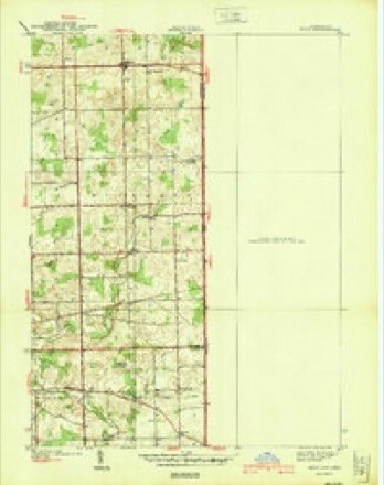
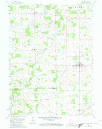
- 1940 USGS Metz quadrangle1:24000, 2 printings
- 1953 USGS Fort Wayne quadrangle1:250000, 4 printings
- 1956 USGS Fort Wayne quadrangle1:250000, 2 printings
- 1961 USGS Edon quadrangle1:24000, 4 printings
- 1985 USGS Adrian quadrangle1:100000
- 1990 USGS Adrian quadrangle1:100000


In the county-history sources
15,226 words on this townshipHistory of Steuben County, Indiana, Together with... Biographies of Representative Citizens, published 1885 names this settlement in its chapter on York Township. These are the passages that mention it, exactly as the scans read.
The first entry of land was made by Kichard Peters, May 12, 1836, being all of fractional section 4. During the same month Koyal B. Hix, George W. Johnson, Martin Eldridge and several other persons located lands in the township. The first white settler was Fayette Barron, who built his cabin on the site of the present village of Metz, in the summer of 1836. In 1837 Clark and Calvin Powers, who had visited the county the previous vear and located land, arrived, also Stephen A. and Winn Powers, Augustus Wood worth and Jackson Cory. From that time to 1840 there came Jeremiah Dillingham and his sons, John Larue, Adam Dygert, Cowee Barns, Griswold and Alvah Phelps, Charles F. Hodges, George Jenks, who was a half brother of the Powers, Royal Hix, George W. Johnson, David K. Jones, John Croy and others. These pioneers and a large portion of those who followed in after years were from the State of New York.
Passage source: History of Steuben County, Indiana, Together with... Biographies of Representative Citizens, published 1885.
About the year 1840, the Methodists organized a class near the center of the township. They met in private houses, and later in the school-houses. They were occasionally cheered and revived by visits from the circuit preachers. In 1850 a church was fully organized at Hathaway's corners, the membership of which became quite numerous, and in 1853 they erected a meeting-house at that point, which is still standing. Very early in the history of the county the Free-Will Baptists had an organization, and met for worship at the houses of Adam Dygert, Cowee Barns, and at other places. Their ministers were Elder J. H. Miner, Silas Ileadley and occasionally others. In 1842, a few Disciples, who had recently emigrated from Bedford, Ohio, organized a church of which Burdett B. Goodale was made pastor. This formed the nucleus for the present flourishing church at Metz, which now numbers about 150 members, and has a pleasant and commodious house of worship. Through the efforts of the Powers family a free church building was erected a few years since on section 2i^, on land donated by Clark Powers. It was called by its founders the Free church, but is now and probably will always be called the Powers church.
Passage source: History of Steuben County, Indiana, Together with... Biographies of Representative Citizens, published 1885.
The village plat of Metz covers portions of sections 5 and 6 of Richland Township, and of sections 31 and 32 of York. The first settler of this village was Fayette Barron, who came here in the fall of 1836. His home was made in the limits of York Township, being the pioneer settler of that township. This was years before any thought of a village here was entertained. The next settler was Joseph Bennett. One half a mile south a store was started in 1841 by Henry Letcher.
Passage source: History of Steuben County, Indiana, Together with... Biographies of Representative Citizens, published 1885.
Machine-read from a century-old scan, so expect the errors a machine makes: misspelled names, dropped words, stray characters.
Read the whole chapter on York Township - it names this place 10 more 10 times.
Storms near this place
4 since 2007Regional context, not property-specific evidence. The National Weather Service names Metz in 4 storm reports between 2007 and 2023: 2 thunderstorm wind, 2 hail. No death or injury is recorded in these reports. Each account below is quoted exactly as the forecast office filed it, from the NOAA Storm Events Database, and each date opens the federal record of that event.
| When | Event | Place named | Harm | What the report says |
|---|---|---|---|---|
| December 2007 | Thunderstorm Wind | Metz | $20,000 | Amateur radio operators measured a 83 mph wind gust. Numerous trees and limbs down across the county by spotters and emergency management officials. |
| June 2023 | Hail | Metz | $1,000 | A video on Twitter shows penny size hail, with a few larger stones. |
| July 2012 | Thunderstorm Wind | Metz | - | An off duty NWS Employee estimated wind gusts to 70 mph. Several large trees were split or otherwise damaged in the area. |
| May 2018 | Hail | Metz | - | no account filed |
Nearest settlements
The eight closest, with where each one stands in the county. Distances are straight-line, computed from the Geographic Names Information System coordinates.
| Map | Place | Distance | Sheets |
|---|---|---|---|
| Courtney Corner | 0.9 miles | 16 | |
| Berlien | 2.4 miles | 15 | |
| Alvarado | 2.7 miles | 14 | |
| Eastpoint Terminal | 3.5 miles | 16 | |
| Ellis | 4.2 miles | 15 | |
| Otsego Center | 4.8 miles | 14 | |
| Ravinia Oaks | 4.8 miles | 14 | |
| Page | 5.0 miles | 16 |
Elsewhere
Matched on this settlement's Geographic Names Information System number rather than its name, so it cannot be a different place of the same name in another state.
| Wikipedia article on Metz | An encyclopaedic summary. Its text is share-alike, so it is linked here rather than copied. |
| Wikidata item Q6825539 | The structured record the population and elevation above come from. Public domain (CC0). |
Provenance
This settlement is recorded in the Geographic Names Information System as feature 439053. The sheet list is computed by point-in-boundary test against the United States Geological Survey's historical topographic inventory. Both are works of the United States government and carry no copyright under 17 U.S.C. 105.
Storms. NOAA National Centers for Environmental Information, Storm Events Database https://www.ncei.noaa.gov/stormevents/ A work of the United States government, no copyright under 17 U.S.C. 105. Narratives are quoted verbatim from the National Weather Service report and are not edited or summarised.