 Block
From the record
17 National Register listings published here.
Sources: the county history on the Internet Archive · the National Register database, National Park Service
63 topographic sheets cover 47 settlements here, and 17 properties are on the National Register of Historic Places.
17 National Register listings published here.
Sources: the county history on the Internet Archive · the National Register database, National Park Service
Every property in this county listed on the National Register of Historic Places, with the year it was listed and the federal nomination document.
| Photograph | Property | Type | Listed | Reference |
|---|---|---|---|---|
 | Angola Commercial Historic District | district | 2010 | 10001073 |
| Cyrus and Jennie Cline House | building | 2017 | 100001615 | |
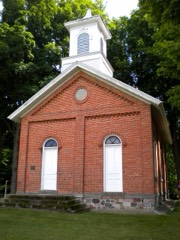 | Collins School | building | 2002 | 02001173 |
 | Combination Shelter | building | 1992 | 92000190 |
| Erastus and Louise Farnham House and Barn | building | 2022 | 100007739 | |
 | Fawn River State Fish Hatchery | site | 1997 | 96001553 |
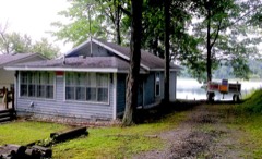 | Fox Lake | district | 2026 | 01000360 |
 | Free Church | building | 1983 | 83000149 |
 | Cornish Griffin Round Barn | building | 1993 | 93000187 |
| Lime Lake - Lake Gage Channel and Bridge | site | 2019 | 100004361 | |
 | William L. Lords House | building | 1983 | 83000114 |
 | Enos Michael House | building | 1982 | 82000075 |
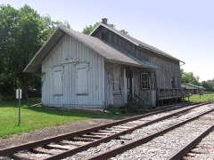 | Pleasant Lake Depot | building | 2001 | 01001344 |
 | Pokagon State Park | district | 1996 | 95001540 |
| Pryor's Country Place | building | 2026 | 100011038 | |
 | Steuben County Courthouse | building | 1975 | 75000051 |
 | Steuben County Jail | building | 1976 | 76000035 |
Every wildfire the federal occurrence database records inside this county: 6 of them, burning about 11 acres. None started naturally and 1 was recorded as arson. Each settlement page carries the fires within five miles of it.
| Reported cause | Fires |
|---|---|
| Debris and open burning | 2 |
| Recreation and ceremony | 2 |
| Equipment and vehicle use | 1 |
| Arson/incendiarism | 1 |
The five largest, by the area the report gives. One of them was set deliberately.
| Date | Cause | Size | Reported by | Name on the report |
|---|---|---|---|---|
| 18 April 2004 | Debris and open burning | 5.0 acres | Indiana State Fire Marshal's Office | not named |
| 4 April 2005 | Recreation and ceremony | 3.0 acres | Indiana State Fire Marshal's Office | not named |
| 13 April 2003 | Recreation and ceremony | 2.0 acres | Indiana State Fire Marshal's Office | not named |
| 18 September 2004 | Arson/incendiarism | under an acre | Indiana State Fire Marshal's Office | not named |
| 15 April 2004 | Equipment and vehicle use | under an acre | Indiana State Fire Marshal's Office | not named |
| 1 June 2003 | Debris and open burning | under an acre | Indiana State Fire Marshal's Office | not named |
Every settlement page carries the fires within five miles of it - see the settlement index below.
The NOAA Storm Events Database holds 280 reports for this county, causing 3 deaths, 30 injuries and about $39,995,250 in recorded property damage. Each settlement page carries the reports that name it.
| Kind of event | Reports |
|---|---|
| Thunderstorm Wind | 165 |
| Hail | 83 |
| Tornado | 21 |
| Lightning | 4 |
| Flood | 4 |
| Flash Flood | 3 |
The most serious of them, by death, then injury, then recorded damage. The accounts are quoted exactly as the forecast office filed them.
| When | Event | Place named | Harm | What the report says |
|---|---|---|---|---|
| April 1974 | Tornado (F3) | not stated | 2 killed, 15 hurt | no account filed |
| March 1991 | Tornado (F3) | not stated | 1 killed, 6 hurt, $25,000,000 | no account filed |
| July 1998 | Thunderstorm Wind | Angola | 4 hurt, $250,000 | WIND DAMAGE TO 4-H BUILDING AND STRUCTURE HIT BY LIGHTNING. SEVERAL PEOPLE WERE INJURED WHEN LIGHTNING STRUCK THE 4-H BUILDING. |
| May 1988 | Thunderstorm Wind | not stated | 4 hurt | no account filed |
| July 2019 | Thunderstorm Wind | Lake James | 1 hurt | Emergency management officials reported multiple trees and power lines were down around Pokagon State Park. One tree limb was reported to have fallen onto a person, resulting in an injury. The extent of the injury was not available. |
| May 1997 | Tornado (F0) | Angola Airport | $10,000,000 | no account filed |
| May 1961 | Tornado (F3) | not stated | $2,500,000 | no account filed |
| March 2009 | Flood | Clear Lake | $500,000 | Numerous roads were flooded with standing water ranging from six inches to a few feet in depth. At least 3 roads suffered some degree of wash out. These were County Road 950 East north of U.S. 20, County Road 20 North near County Road 100 East and a portion of West Fox Lake Road. Several lakes in the northern part of the county experienced high water levels, with some damage reported as well as sporadic evacuations. A NWS Cooperative observer in Angola reported 4.3 inches of rain over a 4 day period. |
| July 1998 | Lightning | Fremont | $312,000 | LIGHTNING INDUCED FIRES DESTROYED A BARN AND KENNEL AT 3580 S CR RD 800 E. ANOTHER LIGHTNING INDUCED FIRE DESTROYED ANOTHER BARN AND FARM TRACTORS AT 3285 N CR RD 650 E WHICH TOOK FIRE FIGHTERS 40 MINUTES TO GET UNDER CONTROL. |
| May 2009 | Flood | Nevada Mills | $250,000 | Spotters and emergency management officials reported several areas in and around the Lake Pleasant area seeing flooding as the lake went out of its banks in many areas. This was the result of around four inches of rain falling across the area. Exact damage estimates were not available, but are estimated at $250,000. |
| March 2025 | Tornado (EF1) | Hudson | $100,000 | An NWS damage survey confirmed a brief QLCS tornado embedded within a broad swath of damaging straight line winds in southwestern Steuben County, Indiana, on March 30th, 2025. The tornado likely originated in a field just north of Little Turkey Lake around 5:28 PM, before racing to the northeast. Several trees outbuildings were damaged to the northeast of Little Turkey Lake, most notably including a collapsed metal barn. Despite very limited ground evidence due to primarily open fields to the northeast, the tornado likely continued in a non continuous path over the next several minutes. A 50 to 100 yard swath of trees were snapped or uprooted on the southwest side of Long Lake, just west of W 500 S. The tornado then crossed Long Lake, before uprooting and snapping several trees and damaging homes along W Long Lake Road. No injuries were reported. Notable tree damage was observed in the boy scout camp just to the north. Aerial drone footage confirmed a convergent pattern to the downed trees, thus indicating the presence of a tornadic circulation along the damage path. Damage was consistent with a high end EF-0 to low end EF-1 tornado with maximum winds near 90 MPH. The tornado is believed to have ended shortly after, around 5:35 PM. In addition to the tornado, numerous trees and power lines were damaged due to straight line winds in excess of 75 MPH, along with some homes suffering roof and siding damage. |
| April 2025 | Tornado (EF1) | Orland | $100,000 | Damage survey from the National Weather Service along with Steuben County EMA found damage consistent with a tornado that touched down on the south side of Orland, IN. The tornado destroyed an old, small barn on the south side, before uprooting and snapping several trees and a communications pole in east Orland. The tornado damaged the roof of an apartment building, including ripping up the wood sheathing on the south end of the building. Non-conclusive, likely rear flank downdraft winds severely damaged a large barn at N 900 W and W State Rd 120 and a set of trees just off to the east. Across the street, a dozen or so trees were uprooted or snapped in a cemetery. Tree damage was also noted in the adjacent tree line. The tornado reached max width at the border of IN/MI where a large swath of significant tree damage occurred to a piece of property owned by the Indiana Toll Road. A semi-truck was reported to be blown over on the Toll Rd. The tornado crossed into Michigan with intermittent light structural and tree damage occurring near East Gilead and extending northeastward. The tornado reached maximum intensity of 105 mph (EF-1) when it struck a farm on E Pearl Road, tearing roofs off large silos, destroying a section of barn, driving 2x4 into the nearby home, and destroying another out building to the west. |
| July 2007 | Thunderstorm Wind | Fremont | $100,000 | Local emergency management performed a storm survey of damage west of Fremont. A strip mall suffered significant damage to the roof and soffits as well as broken windows. Numerous trees were reported down in the area with one onto a car. Some trees were uprooted, as large as 20 inches in diameter. Trees and a light pole were blown down at a Holiday Inn Express. The damage appeared to be consistent with straight line winds of around 70 mph. Damage is estimated at around $100,000. |
| April 2011 | Lightning | Angola | $55,000 | A local newspaper reported a residence in the 300 block of East Stocker Street, in Angola, was struck by lightning, causing an attic fire. The residents were home at the time of the lightning strike and escaped without injuries. An estimated $55,000 in damage was caused to the attic area. |
| September 2005 | Hail | Fremont | $50,000 | 30 to 35 homes were reported to have siding damage and a few vehicles also suffered some damage. Hail up to golf ball size was reported. |
| June 2023 | Thunderstorm Wind | Angola | $40,000 | A car dealership building and inventory was damaged. |
| June 2009 | Lightning | Jamestown | $40,000 | A 32 foot by 50 foot storage facility for Shelton Fireworks on Old US 27 was struck by lightning around 6 am EDT, causing a fire to start. This fire subsequently began causing roughly 1000 boxes of fireworks in the building to ignite, with some of them reaching 100 feet into the air. It took firefighters from 12 departments around 90 minutes to get the fire under control, with the building being a total loss. The building was valued at around $10,000 with the contents around $30,000. |
| September 2005 | Thunderstorm Wind | Fremont | $40,000 | Several trees were blown down, one reported to be 24 inches in diameter. A 12 inch diameter tree fell onto a parked police car, which was totaled as a result. A large cottonwood tree was blown down near Snow Lake, with debris from the tree knocking over a fence and utility shed. |
| June 2023 | Thunderstorm Wind | Salem Center | $30,000 | A large barn sustained structural damage and a small outbuilding was destroyed. |
| November 1998 | Thunderstorm Wind | Countywide | $30,000 | SEVERAL TREES AND POWER LINES WERE BLOWN DOWN. ONE HOME OWNERS GARAGE SUFFERED EXTENSIVE DAMAGE WHEN A LARGE TREE WAS TOPPLED ONTO IT. |
| May 2024 | Hail | Hudson | $30,000 | no account filed |
| August 1996 | Flash Flood | Steuben County | $30,000 | no account filed |
| December 2007 | Thunderstorm Wind | Angola | $25,000 | Numerous reports of downed power lines and trees across the county. |
| May 2024 | Hail | Ashley | $25,000 | no account filed |
| May 1973 | Tornado (F1) | not stated | $25,000 | no account filed |
| August 1969 | Tornado (F2) | not stated | $25,000 | no account filed |
| September 1969 | Tornado (F2) | not stated | $25,000 | no account filed |
| August 1965 | Tornado (F1) | not stated | $25,000 | no account filed |
| August 2022 | Thunderstorm Wind | Lake James | $20,000 | Western Steuben county has numerous power lines and tree branches down. |
| August 2022 | Thunderstorm Wind | Angola | $20,000 | Tree limbs and power lines are down. One tree was down on a vehicle. No injuries were reported. |
| May 2014 | Hail | Moonlight Bay | $20,000 | Broadcast media reported hail damaged a vehicle, as well as siding and window screens on a home. Damage is estimated at $20,000. |
| August 2007 | Thunderstorm Wind | Fremont | $20,000 | Numerous power lines and trees were blown down. |
| December 2007 | Thunderstorm Wind | Metz | $20,000 | Amateur radio operators measured a 83 mph wind gust. Numerous trees and limbs down across the county by spotters and emergency management officials. |
| October 2001 | Tornado (F0) | Steubenville | $20,000 | Tornado touched down east of Kendallville with F1 damage to homes and warehouses in and near the Kendallville East Industrial park. Tornado then moved northeast into Dekalb county where F2 damage occurred around Fairfield Center with significant damage to homes. Then tornado moved southeast of Ashley with F1 damage and then moved into Steuben county south of Steubenville doing F0 damage to a barn before lifting north of Steubenville. |
| March 2025 | Thunderstorm Wind | Orland | $15,000 | Downed power lines and a broken utility pole on CR 350 N, west of IN 327. |
| March 2025 | Thunderstorm Wind | Orland | $15,000 | Damage to a house as well as three sheds and a fence. |
| May 2024 | Hail | Angola | $15,000 | Ping pong ball sized hail near Trine University. |
| August 2009 | Thunderstorm Wind | Crooked Lake | $15,000 | Emergency management officials reported a large tree was blown down onto a trailer on West Shady Side Road, along Crooked Lake. The trailer was destroyed and a woman in the trailer was not injured. |
| July 2005 | Thunderstorm Wind | Countywide | $15,000 | Trees, tree limbs and power lines were reported down in several locations across the county. Much of the damage occurred from Angola to Fremont where large trees blocked some roadways for several hours, forcing temporary closures. A roof of a Bennigans restaurant in Angola suffered damage from the winds, which allowed rain into the building, forcing its closure for a few days. |
| November 2005 | Thunderstorm Wind | Countywide | $15,000 | Trees and power lines were blown down across the county. |
| May 2024 | Hail | Moonlight Bay | $15,000 | no account filed |
| May 2024 | Hail | Angola | $15,000 | no account filed |
| May 2011 | Thunderstorm Wind | Flint | $10,000 | Amateur radio operators reported the roof of a house being peeled off about two-thirds of the way. |
| July 2008 | Thunderstorm Wind | Lake James | $10,000 | Trees and power lines were down across mainly northern portions of the county. The majority of the damage was located in the Angola area, as well as Lake James and the Pokagon State park. |
| May 2007 | Thunderstorm Wind | Clear Lake | $10,000 | A storage shed was rolled over, with facia and gutters torn off a house. In addition, windows were broken in the house with some minor roof damage. |
| June 2001 | Thunderstorm Wind | Crooked Lake | $10,000 | Trees and power lines down. NIPSCO had some broken utility poles. |
| July 2001 | Flood | Fremont | $9,000 | Store located in "a small gully" as described by owner experienced water up to the owners knee after rainfall of around 2 inches in 3 hours. No injuries. |
| March 2025 | Thunderstorm Wind | Jamestown | $7,500 | Roof peeled off of a barn. |
| March 2025 | Lightning | Angola | $7,500 | Lightning struck a power pole near the Trine University football field. |
| June 2023 | Thunderstorm Wind | Salem Center | $7,500 | Piece of roof covering lost and damage to a wall reported at the Salem Township Fire Department. |
| June 2023 | Thunderstorm Wind | York | $7,500 | A barn roof was damaged with debris deposited onto the roadway. |
| July 2025 | Thunderstorm Wind | Nevada Mills | $5,000 | Trees are down around Lake Pleasant. Some smaller structures damaged as well. |
| July 2025 | Thunderstorm Wind | Clear Lake | $5,000 | Trees are down in the area of SR120 and 700 E from thunderstorm outflow wind. |
| July 2024 | Thunderstorm Wind | Angola | $5,000 | Power lines down on Fox Lake Road. |
| July 2024 | Thunderstorm Wind | Crooked Lake | $5,000 | Powerlines down. |
| March 2023 | Hail | Clear Lake | $5,000 | Golf ball sized hail reported. |
| March 2023 | Thunderstorm Wind | Flint | $5,000 | A large tree was down. |
| June 2008 | Thunderstorm Wind | Salem Center | $5,000 | Amateur radio operators reported a tree falling onto a house trailer. Damage is estimated at $5,000. |
| July 1995 | Thunderstorm Wind | not stated | $4,000 | Large trees and powerlines were blown down in Southwest Steuben County. |
| June 2005 | Thunderstorm Wind | Angola | $3,000 | Several 8 to 14 inch diameter trees, as well as power lines, were reported blown down. |
The Survey's mineral resources record lists 9 workings inside this county. 5 still produce and 4 are closed or unrecorded. Each settlement page carries the workings within five miles of it.
| Commodity | Workings |
|---|---|
| Sand and Gravel, Construction | 8 |
| Stone, Crushed/Broken | 1 |
The least common of them first, because a county's hundredth gravel pit says nothing its first ten did not.
| Where | Site | Commodity | Status | Recorded |
|---|---|---|---|---|
| Garman Pit | Stone, Crushed/Broken | Past Producer | ||
| Angola Sand and Gravel Pit | Sand and Gravel, Construction | Past Producer | ||
| Flegal Sand and Gravel Pit | Sand and Gravel, Construction | Producer | ||
| Fremont Pit | Sand and Gravel, Construction | Producer | ||
| Gravel Pit | Sand and Gravel, Construction | Past Producer | ||
| Rice Pit | Sand and Gravel, Construction | Producer | ||
| State Line Sand and Gravel Pit | Sand and Gravel, Construction | Producer | ||
| State Line Sand and Gravel Pit | Sand and Gravel, Construction | Past Producer | ||
| Viking Gravel Pit | Sand and Gravel, Construction | Producer |
History of Steuben County, Indiana, Together with... Biographies of Representative Citizens devotes a chapter to each township: its boundaries and streams, who settled it and when, the mills, the schools and the churches. All 11 are reproduced here in full. Each row shows the township's own shape and where it lies in the county, drawn from the Census Bureau's boundary. Which settlements belong to which township is computed from that same boundary, not taken from the book.
| Shape and position in the county | Township | Settlements in it | Length | Sections |
|---|---|---|---|---|
| Clear Lake Township | Clear Lake | 3,676 words | 1 | |
| Fremont Township | Fremont | 17,226 words | 0 | |
| Jackson Township | Flint, Indian Hills, Otter Lake | 9,957 words | 3 | |
| Jamestown Township | Jamestown, Lake James, Nevada Mills, Potawatomi Inn, Valley Outlet Center | 8,705 words | 1 | |
| Millgrove Township | Inverness, Orland, Panama | 9,104 words | 2 | |
| Otsego Township | Circle Park, Clarks Landing, Cold Springs, Forest Park, Fountain Park, Hamilton, Island Park, Oakwood, Otsego Center, Penn Park, Ravinia Oaks, Russels Point | 19,675 words | 2 | |
| Richland Township | Alvarado | 7,161 words | 1 | |
| Salem Township | Helmer, Hudson, Meadow Shores Park, Salem Center, Turkey Creek, Westview, Wildwood | 18,467 words | 7 | |
| Scott Township | Ellis | 26,791 words | 7 | |
| Steuben Township | Moonlight, Pleasant Lake, Steubenville | 16,431 words | 1 | |
| York Township | Berlien, Courtney Corner, Eastpoint Terminal, Metz, Page, York | 15,226 words | 7 |
One book written about this county, cut here where the book itself is cut, at its printed chapters: 10 chapters in all. Every chapter is public domain, machine-read from the scan and reproduced complete. A chapter already given under one of the county's towns is not repeated in this list.
| Chapter | Length |
|---|---|
| Chapter with an unread heading (no. 1 of those read) | 82,536 words in 6 parts |
| Chapter 1: Introductory | 2,702 words |
| Chapter 2: Scientific | 7,315 words |
| Chapter 3: Early History | 17,354 words in 2 parts |
| Chapter 4: Political History | 13,169 words |
| The Bar | 5,543 words |
| Biographical sketches | 11,995 words |
| Chapter 9: Educational | 3,097 words |
| Chapter 10: Agricultural | 2,268 words |
| Miscellaneous | 10,075 words |
Named settlements recorded in the Geographic Names Information System, each with the topographic sheets covering it. Villages, hamlets and abandoned places alike. Each is shown with the nearest named watercourse or landform and the survey quadrangle it falls on.
Otsego township · 46742 · On Black Creek · Hamilton quadrangle
14 sheets, 1939 to 1992
York township · 46703 · On West Branch Fish Creek · Clear Lake quadrangle
16 sheets, 1939 to 1992
York township · 46737 · On Hanselman Branch · Clear Lake quadrangle
16 sheets, 1939 to 1992
Otsego township · 46742 · Near Shag Island · Hamilton quadrangle
14 sheets, 1939 to 1992
Otsego township · 46742 · On Black Creek · Hamilton quadrangle
14 sheets, 1939 to 1992
Otsego township · 46742 · Near Shag Island · Hamilton quadrangle
14 sheets, 1939 to 1992
Jamestown township · 46737 · On Little Fawn River · Angola West quadrangle
16 sheets, 1941 to 1992
Jamestown township · 46737 · Near Eagle Island · Angola West quadrangle
16 sheets, 1941 to 1992
Otsego township · 46742 · On Black Creek · Hamilton quadrangle
14 sheets, 1939 to 1992
Jamestown township · 46703 · Near Eagle Island · Angola West quadrangle
16 sheets, 1941 to 1992
Otsego township · 46742 · Near Shag Island · Hamilton quadrangle
14 sheets, 1939 to 1992
Jamestown township · 46737 · On Follette Creek · Angola West quadrangle
16 sheets, 1941 to 1992