 Block
Mexico, Indiana
13 topographic sheets cover this place, the earliest surveyed in 1951 and the latest in 1985. It stands in Jefferson Township. It lies in ZIP code area 46970. The Survey maps it on the Peru quadrangle. 915 people lived here at the 2020 count. It stands 702 feet above sea level.
Population over time
2 figuresMexico grew from 836 to 915 between 2010 and 2020. These are the recorded population figures Wikidata holds for this place, reached through the Geographic Names Information System number this page is keyed on rather than by name, so they belong to this place and not to another of the same name. Most are census counts, but not all are: an early figure may be a founding or settlement estimate, and an estimate published within five years of a census is left out. The change column is computed, and is left blank where more than 20 years separate a figure from the one before it, because a gap that long is not a change between two counts.
| Year | People | Change |
|---|---|---|
| 2010 | 836 | |
| 2020 | 915 | +79 (+9%) |
Topographic sheets covering this place
6 surveys from 13 printed sheetsMatched by testing this settlement's coordinate against the published boundary of every sheet in the United States Geological Survey's historical collection. Each opens the scanned sheet at the Survey.
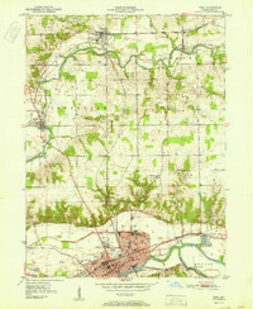
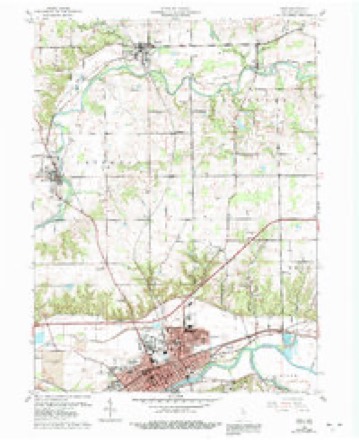
- 1951 USGS Peru quadrangle1:24000, 2 printings
- 1953 USGS Danville quadrangle1:250000, 3 printings
- 1955 USGS Danville quadrangle1:250000
- 1956 USGS Danville quadrangle1:250000
- 1960 USGS Peru quadrangle1:24000, 4 printings
- 1985 USGS Logansport quadrangle1:100000, 2 printings



In the county-history sources
7,329 words on this townshipHistory of Miami County, published 1896 names this settlement in its chapter on Jefferson Township. These are the passages that mention it, exactly as the scans read.
The honor of being the first settler. of Jefferson township is conceded to Solomon Wilkinson. Heentered his land December 13, 1830, and moved his family on the claim early the next spring. His claim was on the present site of Mexico and he and his seven sons, - Ratliff, John, Jacob, Jesse, William, Simeon and Balam - entered much of the land adjoining the homestead. Two brothers, Wood and Abraham Beard, located in the township in 1831. The next year came William Connor, William and John Smith 'and Alexander Jamison.
Passage source: History of Miami County, published 1896.
Charles Murden was a typical pioneer. Inthe summer of 1834 he left the fruited district of Maryland and with his family in a covered wagon moved to Lafayette. He left his family there to look for a location and concluding the Eel river valley was the best point to settle bought a claim of sixty acres. He brought his family to the claim and had to cut the way from Mexico as he went through the dense forest two miies west of the present site of Denver. Just as the sun was reclining over the western hills, he hallooed «*Whoa!" and said in his strong English accent, «'Old woman, we're home." There were no settlers for miles around. There was no voice to greet thim but that of the Pottawatomie, and the howling wolt, the bleeting deer and the welcome chirp of the birds. This was a lonesome spot for his family, who had come from the best populated district of Maryland. They brought from the east a large tent and lived in that for some time until they built a cabin. The cabin at first had no floor. Light was admitted through openings in the sides of the cabin over which was stretched greased paper. There were two doors hung on wooden hinges. The doors were fastened with wooden pins. Pegs were driven into the walls of the cabin. On these were laid boards. This was the table. There was not a nail in the cabin. Everything about the house was in perfect contrast with this simplicity. In this cabin were raised six girls and five boys, all of whom grew to a sturdy maturity and their decendants are now scattered over the country.
Passage source: History of Miami County, published 1896.
The first industry was a corn-cracker, built by Burl Daniels, in 1835, on the Eel river, on the spot, where the old Dennison mill now is. Later that same year John Ratliff built the same kind of a mill on the river a little over a mile above Mexico. 'The first saw mill was built south of Mexico at an early date by a Mr. Wagoner. The first flouring mill was built by the Wilkinsons in 1846, on the south bank of the river, nearly opposite Mexico. The grist mill that stands nearly opposite the old Dennison mill was erected in 1850 by Elijah Cox.
Passage source: History of Miami County, published 1896.
Machine-read from a century-old scan, so expect the errors a machine makes: misspelled names, dropped words, stray characters.
Read the whole chapter on Jefferson Township - it names this place 1 more 1 time.
Fires near this place
2 since 2003Regional context, not property-specific evidence. The federal wildfire occurrence database lists 2 fires within 5 miles of Mexico between 2003 and 2005, burning about 2 acres in total. None started naturally. None was recorded as arson. Distance is straight-line from the map coordinates, so a fire counted here may appear on a neighbouring settlement's page as well.
| Reported cause | Fires |
|---|---|
| Debris and open burning | 1 |
| Missing data/not specified/undetermined | 1 |
The most recent of them, most recent first, with the day each was reported and the service that recorded it.
| Date | Cause | Size | Reported by | Name on the report |
|---|---|---|---|---|
| 30 April 2003 | Missing data/not specified/undetermined | 1.0 acres | Indiana State Fire Marshal's Office | not named |
| 26 February 2005 | Debris and open burning | under an acre | Indiana State Fire Marshal's Office | not named |
Settlements close enough to share some of these fires:
Mines and quarries near this place
2 within 5 milesRegional context, not property-specific evidence. The federal mineral resources record lists 2 workings within 5 miles of Mexico: 2 producers. All of them still produce. What was taken out: Stone, Crushed/Broken, Sand and Gravel, Construction. Distance is straight-line from the map coordinates, so a quarry counted here may appear on a neighbouring settlement's page as well.
| Where | Site | Commodity | Status | Recorded |
|---|---|---|---|---|
| Kickapoo Stone Quarry | Stone, Crushed/Broken | Producer | ||
| Wolf Pit | Sand and Gravel, Construction | Producer |
Storms near this place
19 since 1995Regional context, not property-specific evidence. The National Weather Service names Mexico in 19 storm reports between 1995 and 2024: 13 thunderstorm wind, 5 hail, 1 tornado. The reports record 1 injury. Each account below is quoted exactly as the forecast office filed it, from the NOAA Storm Events Database, and each date opens the federal record of that event.
| When | Event | Place named | Harm | What the report says |
|---|---|---|---|---|
| May 1995 | Tornado (F1) | Mexico | 1 hurt, $700,000 | Brief tornado touchdown damaged 20 homes, destroyed two mobile homes, damaged the roof and steeple of a church in Mexico. A 15-year-old boy received cuts and bruises in one of the damaged homes. Numerous trees and power lines were downed by the storms in Mexico and the nearby town of Denver. |
| July 2006 | Thunderstorm Wind | Mexico | $10,000 | A large tree was blown down with the roof of a barn being blown off. |
| August 2022 | Thunderstorm Wind | Mexico | $5,000 | A large tree is down. |
| June 2001 | Thunderstorm Wind | Mexico | $2,500 | Numerous trees down. One house damaged. |
| May 2024 | Thunderstorm Wind | Mexico | $1,000 | Tree damage reported. |
| June 2012 | Thunderstorm Wind | Mexico | - | Law enforcement officials reported three to five inch diameter tree limbs down. |
| September 2012 | Thunderstorm Wind | Mexico | - | Law enforcement officials reported power lines down. |
| April 2011 | Thunderstorm Wind | Mexico | - | Law enforcement officials reported a large tree down across the road at County Road 300 North, just west of U.S. 31. |
| June 2010 | Thunderstorm Wind | Mexico | - | Emergency management officials reported tree limbs down. |
| August 2009 | Thunderstorm Wind | Mexico | - | Emergency management officials reported a one foot diameter tree down, with numerous power outages. |
| May 2005 | Thunderstorm Wind | Mexico | - | Several 9 to 10 inch diameter branches blown down. |
| July 2003 | Thunderstorm Wind | Mexico | - | Law enforcement reported trees down in Mexico. |
| July 2003 | Thunderstorm Wind | Mexico | - | Emergency management reported trees and power lines down in Mexico. |
| June 2012 | Hail | Mexico | - | no account filed |
| April 2001 | Hail | Mexico | - | no account filed |
| April 2000 | Hail | Mexico | - | no account filed |
| July 1998 | Hail | Mexico | - | no account filed |
| July 1996 | Hail | Mexico | - | no account filed |
| July 1996 | Thunderstorm Wind | Mexico | - | no account filed |
Nearest settlements
The eight closest, with where each one stands in the county. Distances are straight-line, computed from the Geographic Names Information System coordinates.
Elsewhere
Matched on this settlement's Geographic Names Information System number rather than its name, so it cannot be a different place of the same name in another state.
| Wikipedia article on Mexico | An encyclopaedic summary. Its text is share-alike, so it is linked here rather than copied. |
| Wikidata item Q2294975 | The structured record the population and elevation above come from. Public domain (CC0). |
Provenance
This settlement is recorded in the Geographic Names Information System as feature 439059. The sheet list is computed by point-in-boundary test against the United States Geological Survey's historical topographic inventory. Both are works of the United States government and carry no copyright under 17 U.S.C. 105.
Wildfire. Short, Karen C. 2022. Spatial wildfire occurrence data for the United States, 1992-2020 [FPA_FOD_20221014]. 6th Edition. Fort Collins, CO: Forest Service Research Data Archive. https://doi.org/10.2737/RDS-2013-0009.6 Collected with United States Government funding and usable without additional permissions or fees.
Mines and quarries. USGS Mineral Resources Data System (MRDS) https://mrdata.usgs.gov/mrds/ A work of the United States government, no copyright under 17 U.S.C. 105.
Storms. NOAA National Centers for Environmental Information, Storm Events Database https://www.ncei.noaa.gov/stormevents/ A work of the United States government, no copyright under 17 U.S.C. 105. Narratives are quoted verbatim from the National Weather Service report and are not edited or summarised.