 Block
Monroeville, Indiana
14 topographic sheets cover this place, the earliest surveyed in 1953 and the latest in 1986. It stands in Monroe Township. It lies in ZIP code area 46773. The Survey maps it on the Dixon quadrangle. 1,294 people lived here at the 2020 count. It stands 787 feet above sea level.
On record in Monroeville
Buildings and businesses the archive holds for this place. Each opens its own page, with the source record it came from.
On the National Register 1 record
Population over time
2 figuresMonroeville grew from 1,235 to 1,294 between 2010 and 2020. These are the recorded population figures Wikidata holds for this place, reached through the Geographic Names Information System number this page is keyed on rather than by name, so they belong to this place and not to another of the same name. Most are census counts, but not all are: an early figure may be a founding or settlement estimate, and an estimate published within five years of a census is left out. The change column is computed, and is left blank where more than 20 years separate a figure from the one before it, because a gap that long is not a change between two counts.
| Year | People | Change |
|---|---|---|
| 2010 | 1,235 | |
| 2020 | 1,294 | +59 (+5%) |
Topographic sheets covering this place
4 surveys from 14 printed sheetsMatched by testing this settlement's coordinate against the published boundary of every sheet in the United States Geological Survey's historical collection. Each opens the scanned sheet at the Survey.
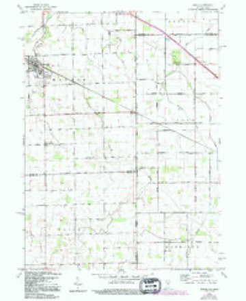
- 1953 USGS Muncie quadrangle1:250000, 5 printings
- 1956 USGS Muncie quadrangle1:250000
- 1960 USGS Dixon quadrangle1:24000, 5 printings
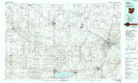
- 1986 USGS Lima quadrangle1:100000, 3 printings


In the county-history sources
7,433 words on this townshipHistory of Allen County, Indiana., published 1880 names this settlement in its chapter on Monroe Township. These are the passages that mention it, exactly as the scans read.
William and James Black and Joseph Rabbit, were the first white men who entered this township with the view of making a permanent settlement within its limits. They came from Carroll County, Ohio, in the fall of 1839, and settled on Section 32. They came endowed with the courage and fortitude characteristic of our first settlers, to endure the bitter trials incident to the settle¬ ment of a new country, the absence of social privileges, remoteness from markets, and the severe physical exertions which were necessary to make their home in the wilderness habitable or productive of the means of subsistence. Their axes were the only instruments which could be effectually used, and the necessities of their loved ones added a zest to the energy with which they waged their warfare against the giants of the forests - the future to crown their labors with reward. The Messrs. Black and Mr. Rabbit succeeded in developing farms, upon which they resided for several yeais, after which they sold out and moved to Adams County, Ind.
Passage source: History of Allen County, Indiana., published 1880.
Samuel Clem came- in February, 1841, and settled on Section 28. He was an enterprising man, and, during his life, did much for the advancement of the township. John Stephenson came in the spring of 1841, and settled on Section 4, where he still resides. James Savage and Peter Barnhart settled near the present site of Monroeville, in the same year (1841). Mr. Savage subsequently removed to Fort Wayne, where he died. Mr. Barnhart died at his home in this township.
Passage source: History of Allen County, Indiana., published 1880.
The first death was that of Mrs. Peter Schlemmer, who died in 1843. She was buried on the farm of her husband, on Section 21. Several other deceased residents of the township were interred on the same farm in later years, but the land was never actually set apart for cemetery purposes.
Passage source: History of Allen County, Indiana., published 1880.
Machine-read from a century-old scan, so expect the errors a machine makes: misspelled names, dropped words, stray characters.
Read the whole chapter on Monroe Township - it names this place 25 more 25 times.
Storms near this place
14 since 1997Regional context, not property-specific evidence. The National Weather Service names Monroeville in 14 storm reports between 1997 and 2023: 8 thunderstorm wind, 2 tornado, 2 hail, 1 flash flood. No death or injury is recorded in these reports. Each account below is quoted exactly as the forecast office filed it, from the NOAA Storm Events Database, and each date opens the federal record of that event.
| When | Event | Place named | Harm | What the report says |
|---|---|---|---|---|
| July 1999 | Thunderstorm Wind | Monroeville | $30,000 | Numerous trees and several semi trailers knocked over. |
| March 2023 | Flood | Monroeville | $15,000 | Two people were rescued from their vehicle after trying to drive through a flooded road and drove into a ditch. |
| August 2007 | Thunderstorm Wind | Monroeville | $10,000 | Trees and power lines were blown down. |
| July 2021 | Flash Flood | Monroeville | - | Emergency management and law enforcement officials reported high, flowing water over several roads along the south side of Fort Wayne east into Monroeville as anywhere from five to almost seven inches of rain fell. State Route 1 from Interstate 469 south to Hamilton Road was closed due to water covering the road. Trier ditch overflowed over Tillman Road between Hessen Cassel and Adams Center Roads. Several cars were stranded in parking lots with one in a ditch in Monroeville due to the high water. |
| November 2013 | Thunderstorm Wind | Monroeville | - | Law enforcement officials reported two-thirds of a roof from a 140 foot hog barn was blown off. |
| June 2012 | Thunderstorm Wind | Monroeville | - | A trained spotter reported widespread tree damage in Monroeville. |
| June 2010 | Thunderstorm Wind | Monroeville | - | Trained spotter estimated wind gusts up to 60 mph. |
| June 2010 | Thunderstorm Wind | Monroeville | - | Trained spotter reports numerous trees and branches down in Monroeville with estimated 60-70 mph gusts. |
| October 2010 | Thunderstorm Wind | Monroeville | - | A trained spotter reported wind gusts measures to 75 mph with power lines down in Monroeville. |
| May 1998 | Tornado (F0) | Monroeville | - | BRIEF TOUCHDOWN |
| May 1998 | Tornado (F0) | Monroeville | - | BRIEF TOUCHDOWN |
| March 2016 | Hail | Monroeville | - | no account filed |
| May 2004 | Hail | Monroeville | - | no account filed |
| July 1997 | Thunderstorm Wind | Monroeville | - | no account filed |
Nearest settlements
The eight closest, with where each one stands in the county. Distances are straight-line, computed from the Geographic Names Information System coordinates.
| Map | Place | Distance | Sheets |
|---|---|---|---|
| Four Presidents Corners | 2.4 miles | 11 | |
| Boston Corner | 2.5 miles | 12 | |
| East Liberty | 2.7 miles | 14 | |
| Townley | 3.0 miles | 11 | |
| Tillman | 3.7 miles | 11 | |
| Zulu | 4.5 miles | 11 | |
| Maples | 6.0 miles | 11 | |
| Hoagland | 6.8 miles | 12 |
Elsewhere
Matched on this settlement's Geographic Names Information System number rather than its name, so it cannot be a different place of the same name in another state.
| Wikipedia article on Monroeville | An encyclopaedic summary. Its text is share-alike, so it is linked here rather than copied. |
| Wikidata item Q3129717 | The structured record the population and elevation above come from. Public domain (CC0). |
Provenance
This settlement is recorded in the Geographic Names Information System as feature 439348. The sheet list is computed by point-in-boundary test against the United States Geological Survey's historical topographic inventory. Both are works of the United States government and carry no copyright under 17 U.S.C. 105.
Storms. NOAA National Centers for Environmental Information, Storm Events Database https://www.ncei.noaa.gov/stormevents/ A work of the United States government, no copyright under 17 U.S.C. 105. Narratives are quoted verbatim from the National Weather Service report and are not edited or summarised.