 Block
Morton, Indiana
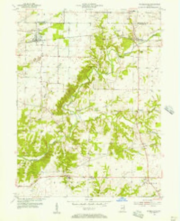
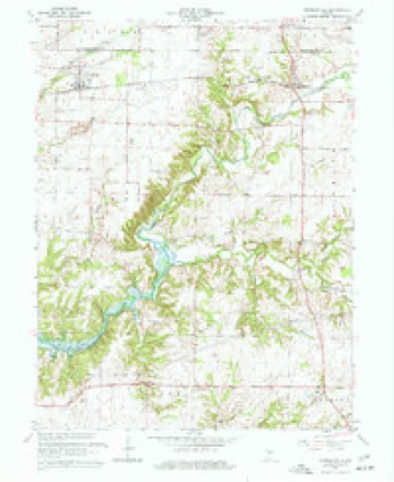
13 topographic sheets cover this place, the earliest surveyed in 1953 and the latest in 1986. It stands in Clinton Township. It lies in ZIP code area 46135. The Survey maps it on the Russellville quadrangle. It stands 869 feet above sea level.
Topographic sheets covering this place
7 surveys from 13 printed sheetsMatched by testing this settlement's coordinate against the published boundary of every sheet in the United States Geological Survey's historical collection. Each opens the scanned sheet at the Survey.
- 1953 USGS Indianapolis quadrangle1:250000, 4 printings
- 1955 USGS Russellville quadrangle1:24000
- 1956 USGS Indianapolis quadrangle1:250000
- 1957 USGS Indianapolis quadrangle1:250000, 2 printings
- 1962 USGS Indianapolis quadrangle1:250000
- 1963 USGS Russellville quadrangle1:24000, 2 printings
- 1986 USGS Indianapolis quadrangle1:100000, 2 printings





In the county-history sources
1,268 words on this townshipBiographical and Historical Record of Putnam County, Indiana .., published 1887 names this settlement in its chapter on Clinton Township. These are the passages that mention it, exactly as the scans read.
In Clinton Township there are three postoffice towns: Portland Mills, Morton and Clinton Falls. The first named is an old town, and is so situated that a part of it is in Clinton and a part in Russell Township, Putnam County, and a part in each of two townships in Parke County.
Passage source: Biographical and Historical Record of Putnam County, Indiana .., published 1887.
The first religious meeting in the town- well, George W. Grose, Andrew T. McCoy, ship was held by the Methodists, at the Moses Nelson, Thomas W. Dowell, Michael house of John Macy, in 1824, and conducted Grose, J. B. Ross. Andrew McMains,J.C. Moby John Cord, an itinerant Methodist Coy- 1. J. Nickson and others. Meetings had preacher, who died the same year. After been held in the township before the organizahim came John McCortl, Stephen Grimes, tion of the church, generally in private houses Daniel Anderson, William 11. Smith and Mr. and in groves. Among those who preached at Strange. They were followed by the Revs, this point are Elders Colwell, Ileadriek, Forbes. Ames, Hebenridge, Morton, Wells, George Pearcy, Ferry and James Blanken- Wood, Scam mahorn, Jackson, Brunei*, Davis, ship, Franklin, Smith, [lawn, Lockharfc, "Williams, John and Byron Carter, Lee. Ros- Burgess, Swinford, Wright.-. Wilsons, Black. son, Poynter, Allison, Walls, Webb, Hewring, Harris. Badger and Pritchard. The last Pewett, Tansey, Johnson and McNaughton. named held a debate with the Rev. Mr. This denomination erected a log church on Brooks, of the Methodist Episcopal church. section 1, township 12, range 4, in the year March 19 to 28, 1866, which created quite a 1827, which was the first built in the town- local excitement. It is claimed by the Chrisship. They continued to use this house un- turn church that about seventy members were til 1848, when they built a frame church in added to its organization, as the result of the
Passage source: Biographical and Historical Record of Putnam County, Indiana .., published 1887.
Machine-read from a century-old scan, so expect the errors a machine makes: misspelled names, dropped words, stray characters.
Storms near this place
4 since 1996Regional context, not property-specific evidence. The National Weather Service names Morton in 4 storm reports between 1996 and 2018: 3 thunderstorm wind, 1 hail. No death or injury is recorded in these reports. Each account below is quoted exactly as the forecast office filed it, from the NOAA Storm Events Database, and each date opens the federal record of that event.
| When | Event | Place named | Harm | What the report says |
|---|---|---|---|---|
| June 2018 | Thunderstorm Wind | Morton | $5,000 | Scattered tree limbs were downed and a couple trees snapped about halfway up their trunks due to damaging thunderstorm wind gusts. This occurred in the vicinity of County Road 880 West and County Road 750 North. In this same general area, other trees and tree limbs were down as well as damage to some corn crops. |
| June 2018 | Thunderstorm Wind | Morton | $1,000 | Approximately one mile north of Morton, a large tree and corn stalks were blown down due to damaging thunderstorm wind gusts. |
| July 2008 | Thunderstorm Wind | Morton | - | no account filed |
| April 1996 | Hail | Morton | - | no account filed |
Nearest settlements
The eight closest, with where each one stands in the county. Distances are straight-line, computed from the Geographic Names Information System coordinates.
| Map | Place | Distance | Sheets |
|---|---|---|---|
| Van Bibber Lake | 2.4 miles | 14 | |
| Blakesburg | 3.4 miles | 13 | |
| Clinton Falls | 3.4 miles | 14 | |
| Fincastle | 3.8 miles | 13 | |
| Portland Mills | 4.0 miles | 13 | |
| Brick Chapel | 5.0 miles | 14 | |
| Bainbridge | 6.6 miles | 11 | |
| Raccoon | 6.8 miles | 13 |
Elsewhere
Matched on this settlement's Geographic Names Information System number rather than its name, so it cannot be a different place of the same name in another state.
| Wikipedia article on Morton | An encyclopaedic summary. Its text is share-alike, so it is linked here rather than copied. |
| Wikidata item Q11142405 | The structured record the population and elevation above come from. Public domain (CC0). |
Provenance
This settlement is recorded in the Geographic Names Information System as feature 439474. The sheet list is computed by point-in-boundary test against the United States Geological Survey's historical topographic inventory. Both are works of the United States government and carry no copyright under 17 U.S.C. 105.
Storms. NOAA National Centers for Environmental Information, Storm Events Database https://www.ncei.noaa.gov/stormevents/ A work of the United States government, no copyright under 17 U.S.C. 105. Narratives are quoted verbatim from the National Weather Service report and are not edited or summarised.