 Block
Mount Pleasant, Indiana
13 topographic sheets cover this place, the earliest surveyed in 1953 and the latest in 1986. It stands in Perry Township. It lies in ZIP code area 47302. It stands on Felton Creek. The Survey maps it on the Mount Pleasant quadrangle. It stands 1,024 feet above sea level.
Topographic sheets covering this place
4 surveys from 13 printed sheetsMatched by testing this settlement's coordinate against the published boundary of every sheet in the United States Geological Survey's historical collection. Each opens the scanned sheet at the Survey.
- 1953 USGS Muncie quadrangle1:250000, 5 printings
- 1956 USGS Muncie quadrangle1:250000
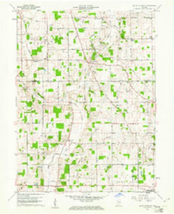
- 1960 USGS Mount Pleasant quadrangle1:24000, 4 printings
- 1986 USGS Muncie quadrangle1:100000, 3 printings



In the county-history sources
41,335 words on this townshipHistory of Delaware County, Indiana : with Illustrations and Biographical Sketches of Some of Its Prominent Men and Pioneers, published 1881 names this settlement in its chapter on Perry Township. These are the passages that mention it, exactly as the scans read.
Among the surviving pupils of that school are Thomas Hackett, John, Mary, Ellen and Martha Van Arsdall (Mrs. C. Ribble), David, Bowen, Lewis and Morris Reese. Jacob Powers was also a pupil of this school, and a promising young man. He became a teacher in after years, and conducted a very fine school in the township where he had been educated. A custom was prevalent in those days (and, among some of the more conservative rural communities of Eastern States, still prevails) by which it was made obligatory upon the teacher, at the Christmas season, to give a holiday treat to his scholars. This Powers refused to conform to (whether from prejudice or pecuniary considerations will never be known), and turned to leave the larger boys of his school, who were pressing the matter. Seeing them follow him, he started to run. He was pursued and overtaken, and, when the boys had led him to the brink of Prairie Creek, they offered him one more chanee to avert the " ducking" that must follow a further refusal. He would not yield, but explained to them that he had but tle day before had a tooth extracted, and that the consummation of their design would jeopardize his life. His explanation availed nothing, however, and his firmness only incensed the boys, who proceeded to throw him into the water. His words seemed prophetic. The cold bath gave him lock-jaw, from which he died in a few days.
Passage source: History of Delaware County, Indiana : with Illustrations and Biographical Sketches of Some of Its Prominent Men and Pioneers, published 1881.
Mount Pleasant is a thickly settled neighborhood in the southwestern part of the township, containing three cooper-shops and a number of dwelling-houses. Its close proximity to Mount Pleasant United Brethren Church probably explains the derivation of its name.
Passage source: History of Delaware County, Indiana : with Illustrations and Biographical Sketches of Some of Its Prominent Men and Pioneers, published 1881.
Soon after his settlement here, he was, compelled to take his team and make a trip to Wayne County, Ind., to mill. During his absence, the streams became swollen by heavy rains, and as there were no bridges, his return was necessarily postponed for several days. Meanwhile his wife was left at home with the care of a family of small boys exposed to the dangers of the forest, in a cabin which, in lieu of a door, was defended against attacks from the outside by a blanket or comfort, stretched across the opening. The wolves came at night, and she could see their wicked little eyes glaring through the darkness. They would pounce against the blanket across the door, but: the fire on the hearth kept them at bay, and they did not enter the cabin. The woods were full of panthers and bears, in addition to the wolves, and the dangers in an unprotected cabin were by no means slight. The nearest neighbor at that time was William McConnell, whose cabin was three miles distant. It was necessary then to place the young pigs in a pen for safe keeping at night, as the wild-cats entertained a special fondness for young pork, and committed serious depredations upon such pig-sties as were not carefully guarded. Game was abundant, and the larders of the settlers were never wanting for meat. Jacob W. Heath relates that, one morning, his father went out to hunt his horses, and found two large bucks fighting. He killed them both and' took them home, and Mr. Heath says that they were very fine, weighing fifty pounds to the quarter.
Passage source: History of Delaware County, Indiana : with Illustrations and Biographical Sketches of Some of Its Prominent Men and Pioneers, published 1881.
Machine-read from a century-old scan, so expect the errors a machine makes: misspelled names, dropped words, stray characters.
Read the whole chapter on Perry Township - it names this place 4 more 4 times.
Mines and quarries near this place
2 within 5 milesRegional context, not property-specific evidence. The federal mineral resources record lists 2 workings within 5 miles of Mount Pleasant: 1 producer, 1 past producer. 1 still produces. What was taken out: Sand and Gravel, Construction. Distance is straight-line from the map coordinates, so a quarry counted here may appear on a neighbouring settlement's page as well.
| Where | Site | Commodity | Status | Recorded |
|---|---|---|---|---|
| Luray Pit | Sand and Gravel, Construction | Producer | ||
| Springport Plant | Sand and Gravel, Construction | Past Producer |
Nearest settlements
The eight closest, with where each one stands in the county. Distances are straight-line, computed from the Geographic Names Information System coordinates.
| Map | Place | Distance | Sheets |
|---|---|---|---|
| New Burlington | 2.2 miles | 13 | |
| Medford | 2.3 miles | 13 | |
| Gates Corner | 3.1 miles | 13 | |
| Oakville | 4.5 miles | 13 | |
| Cowan | 4.5 miles | 13 | |
| Smithfield | 5.9 miles | 15 | |
| Irvington | 6.4 miles | 15 | |
| Hyde Park | 7.2 miles | 15 |
Elsewhere
Matched on this settlement's Geographic Names Information System number rather than its name, so it cannot be a different place of the same name in another state.
| Wikipedia article on Mount Pleasant | An encyclopaedic summary. Its text is share-alike, so it is linked here rather than copied. |
| Wikidata item Q6922809 | The structured record the population and elevation above come from. Public domain (CC0). |
Provenance
This settlement is recorded in the Geographic Names Information System as feature 439640. The sheet list is computed by point-in-boundary test against the United States Geological Survey's historical topographic inventory. Both are works of the United States government and carry no copyright under 17 U.S.C. 105.
Mines and quarries. USGS Mineral Resources Data System (MRDS) https://mrdata.usgs.gov/mrds/ A work of the United States government, no copyright under 17 U.S.C. 105.