 Block
New Burlington, Indiana
13 topographic sheets cover this place, the earliest surveyed in 1953 and the latest in 1986. It stands in Perry Township. It lies in ZIP code area 47302. It stands on Huffman Creek. The Survey maps it on the Mount Pleasant quadrangle.
On record in New Burlington
Buildings and businesses the archive holds for this place. Each opens its own page, with the source record it came from.
On the National Register within a mile 1 record
The National Register names another town for these. They stand within one mile of this settlement's coordinate.
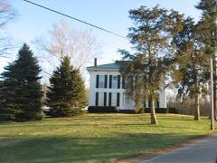 Dr. Samuel Vaughn Jump Houselisted 1982 · 0.0 miles away
Topographic sheets covering this place
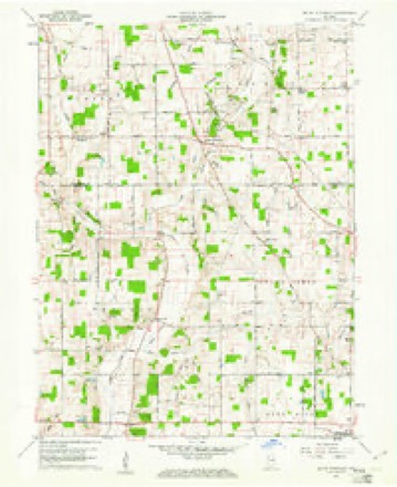
4 surveys from 13 printed sheetsMatched by testing this settlement's coordinate against the published boundary of every sheet in the United States Geological Survey's historical collection. Each opens the scanned sheet at the Survey.
- 1953 USGS Muncie quadrangle1:250000, 5 printings
- 1956 USGS Muncie quadrangle1:250000
- 1960 USGS Mount Pleasant quadrangle1:24000, 4 printings
- 1986 USGS Muncie quadrangle1:100000, 3 printings



In the county-history sources
41,335 words on this townshipHistory of Delaware County, Indiana : with Illustrations and Biographical Sketches of Some of Its Prominent Men and Pioneers, published 1881 names this settlement in its chapter on Perry Township. These are the passages that mention it, exactly as the scans read.
The first white men who entered the township with a view to its improvement came in April, 1820. They were Cornelius Van Arsdall, James Lee, William Blunt, David and Aaron Richardson. The party forced their way slowly through the deep forest, their wagon drawn by four yoke of oxen, and themselves compelled to precede the wagon, cutting away the timber, removing obstacles and bridging streams, in order to make a passage. Near the present site of New Burlington, a tree which they were attempting to remove fell upon one of the oxen, and simultaneously three Indians emerged from the thicket, offering their assistance in removing the tree. They were the first Indians the settlers had met, and the latter regarded them at first suspiciously. But their friendly actions soon re-assured them, and they received the hearty gratitude and good will of the white men, who had come to cultivate their former hunting-ground. These Indians were White Beaver, Wapach and Jefferson, and probably belonged to the Delaware tribe. The sight of the red faces became, in the course of time, very common, and inspired little or no dread, and they did not abuse the confidence of their white neighbors. Their various disastrous meetings with the army of Gen. Wayne had had the effect of subduing them, and making them quiet and peaceable toward the settlers.
Passage source: History of Delaware County, Indiana : with Illustrations and Biographical Sketches of Some of Its Prominent Men and Pioneers, published 1881.
One of the first acts of our pioneer party was the erection of rude cabins for the shelter of their families. Within a few days after their arrival, four new families joined them. Mr. Van Arsdall, with the hospitality characteristic of the times, took them into his own cabin, there to remain until they could erect homes of their own. His house was about fifteen feet square, and the inconvenience of having five fam- 'lies in such narrow quarters may be better imagined than described. Two weeks elapsed ere the inmates of his house completed their respective abodes.
Passage source: History of Delaware County, Indiana : with Illustrations and Biographical Sketches of Some of Its Prominent Men and Pioneers, published 1881.
The winter following their arrival was marked by some severe trials. They had partially succeeded in raising a crop of corn during the summer; but, just as it was ready for the harvest, it was blighted and ruined by frost, early in September. Provisions of all kinds were scarce, and fish almost constituted the diet of the settlers during that winter. The next season was more prosperous, and they did not again have the same difficulty to contend with.
Passage source: History of Delaware County, Indiana : with Illustrations and Biographical Sketches of Some of Its Prominent Men and Pioneers, published 1881.
Machine-read from a century-old scan, so expect the errors a machine makes: misspelled names, dropped words, stray characters.
Read the whole chapter on Perry Township - it names this place 19 more 19 times.
Mines and quarries near this place
1 within 5 milesRegional context, not property-specific evidence. The federal mineral resources record lists 1 working within 5 miles of New Burlington: 1 producer. All of them still produce. What was taken out: Sand and Gravel, Construction. Distance is straight-line from the map coordinates, so a quarry counted here may appear on a neighbouring settlement's page as well.
| Where | Site | Commodity | Status | Recorded |
|---|---|---|---|---|
| Luray Pit | Sand and Gravel, Construction | Producer |
Storms near this place
2 since 2013Regional context, not property-specific evidence. The National Weather Service names New Burlington in 2 storm reports between 2013 and 2023: 1 hail, 1 thunderstorm wind. No death or injury is recorded in these reports. Each account below is quoted exactly as the forecast office filed it, from the NOAA Storm Events Database, and each date opens the federal record of that event.
| When | Event | Place named | Harm | What the report says |
|---|---|---|---|---|
| July 2023 | Thunderstorm Wind | New Burlington | $1,000 | Thunderstorm winds downed a tree on Burlington Drive. Hail as large as quarters was reported on the east side of Prairie Creek Reservoir. |
| April 2013 | Hail | New Burlington | - | no account filed |
Nearest settlements
The eight closest, with where each one stands in the county. Distances are straight-line, computed from the Geographic Names Information System coordinates.
| Map | Place | Distance | Sheets |
|---|---|---|---|
| Medford | 1.2 miles | 13 | |
| Mount Pleasant | 2.2 miles | 13 | |
| Gates Corner | 2.6 miles | 13 | |
| Smithfield | 3.8 miles | 15 | |
| Irvington | 4.7 miles | 15 | |
| Cowan | 4.9 miles | 13 | |
| Hyde Park | 5.0 miles | 15 | |
| Selma | 5.2 miles | 15 |
Provenance
This settlement is recorded in the Geographic Names Information System as feature 440029. The sheet list is computed by point-in-boundary test against the United States Geological Survey's historical topographic inventory. Both are works of the United States government and carry no copyright under 17 U.S.C. 105.
Mines and quarries. USGS Mineral Resources Data System (MRDS) https://mrdata.usgs.gov/mrds/ A work of the United States government, no copyright under 17 U.S.C. 105.
Storms. NOAA National Centers for Environmental Information, Storm Events Database https://www.ncei.noaa.gov/stormevents/ A work of the United States government, no copyright under 17 U.S.C. 105. Narratives are quoted verbatim from the National Weather Service report and are not edited or summarised.