 Block
New Brunswick, Indiana
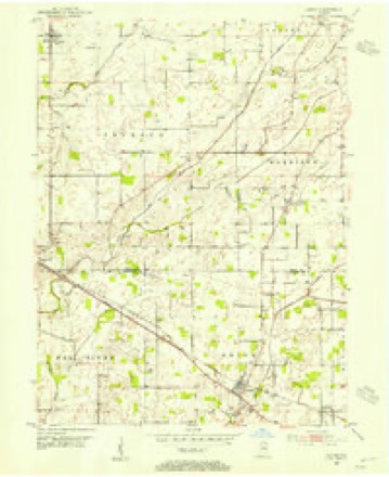
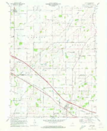
13 topographic sheets cover this place, the earliest surveyed in 1953 and the latest in 1986. It stands in Harrison Township. It lies in ZIP code area 46052. It lies near South Fork Prairie. The Survey maps it on the Lizton quadrangle. It stands 955 feet above sea level.
Topographic sheets covering this place
7 surveys from 13 printed sheetsMatched by testing this settlement's coordinate against the published boundary of every sheet in the United States Geological Survey's historical collection. Each opens the scanned sheet at the Survey.
- 1953 USGS Indianapolis quadrangle1:250000, 4 printings
- 1953 USGS Lizton quadrangle1:24000, 2 printings
- 1956 USGS Indianapolis quadrangle1:250000
- 1957 USGS Indianapolis quadrangle1:250000, 2 printings
- 1962 USGS Indianapolis quadrangle1:250000
- 1970 USGS Lizton quadrangle1:24000
- 1986 USGS Indianapolis quadrangle1:100000, 2 printings





In the county-history sources
548 words on this townshipEarly Life and Times in Boone County Indiana, published 1861 names this settlement in its chapter on Harrison Township. These are the passages that mention it, exactly as the scans read.
This township occupies a place in the south tier of townships. It is bounded on the south by Hendricks County, on the east by Perry Township, on the west by Jackson Township, and on the north by Center Township. It contains nearly twenty-four sections, about one section being taken off the northwest corner. If this corner was full it would be square, and would contain twenty-five sections. The surface is level to a great extent. The headwaters of Eel River have their source here, flowing out of and through the extensive prairie known as "Stoner's Prairie." It was thought at one time that the above lands could not be cultivated, but that idea has long since exploded and many acres are now profitably tilled, An extensive system of drainage has been introduced with good results. New Brunswick and Milledgeville are both in Harrison. They each contain several business houses, churches, postoffices, etc. The population of the township in 1880 was 1,401; number of school houses, 9; number of school children in 1884 was 414; number of brick houses, 4; number of frames,5. Harrison was settled about the year 1834 by the following persons: James Dale, George Johnson, William Butey, R. M. Cumels, Philip Sicks, Caleb Sherley, John Scott, A. Hillis, John McCormack, William Abner, William Joseph, Nick. Yount, James Chitwood, William and James Edwards, Joseph and George Keeth, Fleming Dickerson, Bennet Cline, Jacob Huff, Geo. Walters, Jos. Shepherd, Nathaniel Scott, G. W. Scott, Geo. Sheeks, J. Ingram, Noah Chitwood, Seth Goodwin, Daniel Turner, Jacob Dinsmore. J. B. Fear, Daniel Logan, W. H. Crose, Wm. Britton, the Shirleys. The first election was held at the cabin of W. Logan in 1836, when Wm. Buttery was elected Justice of the Peace. Among the early marriages were Wm. Johnson to Isabella Dale, G. T. Buttery to Barbara Scott, and Jeremiah Craven to Miss James. The first land entered was by James 8. Dale, who also built the first cabin. The first death was the wife of David James in March, 1837. The first: settlers of Harrison Township had many disadvantages to contend with. The surface of the land was covered with water, and where there was no prairie a heavy growth of timber and brush confronted them, and now and then a den of rattlesnakes chimed in to make music for them. Here, as well as in other townships, the first meetings were held in private houses. The first meeting was held at the house of Geo. H. Johnson in 1835, where a few pioneers gathered to hear a Baptist minister preach. arly meetings were also held at the house of Geo. Sheeks. Soon after a log house was built, which saw its day and then gave way to a more modern structure. Harrison Township now contains several frame edifices of different orders, where the citizens gather to hear the gospel preached. The population of Harrison in 1870 was 1,209 ; in 1880 it was 1,401. The number of voters in 1886 was 332. The following have served as Trustees: J. M. Shaw, Sampson Sheeks, W. H. Clements, G. W. Scott, Ora Knowlton, Jas. H. Pinnell, M. P. Higgins, W. H. Ragsdale, H. C. Ulin, J.S. Black, J. H. Acton, John Huffman, and Samuel Scott, now acting, was elected April. 1886.
Passage source: Early Life and Times in Boone County Indiana, published 1861.
Machine-read from a century-old scan, so expect the errors a machine makes: misspelled names, dropped words, stray characters.
Mines and quarries near this place
2 within 5 milesRegional context, not property-specific evidence. The federal mineral resources record lists 2 workings within 5 miles of New Brunswick: 2 past producers. None of them still produces. What was taken out: Sand and Gravel, Construction. Distance is straight-line from the map coordinates, so a quarry counted here may appear on a neighbouring settlement's page as well.
| Where | Site | Commodity | Status | Recorded |
|---|---|---|---|---|
| O.J. Pearcy Sand and Gravel Pit | Sand and Gravel, Construction | Past Producer | ||
| Skaggs Gravel Pit | Sand and Gravel, Construction | Past Producer |
Nearest settlements
The eight closest, with where each one stands in the county. Distances are straight-line, computed from the Geographic Names Information System coordinates.
| Map | Place | Distance | Sheets |
|---|---|---|---|
| Milledgeville | 2.5 miles | 12 | |
| Herr | 4.9 miles | 12 | |
| Shepherd | 5.1 miles | 12 | |
| Max | 5.5 miles | 9 | |
| Jamestown | 5.8 miles | 13 | |
| Advance | 6.3 miles | 13 | |
| Fayette | 6.7 miles | 12 | |
| Hazel College | 7.1 miles | 9 |
Elsewhere
Matched on this settlement's Geographic Names Information System number rather than its name, so it cannot be a different place of the same name in another state.
| Wikipedia article on New Brunswick | An encyclopaedic summary. Its text is share-alike, so it is linked here rather than copied. |
| Wikidata item Q7005773 | The structured record the population and elevation above come from. Public domain (CC0). |
Provenance
This settlement is recorded in the Geographic Names Information System as feature 440028. The sheet list is computed by point-in-boundary test against the United States Geological Survey's historical topographic inventory. Both are works of the United States government and carry no copyright under 17 U.S.C. 105.
Mines and quarries. USGS Mineral Resources Data System (MRDS) https://mrdata.usgs.gov/mrds/ A work of the United States government, no copyright under 17 U.S.C. 105.