 Block
Advance, Indiana
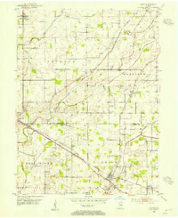
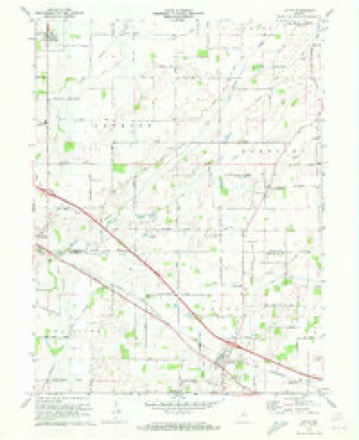
13 topographic sheets cover this place, the earliest surveyed in 1953 and the latest in 1986. It stands in Jackson Township. It lies in ZIP code area 46147. The Survey maps it on the Lizton quadrangle. 503 people lived here at the 2020 count. It stands 932 feet above sea level.
Population over time
2 figuresAdvance grew from 477 to 503 between 2010 and 2020. These are the recorded population figures Wikidata holds for this place, reached through the Geographic Names Information System number this page is keyed on rather than by name, so they belong to this place and not to another of the same name. Most are census counts, but not all are: an early figure may be a founding or settlement estimate, and an estimate published within five years of a census is left out. The change column is computed, and is left blank where more than 20 years separate a figure from the one before it, because a gap that long is not a change between two counts.
| Year | People | Change |
|---|---|---|
| 2010 | 477 | |
| 2020 | 503 | +26 (+5%) |
Topographic sheets covering this place
7 surveys from 13 printed sheetsMatched by testing this settlement's coordinate against the published boundary of every sheet in the United States Geological Survey's historical collection. Each opens the scanned sheet at the Survey.
- 1953 USGS Indianapolis quadrangle1:250000, 4 printings
- 1953 USGS Lizton quadrangle1:24000, 2 printings
- 1956 USGS Indianapolis quadrangle1:250000
- 1957 USGS Indianapolis quadrangle1:250000, 2 printings
- 1962 USGS Indianapolis quadrangle1:250000
- 1970 USGS Lizton quadrangle1:24000
- 1986 USGS Indianapolis quadrangle1:100000, 2 printings





In the county-history sources
11,623 words on this townshipEarly Life and Times in Boone County Indiana, published 1861 names this settlement in its chapter on Jackson Township. These are the passages that mention it, exactly as the scans read.
This township occupies the southwest corner of the county. It is bounded on the south by Hendricks County, on the west by Montgomery County, on the north by Jefferson Township, and on the east by Harrison and Center Townships. It contains a little less than forty-eight sections, being a little deficient at the northeast corner. Jackson Township is drained by Eel River and Raccoon Creek, the former leaving the county and entering Hendricks County at the south line of section eleven a short distance southeast of Jamestown. Raccoon Chests flows in a southwestern direction, leaving the township in section thirty-one, near where the Indiana, Bloomington & Western Railroad enters the county of Montgomery. The above railroad enters Jackson Township at the south line on section eleven, passing through Jamestown, bearing to the north of west, and leaving the county and township in section thirty-one. Without doubt, Jackson is one of the best townships in the county. The land along the above streams can be excelled in no place, much less in Boone County. Good husbandry is noticeable in every direction, brought about by a well-directed system of drainage. Jackson originally was the best timbered township in the county, if one may judge from what is yet standing and from stumps of trees cut down - timber of the most valuable kind - such as walnut, poplar, oak, etc. There is yet (in 1886) standing on the farm of Mrs. Ashley, three miles northwest of Jamestown, one of the finest poplar groves in the state. It is a grand sight to behold those monarchs of the forest. But the ax is, or soon will be, whetted that will lay them low, as well as others of the same kind. A stump of a poplar tree, on the farm of W. H. Coombs, measures nine feet.. This tree, when standing, was said to be one of the finest specimens of its kind in the township. The proposed Anderson & St. Louis Railroad will, if ever finished, pass through Jackson Township in a southwesterly direction, entering at section eighteen, passing through Advance, and leaving the county and township at section thirty. Jamestown, one of the earliest settled places in the county, is, and has been for years, the principal trading point in the township, as well as the voting precinct, a separate account of which will be found in another part of this work, under the head of "Sketch of Jamestown." Advance, mentioned as being located on the Anderson & St. Louis Railroad, is a voting place, and contains several business houses, postoffice, church, etc. Although a new place, it has quite a local trade, and, on the completion of the railroad, will be a place of some importance. It is located in the northern part of the township, midway between the east and west lines, and is six miles due north of Jamestown. Jackson Township was settled about the year 1828. Among the first to arrive, we find the following: Young Hughs, Lewis Dewees, John and Washington Gibson, William Farlow, Isaac Miller, David Bush, John Porter, Robert Davis, Andrew Hudson, Alijah Brown, Samuel Jessie, Andrew Long, George and William Walters, William White, Hiram Young, Jacob Johns, and John Whitley. This pioneer band were joined a few yeers later by the following persons : The Headys, Niceleys, Emmerts, John McLean, John T. Hurt, John Crisman, John Cunningham, Mieken Hurt, Thomas Caldwell, Samuel Miller, James Davis, Robert Walker, William Duncan, Isaac M. Shelly, Anderson Trotter, John Airhart, Henry Airhart, Isaac H. Smith, W. H. Coombs, S. P. Dewees, W. B. Gibson, Dr. George L. Burke, Samuel Penry, Samuel Cunningham, Elisha Jackson, Henry B. Myers, W. W. Emmet, and the Galvins.
Passage source: Early Life and Times in Boone County Indiana, published 1861.
To canvass a community when there are seven threshing machines at work, besides the making of hay, cutting oats, and other work going on at the same time, is not a very desirable job, especially when the thermometer is in the nineties. Among the older citizens called on during the past week were Elijah Jackson, Bart Miller, G. W. Shockley, Peter Deweese, J. H. Kibbey, Milton Young, W. H. Coombs, and J. M. Sandy. All are interested in the early history of Boone. Among the younger men called on were J. M. Ashley, Thos. Ashley, J. M. Emmert, Stephen D. Emmert, Ephraim Kibbey,
Passage source: Early Life and Times in Boone County Indiana, published 1861.
Machine-read from a century-old scan, so expect the errors a machine makes: misspelled names, dropped words, stray characters.
Read the whole chapter on Jackson Township - it names this place 2 more 2 times.
Storms near this place
19 since 1997Regional context, not property-specific evidence. The National Weather Service names Advance in 19 storm reports between 1997 and 2025: 11 thunderstorm wind, 6 hail, 1 tornado, 1 flood. No death or injury is recorded in these reports. Each account below is quoted exactly as the forecast office filed it, from the NOAA Storm Events Database, and each date opens the federal record of that event.
| When | Event | Place named | Harm | What the report says |
|---|---|---|---|---|
| May 2003 | Tornado (F1) | Advance | $50,000 | no account filed |
| April 2017 | Thunderstorm Wind | Advance | $20,000 | Eighteen utility poles were downed along State Road 75 due to damaging thunderstorm wind gusts. |
| June 2023 | Thunderstorm Wind | Advance | $5,000 | Tree limbs downed by thunderstorm wind gusts. |
| June 2010 | Thunderstorm Wind | Advance | $1,000 | Large tree limbs were reported down due to damaging thunderstorm wind gusts at the intersection of County Roads 200 S and 700 W. |
| June 2010 | Flood | Advance | $500 | Water, 6 to 8 inches deep, was reported over the road in Advance. |
| September 1997 | Thunderstorm Wind | Advance | $500 | Thunderstorm winds blew down a tree in Advance. |
| July 2014 | Thunderstorm Wind | Advance | $200 | A 4 to 5 inch diameter tree limb was downed along State Route 75 due to strong thunderstorm wind gusts. |
| March 2025 | Thunderstorm Wind | Advance | - | A 70 mph thunderstorm wind gust was estimated at this location along with 1 inch hail. |
| March 2020 | Hail | Advance | - | Relayed via Skywarn network. |
| February 2014 | Thunderstorm Wind | Advance | - | An estimated 60 mph thunderstorm wind gust was observed in the town of Advance. |
| May 2009 | Thunderstorm Wind | Advance | - | A tree was reported to have been blown down by thunderstorm winds near the junction of State Route 75 and County Road 400 South. |
| June 2006 | Thunderstorm Wind | Advance | - | Trees were downed. |
| March 2020 | Hail | Advance | - | no account filed |
| February 2014 | Hail | Advance | - | no account filed |
| March 2012 | Hail | Advance | - | no account filed |
| June 2008 | Hail | Advance | - | no account filed |
| April 2006 | Hail | Advance | - | no account filed |
| July 2003 | Thunderstorm Wind | Advance | - | no account filed |
| June 1998 | Thunderstorm Wind | Advance | - | no account filed |
Nearest settlements
The eight closest, with where each one stands in the county. Distances are straight-line, computed from the Geographic Names Information System coordinates.
| Map | Place | Distance | Sheets |
|---|---|---|---|
| Max | 2.2 miles | 9 | |
| Dover | 4.0 miles | 9 | |
| Jamestown | 4.8 miles | 13 | |
| New Brunswick | 6.3 miles | 13 | |
| Hazelrigg | 6.7 miles | 9 | |
| Milledgeville | 6.7 miles | 12 | |
| Hazel College | 6.8 miles | 9 | |
| Lebanon | 8.8 miles | 11 |
Elsewhere
Matched on this settlement's Geographic Names Information System number rather than its name, so it cannot be a different place of the same name in another state.
| Wikipedia article on Advance | An encyclopaedic summary. Its text is share-alike, so it is linked here rather than copied. |
| Wikidata item Q2513068 | The structured record the population and elevation above come from. Public domain (CC0). |
Provenance
This settlement is recorded in the Geographic Names Information System as feature 430023. The sheet list is computed by point-in-boundary test against the United States Geological Survey's historical topographic inventory. Both are works of the United States government and carry no copyright under 17 U.S.C. 105.
Storms. NOAA National Centers for Environmental Information, Storm Events Database https://www.ncei.noaa.gov/stormevents/ A work of the United States government, no copyright under 17 U.S.C. 105. Narratives are quoted verbatim from the National Weather Service report and are not edited or summarised.