 Block
North Salem, Indiana
13 topographic sheets cover this place, the earliest surveyed in 1953 and the latest in 1986. It stands in Eel River Township. It lies in ZIP code area 46165. It stands on Middle Fork Big Walnut Creek. The Survey maps it on the North Salem quadrangle. 464 people lived here at the 2020 count. It stands 892 feet above sea level.
Population over time
2 figuresNorth Salem fell from 518 to 464 between 2010 and 2020. These are the recorded population figures Wikidata holds for this place, reached through the Geographic Names Information System number this page is keyed on rather than by name, so they belong to this place and not to another of the same name. Most are census counts, but not all are: an early figure may be a founding or settlement estimate, and an estimate published within five years of a census is left out. The change column is computed, and is left blank where more than 20 years separate a figure from the one before it, because a gap that long is not a change between two counts.
| Year | People | Change |
|---|---|---|
| 2010 | 518 | |
| 2020 | 464 | -54 (-10%) |
Topographic sheets covering this place
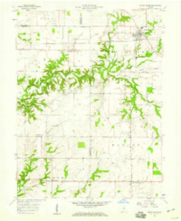
6 surveys from 13 printed sheetsMatched by testing this settlement's coordinate against the published boundary of every sheet in the United States Geological Survey's historical collection. Each opens the scanned sheet at the Survey.
- 1953 USGS Indianapolis quadrangle1:250000, 4 printings
- 1956 USGS Indianapolis quadrangle1:250000
- 1957 USGS Indianapolis quadrangle1:250000, 2 printings
- 1958 USGS North Salem quadrangle1:24000, 3 printings
- 1962 USGS Indianapolis quadrangle1:250000
- 1986 USGS Indianapolis quadrangle1:100000, 2 printings





In the county-history sources
11,488 words on this townshipHistory of Hendricks County, Indiana, Together with Sketches of Its Cities, Villages and Towns, Educational, Religious, Civil, Military, and Political History, Portraits of Prominent Persons, and Biographies of Representative Citizens, published 1885 names this settlement in its chapter on Eel River Township. These are the passages that mention it, exactly as the scans read.
Near the southwest corner of the township, from difterent directions, come together five considerable streams, to form Eel River proper. These five streams spread out orer the township like a fan, and make as many beautiful valleys, which are separated bv undulating ridges which were originally covered with a dense growth of sugar maple, walnut, oak and poplar trees. From many points in the township extensive tracts of country may be seen at one view; and as the delighted beholder looks out upon vistas of rich farm land, stretching down the valleya, Tvitli alternating fields of dark green corn or golden wliert, while upon either side stretch away beautiful undulating hills, diversified by open woodland and cleared fields, upon which hundreds of fiit, sleek cattle are feedinoupon the rich carpet of blue grass, or ruminating beneath some mighty old monarch of the primeval forest, he can hardly realize that be lias before him a realitj", and tliat the picture he sees is not a dream about some fairj land. As may be already inferred, there is little land in Eel River Township that is not first-class. The soil is uniformly good, and is adapted to grain and grass alike.
Passage source: History of Hendricks County, Indiana, Together with Sketches of Its Cities, Villages and Towns, Educational, Religious, Civil, Military, and Political History, Portraits of Prominent Persons, and Biographies of Representative Citizens, published 1885.
In the spring of 1S24 Noah Bateman and Eeuben Claypool settled in this township a mile south of North Salem, and were followed in the fall by John Claypool and John S. "Woodward. Among those who located in the township previous to 1830 were James Trotter, Ileury Bales, J. and Martha Page, John F.Benson, Eobert Covey, Enoch Davis and his sons, William, Frank and Jesse; Willian^ Dewitt, Dr. Collins, Andrew Clifton, James Campbell, Mr. Cram and the Fenningtons. John F. Benson built the first mill in the county on Eock Branch, in 1820. Colonel Kichols says it was a very patient and industrious mill, but " rather slow."
Passage source: History of Hendricks County, Indiana, Together with Sketches of Its Cities, Villages and Towns, Educational, Religious, Civil, Military, and Political History, Portraits of Prominent Persons, and Biographies of Representative Citizens, published 1885.
The first school was taught about 1S29, ia a house one-half mile southeast of North Salem, by "William Dewitt. This man had fled from Now Orleans for some crime, joined a pirate vessel, and with it sailed more than once around the world, and finally left the vessel to seek a new and different life in the wilds of the JS'orth. He was a man of intelligence, and was one of the most successful pioneer instructors in Hendricks County. He was one of the principal teachers of Eel River Township for a number of years. He died near North Salem at the advanced age of 115.' He used to say to his neighbors, after he was passed 100 years old, that if he did not get out of this wet country, he would never again be the man he had been.
Passage source: History of Hendricks County, Indiana, Together with Sketches of Its Cities, Villages and Towns, Educational, Religious, Civil, Military, and Political History, Portraits of Prominent Persons, and Biographies of Representative Citizens, published 1885.
Machine-read from a century-old scan, so expect the errors a machine makes: misspelled names, dropped words, stray characters.
Read the whole chapter on Eel River Township - it names this place 28 more 28 times.
Storms near this place
29 since 2002Regional context, not property-specific evidence. The National Weather Service names North Salem in 29 storm reports between 2002 and 2023: 14 hail, 12 thunderstorm wind, 3 tornado. No death or injury is recorded in these reports. Each account below is quoted exactly as the forecast office filed it, from the NOAA Storm Events Database, and each date opens the federal record of that event.
| When | Event | Place named | Harm | What the report says |
|---|---|---|---|---|
| March 2021 | Thunderstorm Wind | North Salem | $250,000 | Reports of trees uprooted by thunderstorm wind gusts with some falling on a couple of houses. Powerlines were also downed. At least three garages were lifted off their foundation. |
| April 2004 | Tornado (F1) | North Salem | $150,000 | A tornado associated with a low-topped supercell touched down a quarter of a mile south of the Boone/Hendricks county line in Hendricks county. The tornado continued northeast through Jamestown and into Boone county causing significant damage to a dozen homes. 2 homes had their roofs blown completely off and tossed several hundred feet into a corn field. There were 8 minor injuries including one man whose semi was blown over along Interstate 74. Estimated wind speeds were around 110 mph or on the high end of an F1 rating. |
| April 2006 | Thunderstorm Wind | North Salem | $15,000 | A trailer was destroyed by straight line winds. |
| May 2013 | Tornado (EF0) | North Salem | $10,000 | One weak tornado occurred west of Brownsburg near North Salem. Toppled trees, snapped limbs, light damage to a barn, and minor roof damage revealed evidence of rotation in the winds and damage consistent with an EF0 tornado with winds up to 85 mph. |
| June 2009 | Thunderstorm Wind | North Salem | $10,000 | A tree, twenty inches in diameter, was downed at State Route 75 and Elm Street in Jamestown due to thunderstorm wind gusts. Half of the town was reported to be without power. The time this event occurred is estimated. Other power lines and trees were reported downed in the area as well. |
| June 2009 | Thunderstorm Wind | North Salem | $2,000 | Trees, near six inches in diameter, were downed in North Salem due to thunderstorm wind gusts. |
| September 2012 | Thunderstorm Wind | North Salem | $500 | Multiple 4 to 6 inch diameter tree limbs were downed due to damaging thunderstorm wind gusts near the intersection of County Roads 900 North and 775 West. |
| June 2023 | Thunderstorm Wind | North Salem | - | A 63 mph thunderstorm wind gust was measured by a trained spotter. |
| July 2017 | Thunderstorm Wind | North Salem | - | Crops and buildings were damaged because of damaging thunderstorm wind gusts. The what and to what extent something was damaged is not known. |
| September 2012 | Hail | North Salem | - | An estimated thunderstorm wind gust of 50 mph was also observed. |
| May 2009 | Thunderstorm Wind | North Salem | - | Four trees were reported blown down by thunderstorm winds across town, ranging in size from 6 to 12 inches in diameter. |
| June 2008 | Thunderstorm Wind | North Salem | - | Thunderstorm winds blew 3-inch limbs down onto SR 136. |
| April 2007 | Tornado (EF0) | North Salem | - | The same mini supercell storm that produced the first tornado in Clay County produced a second tornado at 5:35 P.M. EDT near North Salem or about 12 miles west of Brownsburg. This tornado, first reported by the Hendricks County Sheriff Department, touched down over open fields causing no damage and was rated an EF0 on the Enhanced Fujita Intensity scale with winds estimated near 70 mph. | |
| June 2007 | Thunderstorm Wind | North Salem | - | Trees were reported down due to damaging thunderstorm winds. |
| April 2006 | Hail | North Salem | - | No damage estimates were available. |
| June 2005 | Thunderstorm Wind | North Salem | - | A telephone pole was snapped off. |
| May 2012 | Hail | North Salem | - | no account filed |
| May 2012 | Hail | North Salem | - | no account filed |
| March 2012 | Hail | North Salem | - | no account filed |
| August 2012 | Hail | North Salem | - | no account filed |
| September 2012 | Hail | North Salem | - | no account filed |
| April 2011 | Hail | North Salem | - | no account filed |
| May 2011 | Hail | North Salem | - | no account filed |
| June 2008 | Hail | North Salem | - | no account filed |
| April 2007 | Hail | North Salem | - | no account filed |
| April 2006 | Hail | North Salem | - | no account filed |
| June 2005 | Hail | North Salem | - | no account filed |
| June 2005 | Hail | North Salem | - | no account filed |
| June 2002 | Thunderstorm Wind | North Salem | - | no account filed |
Nearest settlements
The eight closest, with where each one stands in the county. Distances are straight-line, computed from the Geographic Names Information System coordinates.
Elsewhere
Matched on this settlement's Geographic Names Information System number rather than its name, so it cannot be a different place of the same name in another state.
| Wikipedia article on North Salem | An encyclopaedic summary. Its text is share-alike, so it is linked here rather than copied. |
| Wikidata item Q2894084 | The structured record the population and elevation above come from. Public domain (CC0). |
Provenance
This settlement is recorded in the Geographic Names Information System as feature 440289. The sheet list is computed by point-in-boundary test against the United States Geological Survey's historical topographic inventory. Both are works of the United States government and carry no copyright under 17 U.S.C. 105.
Storms. NOAA National Centers for Environmental Information, Storm Events Database https://www.ncei.noaa.gov/stormevents/ A work of the United States government, no copyright under 17 U.S.C. 105. Narratives are quoted verbatim from the National Weather Service report and are not edited or summarised.