 Block
Lizton, Indiana
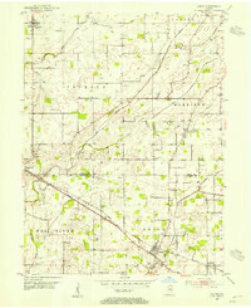
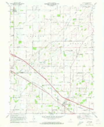
13 topographic sheets cover this place, the earliest surveyed in 1953 and the latest in 1986. It stands in Union Township. It lies in ZIP code area 46149. The Survey maps it on the Lizton quadrangle. 511 people lived here at the 2020 count. It stands 955 feet above sea level.
Population over time
2 figuresLizton grew from 488 to 511 between 2010 and 2020. These are the recorded population figures Wikidata holds for this place, reached through the Geographic Names Information System number this page is keyed on rather than by name, so they belong to this place and not to another of the same name. Most are census counts, but not all are: an early figure may be a founding or settlement estimate, and an estimate published within five years of a census is left out. The change column is computed, and is left blank where more than 20 years separate a figure from the one before it, because a gap that long is not a change between two counts.
| Year | People | Change |
|---|---|---|
| 2010 | 488 | |
| 2020 | 511 | +23 (+5%) |
Topographic sheets covering this place
7 surveys from 13 printed sheetsMatched by testing this settlement's coordinate against the published boundary of every sheet in the United States Geological Survey's historical collection. Each opens the scanned sheet at the Survey.
- 1953 USGS Indianapolis quadrangle1:250000, 4 printings
- 1953 USGS Lizton quadrangle1:24000, 2 printings
- 1956 USGS Indianapolis quadrangle1:250000
- 1957 USGS Indianapolis quadrangle1:250000, 2 printings
- 1962 USGS Indianapolis quadrangle1:250000
- 1970 USGS Lizton quadrangle1:24000
- 1986 USGS Indianapolis quadrangle1:100000, 2 printings





In the county-history sources
15,349 words on this townshipHistory of Hendricks County, Indiana, Together with Sketches of Its Cities, Villages and Towns, Educational, Religious, Civil, Military, and Political History, Portraits of Prominent Persons, and Biographies of Representative Citizens, published 1885 names this settlement in its chapter on Union Township. These are the passages that mention it, exactly as the scans read.
The, first settlement in the township was made on the farm which Mr. Yeiley lias since owned, by John Matlock and John Fowler, about the year 1S2S. Isaac Yeiley entered the land where Lizton stands, in 1S2S, but did not move to the settlement until 1831. Among those wlio settled in the township before 183.5 are Archibald Alexander, James and William Leak and their sons, AYilliam Montgomery, John Pritchett, Claiborne Davis and the Plnmmers. Owing to the poor natural drainage, the bad condition of the roads, and the very many inconveniences of this locality, the settlement grew very slowly until 1S40, at which date the cabins were very scattering, and the clearings very small. Since that tinae the development ot the country and the increase of population has been rapid.
Passage source: History of Hendricks County, Indiana, Together with Sketches of Its Cities, Villages and Towns, Educational, Religious, Civil, Military, and Political History, Portraits of Prominent Persons, and Biographies of Representative Citizens, published 1885.
The settlers often canglit them in traps. "When desirable to capture them alive, this was always necessary, and was accomplished by making a log pen so high that they could not jump over, and arranging a trap door, to which a string was fastened. Corn was then scattered in trails in different directions through the woods to entice the swine into the pen, when a man secreted high in a tree top would spring the trap and the swine were caught.
Passage source: History of Hendricks County, Indiana, Together with Sketches of Its Cities, Villages and Towns, Educational, Religious, Civil, Military, and Political History, Portraits of Prominent Persons, and Biographies of Representative Citizens, published 1885.
As soon as enough persons could be got together to make a hearing, Gilbert Harney and .Jol)n Harris, of the Christian church, began preaching in the settlement; and in 1837 Gilbert Harney organized, at the house of Archibald Alexander, a church, with Mr. Alexander, Joseph F. Lewis, Samuel C. Carrington and their wives, and a few others, as members. The present church was built about 1ST5. Rev. U. C. Brewer, of Danville, conducts services here the fourth Sunday of each month. The Methodist Episcopal society date from 1533, when a class was formed at the house of William Montgomery, who was leader. Among the members were Mr. Plumraer, Sally Bargan, Claiborne Davis and John Pritchett. Tlie church is a half a mile south of Lizton. Services are held e\ery two weeks by Rev. Mr. Smith, of Jamestown.
Passage source: History of Hendricks County, Indiana, Together with Sketches of Its Cities, Villages and Towns, Educational, Religious, Civil, Military, and Political History, Portraits of Prominent Persons, and Biographies of Representative Citizens, published 1885.
Machine-read from a century-old scan, so expect the errors a machine makes: misspelled names, dropped words, stray characters.
Read the whole chapter on Union Township - it names this place 4 more 4 times.
Mines and quarries near this place
2 within 5 milesRegional context, not property-specific evidence. The federal mineral resources record lists 2 workings within 5 miles of Lizton: 2 past producers. None of them still produces. What was taken out: Sand and Gravel, Construction. Distance is straight-line from the map coordinates, so a quarry counted here may appear on a neighbouring settlement's page as well.
| Where | Site | Commodity | Status | Recorded |
|---|---|---|---|---|
| O.J. Pearcy Sand and Gravel Pit | Sand and Gravel, Construction | Past Producer | ||
| Skaggs Gravel Pit | Sand and Gravel, Construction | Past Producer |
Storms near this place
16 since 1998Regional context, not property-specific evidence. The National Weather Service names Lizton in 16 storm reports between 1998 and 2026: 10 thunderstorm wind, 5 hail, 1 tornado. No death or injury is recorded in these reports. Each account below is quoted exactly as the forecast office filed it, from the NOAA Storm Events Database, and each date opens the federal record of that event.
| When | Event | Place named | Harm | What the report says |
|---|---|---|---|---|
| March 2026 | Thunderstorm Wind | Lizton | $80,000 | Thunderstorm wind gusts downed multiple trees and branches. A long section of chain link fence was torn off its support pole at Tri West Middle School. School also had damage to athletic facilities and a shed. Some shingles were also torn off a home across the street and a nearby family pole barn was destroyed with significant roof damage. |
| April 2007 | Tornado (EF1) | Lizton | $70,000 | This third tornado, also reported by the Sheriff Department, began at 6:37 P.M. EDT about two miles southwest of Lizton, or about 8 miles northwest of Brownsburg. This tornado passed southeast of Lizton and lifted about one mile west of Pittsboro around 6:50 P.M. EDT. Several garages and barns were destroyed, several homes suffered lighter damage. Trees and power lines were also reported down. This tornado was rated an EF1 on the Enhanced Fujita scale with winds estimated around 90 mph.| |
| April 2007 | Thunderstorm Wind | Lizton | $10,000 | A roof and a farm building sustained damage due to damaging thunderstorm winds. Trees also were reported down from the winds. |
| September 2014 | Thunderstorm Wind | Lizton | $5,000 | Trees were reported down onto a street due to damaging thunderstorm wind gusts. A corn field also sustained some damage. Time of this event was estimated based on radar. |
| April 2007 | Thunderstorm Wind | Lizton | $1,000 | Trees and power lines were reported down due to damaging thunderstorm winds. |
| April 2007 | Thunderstorm Wind | Lizton | $500 | Metal debris was reported on the road due to damaging thunderstorm winds. |
| May 1998 | Thunderstorm Wind | Lizton | $500 | Trees blown down. |
| April 2017 | Hail | Lizton | - | This report originated from the county emergency manager. |
| June 2008 | Thunderstorm Wind | Lizton | - | no account filed |
| October 2007 | Hail | Lizton | - | no account filed |
| June 2006 | Hail | Lizton | - | no account filed |
| June 2005 | Hail | Lizton | - | no account filed |
| June 2005 | Thunderstorm Wind | Lizton | - | no account filed |
| June 2005 | Thunderstorm Wind | Lizton | - | no account filed |
| June 2000 | Thunderstorm Wind | Lizton | - | no account filed |
| August 2000 | Hail | Lizton | - | no account filed |
Nearest settlements
The eight closest, with where each one stands in the county. Distances are straight-line, computed from the Geographic Names Information System coordinates.
| Map | Place | Distance | Sheets |
|---|---|---|---|
| Raintown | 1.9 miles | 13 | |
| Montclair | 2.9 miles | 12 | |
| Maplewood | 4.1 miles | 12 | |
| Pittsboro | 4.3 miles | 15 | |
| North Salem | 5.6 miles | 13 | |
| Tilden | 7.1 miles | 15 | |
| Brownsburg | 8.3 miles | 15 | |
| Danville | 8.7 miles | 12 |
Elsewhere
Matched on this settlement's Geographic Names Information System number rather than its name, so it cannot be a different place of the same name in another state.
| Wikipedia article on Lizton | An encyclopaedic summary. Its text is share-alike, so it is linked here rather than copied. |
| Wikidata item Q523493 | The structured record the population and elevation above come from. Public domain (CC0). |
Provenance
This settlement is recorded in the Geographic Names Information System as feature 438191. The sheet list is computed by point-in-boundary test against the United States Geological Survey's historical topographic inventory. Both are works of the United States government and carry no copyright under 17 U.S.C. 105.
Mines and quarries. USGS Mineral Resources Data System (MRDS) https://mrdata.usgs.gov/mrds/ A work of the United States government, no copyright under 17 U.S.C. 105.
Storms. NOAA National Centers for Environmental Information, Storm Events Database https://www.ncei.noaa.gov/stormevents/ A work of the United States government, no copyright under 17 U.S.C. 105. Narratives are quoted verbatim from the National Weather Service report and are not edited or summarised.