 Block
Oaklandon, Indiana
12 topographic sheets cover this place, the earliest surveyed in 1952 and the latest in 1986. It stands in Lawrence Township. It lies in ZIP code area 46236. It stands on Mock Creek. The Survey maps it on the Cumberland quadrangle.
On record in Oaklandon
Buildings and businesses the archive holds for this place. Each opens its own page, with the source record it came from.
On the National Register 1 record
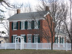 Christopher Apple Houselisted 1980
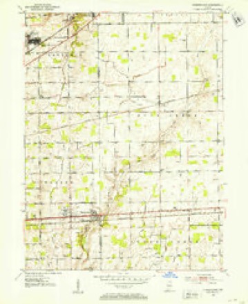
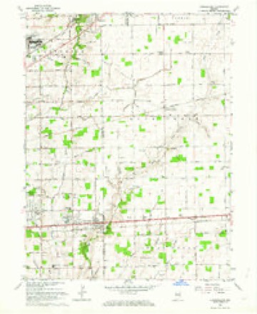
Topographic sheets covering this place
5 surveys from 12 printed sheetsMatched by testing this settlement's coordinate against the published boundary of every sheet in the United States Geological Survey's historical collection. Each opens the scanned sheet at the Survey.
- 1952 USGS Cumberland quadrangle1:24000
- 1953 USGS Cincinnati quadrangle1:250000, 3 printings
- 1957 USGS Cincinnati quadrangle1:250000
- 1962 USGS Cumberland quadrangle1:24000, 5 printings
- 1986 USGS New Castle quadrangle1:100000, 2 printings



In the county-history sources
25,786 words on this townshipHistory of Indianapolis and Marion County, Indiana, published 1884 names this settlement in its chapter on Lawrence Township. These are the passages that mention it, exactly as the scans read.
Post-Offices and Villages. - The following-named post-offices are located in Lawrence township, viz. : Castleton, Lawrence, and Oaklandon. At. and from each of these offices the mail arrives and departs twice daily. Mail matter intended for Germantown is sent to Oaklandon, and that bound for Vertland goes to Castleton.
Passage source: History of Indianapolis and Marion County, Indiana, published 1884.
The village of Oakland is situated thirteen miles from Indianapolis, on the Bee-Line Railroad. It was laid out June 18, 1849, by John Emery. The name Oakland was suggested by Dr. Moore. The streets have never been improved and many of the houses are in a dilapidated condition, and the village presents the appearance of age and decay. Subsequent to 1849 John Mock, Andrew F. Cory, John ' W. Combs, and Enoch Hanna laid out additions. The first merchants were the firm of John W. & William Combs ; the first practicing physician was James W. Hervey. The town has a population of about two hundred, and has a telephonic connection and a Western Union Telegraph office. The railroad company recently completed a commodious depot, which adds greatly to the comfort of the traveling public. The present merchants are David G. Hanna and Naaman G. Plummer, both of whom are dealers in general merchandise. Andrew F. Cory and Jeff. K. Heltman are the physicians, and Naaman C. Plummer is the postmaster. The name of the postoffice is Oaklandon. The town has three churches, - a Methodist, a Christian, and a Universalist. The last two named have a large membership and are well attended. The first Darned, however, is in a precarious condition. The village contains a graded school, and the Masons, Odd-Fellows, and Grangers have lodges located there.
Passage source: History of Indianapolis and Marion County, Indiana, published 1884.
Tlie following are the officers of the association for 1883: 0. W. Voorhis, president, Lawrence, Ind. ; John W. Apple, vice-president, Oaklandon, Ind.; Levi Bolander, treasurer, Oaklandon, Ind. ; James H. Thomas, general superintendent, Lawrence, Ind. ; William B. Flick, secretary, Lawrence, Ind.
Passage source: History of Indianapolis and Marion County, Indiana, published 1884.
Machine-read from a century-old scan, so expect the errors a machine makes: misspelled names, dropped words, stray characters.
Mines and quarries near this place
1 within 5 milesRegional context, not property-specific evidence. The federal mineral resources record lists 1 working within 5 miles of Oaklandon: 1 producer. All of them still produce. What was taken out: Stone. Distance is straight-line from the map coordinates, so a quarry counted here may appear on a neighbouring settlement's page as well.
| Where | Site | Commodity | Status | Recorded |
|---|---|---|---|---|
| Lawrence City-Own Crews | Stone | Producer |
Storms near this place
21 since 1996Regional context, not property-specific evidence. The National Weather Service names Oaklandon in 21 storm reports between 1996 and 2025: 12 hail, 8 thunderstorm wind, 1 flood. No death or injury is recorded in these reports. Each account below is quoted exactly as the forecast office filed it, from the NOAA Storm Events Database, and each date opens the federal record of that event.
| When | Event | Place named | Harm | What the report says |
|---|---|---|---|---|
| April 2025 | Thunderstorm Wind | Oaklandon | $10,000 | Furniture blown, large limbs, and tree tops downed from thunderstorm winds. |
| August 2011 | Thunderstorm Wind | Oaklandon | $10,000 | Rotted or partially rotted trees were blown down in a few locations within the Geist Reservoir area due to damaging thunderstorm wind gusts. These locations included the 10500th block of Fall Creek Road, the 900th block of Brigs Way, and the 10300th block of Stormhaven Way. |
| May 2008 | Hail | Oaklandon | $5,000 | Tree limbs were down and structural damage occurred to a house due to large damaging hail. |
| August 2012 | Thunderstorm Wind | Oaklandon | $3,000 | A healthy tree about 50 feet tall and 16 to 18 inches in diameter was downed across a road and partially on to a pickup truck due to damaging thunderstorm wind gusts. |
| June 2025 | Thunderstorm Wind | Oaklandon | $1,000 | Large tree branch downed by thunderstorm wind gusts. |
| July 2023 | Thunderstorm Wind | Oaklandon | $1,000 | Large tree snapped by thunderstorm wind gusts. |
| February 2016 | Thunderstorm Wind | Oaklandon | $750 | A tree was reported down on East 56th Street in Lawrence due to thunderstorm gusts estimated at 45 mph. |
| June 2011 | Flood | Oaklandon | $500 | Street flooding was occurring near the intersection of 79th Street and Fall Creek Parkway, due to thunderstorm heavy rainfall. |
| June 1998 | Thunderstorm Wind | Oaklandon | $500 | Thunderstorm winds blew down a tree and a large limb. |
| June 2010 | Thunderstorm Wind | Oaklandon | - | Thunderstorm winds blew down a healthy tree/tree limb at its 10-inch diameter base. |
| July 1998 | Hail | Oaklandon | - | Reported by TV meteorologist. |
| July 2023 | Hail | Oaklandon | - | no account filed |
| June 2021 | Hail | Oaklandon | - | no account filed |
| January 2018 | Hail | Oaklandon | - | no account filed |
| May 2014 | Hail | Oaklandon | - | no account filed |
| June 2013 | Hail | Oaklandon | - | no account filed |
| April 2012 | Hail | Oaklandon | - | no account filed |
| April 2012 | Hail | Oaklandon | - | no account filed |
| April 2006 | Hail | Oaklandon | - | no account filed |
| May 2006 | Hail | Oaklandon | - | no account filed |
| June 1996 | Hail | Oaklandon | - | no account filed |
Nearest settlements
The eight closest, with where each one stands in the county. Distances are straight-line, computed from the Geographic Names Information System coordinates.
| Map | Place | Distance | Sheets |
|---|---|---|---|
| Rainbow Highlands | 1.8 miles | 12 | |
| Indian Lake | 1.8 miles | 12 | |
| Trilobi Hills | 2.2 miles | 12 | |
| Fall Creek Highland | 2.4 miles | 12 | |
| Germantown | 3.7 miles | 12 | |
| Fairwood Hills | 3.9 miles | 19 | |
| Lawrence | 4.3 miles | 17 | |
| Robinson (historical) | 4.5 miles | 17 |
Elsewhere
Matched on this settlement's Geographic Names Information System number rather than its name, so it cannot be a different place of the same name in another state.
| Wikidata item Q122560498 | The structured record the population and elevation above come from. Public domain (CC0). |
Provenance
This settlement is recorded in the Geographic Names Information System as feature 440474. The sheet list is computed by point-in-boundary test against the United States Geological Survey's historical topographic inventory. Both are works of the United States government and carry no copyright under 17 U.S.C. 105.
Mines and quarries. USGS Mineral Resources Data System (MRDS) https://mrdata.usgs.gov/mrds/ A work of the United States government, no copyright under 17 U.S.C. 105.
Storms. NOAA National Centers for Environmental Information, Storm Events Database https://www.ncei.noaa.gov/stormevents/ A work of the United States government, no copyright under 17 U.S.C. 105. Narratives are quoted verbatim from the National Weather Service report and are not edited or summarised.