 Block
Otisco, Indiana
8 topographic sheets cover this place, the earliest surveyed in 1956 and the latest in 1990. It stands in Charlestown Township. It lies in ZIP code area 47163. The Survey maps it on the Otisco quadrangle. It stands 673 feet above sea level.
Topographic sheets covering this place
5 surveys from 8 printed sheetsMatched by testing this settlement's coordinate against the published boundary of every sheet in the United States Geological Survey's historical collection. Each opens the scanned sheet at the Survey.
- 1956 USGS Louisville quadrangle1:250000, 2 printings
- 1956 USGS Otisco quadrangle1:24000, 3 printings
- 1964 USGS Louisville quadrangle1:250000
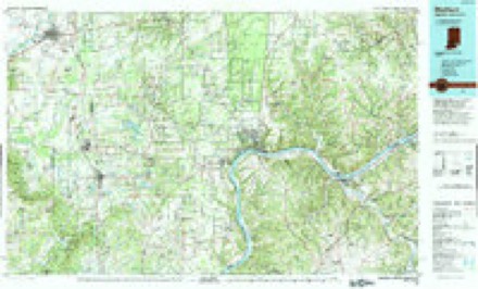
- 1986 USGS Madison quadrangle1:100000
- 1990 USGS Madison quadrangle1:100000
In the county-history sources
3,790 words on this townshipBaird's History of Clark County, Indiana, published 1909 names this settlement in its chapter on Charlestown Township. These are the passages that mention it, exactly as the scans read.
The Otisco society was organized early in 1870 in the school-house, with only eleven members, none of which are now living. It was organized by Rev. Peter H. Bottorff, as local elder. He is now living on a farm in ITica township, near Utica, Indiana. At that time Enoch G. ^^'ood was presiding elder. The following pastors served while they worshiped in the school-house : In the fall of 1870 Rev. W. H. Widman was sent on the work; his year was completed by Rev. Jacob Ruddle. Rev. A. M. Louden served one year, from 1871 to 1872. Rev. Thomas Brooks served one year, from 1872 to 1873: Rev. A. G. Aldridge one year, from 1873 to 1874. Rev, Henn.' Morrow, one year, from 1874 to 1875. Then came the Rev. W. H. Burton, who served three years in all, from 1875 to 1878. During his first year's work in the school-house, he, with the help of others, erected and completed the church which is now standing, and in June, 1876, on the 25th day of the month, the church was dedicated for the public worship of God, by the Rev. F. A. Hester. D. D. Brother Ed Covert is now the oldest living member uniting with the Methodist Episcopal church, in March of 1870. Sister Emma Nevelle, being the next oldest living member, both of these united during the pastorate of Rev. P. H. Bottorff. Brother J. A. Kirk, now living at this place was licensed as a local preacher in 1878, during the pastorate of Rev. J. T. O'Neal, D. D., who ser\'ed as pastor two years, from 1878 to 1880. Brother Ed Kirk was given an exhorter's license by Rev. George Church, who served one year, from 1901 to 1902. The following pastors have served the church faithfully and well :
Passage source: Baird's History of Clark County, Indiana, published 1909.
Other chapels in the Otisco circuit are: Pleasant Ridge, a class of sixtyfive members; Beswick chapel, a class of thirty-nine members; Nabb's chapel at Nabbs, with a class of thirty-five members ; New Bethel, a class with ninety members, and Lexington, a class with thirty-five members.
Passage source: Baird's History of Clark County, Indiana, published 1909.
Machine-read from a century-old scan, so expect the errors a machine makes: misspelled names, dropped words, stray characters.
Mines and quarries near this place
8 within 5 milesRegional context, not property-specific evidence. The federal mineral resources record lists 8 workings within 5 miles of Otisco: 8 occurrences. None of them still produces. What was taken out: Iron. Distance is straight-line from the map coordinates, so a quarry counted here may appear on a neighbouring settlement's page as well.
| Where | Site | Commodity | Status | Recorded |
|---|---|---|---|---|
| Unnamed Prospect | Iron | Occurrence | ||
| Unnamed Prospect | Iron | Occurrence | ||
| Unnamed Prospect | Iron | Occurrence | ||
| Unnamed Prospect | Iron | Occurrence | ||
| Unnamed Prospect | Iron | Occurrence | ||
| Unnamed Prospect | Iron | Occurrence | ||
| Unnamed Prospect | Iron | Occurrence | ||
| Unnamed Prospect | Iron | Occurrence |
Storms near this place
11 since 2012Regional context, not property-specific evidence. The National Weather Service names Otisco in 11 storm reports between 2012 and 2025: 6 hail, 4 thunderstorm wind, 1 flash flood. No death or injury is recorded in these reports. Each account below is quoted exactly as the forecast office filed it, from the NOAA Storm Events Database, and each date opens the federal record of that event.
| When | Event | Place named | Harm | What the report says |
|---|---|---|---|---|
| July 2015 | Flash Flood | Otisco | $5,000 | A Clark County law enforcement official reported that a water rescue was performed near the intersection of Henryville-Otisco and Pfister roads. |
| March 2025 | Thunderstorm Wind | Otisco | - | A tree was blown down on the 900 block of Leon Prall Road near Otisco. |
| May 2025 | Hail | Otisco | - | Quarter sized hail was observed between Henryville and Otisco. |
| June 2025 | Thunderstorm Wind | Otisco | - | A tree was blown down onto power lines and a shed near Zollman Road. |
| March 2023 | Hail | Otisco | - | Quarter sized hail fell near Otisco. |
| July 2023 | Hail | Otisco | - | Quarter sized hail reported near Otisco. |
| March 2019 | Hail | Otisco | - | Hail was reported in Otisco, Indiana. |
| January 2013 | Thunderstorm Wind | Otisco | - | A spotter estimated winds of 50 to 60 mph. |
| March 2012 | Hail | Otisco | - | Sporadic baseball sized fell, denting a vehicle in the driveway. |
| July 2012 | Thunderstorm Wind | Otisco | - | A trained spotter estimated 60 mph winds and half inch hail. |
| August 2017 | Hail | Otisco | - | no account filed |
Nearest settlements
The eight closest, with where each one stands in the county. Distances are straight-line, computed from the Geographic Names Information System coordinates.
| Map | Place | Distance | Sheets |
|---|---|---|---|
| New Market | 2.7 miles | 9 | |
| Marysville | 3.2 miles | 8 | |
| Runyantown | 4.6 miles | 17 | |
| Clark Siding | 4.8 miles | 15 | |
| Henryville | 5.3 miles | 11 | |
| Rolling Hills | 6.1 miles | 17 | |
| Charlestown | 6.2 miles | 15 | |
| Sylvan Grove | 6.3 miles | 15 |
Elsewhere
Matched on this settlement's Geographic Names Information System number rather than its name, so it cannot be a different place of the same name in another state.
| Wikipedia article on Otisco | An encyclopaedic summary. Its text is share-alike, so it is linked here rather than copied. |
| Wikidata item Q7108843 | The structured record the population and elevation above come from. Public domain (CC0). |
Provenance
This settlement is recorded in the Geographic Names Information System as feature 440733. The sheet list is computed by point-in-boundary test against the United States Geological Survey's historical topographic inventory. Both are works of the United States government and carry no copyright under 17 U.S.C. 105.
Mines and quarries. USGS Mineral Resources Data System (MRDS) https://mrdata.usgs.gov/mrds/ A work of the United States government, no copyright under 17 U.S.C. 105.
Storms. NOAA National Centers for Environmental Information, Storm Events Database https://www.ncei.noaa.gov/stormevents/ A work of the United States government, no copyright under 17 U.S.C. 105. Narratives are quoted verbatim from the National Weather Service report and are not edited or summarised.