 Block
Plainfield, Indiana
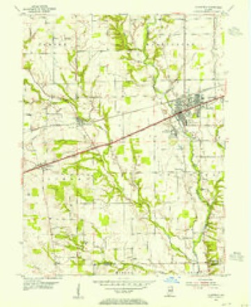
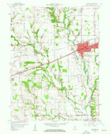
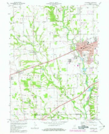
16 topographic sheets cover this place, the earliest surveyed in 1953 and the latest in 1986. It stands in Guilford Township. It lies in ZIP code area 46168. The Survey maps it on the Plainfield quadrangle. 34,625 people lived here at the 2020 count. It stands 715 feet above sea level.
Research this city
On record in Plainfield
Buildings and businesses the archive holds for this place. Each opens its own page, with the source record it came from.
On the National Register 6 records
 Hendricks County Bridge Number 316listed 2003
 Kellum-Jessup-Chandler Farmlisted 1994
 Plainfield Historic Districtlisted 2010
 Smith Farmlisted 2007
 THI and E Interurban Depot-Substationlisted 2002
- Sugar Grove Meetinghouse and Cemeterylisted 2000
Population over time
2 figuresPlainfield grew from 27,631 to 34,625 between 2010 and 2020. These are the recorded population figures Wikidata holds for this place, reached through the Geographic Names Information System number this page is keyed on rather than by name, so they belong to this place and not to another of the same name. Most are census counts, but not all are: an early figure may be a founding or settlement estimate, and an estimate published within five years of a census is left out. The change column is computed, and is left blank where more than 20 years separate a figure from the one before it, because a gap that long is not a change between two counts.
| Year | People | Change |
|---|---|---|
| 2010 | 27,631 | |
| 2020 | 34,625 | +6,994 (+25%) |
Topographic sheets covering this place
8 surveys from 16 printed sheetsMatched by testing this settlement's coordinate against the published boundary of every sheet in the United States Geological Survey's historical collection. Each opens the scanned sheet at the Survey.
- 1953 USGS Indianapolis quadrangle1:250000, 4 printings
- 1953 USGS Plainfield quadrangle1:24000
- 1956 USGS Indianapolis quadrangle1:250000
- 1957 USGS Indianapolis quadrangle1:250000, 2 printings
- 1959 USGS Plainfield quadrangle1:24000, 2 printings
- 1962 USGS Indianapolis quadrangle1:250000
- 1970 USGS Plainfield quadrangle1:24000, 3 printings
- 1986 USGS Indianapolis quadrangle1:100000, 2 printings





In the county-history sources
10,518 words on this townshipHistory of Hendricks County, Indiana, Together with Sketches of Its Cities, Villages and Towns, Educational, Religious, Civil, Military, and Political History, Portraits of Prominent Persons, and Biographies of Representative Citizens, published 1885 names this settlement in its chapter on Guilford Township. These are the passages that mention it, exactly as the scans read.
Guilford was the first settled township in the county, and its occupancy dates back to 1820. In that year Samuel Herriman James Dunn, Bat Ramsey, Harris Bay, John W. Bryant, and George Moore settled on White Lick, south of Plainfield, near the Morgan County line. Some of these settlers raised some corn and ' potatoes in 1S20. I'l the spring of 1821 Xoah Kellum, Thomas ' = - - - (607)
Passage source: History of Hendricks County, Indiana, Together with Sketches of Its Cities, Villages and Towns, Educational, Religious, Civil, Military, and Political History, Portraits of Prominent Persons, and Biographies of Representative Citizens, published 1885.
Few co'amunities in the world are as unequally divided in political sent' jient as Guilford, which has been almost unanimous in its loyalt" to the Whig party and its successor, the Republican party. The largest number of votes ever given the .Democratic ticket was fit'ty-two, in 1836. In .186i, Lincoln received 575 votes, and McOleiland'One. Following is the vote for President at each election since 1S2S:
Passage source: History of Hendricks County, Indiana, Together with Sketches of Its Cities, Villages and Towns, Educational, Religious, Civil, Military, and Political History, Portraits of Prominent Persons, and Biographies of Representative Citizens, published 1885.
Constallcs: Granville P. Barker and '"William Bryant, 1836; Ziniri Vestal, 1837; "William Hamlet and Isaac Holton, 1838; ""William Bryant and John Shelley, 1839; Eli McCaslin, 1844; Eli M- Jaslin and John C. Johnson, 184-5; Eli McCaslin and Line Jfown, 1847; Coleman Francis, Rufus Ostler and Yerlin Jones, 1848; - John Moon and Eli McCaslin, 1849; John Dobbins and Barney A. Tomlinson, 1850; "Willis H. lV;lhite and "William Glasscock, 1851; Benjamin McConaha, and John Tauksley, 1852; John Dobbins and "William Moss, 1853; Joseph Talbot and Robert Edmonds. 1854; John Medaris, Loten Jenkins and George "W. Stephens, 1855; Caleb Dalton, Isaac Sparks and Madison Lawrence, 1856; John D. "Williams and B. A. Tomlinson, 1857; Milton Harvey and Joseph Cox, 1858; Cargy Eeagan and "W. H. "Williite, 1859; Perry Ransom and "W. H. "Wilhite, 1860; Perry Ransom and Amos Easterling, 1861; Joseph A- Co.x and F. Shirley, 1862; Edward D. Stratton and John Sims, 1S63; William H. Thompson and John Dobbins, 1864; John Dobbins and Isaac Sparks, 1865; Nathan Hubbard and Jonathan Mendenhall, 1S66; Elijah Eddy and A. ^V. Greenlee, 1867; "William K. Lakin and Elijah Eddy, 1868; David McNabb and Charles Doan, 1869; Thomas J. Stewart and Daniel McXabb, 1870; Thomas J. Stewart, 1S72; Thomas Stewart and Henry "Widdows, 1874; Thomas Stewart and "William Lakin, 1876; "William Lakin and "Willsam Stone, 1878; "William Sorters and John Craig, 1880; "William Sorters and Peter Bryant, 1882; Corry Edmonds, 1SS4.
Passage source: History of Hendricks County, Indiana, Together with Sketches of Its Cities, Villages and Towns, Educational, Religious, Civil, Military, and Political History, Portraits of Prominent Persons, and Biographies of Representative Citizens, published 1885.
Machine-read from a century-old scan, so expect the errors a machine makes: misspelled names, dropped words, stray characters.
Read the whole chapter on Guilford Township - it names this place 33 more 33 times.
Fires near this place
6 since 2003Regional context, not property-specific evidence. The federal wildfire occurrence database lists 6 fires within 5 miles of Plainfield between 2003 and 2007, burning about 2 acres in total. None started naturally. 1 was recorded as arson. Distance is straight-line from the map coordinates, so a fire counted here may appear on a neighbouring settlement's page as well.
| Reported cause | Fires |
|---|---|
| Smoking | 2 |
| Missing data/not specified/undetermined | 2 |
| Equipment and vehicle use | 1 |
| Arson/incendiarism | 1 |
The most recent of them, most recent first, with the day each was reported and the service that recorded it.
| Date | Cause | Size | Reported by | Name on the report |
|---|---|---|---|---|
| 21 May 2007 | Missing data/not specified/undetermined | under an acre | Indiana State Fire Marshal's Office | not named |
| 7 April 2007 | Arson/incendiarism | under an acre | Indiana State Fire Marshal's Office | not named |
| 15 April 2003 | Smoking | 1.0 acres | Indiana State Fire Marshal's Office | not named |
| 12 April 2006 | Smoking | under an acre | Indiana State Fire Marshal's Office | not named |
| 11 March 2007 | Missing data/not specified/undetermined | under an acre | Indiana State Fire Marshal's Office | not named |
| 7 October 2005 | Equipment and vehicle use | under an acre | Indiana State Fire Marshal's Office | not named |
Settlements close enough to share some of these fires:
Mines and quarries near this place
3 within 5 milesRegional context, not property-specific evidence. The federal mineral resources record lists 3 workings within 5 miles of Plainfield: 2 past producers, 1 producer. 1 still produces. What was taken out: Sand and Gravel, Construction, Clay. Distance is straight-line from the map coordinates, so a quarry counted here may appear on a neighbouring settlement's page as well.
| Where | Site | Commodity | Status | Recorded |
|---|---|---|---|---|
| Indiana Tile Clay and Shale Pit | Clay | Past Producer | ||
| Happy Valley Gravel Pit | Sand and Gravel, Construction | Past Producer | ||
| U. S. Aggregates, Inc. | Sand and Gravel, Construction | Producer |
Storms near this place
60 of 75 shownRegional context, not property-specific evidence. The National Weather Service names Plainfield in 75 storm reports between 1994 and 2025: 38 hail, 27 thunderstorm wind, 5 flash flood, 3 flood. The reports record 2 injuries. Each account below is quoted exactly as the forecast office filed it, from the NOAA Storm Events Database, and each date opens the federal record of that event.
| When | Event | Place named | Harm | What the report says |
|---|---|---|---|---|
| May 1996 | Thunderstorm Wind | Plainfield | 2 hurt, $5,000 | no account filed |
| June 2023 | Thunderstorm Wind | Plainfield | $150,000 | Numerous trees and powerlines downed by thunderstorm wind gusts in Plainfield and across the county. Over 3000 power outages caused by the storm. |
| June 2002 | Lightning | Plainfield | $80,000 | Lightning struck a bank. |
| April 1994 | Thunderstorm Wind | Plainfield | $50,000 | High winds downed numerous trees, destroyed a two car garage and flying debris damaged the adjacent home. |
| May 2002 | Flash Flood | Plainfield | $25,000 | no account filed |
| June 2025 | Thunderstorm Wind | Plainfield | $10,000 | Thunderstorm wind gusts downed multiple trees and tree limbs on Stafford Rd. |
| June 2010 | Thunderstorm Wind | Plainfield | $10,000 | Heavy roof damage was reported in this location due to damaging thunderstorm wind gusts. |
| August 2020 | Thunderstorm Wind | Plainfield | $5,000 | A tree and power lines were blown down from thunderstorm winds at County Road 200 South and Dan Jones Road. |
| July 2015 | Flash Flood | Plainfield | $5,000 | Several houses surrounded by water on County Road 350 due to heavy thunderstorm rainfall. |
| August 2012 | Hail | Plainfield | $5,000 | Quarter sized hail damaged shingles and shredded leaves. |
| June 2010 | Thunderstorm Wind | Plainfield | $5,000 | A home in the West Bay subdivision sustained partial roof damage due to damaging thunderstorm wind gusts. |
| August 2021 | Thunderstorm Wind | Plainfield | $3,000 | Tree limbs and a few small trees were snapped by thunderstorm wind gusts. |
| October 2010 | Thunderstorm Wind | Plainfield | $3,000 | A support post was reportedly blown out on a front porch due to damaging thunderstorm wind gusts. |
| July 2021 | Thunderstorm Wind | Plainfield | $2,000 | A tree branch with diameter of 4 inches was snapped at the trunk by thunderstorm wind gusts. A tree was also blown down nearby. |
| July 2008 | Thunderstorm Wind | Plainfield | $2,000 | Trees and utility lines were blown down by thunderstorm winds. |
| June 1997 | Thunderstorm Wind | Plainfield | $1,300 | Three foot diameter tree blown onto apartment roof. |
| June 2025 | Thunderstorm Wind | Plainfield | $1,000 | Thunderstorm wind gusts downed an eight-inch diameter live tree near Carr Road and US 40. |
| August 2020 | Thunderstorm Wind | Plainfield | $1,000 | Thunderstorm winds blew down a 14 to 16 inch diameter tree across the road near or at the intersection of County Road 625 East and County Road 300 South. |
| August 2020 | Thunderstorm Wind | Plainfield | $1,000 | A large tree limb approximately 8 to 10 inches in diameter was blown down by thunderstorm wind gusts. |
| June 2019 | Flood | Plainfield | $1,000 | There was extensive flooding at Saratoga Parkway and Fairfield Road due to heavy rainfall. |
| July 2017 | Flash Flood | Plainfield | $1,000 | State Road 267 was closed three miles north of Interstate 70 due to flooding from thunderstorm heavy rainfall. |
| July 2015 | Flash Flood | Plainfield | $1,000 | Heavy thunderstorm rainfall over the past 4 hours has created flash flooding resulting in swiftly moving water. Rain is continuing to fall. |
| July 2013 | Thunderstorm Wind | Plainfield | $1,000 | A tree was reported down near the intersection of Dan Jones Road and County Road 200 South due to damaging thunderstorm wind gusts. This report was received via Twitter. |
| May 1997 | Lightning | Plainfield | $1,000 | no account filed |
| July 2014 | Flood | Plainfield | $500 | Water was reported to be crossing the roadway in a lower lying area of Dan Jones Road, south of County Road 200 South, due to heavy thunderstorm rainfall. |
| January 2013 | Flood | Plainfield | $500 | White Lick Creek, south of Brownsburg, is flooded due to heavy thunderstorm rainfall. Many other local roads are closed and County Road 267 is closed south of Plainfield. |
| August 2014 | Thunderstorm Wind | Plainfield | $250 | A 4-inch diameter, live tree limb was broken off due to strong thunderstorm wind gusts. |
| July 2014 | Thunderstorm Wind | Plainfield | $100 | A thunderstorm wind gust, estimated at between 55 and 65 mph, blew a stop sign down in this location. |
| June 2023 | Hail | Plainfield | - | Thunderstorm hail continued into southeastern Hendricks County, with hail as large as 1.25 inches in the Plainfield area. |
| March 2012 | Hail | Plainfield | - | Quarter-sized hail was observed near Dan Jones Road and County Road 200 South. |
| August 2012 | Hail | Plainfield | - | Many small limbs were reported down as well, with rainfall measuring 1.01 inches in 30 minutes. |
| August 2012 | Hail | Plainfield | - | A thunderstorm wind gust of 50 mph was observed in this location as well. |
| August 2012 | Hail | Plainfield | - | The hail lasted nearly 10 minutes. |
| August 2012 | Hail | Plainfield | - | Quarter size hail was observed at the Homewood Suites. |
| August 2011 | Thunderstorm Wind | Plainfield | - | A measured 77 mph thunderstorm wind gust was observed at Highway 40 and Center Street. |
| April 2010 | Hail | Plainfield | - | Pea to nickel sized hail was observed by the public in this location. |
| June 2010 | Flash Flood | Plainfield | - | Plainfield Police evacuated 25 people on a voluntary basis from the Crystal Bay neighborhood due to flooding. Several roads in the nearby area were flooded and closed to traffic: Sugar Grove (700 E), Township Line Road between Dan Jones and Smith Road, 300 South between Vestal and Center Street, South Center Street between Hadley Road and I-70, 2600 East Main Street, and Vestal/800 East. Time of event is estimated. |
| June 2008 | Thunderstorm Wind | Plainfield | - | A three foot diameter tree was blown down near Center Street and Stanley Road. |
| July 2008 | Thunderstorm Wind | Plainfield | - | These thunderstorm winds were encountered in Plainfield and on Six Points Road. |
| June 2007 | Thunderstorm Wind | Plainfield | - | Trees were reported down due to damaging thunderstorm winds. |
| July 2005 | Thunderstorm Wind | Plainfield | - | Trees were downed. |
| July 2005 | Thunderstorm Wind | Plainfield | - | A truck driver measured a 71 mph wind gust on Interstate 70. |
| May 1995 | Thunderstorm Wind | Plainfield | - | Thunderstorm winds blew down numerous trees and carried a trampoline nearly a quarter mile in the air. |
| June 1995 | Hail | Plainfield | - | Tractor-semitrailers and mobile homes were damaged. |
| June 1995 | Hail | Plainfield | - | Tractor-semitrailers and mobile homes were damaged. |
| April 2018 | Hail | Plainfield | - | no account filed |
| April 2015 | Hail | Plainfield | - | no account filed |
| April 2015 | Hail | Plainfield | - | no account filed |
| July 2015 | Hail | Plainfield | - | no account filed |
| May 2014 | Hail | Plainfield | - | no account filed |
| May 2012 | Hail | Plainfield | - | no account filed |
| May 2012 | Hail | Plainfield | - | no account filed |
| March 2012 | Hail | Plainfield | - | no account filed |
| March 2012 | Hail | Plainfield | - | no account filed |
| March 2012 | Hail | Plainfield | - | no account filed |
| March 2012 | Hail | Plainfield | - | no account filed |
| March 2012 | Hail | Plainfield | - | no account filed |
| August 2012 | Hail | Plainfield | - | no account filed |
| August 2012 | Hail | Plainfield | - | no account filed |
| August 2012 | Hail | Plainfield | - | no account filed |
Nearest settlements
The eight closest, with where each one stands in the county. Distances are straight-line, computed from the Geographic Names Information System coordinates.
| Map | Place | Distance | Sheets |
|---|---|---|---|
| Cartersburg | 3.4 miles | 16 | |
| Six Points | 3.7 miles | 17 | |
| Magnetic Springs | 3.9 miles | 16 | |
| Avon | 4.0 miles | 15 | |
| Big Four Yard | 4.5 miles | 16 | |
| Belleville | 5.1 miles | 16 | |
| North Belleville | 5.1 miles | 16 | |
| Joppa | 5.3 miles | 16 |
Elsewhere
Matched on this settlement's Geographic Names Information System number rather than its name, so it cannot be a different place of the same name in another state.
| Wikipedia article on Plainfield | An encyclopaedic summary. Its text is share-alike, so it is linked here rather than copied. |
| Wikidata item Q986631 | The structured record the population and elevation above come from. Public domain (CC0). |
Provenance
This settlement is recorded in the Geographic Names Information System as feature 441219. The sheet list is computed by point-in-boundary test against the United States Geological Survey's historical topographic inventory. Both are works of the United States government and carry no copyright under 17 U.S.C. 105.
Wildfire. Short, Karen C. 2022. Spatial wildfire occurrence data for the United States, 1992-2020 [FPA_FOD_20221014]. 6th Edition. Fort Collins, CO: Forest Service Research Data Archive. https://doi.org/10.2737/RDS-2013-0009.6 Collected with United States Government funding and usable without additional permissions or fees.
Mines and quarries. USGS Mineral Resources Data System (MRDS) https://mrdata.usgs.gov/mrds/ A work of the United States government, no copyright under 17 U.S.C. 105.
Storms. NOAA National Centers for Environmental Information, Storm Events Database https://www.ncei.noaa.gov/stormevents/ A work of the United States government, no copyright under 17 U.S.C. 105. Narratives are quoted verbatim from the National Weather Service report and are not edited or summarised.