 Block
Plattsburg, Indiana
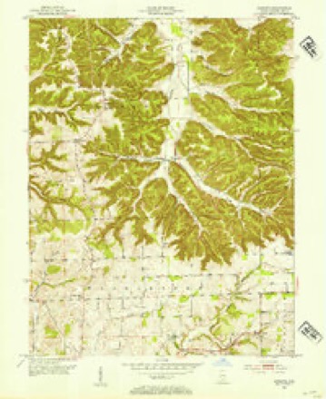
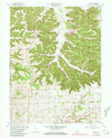
15 topographic sheets cover this place, the earliest surveyed in 1953 and the latest in 1990. It stands in Monroe Township. It lies in ZIP code area 47281. The Survey maps it on the Kossuth quadrangle. It stands 863 feet above sea level.
Topographic sheets covering this place
7 surveys from 15 printed sheetsMatched by testing this settlement's coordinate against the published boundary of every sheet in the United States Geological Survey's historical collection. Each opens the scanned sheet at the Survey.
- 1953 USGS Kossuth quadrangle1:24000, 3 printings
- 1956 USGS Vincennes quadrangle1:250000, 4 printings
- 1957 USGS Vincennes quadrangle1:250000
- 1958 USGS Vincennes quadrangle1:250000, 2 printings
- 1963 USGS Kossuth quadrangle1:24000, 3 printings
- 1986 USGS Bedford quadrangle1:100000
- 1990 USGS Bedford quadrangle1:100000



In the county-history sources
3,578 words on this townshipCentennial History of Washington County, Indiana : Its People, Industies and Institutions : with Biographical Sketches of Representative Citizens and Genealogical Records of Many of the Old Families, published 1916 names this settlement in its chapter on Monroe Township. These are the passages that mention it, exactly as the scans read.
At quite an early day the backbone of land extending north from Salem to the Muscatatuck river was called "Wahiut Ridge'" on account of the fine groves of black-walnut trees that grew on these lands. Along the ridge, extending from the headwaters of Blue river to the Muscatatuck, there was an old Indian trail- that had, no doubt, been traveled over a great deal by redmen, for it was easily traced from one end to the other. The first white men coming into this county', finding this trail, rightly concluded that there must be a fertile country lying to the north, and would have gone there, but for some se;ven or eight years after they first located in this county, the river was considered the "dead-line," between the whites and the warring savages, and it was very liazardous for the pioneers to venture over into disputed territory. The Indians, who remained south of Muscatatuck and White rivers were friendly to the whites and never gave them any trouble. The depredations that were committed were by Indians who came across into the county from the north and west. Walnut ridge, which is now included within the boundaries of Monroe township, was for several years rather a dangerous place for scattered settlers, some of whom were killed by the Indians, and they frequently lost stock by thieving bands of these savages that roamed about through the country.
Passage source: Centennial History of Washington County, Indiana : Its People, Industies and Institutions : with Biographical Sketches of Representative Citizens and Genealogical Records of Many of the Old Families, published 1916.
The first settlers to venture into the township were Adam Housh and Solomon Rink, in 1808. The first cabin built in the township was Housh's, which stood a few rods south of the Kossuth store. Rink had a sort of pen made of poles on his land about a half mile south of where Plattsburg stands. In the spring of 1809, several others moved in, including Jacob Hattabough, \\'illiam Logan and Thomas Denney. In 1810 George Hattabough, Jacob Rink, Michael Rink, Dempsey Rice and many others came in. Shortly after landing here Jacob Hattabough purchased Rink's right to the land he had squatted on. In those days lands sold at the land office for two dollars and fifty cents per acre, on the installment plan. Hattabough had been to Jeffersonville to make a payment on his land and had paid out all but fifty dollars and had a certificate showing that to be a fact, but on his way home he lost his receipt. The word went round that this certificate was lost, when Adam Housh went to Jeftersonville and finished paying out on the land, getting a land warrant in his own name. This gave rise to a lawsuit which came off at Corydon, in which nattabough was winner. Someone had found the certificate he had lost and left it at Royse's Lick, with Doctor Lamb, which put in evidence, with the other facts in the case, won the suit for Hattabough.
Passage source: Centennial History of Washington County, Indiana : Its People, Industies and Institutions : with Biographical Sketches of Representative Citizens and Genealogical Records of Many of the Old Families, published 1916.
In 1819 John DePauw erected a saw and grist-mill on the Muscatatuck. and named the place "Millport." It was a water mil! and was operated regularly until about 1850, when the dam washed out during a spring freshet. From this point several flat-boats were sent out every spring as the waters subsided; many of the Salem merchants put their surplus farm products in these boats, it being then the most convenient method of getting their stuff to the southern market - New Orleans then being the only outlet for farm products for all the Ohio and Mississippi valleys. After the dam at Millport washed away the farmers owning lands about the mill seriously objected to its being replaced, whereupon W. C. DePauw put in a steam power which he operated for several years; Jonathan Pidgeon being the head man of the entire plant, he being the owner of the mill when the dam washed out. ^Vhen the Salem and Millport plank road was completed in the fall of 1851 and the spring of 1852, most of the lumber used was sawed at Millport; there being much fine timljer on the knobs near the mill. This was the only plank mad ever completed in the county, se\'eral nthers being talked of and even rights of way being secured for the saiue. One was to lead from Harrstown from Delaney's creek and on to Brownstown, and some grading was begun on the same, but work ceased for lack of funds.
Passage source: Centennial History of Washington County, Indiana : Its People, Industies and Institutions : with Biographical Sketches of Representative Citizens and Genealogical Records of Many of the Old Families, published 1916.
Machine-read from a century-old scan, so expect the errors a machine makes: misspelled names, dropped words, stray characters.
Read the whole chapter on Monroe Township - it names this place 6 more 6 times.
Mines and quarries near this place
1 within 5 milesRegional context, not property-specific evidence. The federal mineral resources record lists 1 working within 5 miles of Plattsburg: 1 past producer. None of them still produces. What was taken out: Sand and Gravel, Construction. Distance is straight-line from the map coordinates, so a quarry counted here may appear on a neighbouring settlement's page as well.
| Where | Site | Commodity | Status | Recorded |
|---|---|---|---|---|
| Hatlebaugh-Ewing Gravel Pit | Sand and Gravel, Construction | Past Producer |
Storms near this place
2 since 2011Regional context, not property-specific evidence. The National Weather Service names Plattsburg in 2 storm reports between 2011 and 2025: 2 thunderstorm wind. No death or injury is recorded in these reports. Each account below is quoted exactly as the forecast office filed it, from the NOAA Storm Events Database, and each date opens the federal record of that event.
| When | Event | Place named | Harm | What the report says |
|---|---|---|---|---|
| March 2025 | Thunderstorm Wind | Plattsburg | - | A tree blew down on Rooster Hill Road and Shady Hollow Road. |
| May 2011 | Thunderstorm Wind | Plattsburg | - | A barn was destroyed by high winds. |
Nearest settlements
The eight closest, with where each one stands in the county. Distances are straight-line, computed from the Geographic Names Information System coordinates.
| Map | Place | Distance | Sheets |
|---|---|---|---|
| Kossuth | 1.2 miles | 15 | |
| Haleysbury | 3.6 miles | 15 | |
| Millport | 3.7 miles | 13 | |
| Rush Creek Valley | 4.6 miles | 15 | |
| Highland | 5.2 miles | 15 | |
| Prowsville | 6.5 miles | 15 | |
| McKinley | 6.6 miles | 15 | |
| Georgetown | 6.9 miles | 11 |
Elsewhere
Matched on this settlement's Geographic Names Information System number rather than its name, so it cannot be a different place of the same name in another state.
| Wikipedia article on Plattsburg | An encyclopaedic summary. Its text is share-alike, so it is linked here rather than copied. |
| Wikidata item Q7202538 | The structured record the population and elevation above come from. Public domain (CC0). |
Provenance
This settlement is recorded in the Geographic Names Information System as feature 441230. The sheet list is computed by point-in-boundary test against the United States Geological Survey's historical topographic inventory. Both are works of the United States government and carry no copyright under 17 U.S.C. 105.
Mines and quarries. USGS Mineral Resources Data System (MRDS) https://mrdata.usgs.gov/mrds/ A work of the United States government, no copyright under 17 U.S.C. 105.
Storms. NOAA National Centers for Environmental Information, Storm Events Database https://www.ncei.noaa.gov/stormevents/ A work of the United States government, no copyright under 17 U.S.C. 105. Narratives are quoted verbatim from the National Weather Service report and are not edited or summarised.