 Block
Pleasant Lake, Indiana
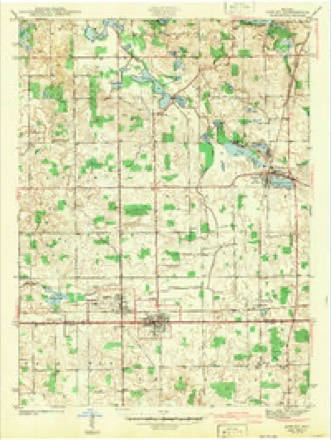
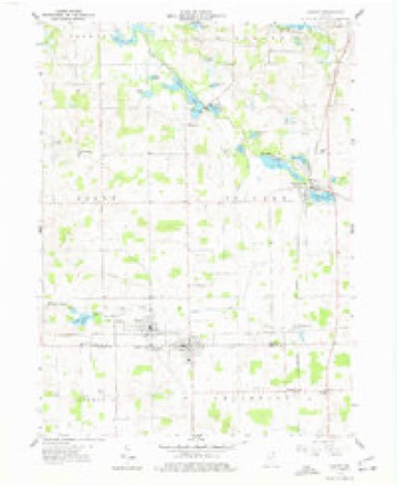
14 topographic sheets cover this place, the earliest surveyed in 1942 and the latest in 1993. It stands in Steuben Township. It lies in ZIP code area 46779. The Survey maps it on the Ashley quadrangle. It stands 978 feet above sea level.
On record in Pleasant Lake
Buildings and businesses the archive holds for this place. Each opens its own page, with the source record it came from.
On the National Register 2 records
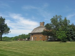 Cornish Griffin Round Barnlisted 1993
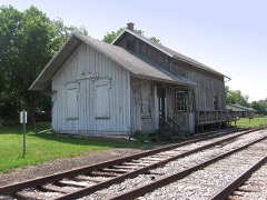 Pleasant Lake Depotlisted 2001
Topographic sheets covering this place
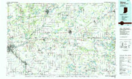
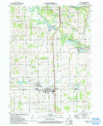
6 surveys from 14 printed sheetsMatched by testing this settlement's coordinate against the published boundary of every sheet in the United States Geological Survey's historical collection. Each opens the scanned sheet at the Survey.
- 1942 USGS Ashley quadrangle1:24000, 2 printings
- 1953 USGS Fort Wayne quadrangle1:250000, 4 printings
- 1956 USGS Fort Wayne quadrangle1:250000, 2 printings
- 1959 USGS Ashley quadrangle1:24000, 3 printings
- 1985 USGS Elkhart quadrangle1:100000, 2 printings
- 1993 USGS Ashley quadrangle1:24000


In the county-history sources
16,431 words on this townshipHistory of Steuben County, Indiana, Together with... Biographies of Representative Citizens, published 1885 names this settlement in its chapter on Steuben Township. These are the passages that mention it, exactly as the scans read.
Steuben Township is in the southern tier of the county, and is bounded as follows: On the north by Pleasant, on the east by Otsego, on the south by the county of De Kalb, and on the west by Salem. It is six miles north and south by nearly the same distance east and west, and therefore contains nearly 36 sections, or nearly 23,000 acres. The township is drained by Pigeon Creek, which flows from east to west irregularly through the northern part, connecting several lakes. The village of Pleasant Lake is on section 15, between Long and Pleasant lakes, the former of which lies on sections 15 and 16, and the latter on 14, 15, 22 and 23. There are a number of other bodies of water, the most important of which are Golden Lake, on sections 6, 5 and 8, and Goose JS^eck Lake, on sections 23 and 24. The Fort Wayne & Jackson branch of the Lake Shore & Michigan Southern Railroad crosses the township north and south.
Passage source: History of Steuben County, Indiana, Together with... Biographies of Representative Citizens, published 1885.
Steubenville, which was platted in November, 1835, was the competitor of Angola for the location of the county seat, early in 1837, Glover, "Winsor and others endeavoring unsuccessfully to have the county buildings in their town. Steubenville was situated not far from the present village of Pleasant Lake. When the county seat was located at Angola, in 1837, Steubenville commenced declining, and was never destined to fulfill the expectations of its pioneer proprietors .
Passage source: History of Steuben County, Indiana, Together with... Biographies of Representative Citizens, published 1885.
The village of Pleasant Lake was laid out by William Thompson and Sheldon X. Ball in 1870, on section 15, and an addition has since been made by David S. Gilbert. Within the past few years Pleasant Lake has achieved celebrity as a summer resort, on account of the beautiful sheet of water from which the village derived its name. The inhabitants of the village and township are exceedingly enterprising, and constantly doing all they can toward developing the resources of the country, which many of them knew when it was a wilderness. Here, in their youthful days, they made their homes, and they do not propose to move away now that old age is creeping on apace. But few of the very early pioneers are left, many having died, and the restless ones long since followed the star of empire in her westward course, and their children are amjng the citizens who inhabit the prairies of Nebraska and Kansas. Of the first settlers, Sylvanus B. George, Abner Winsor and Omer Clark, are yet left.
Passage source: History of Steuben County, Indiana, Together with... Biographies of Representative Citizens, published 1885.
Machine-read from a century-old scan, so expect the errors a machine makes: misspelled names, dropped words, stray characters.
Read the whole chapter on Steuben Township - it names this place 22 more 22 times.
Fires near this place
6 since 2003Regional context, not property-specific evidence. The federal wildfire occurrence database lists 6 fires within 5 miles of Pleasant Lake between 2003 and 2005, burning about 11 acres in total. None started naturally. 1 was recorded as arson. Distance is straight-line from the map coordinates, so a fire counted here may appear on a neighbouring settlement's page as well.
| Reported cause | Fires |
|---|---|
| Debris and open burning | 2 |
| Recreation and ceremony | 2 |
| Equipment and vehicle use | 1 |
| Arson/incendiarism | 1 |
The most recent of them, most recent first, with the day each was reported and the service that recorded it.
| Date | Cause | Size | Reported by | Name on the report |
|---|---|---|---|---|
| 18 September 2004 | Arson/incendiarism | under an acre | Indiana State Fire Marshal's Office | not named |
| 1 June 2003 | Debris and open burning | under an acre | Indiana State Fire Marshal's Office | not named |
| 4 April 2005 | Recreation and ceremony | 3.0 acres | Indiana State Fire Marshal's Office | not named |
| 18 April 2004 | Debris and open burning | 5.0 acres | Indiana State Fire Marshal's Office | not named |
| 15 April 2004 | Equipment and vehicle use | under an acre | Indiana State Fire Marshal's Office | not named |
| 13 April 2003 | Recreation and ceremony | 2.0 acres | Indiana State Fire Marshal's Office | not named |
Settlements close enough to share some of these fires:
Mines and quarries near this place
2 within 5 milesRegional context, not property-specific evidence. The federal mineral resources record lists 2 workings within 5 miles of Pleasant Lake: 2 producers. All of them still produce. What was taken out: Sand and Gravel, Construction. Distance is straight-line from the map coordinates, so a quarry counted here may appear on a neighbouring settlement's page as well.
| Where | Site | Commodity | Status | Recorded |
|---|---|---|---|---|
| Flegal Sand and Gravel Pit | Sand and Gravel, Construction | Producer | ||
| Fremont Pit | Sand and Gravel, Construction | Producer |
Storms near this place
9 since 1999Regional context, not property-specific evidence. The National Weather Service names Pleasant Lake in 9 storm reports between 1999 and 2023: 5 hail, 4 thunderstorm wind. No death or injury is recorded in these reports. Each account below is quoted exactly as the forecast office filed it, from the NOAA Storm Events Database, and each date opens the federal record of that event.
| When | Event | Place named | Harm | What the report says |
|---|---|---|---|---|
| June 2023 | Thunderstorm Wind | Pleasant Lake | - | A trained spotter reported a 70 mph wind gust. |
| August 2018 | Thunderstorm Wind | Pleasant Lake | - | Emergency management officials reported a few smaller tree limbs were blown down east of Pleasant Lake along Bellefontaine Rd. A wall cloud was observed in the area. |
| June 2010 | Thunderstorm Wind | Pleasant Lake | - | Large tree and 6 inch branches reported down. |
| June 2010 | Thunderstorm Wind | Pleasant Lake | - | Law enforcement reported US 27 closed due to a large tree down between Pleasant Lake and Angola. There were widespread trees downed and power outages across the county. |
| June 2019 | Hail | Pleasant Lake | - | no account filed |
| February 2017 | Hail | Pleasant Lake | - | no account filed |
| August 2000 | Hail | Pleasant Lake | - | no account filed |
| August 2000 | Hail | Pleasant Lake | - | no account filed |
| May 1999 | Hail | Pleasant Lake | - | no account filed |
Nearest settlements
The eight closest, with where each one stands in the county. Distances are straight-line, computed from the Geographic Names Information System coordinates.
| Map | Place | Distance | Sheets |
|---|---|---|---|
| Moonlight | 1.0 miles | 14 | |
| Steubenville | 3.0 miles | 14 | |
| Angola | 4.2 miles | 15 | |
| Holiday Woods | 4.4 miles | 14 | |
| Hudson | 4.5 miles | 14 | |
| Russels Point | 5.1 miles | 14 | |
| Forest Park | 5.1 miles | 14 | |
| Penn Park | 5.3 miles | 14 |
Elsewhere
Matched on this settlement's Geographic Names Information System number rather than its name, so it cannot be a different place of the same name in another state.
| Wikipedia article on Pleasant Lake | An encyclopaedic summary. Its text is share-alike, so it is linked here rather than copied. |
| Wikidata item Q14688747 | The structured record the population and elevation above come from. Public domain (CC0). |
Provenance
This settlement is recorded in the Geographic Names Information System as feature 441288. The sheet list is computed by point-in-boundary test against the United States Geological Survey's historical topographic inventory. Both are works of the United States government and carry no copyright under 17 U.S.C. 105.
Wildfire. Short, Karen C. 2022. Spatial wildfire occurrence data for the United States, 1992-2020 [FPA_FOD_20221014]. 6th Edition. Fort Collins, CO: Forest Service Research Data Archive. https://doi.org/10.2737/RDS-2013-0009.6 Collected with United States Government funding and usable without additional permissions or fees.
Mines and quarries. USGS Mineral Resources Data System (MRDS) https://mrdata.usgs.gov/mrds/ A work of the United States government, no copyright under 17 U.S.C. 105.
Storms. NOAA National Centers for Environmental Information, Storm Events Database https://www.ncei.noaa.gov/stormevents/ A work of the United States government, no copyright under 17 U.S.C. 105. Narratives are quoted verbatim from the National Weather Service report and are not edited or summarised.