 Block
Porter, Indiana
17 topographic sheets cover this place, the earliest surveyed in 1934 and the latest in 1991. It stands in Westchester Township. It lies in ZIP code area 46304. It stands on Peterson Ditch. The Survey maps it on the Chesterton quadrangle. 5,210 people lived here at the 2020 count. It stands 640 feet above sea level.
On record in Porter
Buildings and businesses the archive holds for this place. Each opens its own page, with the source record it came from.
On the National Register 5 records
 Joseph Bailley HomesteadNational Historic Landmark · listed 1966
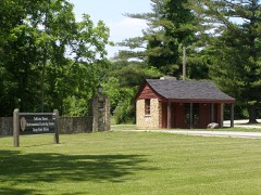 Good Fellow Club Youth Camplisted 2013
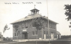 Porter Town Halllisted 2000
- Nike Missile Site C-32listed 2025
- Edward Astoria and Margaret Wilson Houselisted 2025
Population over time
2 figuresPorter grew from 4,858 to 5,210 between 2010 and 2020. These are the recorded population figures Wikidata holds for this place, reached through the Geographic Names Information System number this page is keyed on rather than by name, so they belong to this place and not to another of the same name. Most are census counts, but not all are: an early figure may be a founding or settlement estimate, and an estimate published within five years of a census is left out. The change column is computed, and is left blank where more than 20 years separate a figure from the one before it, because a gap that long is not a change between two counts.
| Year | People | Change |
|---|---|---|
| 2010 | 4,858 | |
| 2020 | 5,210 | +352 (+7%) |
Topographic sheets covering this place
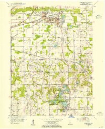
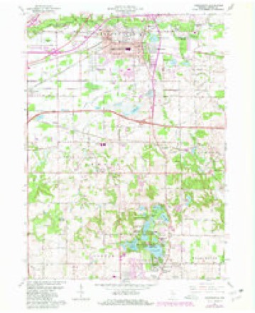
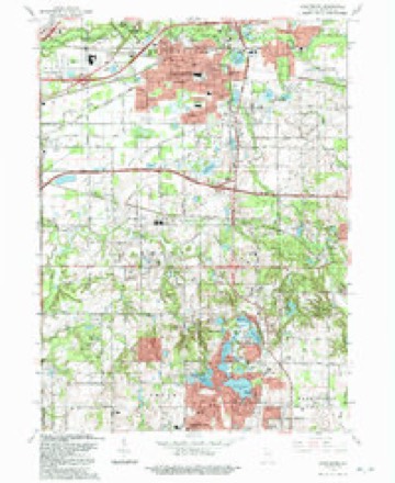
8 surveys from 17 printed sheetsMatched by testing this settlement's coordinate against the published boundary of every sheet in the United States Geological Survey's historical collection. Each opens the scanned sheet at the Survey.
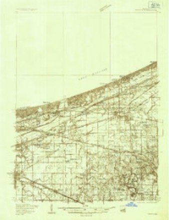
- 1934 USGS Porter quadrangle1:48000
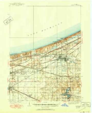
- 1940 USGS Porter quadrangle1:62500, 3 printings
- 1953 USGS Chesterton quadrangle1:24000
- 1953 USGS Chicago quadrangle1:250000, 5 printings
- 1957 USGS Chicago quadrangle1:250000
- 1962 USGS Chesterton quadrangle1:24000, 4 printings
- 1980 USGS Chicago quadrangle1:100000
- 1991 USGS Chesterton quadrangle1:24000


In the county-history sources
16,139 words on this townshipCounties of Porter and Lake, Indiana : Historical and Biographical, published 1882 names this settlement in its chapter on Westchester Township. These are the passages that mention it, exactly as the scans read.
V isolated labor at the spinning wheel. After his release, he was compelled to join the Huzzars, but in about three days he deserted and went to Antwerp, where he was engaged as hotel porter, on account of ability to speak French and German, until he made enough to take him to America, three months later. He soon went to work on the Sault Ste. Marie Canal at Lake Superior, then soon to Detroit, Chicago, then to different places, and on steamers on Lake Michigan. In 1854, he began work for Hiram Joy, the Chicago ice king, remaining nine years, when he bought land near Chesterton ; for a year was in Chicago, also at Lake Superior, where he made considerable money. For some time, he was Deputy Sheriff in Houghton, Mich., near Lake Superior. He is the originator of the present brick-yards at New Porter. Since 1875, He has farmed. For four years before, he kept store at New Porter. He has been a member of the I. 0. 0. F. Lodge. Since 1876, he has been Justice of the Peace. He was married November 15, 1855, to Elizabeth Foederath, a German. She died exactly ten years after her marriage. In 1868, he married Theresa Kuhn, also a German. He has five children living. He is Independent in politics, a public-spirited citizen and a live business man.
Passage source: Counties of Porter and Lake, Indiana : Historical and Biographical, published 1882.
August Hylander, the other member of the firm of Hylander Brothers, was born August 21, 1838, in Sweden ; he lived at home until thirteen years old, when he entered as clerk in a store in Helsingborg, remaining for eighteen years. He then came to America and settled in Porter County and has been here ever since, with the exception of a short time in Chicago. In 1876, he began clerking for Jay Pinney, and continued until he, with his brother, established their present firm. He is a member of th,e Swedish Lutheran Church. The brothers are of similar belief in politics. August was married in 1881, to Matilda Swanson, a native of Sweden ; they have one boy - Ernst W.
Passage source: Counties of Porter and Lake, Indiana : Historical and Biographical, published 1882.
John Pillman, senior member of the firm of Pillman Bros., at Porter Station, merchants, was born July 23, 1851, in Sweden. He is the eldest son of four children born to Andrew and Mary (Peterson) Pillman, both natives of Sweden. The elder Pillman's father was a Swedish soldier in the early part of the nineteenth century. John lived at home until of age. In 1872, he married Hannah Johnson, a native of Sweden, and began farming one of his father's farms. At the end of three years, he began railroading, until he and his brother formed their present firm. He is a member of the Swedish Lutheran Church, and in political faith is a Republican. He is a public-spirited citizen, and is interested in promoting temperance and' other public benefits. His wife died in October, 1881. They had two children - both dead.
Passage source: Counties of Porter and Lake, Indiana : Historical and Biographical, published 1882.
Machine-read from a century-old scan, so expect the errors a machine makes: misspelled names, dropped words, stray characters.
Read the whole chapter on Westchester Township - it names this place 24 more 24 times.
Fires near this place
184 since 1992Regional context, not property-specific evidence. The federal wildfire occurrence database lists 184 fires within 5 miles of Porter between 1992 and 2020, burning about 249 acres in total. 7 started naturally. 15 were recorded as arson. Distance is straight-line from the map coordinates, so a fire counted here may appear on a neighbouring settlement's page as well.
| Reported cause | Fires |
|---|---|
| Missing data/not specified/undetermined | 50 |
| Debris and open burning | 25 |
| Railroad operations and maintenance | 23 |
| Power generation/transmission/distribution | 18 |
| Arson/incendiarism | 15 |
| Fireworks | 11 |
| Misuse of fire by a minor | 10 |
| Recreation and ceremony | 8 |
| Equipment and vehicle use | 8 |
| Natural | 7 |
| Other causes | 5 |
| Smoking | 4 |
The most recent of them, most recent first, with the day each was reported and the service that recorded it.
| Date | Cause | Size | Reported by | Name on the report |
|---|---|---|---|---|
| 7 September 2001 | Power generation/transmission/distribution | under an acre | Indiana Dunes National Lakeshore | TAB FIRE |
| 6 September 2019 | Missing data/not specified/undetermined | under an acre | Indiana Dunes National Lakeshore | TREMONT STUMP |
| 4 September 2018 | Railroad operations and maintenance | 1.0 acres | Indiana Dunes National Lakeshore | MILL |
| 30 September 2000 | Railroad operations and maintenance | 5.0 acres | Indiana Dunes National Lakeshore | STEEL FIRE |
| 3 September 2000 | Arson/incendiarism | 25 acres | Indiana Dunes National Lakeshore | HANDCREW |
| 26 September 1999 | Equipment and vehicle use | 3.0 acres | Indiana Dunes National Lakeshore | BARN |
| 20 September 2020 | Railroad operations and maintenance | under an acre | Indiana Dunes National Lakeshore | CHESTERON ASSIST |
| 17 September 1998 | Power generation/transmission/distribution | under an acre | Indiana Dunes National Lakeshore | SPARKLER |
Settlements close enough to share some of these fires:
Mines and quarries near this place
2 within 5 milesRegional context, not property-specific evidence. The federal mineral resources record lists 2 workings within 5 miles of Porter: 2 past producers. None of them still produces. What was taken out: Clay. Distance is straight-line from the map coordinates, so a quarry counted here may appear on a neighbouring settlement's page as well.
| Where | Site | Commodity | Status | Recorded |
|---|---|---|---|---|
| Lorenz Brothers Pit Number 1 | Clay | Past Producer | ||
| Zehner Pit | Clay | Past Producer |
Storms near this place
10 since 2000Regional context, not property-specific evidence. The National Weather Service names Porter in 10 storm reports between 2000 and 2025: 6 thunderstorm wind, 3 hail, 1 flood. No death or injury is recorded in these reports. Each account below is quoted exactly as the forecast office filed it, from the NOAA Storm Events Database, and each date opens the federal record of that event.
| When | Event | Place named | Harm | What the report says |
|---|---|---|---|---|
| December 2025 | Flood | Porter | - | Lane flooding was reported on Interstate 94 one mile east of Chesterton. A photo showed lanes flooded near the Route 49 interchange. |
| May 2024 | Thunderstorm Wind | Porter | - | Trees were blown down. |
| May 2024 | Thunderstorm Wind | Porter | - | Large trees were snapped near their base. |
| May 2024 | Thunderstorm Wind | Porter | - | Numerous trees were blown down including a tree down on a road near Route 20 and County Road 50. |
| January 2013 | Hail | Porter | - | Hail lasted for five minutes and completely covered the ground. Hail size ranged from peas up to quarters. |
| August 2006 | Thunderstorm Wind | Porter | - | A tree was blown down in an alley. |
| June 2005 | Hail | Porter | - | Nickel size hail was reported at the Indiana Dunes National Park. |
| July 2004 | Thunderstorm Wind | Porter | - | Tree limbs and power lines were knocked down. |
| September 2000 | Thunderstorm Wind | Porter | - | no account filed |
| September 2000 | Hail | Porter | - | no account filed |
Nearest settlements
The eight closest, with where each one stands in the county. Distances are straight-line, computed from the Geographic Names Information System coordinates.
| Map | Place | Distance | Sheets |
|---|---|---|---|
| Chesterton | 0.6 miles | 17 | |
| Western Acres | 1.2 miles | 17 | |
| Morgan Park | 1.6 miles | 17 | |
| Dune Acres Station | 1.6 miles | 16 | |
| Haglund | 2.2 miles | 17 | |
| Dune Acres | 2.4 miles | 16 | |
| Graham Woods | 2.5 miles | 17 | |
| Meadowbrook | 2.5 miles | 17 |
Elsewhere
Matched on this settlement's Geographic Names Information System number rather than its name, so it cannot be a different place of the same name in another state.
| Wikipedia article on Porter | An encyclopaedic summary. Its text is share-alike, so it is linked here rather than copied. |
| Wikidata item Q935863 | The structured record the population and elevation above come from. Public domain (CC0). |
Provenance
This settlement is recorded in the Geographic Names Information System as feature 441459. The sheet list is computed by point-in-boundary test against the United States Geological Survey's historical topographic inventory. Both are works of the United States government and carry no copyright under 17 U.S.C. 105.
Wildfire. Short, Karen C. 2022. Spatial wildfire occurrence data for the United States, 1992-2020 [FPA_FOD_20221014]. 6th Edition. Fort Collins, CO: Forest Service Research Data Archive. https://doi.org/10.2737/RDS-2013-0009.6 Collected with United States Government funding and usable without additional permissions or fees.
Mines and quarries. USGS Mineral Resources Data System (MRDS) https://mrdata.usgs.gov/mrds/ A work of the United States government, no copyright under 17 U.S.C. 105.
Storms. NOAA National Centers for Environmental Information, Storm Events Database https://www.ncei.noaa.gov/stormevents/ A work of the United States government, no copyright under 17 U.S.C. 105. Narratives are quoted verbatim from the National Weather Service report and are not edited or summarised.