 Block
Chesterton, Indiana
17 topographic sheets cover this place, the earliest surveyed in 1934 and the latest in 1991. It stands in Westchester Township. It lies in ZIP code area 46304. It stands on Coffee Creek. The Survey maps it on the Chesterton quadrangle. 14,241 people lived here at the 2020 count. It stands 640 feet above sea level.
On record in Chesterton
Buildings and businesses the archive holds for this place. Each opens its own page, with the source record it came from.
On the National Register 8 records
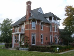 George Brown Mansionlisted 1998
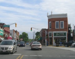 Chesterton Commercial Historic Districtlisted 1999
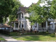 Chesterton Residential Historic Districtlisted 2009
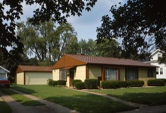 Norris and Harriet Coambs Lustron Houselisted 1992
 New York Central Railroad Passenger Depotlisted 1998
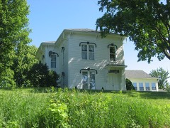 Weller Houselisted 1982
 Martin Young Houselisted 2007
- Cowles Boglisted 2025
Population over time
2 figuresChesterton grew from 13,068 to 14,241 between 2010 and 2020. These are the recorded population figures Wikidata holds for this place, reached through the Geographic Names Information System number this page is keyed on rather than by name, so they belong to this place and not to another of the same name. Most are census counts, but not all are: an early figure may be a founding or settlement estimate, and an estimate published within five years of a census is left out. The change column is computed, and is left blank where more than 20 years separate a figure from the one before it, because a gap that long is not a change between two counts.
| Year | People | Change |
|---|---|---|
| 2010 | 13,068 | |
| 2020 | 14,241 | +1,173 (+9%) |
Topographic sheets covering this place
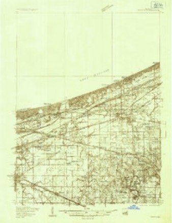
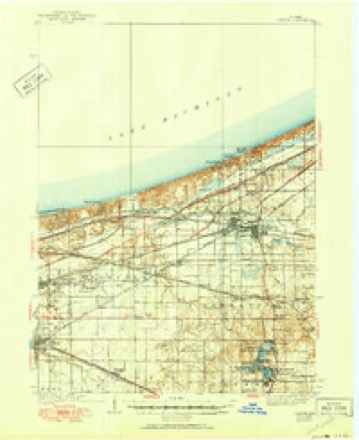
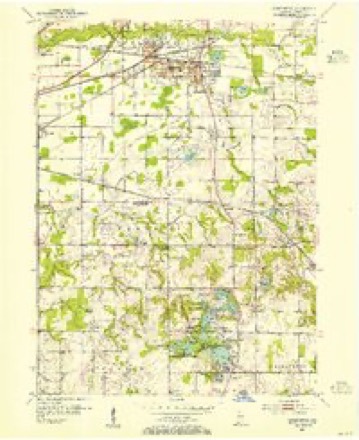
8 surveys from 17 printed sheetsMatched by testing this settlement's coordinate against the published boundary of every sheet in the United States Geological Survey's historical collection. Each opens the scanned sheet at the Survey.
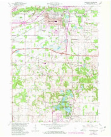
- 1934 USGS Porter quadrangle1:48000
- 1940 USGS Porter quadrangle1:62500, 3 printings
- 1953 USGS Chesterton quadrangle1:24000
- 1953 USGS Chicago quadrangle1:250000, 5 printings
- 1957 USGS Chicago quadrangle1:250000
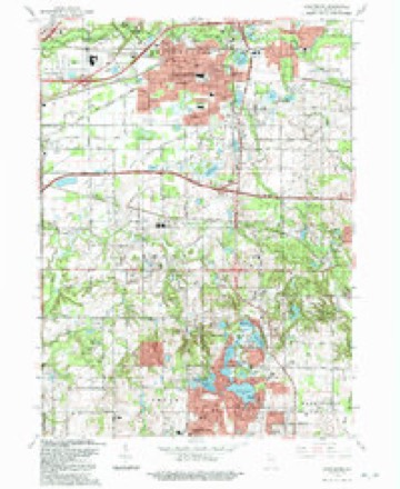
- 1962 USGS Chesterton quadrangle1:24000, 4 printings
- 1980 USGS Chicago quadrangle1:100000
- 1991 USGS Chesterton quadrangle1:24000


In the county-history sources
16,139 words on this townshipCounties of Porter and Lake, Indiana : Historical and Biographical, published 1882 names this settlement in its chapter on Westchester Township. These are the passages that mention it, exactly as the scans read.
V isolated labor at the spinning wheel. After his release, he was compelled to join the Huzzars, but in about three days he deserted and went to Antwerp, where he was engaged as hotel porter, on account of ability to speak French and German, until he made enough to take him to America, three months later. He soon went to work on the Sault Ste. Marie Canal at Lake Superior, then soon to Detroit, Chicago, then to different places, and on steamers on Lake Michigan. In 1854, he began work for Hiram Joy, the Chicago ice king, remaining nine years, when he bought land near Chesterton ; for a year was in Chicago, also at Lake Superior, where he made considerable money. For some time, he was Deputy Sheriff in Houghton, Mich., near Lake Superior. He is the originator of the present brick-yards at New Porter. Since 1875, He has farmed. For four years before, he kept store at New Porter. He has been a member of the I. 0. 0. F. Lodge. Since 1876, he has been Justice of the Peace. He was married November 15, 1855, to Elizabeth Foederath, a German. She died exactly ten years after her marriage. In 1868, he married Theresa Kuhn, also a German. He has five children living. He is Independent in politics, a public-spirited citizen and a live business man.
Passage source: Counties of Porter and Lake, Indiana : Historical and Biographical, published 1882.
Peterson left home and came to the United States, and settled in Chicago, and was engaged in building the early Chicago "plank streets." In a short time, he went to Aurora, 111., and learned and worked at upholstering for about three years. He then went to Lyons, Iowa, and established his business there, but failed, and as he was but nineteen years of age, and lost all, he shipped on a steamboat as " roustabout " to St. Louis, where he was without work and food for about three days, but soon got work near, on a farm, for all winter. He afterward bought a team, and began farming in Madison County, 111. After two years, he moved to Westchester Township, and began farming in Waverly, remaining there eleven years, when he bought his present farm of 209 acres of fine land, near Chesterton, on which he lives in a beautifully situated brick, nearly hidden by a fine grove. He has altogether about three hundred and thirty acres, indicating him to be a successful farmer and financier. He has been a member of the Swedish Lutheran Church. He has always been a Republican, bjit in local affairs is liberal. He was married, in 1861, to Christina S. Carlson, a native of Sweden. They have four children - Charles A., Ida B., Arthur 0. and Cora M. In 1863, he went to Sweden on business, and on the way there and back he visited and traveled through Norway, Germany, France, Denmark, all Great Britain and Ireland, to see the countries.
Passage source: Counties of Porter and Lake, Indiana : Historical and Biographical, published 1882.
School education ; he then went to Kansas for health and business^ and after a residence of about fourteen months, bought two car loads of Texas cattle and brought them to Chicago. He now bought a half-interest in a store in Wanatah, La Porte County. After about fourteen months, he came to Chesterton and purchased his present general merchandise store. Mr. Pinney has built up one of the finest trades in the township ; his sales, the first pear, amounted to $26,000. He carries an average stock of $6,000 ; he has been City Treasurer, and has been a Democrat, but votes for the man and principle rather than party. Mr. Pinney was married, June 9, 1874, to Laura E. Hopkins, a native of Chesterton. They have one child, Clara B., born September 9, 1875. Mrs. Pinney is daughter of Hamilton Hopkins, one of the first merchants of Chesterton, and one of the old settlers ; he died in July, 1870. Mr. Pinney is agent for the Studebaker Wagon Company.
Passage source: Counties of Porter and Lake, Indiana : Historical and Biographical, published 1882.
Machine-read from a century-old scan, so expect the errors a machine makes: misspelled names, dropped words, stray characters.
Read the whole chapter on Westchester Township - it names this place 31 more 31 times.
Fires near this place
177 since 1992Regional context, not property-specific evidence. The federal wildfire occurrence database lists 177 fires within 5 miles of Chesterton between 1992 and 2020, burning about 227 acres in total. 6 started naturally. 14 were recorded as arson. Distance is straight-line from the map coordinates, so a fire counted here may appear on a neighbouring settlement's page as well.
| Reported cause | Fires |
|---|---|
| Missing data/not specified/undetermined | 49 |
| Debris and open burning | 25 |
| Railroad operations and maintenance | 19 |
| Power generation/transmission/distribution | 18 |
| Arson/incendiarism | 14 |
| Fireworks | 11 |
| Misuse of fire by a minor | 10 |
| Recreation and ceremony | 8 |
| Equipment and vehicle use | 8 |
| Natural | 6 |
| Other causes | 5 |
| Smoking | 4 |
The most recent of them, most recent first, with the day each was reported and the service that recorded it.
| Date | Cause | Size | Reported by | Name on the report |
|---|---|---|---|---|
| 7 September 2001 | Power generation/transmission/distribution | under an acre | Indiana Dunes National Lakeshore | TAB FIRE |
| 6 September 2019 | Missing data/not specified/undetermined | under an acre | Indiana Dunes National Lakeshore | TREMONT STUMP |
| 30 September 2000 | Railroad operations and maintenance | 5.0 acres | Indiana Dunes National Lakeshore | STEEL FIRE |
| 3 September 2000 | Arson/incendiarism | 25 acres | Indiana Dunes National Lakeshore | HANDCREW |
| 26 September 1999 | Equipment and vehicle use | 3.0 acres | Indiana Dunes National Lakeshore | BARN |
| 20 September 2020 | Railroad operations and maintenance | under an acre | Indiana Dunes National Lakeshore | CHESTERON ASSIST |
| 17 September 1998 | Power generation/transmission/distribution | under an acre | Indiana Dunes National Lakeshore | SPARKLER |
| 1 September 1994 | Fireworks | 5.3 acres | Indiana Dunes National Lakeshore | BIRTHDAY 2 |
Settlements close enough to share some of these fires:
Mines and quarries near this place
2 within 5 milesRegional context, not property-specific evidence. The federal mineral resources record lists 2 workings within 5 miles of Chesterton: 2 past producers. None of them still produces. What was taken out: Clay. Distance is straight-line from the map coordinates, so a quarry counted here may appear on a neighbouring settlement's page as well.
| Where | Site | Commodity | Status | Recorded |
|---|---|---|---|---|
| Lorenz Brothers Pit Number 1 | Clay | Past Producer | ||
| Zehner Pit | Clay | Past Producer |
Storms near this place
40 since 1993Regional context, not property-specific evidence. The National Weather Service names Chesterton in 40 storm reports between 1993 and 2025: 22 thunderstorm wind, 9 hail, 6 lightning, 2 heavy rain. No death or injury is recorded in these reports. Each account below is quoted exactly as the forecast office filed it, from the NOAA Storm Events Database, and each date opens the federal record of that event.
| When | Event | Place named | Harm | What the report says |
|---|---|---|---|---|
| August 2009 | Tornado (EF2) | Chesterton | $1,500,000 | A tornado touched down in southern Chesterton east of 11th Street and southwest of South Park Drive. The tornado quickly intensified as it moved to the northeast and caused the partial collapse of a gymnasium roof at the Chesterton Junior High School. A wind gust to 105 mph was measured by an anemometer near the school. This damage along with numerous trees that were either uprooted or sheared off was caused by tornado winds reaching 110 mph. The tornado was rated EF1 at this point with a path width of 40 yards. The tornado continued to track to the northeast across the New York Central railroad tracks toward Grant Avenue where the roof of a warehouse had been peeled off and thrown about 15 yards behind the building to the north. The tornado continued to the northeast where an apartment building on Brown Avenue lost its entire roof. This damage was caused by tornado winds reaching 120 mph. The tornado damage was rated EF2 through this area with a path width of 60 yards. In the city of Chesterton, 211 structures sustained damage; 8 were completely destroyed; 54 suffered major damage, such as trees falling through roofs. The remaining 149 structures sustained damage such as missing shingles or damaged gutters. Multiple vehicles were damaged by falling debris from buildings or trees. Numerous power lines were blown down along with utility poles blown down or snapped. This EF2 damage continued northeast where an entire field of healthy old hardwood tree trunks were snapped off or uprooted. The tornado then started to slightly weaken as it approached the Interstate 94 eastbound exit/westbound entrance ramps at Indiana Highway 49. A home south of the interstate had a garage roof blown off with still numerous trees uprooted or sheared off. Tornado wind speeds here were estimated at 100 mph with an EF1 rating. Similar tree damage was noted along a path that continued to go to the northeast across Highway 49 and toward Highway 20 near Hadenfelt Road where some aluminum roofing material of a storage facility had been peeled off. Tornado wind speeds were estimated at 95 mph here and was rated EF1 with a path width of 30 yards. The tornado continued to move through a heavily forested area in the Indiana Dunes National Lakeshore, eventually crossing Highway 12. Radar imagery and an aerial survey suggests that the tornado dissipated north of Highway 12. |
| August 2006 | Hail | Chesterton | $500,000 | Golf ball size hail was reported at Route 20 and Bean Road. |
| August 2007 | Lightning | Chesterton | $50,000 | A house was struck by lightning, which ignited a fire in the attic. The house suffered extensive damage, mainly from water. |
| August 2005 | Lightning | Chesterton | $40,000 | A bolt of lightning struck an apartment building during a thunderstorm early Saturday morning. It is suspected of starting a smoldering fire in the insulation in the attic which was finally noticed at 315 pm in the afternoon. Damage was estimated at $30,000 for the structure, mainly the roof, and $10,000 to contents in the building. |
| August 2001 | Lightning | Chesterton | $25,000 | Lightning struck a tree, went down a security wire which was nailed to the tree, blew out wall sockets in a garage, traveled underground, blew out a light and a pump in a pool and finally struck a gas meter , but did not cause a fire. |
| July 2001 | Lightning | Chesterton | $10,000 | no account filed |
| August 1996 | Lightning | Chesterton | $10,000 | no account filed |
| December 2007 | Thunderstorm Wind | Chesterton | $5,000 | Numerous trees and utility poles were blown down. |
| June 1995 | Thunderstorm Wind | Chesterton | $5,000 | Large tree limbs fell on cars at Chesterton and Valparaiso. A tree also fell across Route 12 in Porter County. |
| August 2008 | Thunderstorm Wind | Chesterton | $2,000 | Numerous tree limbs were blown down. Part of a utility pole was blown down along with some power lines. |
| July 2001 | Thunderstorm Wind | Chesterton | $2,000 | no account filed |
| June 2010 | Thunderstorm Wind | Chesterton | $1,000 | Utility poles were blown down. |
| May 2025 | Thunderstorm Wind | Chesterton | - | Large trees were blown down at Bailly Elementary School. |
| July 2022 | Thunderstorm Wind | Chesterton | - | A photo shared on social media showed a large tree limb blown down on South Park Drive near Porter Avenue. |
| July 2022 | Thunderstorm Wind | Chesterton | - | Large trees were blown down in the vicinity of South 2nd Street and Morgan Avenue, which brought down power lines and utility poles. |
| May 2020 | Heavy Rain | Chesterton | - | Rainfall of 1.60 inches was measured in 45 minutes. |
| August 2016 | Thunderstorm Wind | Chesterton | - | A willow tree approximately 40 ft was uprooted, and a 10-12 feet pear tree snapped and corn was flattened. Time estimated based on radar. |
| July 2016 | Thunderstorm Wind | Chesterton | - | Numerous branches off of trees in Chesterton. In South Haven several medium size tree branches and power lines downed. |
| July 2015 | Thunderstorm Wind | Chesterton | - | Six to twelve inch diameter trees were snapped about halfway up the base. |
| November 2013 | Thunderstorm Wind | Chesterton | - | Large limbs and power lines were blown down. |
| June 2010 | Thunderstorm Wind | Chesterton | - | Wind gusts were estimated to 60 mph. |
| August 2009 | Heavy Rain | Chesterton | - | Rainfall of 2.75 inches was reported in the past 24 hours. |
| June 2008 | Thunderstorm Wind | Chesterton | - | Eight inch diameter tree limbs were blown down. |
| May 2007 | Thunderstorm Wind | Chesterton | - | Wind gusts estimated to 70 mph near 1100 N and IN-49 Bypass just north of the toll Road. |
| August 2006 | Thunderstorm Wind | Chesterton | - | A tree was blown down, partially blocking a road. |
| August 2006 | Thunderstorm Wind | Chesterton | - | Several tree limbs were blown down. |
| July 2005 | Thunderstorm Wind | Chesterton | - | Trees and power lines were blown down between Chesterton and Valparaiso. The front porch on a house in Valparaiso was destroyed when a tree fell on it. Several tents at the Porter County Fairgrounds also received wind damage. |
| July 2017 | Hail | Chesterton | - | no account filed |
| July 2017 | Hail | Chesterton | - | no account filed |
| May 2014 | Thunderstorm Wind | Chesterton | - | no account filed |
| June 2014 | Thunderstorm Wind | Chesterton | - | no account filed |
| May 2011 | Hail | Chesterton | - | no account filed |
| June 2007 | Hail | Chesterton | - | no account filed |
| May 2004 | Hail | Chesterton | - | no account filed |
| July 2003 | Thunderstorm Wind | Chesterton | - | no account filed |
| June 2001 | Lightning | Chesterton | - | no account filed |
| October 2001 | Thunderstorm Wind | Chesterton | - | no account filed |
| April 1999 | Hail | Chesterton | - | no account filed |
| June 1994 | Hail | Chesterton | - | no account filed |
| April 1993 | Hail | Chesterton | - | no account filed |
Nearest settlements
The eight closest, with where each one stands in the county. Distances are straight-line, computed from the Geographic Names Information System coordinates.
| Map | Place | Distance | Sheets |
|---|---|---|---|
| Porter | 0.6 miles | 17 | |
| Morgan Park | 1.0 miles | 17 | |
| Western Acres | 1.3 miles | 17 | |
| Graham Woods | 2.0 miles | 17 | |
| Wake Robin Fields | 2.0 miles | 17 | |
| Dune Acres Station | 2.1 miles | 16 | |
| Brummitt Acres | 2.6 miles | 17 | |
| Haglund | 2.7 miles | 17 |
Elsewhere
Matched on this settlement's Geographic Names Information System number rather than its name, so it cannot be a different place of the same name in another state.
| Wikipedia article on Chesterton | An encyclopaedic summary. Its text is share-alike, so it is linked here rather than copied. |
| Wikidata item Q3292506 | The structured record the population and elevation above come from. Public domain (CC0). |
Provenance
This settlement is recorded in the Geographic Names Information System as feature 432457. The sheet list is computed by point-in-boundary test against the United States Geological Survey's historical topographic inventory. Both are works of the United States government and carry no copyright under 17 U.S.C. 105.
Wildfire. Short, Karen C. 2022. Spatial wildfire occurrence data for the United States, 1992-2020 [FPA_FOD_20221014]. 6th Edition. Fort Collins, CO: Forest Service Research Data Archive. https://doi.org/10.2737/RDS-2013-0009.6 Collected with United States Government funding and usable without additional permissions or fees.
Mines and quarries. USGS Mineral Resources Data System (MRDS) https://mrdata.usgs.gov/mrds/ A work of the United States government, no copyright under 17 U.S.C. 105.
Storms. NOAA National Centers for Environmental Information, Storm Events Database https://www.ncei.noaa.gov/stormevents/ A work of the United States government, no copyright under 17 U.S.C. 105. Narratives are quoted verbatim from the National Weather Service report and are not edited or summarised.