 Block
Portland, Indiana
15 topographic sheets cover this place, the earliest surveyed in 1915 and the latest in 1992. It stands in Wayne Township. It lies in ZIP code area 47371. It stands on Millers Branch. The Survey maps it on the Portland quadrangle. 6,320 people lived here at the 2020 count. It stands 909 feet above sea level.
Research this city
On record in Portland
Buildings and businesses the archive holds for this place. Each opens its own page, with the source record it came from.
On the National Register 6 records
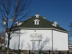 Floral Halllisted 1983
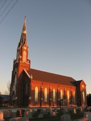 Grouping of Religious Buildings at Trinitylisted 1980
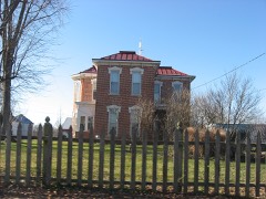 James Haines Farmlisted 2000
 Jay County Courthouselisted 1981
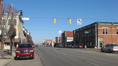 Portland Commercial Historic Districtlisted 1996
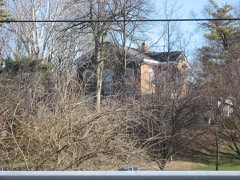 Jonas Votaw Houselisted 2004
Population over time
2 figuresPortland grew from 6,223 to 6,320 between 2010 and 2020. These are the recorded population figures Wikidata holds for this place, reached through the Geographic Names Information System number this page is keyed on rather than by name, so they belong to this place and not to another of the same name. Most are census counts, but not all are: an early figure may be a founding or settlement estimate, and an estimate published within five years of a census is left out. The change column is computed, and is left blank where more than 20 years separate a figure from the one before it, because a gap that long is not a change between two counts.
| Year | People | Change |
|---|---|---|
| 2010 | 6,223 | |
| 2020 | 6,320 | +97 (+2%) |
Topographic sheets covering this place
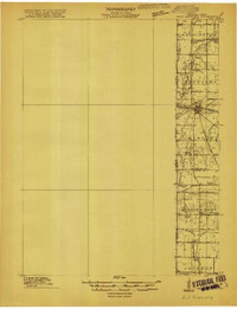
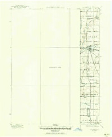
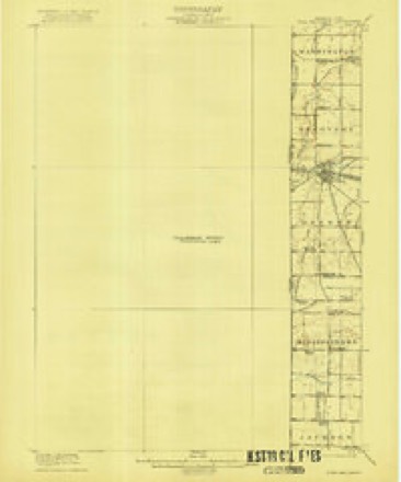
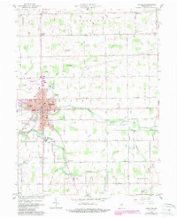
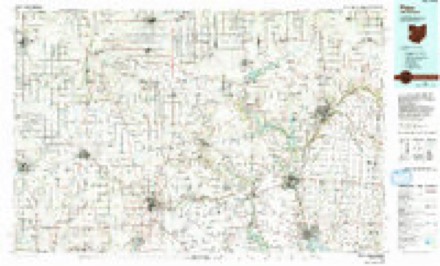
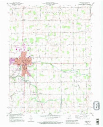
8 surveys from 15 printed sheetsMatched by testing this settlement's coordinate against the published boundary of every sheet in the United States Geological Survey's historical collection. Each opens the scanned sheet at the Survey.
- 1915 USGS Fort Recovery quadrangle1:48000
- 1915 USGS Fort Recovery quadrangle1:62500
- 1918 USGS Fort Recovery quadrangle1:62500
- 1953 USGS Muncie quadrangle1:250000, 5 printings
- 1956 USGS Muncie quadrangle1:250000
- 1960 USGS Portland quadrangle1:24000, 2 printings
- 1986 USGS Piqua quadrangle1:100000, 3 printings
- 1992 USGS Portland quadrangle1:24000


In the county-history sources
38,791 words on this townshipHistorical Hand-atlas, Illustrated : Containing ... Twelve Farm Maps, and History of Jay County, Indiana, published 1881 names this settlement in its chapter on Wayne Township. These are the passages that mention it, exactly as the scans read.
CHRISTOPHER COX - and Rebecca Headington began to share the joys and sorrows of life together on June 28, 1840, in Delaware county, Ohio. The comforts of home have been increased by the addition of Warner, born April 20, 1841 - he was a soldier of the late war, and died, August 6, 1862, at Oberly Hospital, Memphis, Tennessee. He was a member of Company B, 84th Regiment Indiana Volunteer Infantry ; Sherman was born September 3, 1842; Emeline, December 3, 1844; Ruth, August 11, 1846; Catherine, October 14, 1850 ; Lucina, September 21, 1854 ; Wesley, August 23, 1858 ; Geneva Kitura, December 10, 1859. A farmer of Wayne township, Mr. Cox receives mail at Portland. He was born'in Green county, Pennsylvania, November 5, 1813. His wife was born in Frederick county, Maryland, October 3, 1821.
Passage source: Historical Hand-atlas, Illustrated : Containing ... Twelve Farm Maps, and History of Jay County, Indiana, published 1881.
JACOB M. H AY NE S - son of Henry and Achsah (March) Haynes, may be addressed at Portland, is engaged as an attoraey-at-faw, settled in Jay county in the year 1844, and was born at Monson, Hamden county, Massachusetts, April 12, 1817. His children are: Eleanor J., horn June 23, 1850; Susan J., November 3, 1851; Walter M., September 15, 1853; Sumner W., August 14, 1855; Elwood, October 14, 1857; Frank, March 28, 1861; Calvin, February 7, 1864; Edward, August 12, 1867. Mrs. Haynes was Hilinda S., daughter of William and Elizabeth (Morrow) Haines. Her wedding-day was August 27, 1846, the place, Portland, Indiana. Her natal day was April 5, 1828, the place, Clarksville, Clinton county, Ohio. Mr". Haynes filled the office of judge of common pleas from the year 1856 to that of 1871, and was circuit judge from 1871 to that of 1877.
Passage source: Historical Hand-atlas, Illustrated : Containing ... Twelve Farm Maps, and History of Jay County, Indiana, published 1881.
November 6, 1840. Her children are : Charles W., burn July 27, 1864 ; George K, September 6, 1868; Jesse M., October 29, 1871; Orville C, March 6, 1879. Mr. McLaughlin is engaged as a real estate, abstract, and general insurance agent, residing in Wayne township, w ith address at Portland, Indiana. His father removed to Jay county in 188:j, and, alter staying 'me year, removed to Kosciusko county, where he remained four years, and returned to Jay county in 1837. The country being new, he was obliged to cut his road to his farm. His sou, "William H., was a member of the 40th Regiment O. V. I. John S. was a member of Company I, 130th Regiment Indiana Volunteer Infantry, and served until the close of the conflict. Wiley S., a member of Company B, 11th Regiment Indiana Cavalry, was killed at the battle of Franklin, Tennessee, December 1, 1864.
Passage source: Historical Hand-atlas, Illustrated : Containing ... Twelve Farm Maps, and History of Jay County, Indiana, published 1881.
Machine-read from a century-old scan, so expect the errors a machine makes: misspelled names, dropped words, stray characters.
Read the whole chapter on Wayne Township - it names this place 42 more 42 times.
Mines and quarries near this place
1 within 5 milesRegional context, not property-specific evidence. The federal mineral resources record lists 1 working within 5 miles of Portland: 1 producer. All of them still produce. What was taken out: Stone, Crushed/Broken. Distance is straight-line from the map coordinates, so a quarry counted here may appear on a neighbouring settlement's page as well.
| Where | Site | Commodity | Status | Recorded |
|---|---|---|---|---|
| Portland Quarry | Stone, Crushed/Broken | Producer |
Storms near this place
33 since 1998Regional context, not property-specific evidence. The National Weather Service names Portland in 33 storm reports between 1998 and 2025: 23 thunderstorm wind, 6 hail, 3 flash flood, 1 lightning. No death or injury is recorded in these reports. Each account below is quoted exactly as the forecast office filed it, from the NOAA Storm Events Database, and each date opens the federal record of that event.
| When | Event | Place named | Harm | What the report says |
|---|---|---|---|---|
| July 1998 | Flash Flood | Portland | $500,000 | SEVERAL ROADS ACROSS THE COUNTY SUSTAINED DAMAGE DUE TO PARTIAL OR COMPLETE WASHOUTS. MANY HOMES IN LOW LYING AREAS HAD THEIR BASEMENTS FLOODED ESPECIALLY SOUTH OF BRYANT. |
| August 1998 | Flash Flood | Portland | $100,000 | OAKWOOD MOBILE HOME PARK INUNDATED. SEVERAL RESIDENCES IN PORTLAND FLOODED. MOST RURAL COUNTY ROADS WERE CLOSED DUE TO THE HIGH WATER OVER THE ROADS. |
| June 2008 | Thunderstorm Wind | Portland | $75,000 | Numerous trees, tree limbs and power poles were blown down in the Bryant, Portland and Salamonia areas. |
| August 2007 | Lightning | Portland | $50,000 | Lightning struck a house in the 5300 block of E 100 S in Portland. Heavy damage was reported to the upstairs. A County deputy was able to awake the residents and get them to safety. Damage is estimated at $50,000. |
| June 2005 | Thunderstorm Wind | Portland | $10,000 | Three 18 to 24 inch diameter trees were blown down, as well as power lines in the city of Portland. |
| November 1998 | Thunderstorm Wind | Portland | $10,000 | SEVERAL TREES AND POWER LINES WERE DOWN ACROSS THE TOWN. |
| July 2023 | Thunderstorm Wind | Portland | $5,000 | Multiple trees down. Time estimated by radar. |
| August 2021 | Thunderstorm Wind | Portland | $5,000 | Multiple trees were downed near Jay County High School and surrounding areas. |
| July 2025 | Flash Flood | Portland | $1,000 | Storm chaser reports 3 inches of water covering the road at the intersection of West Votaw Street and North Meridian Street in Portland. |
| July 2023 | Thunderstorm Wind | Portland | $1,000 | Jay County Sheriffs Office reports that 100 S is closed between 100 E and 300 E due to power lines down accross the road. Time estimated via radar. |
| May 2000 | Thunderstorm Wind | Portland | $1,000 | Tree down on a car. |
| March 2017 | Thunderstorm Wind | Portland | - | Emergency management officials reported trees, power lines and phone lines down across the county. Some buildings had roofing blown off and others were impacted by trees. |
| July 2016 | Thunderstorm Wind | Portland | - | Law enforcement officials reported a ten to twelve inch diameter tree limb was blown down. |
| July 2013 | Thunderstorm Wind | Portland | - | Emergency management officials reported several trees were blown down onto camper trailers, with power lines laid out across trailers. Tents were blown over at the Jay county fair. No injuries were reported. |
| July 2013 | Thunderstorm Wind | Portland | - | County officials reported two utility poles were blown down. |
| November 2013 | Thunderstorm Wind | Portland | - | Emergency management officials reported some trees and tree limbs were blown down across portions of the county. Reports of leaning power poles were also received. |
| July 2012 | Thunderstorm Wind | Portland | - | An automated weather sensor in Portland recorded a 70 mph wind gust. |
| August 2012 | Thunderstorm Wind | Portland | - | Law enforcement officials reported trees limbs and power lines down in Portland and Pennville. |
| May 2011 | Thunderstorm Wind | Portland | - | Law enforcement officials reported several small trees down, blocking some roads. A small boat on a trailer was also pushed into a truck. |
| August 2011 | Thunderstorm Wind | Portland | - | Law enforcement officials reported several trees and power lines down across southern portions of the county. |
| June 2008 | Thunderstorm Wind | Portland | - | County officials reported three trees were blown down in the Portland area. |
| June 2006 | Thunderstorm Wind | Portland | - | Trees uprooted and limbs blown down. |
| June 2003 | Thunderstorm Wind | Portland | - | Law enforcement reported power pole snapped in Portland. |
| July 2003 | Thunderstorm Wind | Portland | - | Law enforcement reported numerous trees down in Portland. |
| June 1998 | Thunderstorm Wind | Portland | - | NUMEROUS TREES WERE BLOWN DOWN IN THE CITY. |
| June 1998 | Thunderstorm Wind | Portland | - | NUMEROUS TREES DOWN ACROSS COUNTY |
| July 1998 | Thunderstorm Wind | Portland | - | NUMEROUS TREES AND POWER LINES DOWN THROUGHOUT COUNTY. |
| May 2006 | Hail | Portland | - | no account filed |
| June 2005 | Hail | Portland | - | no account filed |
| May 2004 | Hail | Portland | - | no account filed |
| April 2001 | Hail | Portland | - | no account filed |
| April 2001 | Hail | Portland | - | no account filed |
| May 1998 | Hail | Portland | - | no account filed |
Nearest settlements
The eight closest, with where each one stands in the county. Distances are straight-line, computed from the Geographic Names Information System coordinates.
| Map | Place | Distance | Sheets |
|---|---|---|---|
| College Corner | 1.6 miles | 15 | |
| Liber | 1.9 miles | 15 | |
| Pleasant Ridge | 3.3 miles | 15 | |
| Collett | 4.3 miles | 12 | |
| Antiville | 4.4 miles | 15 | |
| Brice | 4.5 miles | 15 | |
| Blaine | 4.7 miles | 12 | |
| Corkwell | 4.8 miles | 12 |
Elsewhere
Matched on this settlement's Geographic Names Information System number rather than its name, so it cannot be a different place of the same name in another state.
| Wikipedia article on Portland | An encyclopaedic summary. Its text is share-alike, so it is linked here rather than copied. |
| Wikidata item Q1807259 | The structured record the population and elevation above come from. Public domain (CC0). |
Provenance
This settlement is recorded in the Geographic Names Information System as feature 441471. The sheet list is computed by point-in-boundary test against the United States Geological Survey's historical topographic inventory. Both are works of the United States government and carry no copyright under 17 U.S.C. 105.
Mines and quarries. USGS Mineral Resources Data System (MRDS) https://mrdata.usgs.gov/mrds/ A work of the United States government, no copyright under 17 U.S.C. 105.
Storms. NOAA National Centers for Environmental Information, Storm Events Database https://www.ncei.noaa.gov/stormevents/ A work of the United States government, no copyright under 17 U.S.C. 105. Narratives are quoted verbatim from the National Weather Service report and are not edited or summarised.