 Block
Putnamville, Indiana
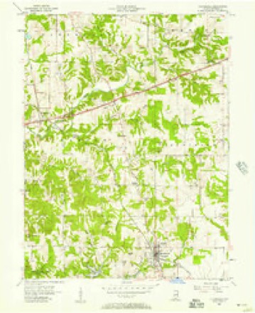
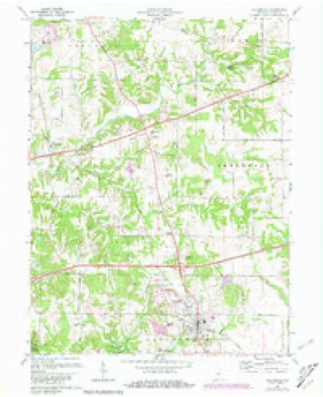
14 topographic sheets cover this place, the earliest surveyed in 1953 and the latest in 1986. It stands in Warren Township. It lies in ZIP code area 46135. It stands on Limestone Creek. The Survey maps it on the Cloverdale quadrangle. It stands 676 feet above sea level.
On record in Putnamville
Buildings and businesses the archive holds for this place. Each opens its own page, with the source record it came from.
On the National Register 2 records
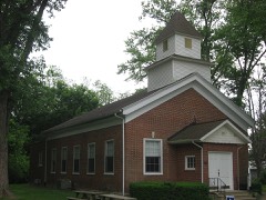 Putnamville Presbyterian Churchlisted 1984
- National Road over Deer Creek Historic Districtlisted 2018
Topographic sheets covering this place
7 surveys from 14 printed sheetsMatched by testing this settlement's coordinate against the published boundary of every sheet in the United States Geological Survey's historical collection. Each opens the scanned sheet at the Survey.
- 1953 USGS Indianapolis quadrangle1:250000, 4 printings
- 1956 USGS Cloverdale quadrangle1:24000
- 1956 USGS Indianapolis quadrangle1:250000
- 1957 USGS Indianapolis quadrangle1:250000, 2 printings
- 1962 USGS Indianapolis quadrangle1:250000
- 1970 USGS Cloverdale quadrangle1:24000, 3 printings
- 1986 USGS Indianapolis quadrangle1:100000, 2 printings





In the county-history sources
1,225 words on this townshipWeik's History of Putnam County, Indiana, published 1910 names this settlement in its chapter on Warren Township. These are the passages that mention it, exactly as the scans read.
One of the marked features of the township is an excellent stone quarry one-half mile west of Putnamville. on the National road. The ledges of rock in this quarry vary from two inches to five feet in thickness. The following analysis of this stone is given by Professor Cox. state geologist : "Lime, twenty per cent; sand, twenty per cent: gray granite, sixty per cent: almost, if not exactly, like what is called 'English firestone.' He also says, "Granite will last three hundred years, but this stone will last as long as time. lM)r foundation stone, there is probably none superior in America. It is not affected by any change of temperature, and can be f(uarried in winter just as well as summer."
Passage source: Weik's History of Putnam County, Indiana, published 1910.
Putnamville is the only postoffice town in the township. Westland, which was laid out soon after Putnamville. had one store for a short time, but now has no inisiness house of any kind. A few houses in close proximity on either side of the National road are the only indications left to remind the passer-by of its former existence.
Passage source: Weik's History of Putnam County, Indiana, published 1910.
The first grist-mill was erected on Deer creek one-half mile southeast of Putnamville. October 16, 1826, by Alexander Conley. Another was built on the same creek, one-half mile southwest of the town, in 1834. by Samuel Steele and Dr. D. W. Layman.
Passage source: Weik's History of Putnam County, Indiana, published 1910.
Machine-read from a century-old scan, so expect the errors a machine makes: misspelled names, dropped words, stray characters.
Read the whole chapter on Warren Township - it names this place 5 more 5 times.
Mines and quarries near this place
10 within 5 milesRegional context, not property-specific evidence. The federal mineral resources record lists 10 workings within 5 miles of Putnamville: 8 producers, 1 plant, 1 past producer. 9 still produce. What was taken out: Stone, Crushed/Broken, Limestone, Dimension, Fire Clay (Refractory), Clay. Distance is straight-line from the map coordinates, so a quarry counted here may appear on a neighbouring settlement's page as well.
| Where | Site | Commodity | Status | Recorded |
|---|---|---|---|---|
| Indiana State Farm Plant | Fire Clay (Refractory) | Producer | ||
| Lone Star Greencastle Qy/Cement Plt | Stone, Crushed/Broken, Clay | Producer | ||
| Putnam Co. Hwy. Dept. | Stone | Producer | ||
| Rock Hill Quarry | Limestone, Dimension | Producer | ||
| Cloverdale Stone Quarry | Stone, Crushed/Broken | Producer | ||
| Greencastle Pulverizing Plant | Stone, Crushed/Broken | Plant | ||
| Greencastle Quarry | Stone, Crushed/Broken | Past Producer | ||
| Lone Star Greencastle Quarry | Stone, Crushed/Broken | Producer | ||
| Manhattan Quarry | Stone, Crushed/Broken | Producer | ||
| Putman County Stone Pit | Stone, Crushed/Broken | Producer |
Storms near this place
9 since 1993Regional context, not property-specific evidence. The National Weather Service names Putnamville in 9 storm reports between 1993 and 2021: 4 thunderstorm wind, 3 hail, 1 tornado, 1 flood. The reports record 1 injury. Each account below is quoted exactly as the forecast office filed it, from the NOAA Storm Events Database, and each date opens the federal record of that event.
| When | Event | Place named | Harm | What the report says |
|---|---|---|---|---|
| May 1999 | Thunderstorm Wind | Putnamville | 1 hurt, $20,000 | no account filed |
| June 2019 | Thunderstorm Wind | Putnamville | $10,000 | Trees reported down all along US Highway 40 near Putnamville due to damaging thunderstorm wind gusts. |
| August 2021 | Thunderstorm Wind | Putnamville | $5,000 | Multiple trees blown over by thunderstorm wind gusts in Putnamville with some trees landing on power lines. |
| August 1993 | Tornado (F1) | Putnamville | $5,000 | no account filed |
| June 2010 | Flood | Putnamville | $500 | The Putnam County Sheriffs Office reported high water near the intersection of County Roads 550 S and 75 W. |
| April 2016 | Hail | Putnamville | - | no account filed |
| May 2003 | Hail | Putnamville | - | no account filed |
| June 1998 | Thunderstorm Wind | Putnamville | - | no account filed |
| April 1998 | Hail | Putnamville | - | no account filed |
Nearest settlements
The eight closest, with where each one stands in the county. Distances are straight-line, computed from the Geographic Names Information System coordinates.
| Map | Place | Distance | Sheets |
|---|---|---|---|
| Westland | 1.2 miles | 14 | |
| Jenkinsville | 2.9 miles | 16 | |
| Limedale | 3.2 miles | 16 | |
| Manhattan | 3.6 miles | 16 | |
| Cradick Corner | 3.8 miles | 14 | |
| Fox Ridge | 4.1 miles | 14 | |
| Greencastle | 4.8 miles | 14 | |
| Pleasant Gardens | 5.5 miles | 16 |
Elsewhere
Matched on this settlement's Geographic Names Information System number rather than its name, so it cannot be a different place of the same name in another state.
| Wikipedia article on Putnamville | An encyclopaedic summary. Its text is share-alike, so it is linked here rather than copied. |
| Wikidata item Q7262362 | The structured record the population and elevation above come from. Public domain (CC0). |
Provenance
This settlement is recorded in the Geographic Names Information System as feature 441673. The sheet list is computed by point-in-boundary test against the United States Geological Survey's historical topographic inventory. Both are works of the United States government and carry no copyright under 17 U.S.C. 105.
Mines and quarries. USGS Mineral Resources Data System (MRDS) https://mrdata.usgs.gov/mrds/ A work of the United States government, no copyright under 17 U.S.C. 105.
Storms. NOAA National Centers for Environmental Information, Storm Events Database https://www.ncei.noaa.gov/stormevents/ A work of the United States government, no copyright under 17 U.S.C. 105. Narratives are quoted verbatim from the National Weather Service report and are not edited or summarised.