 Block
Pyrmont, Indiana
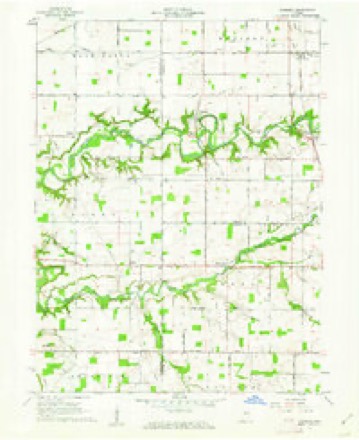
9 topographic sheets cover this place, the earliest surveyed in 1953 and the latest in 1984. It stands in Clay Township. It lies in ZIP code area 46923. The Survey maps it on the Pyrmont quadrangle. It stands 676 feet above sea level.
Topographic sheets covering this place
5 surveys from 9 printed sheetsMatched by testing this settlement's coordinate against the published boundary of every sheet in the United States Geological Survey's historical collection. Each opens the scanned sheet at the Survey.
- 1953 USGS Danville quadrangle1:250000, 3 printings
- 1955 USGS Danville quadrangle1:250000
- 1956 USGS Danville quadrangle1:250000
- 1961 USGS Pyrmont quadrangle1:24000, 2 printings
- 1984 USGS Lafayette quadrangle1:100000, 2 printings




In the county-history sources
165 words on this townshipHistory of Carroll County Indiana, published 1916 names this settlement in its chapter on Clay Township. These are the passages that mention it, exactly as the scans read.
Clay township was organized by the board of county commissioners in 1831, and Albert G. Hanna was appointed inspector of elections. The first election was held at the house of Jonathan Gillam, on the second Mon¬ day of April, 1831, and George Julian was elected justice of the peace. This township is the southwest township of the county. Wild Cat creek runs through this township. ( The first school house was built on the farm of Alexander Murphy in 1837 and a Mr. Troxell taught the first school. The next school house was built on the land of John Beard in 1839. Log school houses were built thereafter as the demands of the people required. Two churches of the German Baptist denomination are located in this township. John Wagoner erected the first saw-mill, and also a mill to grind wheat and com. The villages in this township, are Pyrmont and Owasco. Pyrmont is situated on the western border, and Owasco on the Monon rail¬ road.
Passage source: History of Carroll County Indiana, published 1916.
Machine-read from a century-old scan, so expect the errors a machine makes: misspelled names, dropped words, stray characters.
Fires near this place
1 since 2007Regional context, not property-specific evidence. The federal wildfire occurrence database lists 1 fire within 5 miles of Pyrmont in 2007, burning under an acre in total. 1 started naturally. None was recorded as arson. Distance is straight-line from the map coordinates, so a fire counted here may appear on a neighbouring settlement's page as well.
| Reported cause | Fires |
|---|---|
| Natural | 1 |
The most recent of them, most recent first, with the day each was reported and the service that recorded it.
| Date | Cause | Size | Reported by | Name on the report |
|---|---|---|---|---|
| 15 May 2007 | Natural | under an acre | Indiana State Fire Marshal's Office | not named |
Settlements close enough to share some of these fires:
Storms near this place
6 since 2002Regional context, not property-specific evidence. The National Weather Service names Pyrmont in 6 storm reports between 2002 and 2021: 3 thunderstorm wind, 2 tornado, 1 heavy rain. No death or injury is recorded in these reports. Each account below is quoted exactly as the forecast office filed it, from the NOAA Storm Events Database, and each date opens the federal record of that event.
| When | Event | Place named | Harm | What the report says |
|---|---|---|---|---|
| June 2021 | Tornado (EF1) | Pyrmont | $97,500 | A National Weather Service damage survey found the first tornado of the episode was an EF1 with maximum winds of 95 mph and a path length of 2.17 miles, which included both Tippecanoe and Carroll Counties. Upon the tornado crossing into Carroll County, a farm on the east side of County Line Road had a barn roof lifted and the west wall collapsed. The tornado continued on a northeast path to just north of the intersection of county road 700 S and 800 W where another farm was hit with the roof and sides of two barns thrown to the north and west. This appears to be where this tornado ended. Damage at both of these locations was consistent with an EF1 and winds up to 95|mph. |
| June 2012 | Thunderstorm Wind | Pyrmont | $20,000 | Trees and power lines were reported down at several spots across Carroll county due to damaging thunderstorm wind gusts. Time and location was estimated from radar data. |
| May 2019 | Thunderstorm Wind | Pyrmont | $9,000 | A patio door was blown into a family room of a home due to damaging thunderstorm wind gusts. Trees and utility lines were blown down as well. A swing set was overturned. |
| June 2010 | Heavy Rain | Pyrmont | - | Rainfall of 1.67 inches was reported in this location for a one hour period. |
| May 2008 | Tornado (EF0) | Pyrmont | - | A couple of trees sustained damage as a result of a supercell that formed a tornado that briefly touched down near a field. Wind speeds were around 65 mph based on damage indicators. |
| June 2002 | Thunderstorm Wind | Pyrmont | - | no account filed |
Nearest settlements
The eight closest, with where each one stands in the county. Distances are straight-line, computed from the Geographic Names Information System coordinates.
| Map | Place | Distance | Sheets |
|---|---|---|---|
| Owasco | 2.8 miles | 9 | |
| Ockley | 2.8 miles | 9 | |
| Radnor | 3.7 miles | 9 | |
| Harley | 5.4 miles | 9 | |
| Prince William | 5.9 miles | 9 | |
| Harley Siding | 6.3 miles | 9 | |
| Ray | 8.2 miles | 9 | |
| Cutler | 8.3 miles | 9 |
Elsewhere
Matched on this settlement's Geographic Names Information System number rather than its name, so it cannot be a different place of the same name in another state.
| Wikipedia article on Pyrmont | An encyclopaedic summary. Its text is share-alike, so it is linked here rather than copied. |
| Wikidata item Q7263611 | The structured record the population and elevation above come from. Public domain (CC0). |
Provenance
This settlement is recorded in the Geographic Names Information System as feature 441677. The sheet list is computed by point-in-boundary test against the United States Geological Survey's historical topographic inventory. Both are works of the United States government and carry no copyright under 17 U.S.C. 105.
Wildfire. Short, Karen C. 2022. Spatial wildfire occurrence data for the United States, 1992-2020 [FPA_FOD_20221014]. 6th Edition. Fort Collins, CO: Forest Service Research Data Archive. https://doi.org/10.2737/RDS-2013-0009.6 Collected with United States Government funding and usable without additional permissions or fees.
Storms. NOAA National Centers for Environmental Information, Storm Events Database https://www.ncei.noaa.gov/stormevents/ A work of the United States government, no copyright under 17 U.S.C. 105. Narratives are quoted verbatim from the National Weather Service report and are not edited or summarised.