 Block
Raab Crossroads, Indiana
15 topographic sheets cover this place, the earliest surveyed in 1953 and the latest in 1986. It stands in Washington Township. It lies in ZIP code area 46171. It stands on Church Creek. The Survey maps it on the Poland quadrangle.
Topographic sheets covering this place
6 surveys from 15 printed sheetsMatched by testing this settlement's coordinate against the published boundary of every sheet in the United States Geological Survey's historical collection. Each opens the scanned sheet at the Survey.
- 1953 USGS Indianapolis quadrangle1:250000, 4 printings
- 1956 USGS Indianapolis quadrangle1:250000
- 1957 USGS Indianapolis quadrangle1:250000, 2 printings
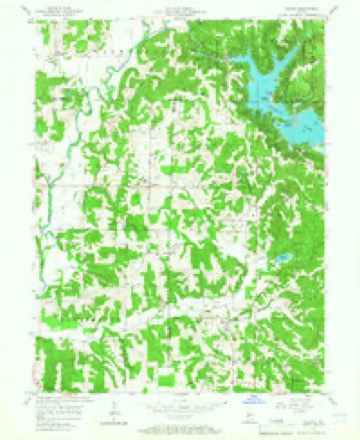
- 1957 USGS Poland quadrangle1:24000, 4 printings
- 1962 USGS Indianapolis quadrangle1:250000
- 1986 USGS Bloomington quadrangle1:100000, 3 printings





What happened here
An account from the chapter on Washington township. The inset identifies its exact source book and publication year.
Guarding Against Indians
The fashion of carrying tire-arms was made necessary by the presence of roving bauds of Indians, most of whom were ostensibly friendly, but like Indians in all times, treacherous and unreliable. An Indian war was at any time probable, and all the old settlers still retain vivid recollections of Indian massacres, murders, plunder, and frightful rumors of intended raids.
In the county-history sources
13,785 words on this townshipBiographical and Historical Record of Putnam County, Indiana .., published 1887 has no passage naming this settlement, which was common for smaller places. Its township is covered in full.
The chapter on Washington Township covers the township.
Read the chapter on Washington Township - 13,785 words.
Fires near this place
1 since 2001Regional context, not property-specific evidence. The federal wildfire occurrence database lists 1 fire within 5 miles of Raab Crossroads in 2001, burning about 40 acres in total. None started naturally. None was recorded as arson. Distance is straight-line from the map coordinates, so a fire counted here may appear on a neighbouring settlement's page as well.
| Reported cause | Fires |
|---|---|
| Missing data/not specified/undetermined | 1 |
The most recent of them, most recent first, with the day each was reported and the service that recorded it.
| Date | Cause | Size | Reported by | Name on the report |
|---|---|---|---|---|
| 3 October 2001 | Missing data/not specified/undetermined | 40 acres | Indiana State Fire Marshal's Office | not named |
Settlements close enough to share some of these fires:
Mines and quarries near this place
1 within 5 milesRegional context, not property-specific evidence. The federal mineral resources record lists 1 working within 5 miles of Raab Crossroads: 1 producer. All of them still produce. What was taken out: Sand and Gravel, Construction. Distance is straight-line from the map coordinates, so a quarry counted here may appear on a neighbouring settlement's page as well.
| Where | Site | Commodity | Status | Recorded |
|---|---|---|---|---|
| A and C Products Inc. | Sand and Gravel, Construction | Producer |
Nearest settlements
The eight closest, with where each one stands in the county. Distances are straight-line, computed from the Geographic Names Information System coordinates.
| Map | Place | Distance | Sheets |
|---|---|---|---|
| Hirt Corner | 1.6 miles | 16 | |
| Cagle Mill | 2.8 miles | 15 | |
| Pleasant Gardens | 4.6 miles | 16 | |
| Reelsville | 5.0 miles | 16 | |
| Manhattan | 5.8 miles | 16 | |
| Jenkinsville | 6.9 miles | 16 | |
| Putnamville | 9.0 miles | 14 | |
| Westland | 10.2 miles | 14 |
Provenance
This settlement is recorded in the Geographic Names Information System as feature 441705. The sheet list is computed by point-in-boundary test against the United States Geological Survey's historical topographic inventory. Both are works of the United States government and carry no copyright under 17 U.S.C. 105.
Wildfire. Short, Karen C. 2022. Spatial wildfire occurrence data for the United States, 1992-2020 [FPA_FOD_20221014]. 6th Edition. Fort Collins, CO: Forest Service Research Data Archive. https://doi.org/10.2737/RDS-2013-0009.6 Collected with United States Government funding and usable without additional permissions or fees.
Mines and quarries. USGS Mineral Resources Data System (MRDS) https://mrdata.usgs.gov/mrds/ A work of the United States government, no copyright under 17 U.S.C. 105.