 Block
Roachdale, Indiana
11 topographic sheets cover this place, the earliest surveyed in 1953 and the latest in 1986. It stands in Franklin Township. It lies in ZIP code area 46172. The Survey maps it on the Roachdale quadrangle. 840 people lived here at the 2020 count. It stands 840 feet above sea level.
On record in Roachdale
Buildings and businesses the archive holds for this place. Each opens its own page, with the source record it came from.
On the National Register 3 records
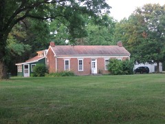 Samuel Brown Houselisted 2006
- Cornstalk Covered Bridgelisted 2024
- Roachdale Historic Districtlisted 2020
Population over time
2 figuresRoachdale fell from 926 to 840 between 2010 and 2020. These are the recorded population figures Wikidata holds for this place, reached through the Geographic Names Information System number this page is keyed on rather than by name, so they belong to this place and not to another of the same name. Most are census counts, but not all are: an early figure may be a founding or settlement estimate, and an estimate published within five years of a census is left out. The change column is computed, and is left blank where more than 20 years separate a figure from the one before it, because a gap that long is not a change between two counts.
| Year | People | Change |
|---|---|---|
| 2010 | 926 | |
| 2020 | 840 | -86 (-9%) |
Topographic sheets covering this place
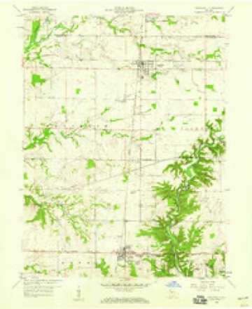
6 surveys from 11 printed sheetsMatched by testing this settlement's coordinate against the published boundary of every sheet in the United States Geological Survey's historical collection. Each opens the scanned sheet at the Survey.
- 1953 USGS Indianapolis quadrangle1:250000, 4 printings
- 1956 USGS Indianapolis quadrangle1:250000
- 1957 USGS Indianapolis quadrangle1:250000, 2 printings
- 1958 USGS Roachdale quadrangle1:24000
- 1962 USGS Indianapolis quadrangle1:250000
- 1986 USGS Indianapolis quadrangle1:100000, 2 printings





In the county-history sources
2,008 words on this townshipBiographical and Historical Record of Putnam County, Indiana .., published 1887 names this settlement in its chapter on Franklin Township. These are the passages that mention it, exactly as the scans read.
Roachdale, in the northern part of the township, was laid out in the autumn of 1879, by Elijah Grantham, on the southeast quarter of section 1. It was named in honor of the late Judge Roach, of Indianapolis. The first buildings (a store and a dwelling) were built by Mr. Grantham. Both have been since burned. The first blacksmith shop was built by S. B. Sweeney, who still owns and runs it. The first hotel was begun by William Atkins, of Green castle, and completed by E. Grantham. It is the present McCoy House. The first harness shop was started by its present proprietor, W. 11. Rich. The postoffice was established in 1880. The first livery stable was established in 1882, by J. R. Miller. The first physician was Dr. J. T. Seller, who died in 1884. The village now claims 350 inhabitants, and has two drug and grocery stores, one harness shop, one hardware store, one implement store, one furniture and implement store, one shoe shop, one barber shop, two hotels, one restaurant, three blacksmith shops, two livery stables, one wagon and repair shop, two millinery shops, one flonring-mill, one sawmill, one grain elevator and two physicians. The village is incorporated, and has (in 1887) the following officers: Isaac Edwards (President); J. W. King, J. W. Sutherlin and W.
Passage source: Biographical and Historical Record of Putnam County, Indiana .., published 1887.
Machine-read from a century-old scan, so expect the errors a machine makes: misspelled names, dropped words, stray characters.
Storms near this place
14 since 1994Regional context, not property-specific evidence. The National Weather Service names Roachdale in 14 storm reports between 1994 and 2022: 8 thunderstorm wind, 6 hail. No death or injury is recorded in these reports. Each account below is quoted exactly as the forecast office filed it, from the NOAA Storm Events Database, and each date opens the federal record of that event.
| When | Event | Place named | Harm | What the report says |
|---|---|---|---|---|
| February 2008 | Thunderstorm Wind | Roachdale | $20,000 | A modular home was blown nearly 10 feet off its foundation and into a carport due to damaging thunderstorm winds. |
| August 2022 | Thunderstorm Wind | Roachdale | $10,000 | Numerous medium to large tree limbs downed by thunderstorm wind gusts across Putnam county with most widespread damage near Roachdale. More than 1600 homes were without power. |
| July 2017 | Thunderstorm Wind | Roachdale | $10,000 | Trees were downed in Roachdale due to damaging thunderstorm wind gusts. One tree was down on a minivan. |
| August 2013 | Thunderstorm Wind | Roachdale | $5,500 | Trees and power lines were downed in this location due to a measured 60 mph thunderstorm wind gust. |
| June 2015 | Thunderstorm Wind | Roachdale | $500 | Large tree limbs from a fairly healthy tree were downed due to damaging thunderstorm wind gusts. |
| September 2008 | Thunderstorm Wind | Roachdale | - | A couple of trees were blown down by thunderstorm winds. |
| February 2008 | Thunderstorm Wind | Roachdale | - | Damaging thunderstorm winds were measured at North Putnam Middle School. |
| September 2012 | Hail | Roachdale | - | no account filed |
| April 2006 | Hail | Roachdale | - | no account filed |
| May 2005 | Hail | Roachdale | - | no account filed |
| April 2004 | Hail | Roachdale | - | no account filed |
| July 2004 | Thunderstorm Wind | Roachdale | - | no account filed |
| May 2003 | Hail | Roachdale | - | no account filed |
| June 1994 | Hail | Roachdale | - | no account filed |
Nearest settlements
The eight closest, with where each one stands in the county. Distances are straight-line, computed from the Geographic Names Information System coordinates.
| Map | Place | Distance | Sheets |
|---|---|---|---|
| Carpentersville | 3.0 miles | 11 | |
| Raccoon | 5.0 miles | 13 | |
| Barnard | 5.4 miles | 13 | |
| New Maysville | 5.6 miles | 13 | |
| Fincastle | 5.7 miles | 13 | |
| Bainbridge | 6.1 miles | 11 | |
| Blakesburg | 6.4 miles | 13 | |
| Groveland | 7.5 miles | 13 |
Elsewhere
Matched on this settlement's Geographic Names Information System number rather than its name, so it cannot be a different place of the same name in another state.
| Wikipedia article on Roachdale | An encyclopaedic summary. Its text is share-alike, so it is linked here rather than copied. |
| Wikidata item Q2667431 | The structured record the population and elevation above come from. Public domain (CC0). |
Provenance
This settlement is recorded in the Geographic Names Information System as feature 442122. The sheet list is computed by point-in-boundary test against the United States Geological Survey's historical topographic inventory. Both are works of the United States government and carry no copyright under 17 U.S.C. 105.
Storms. NOAA National Centers for Environmental Information, Storm Events Database https://www.ncei.noaa.gov/stormevents/ A work of the United States government, no copyright under 17 U.S.C. 105. Narratives are quoted verbatim from the National Weather Service report and are not edited or summarised.