 Block
From the record
One of 33 National Register listings published here for Putnam County · listed in 2024 · category: Structure.
Sources: the National Register database, National Park Service
Listed on the National Register of Historic Places in 2024.
One of 33 National Register listings published here for Putnam County · listed in 2024 · category: Structure.
Sources: the National Register database, National Park Service
The chapter on Franklin Township in Biographical and Historical Record of Putnam County, Indiana .., published 1887 names Roachdale. This is what it says, exactly as the scans read.
Roachdale, in the northern part of the township, was laid out in the autumn of 1879, by Elijah Grantham, on the southeast quarter of section 1. It was named in honor of the late Judge Roach, of Indianapolis. The first buildings (a store and a dwelling) were built by Mr. Grantham. Both have been since burned. The first blacksmith shop was built by S. B. Sweeney, who still owns and runs it. The first hotel was begun by William Atkins, of Green castle, and completed by E. Grantham. It is the present McCoy House. The first harness shop was started by its present proprietor, W. 11. Rich. The postoffice was established in 1880. The first livery stable was established in 1882, by J. R. Miller. The first physician was Dr. J. T. Seller, who died in 1884. The village now claims 350 inhabitants, and has two drug and grocery stores, one harness shop, one hardware store, one implement store, one furniture and implement store, one shoe shop, one barber shop, two hotels, one restaurant, three blacksmith shops, two livery stables, one wagon and repair shop, two millinery shops, one flonring-mill, one sawmill, one grain elevator and two physicians. The village is incorporated, and has (in 1887) the following officers: Isaac Edwards (President); J. W. King, J. W. Sutherlin and W.
Passage source: Biographical and Historical Record of Putnam County, Indiana .., published 1887.
Machine-read from a century-old scan, so expect the errors a machine makes: misspelled names, dropped words, stray characters.
Read the whole chapter on Franklin Township - 2,008 words on its settlement, mills, schools and churches.
Regional context, not property-specific evidence. The federal mineral resources record lists 1 working within 5 miles of Cornstalk Covered Bridge: 1 producer. All of them still produce. What was taken out: Stone, Crushed/Broken. Distance is straight-line from the map coordinates, so a quarry counted here may appear on a neighbouring settlement's page as well.
| Where | Site | Commodity | Status | Recorded |
|---|---|---|---|---|
| Russellville Plant | Stone, Crushed/Broken | Producer |
Regional context, not property-specific evidence. The National Weather Service names Roachdale, the town this property stands in, in 14 storm reports between 1994 and 2022: 8 thunderstorm wind, 6 hail. No death or injury is recorded in these reports. Each account below is quoted exactly as the forecast office filed it, from the NOAA Storm Events Database, and each date opens the federal record of that event.
| When | Event | Place named | Harm | What the report says |
|---|---|---|---|---|
| February 2008 | Thunderstorm Wind | Roachdale | $20,000 | A modular home was blown nearly 10 feet off its foundation and into a carport due to damaging thunderstorm winds. |
| August 2022 | Thunderstorm Wind | Roachdale | $10,000 | Numerous medium to large tree limbs downed by thunderstorm wind gusts across Putnam county with most widespread damage near Roachdale. More than 1600 homes were without power. |
| July 2017 | Thunderstorm Wind | Roachdale | $10,000 | Trees were downed in Roachdale due to damaging thunderstorm wind gusts. One tree was down on a minivan. |
| August 2013 | Thunderstorm Wind | Roachdale | $5,500 | Trees and power lines were downed in this location due to a measured 60 mph thunderstorm wind gust. |
| June 2015 | Thunderstorm Wind | Roachdale | $500 | Large tree limbs from a fairly healthy tree were downed due to damaging thunderstorm wind gusts. |
| September 2008 | Thunderstorm Wind | Roachdale | - | A couple of trees were blown down by thunderstorm winds. |
| February 2008 | Thunderstorm Wind | Roachdale | - | Damaging thunderstorm winds were measured at North Putnam Middle School. |
| September 2012 | Hail | Roachdale | - | no account filed |
| April 2006 | Hail | Roachdale | - | no account filed |
| May 2005 | Hail | Roachdale | - | no account filed |
| April 2004 | Hail | Roachdale | - | no account filed |
| July 2004 | Thunderstorm Wind | Roachdale | - | no account filed |
| May 2003 | Hail | Roachdale | - | no account filed |
| June 1994 | Hail | Roachdale | - | no account filed |
No historic map-sheet match is published for this property yet. That does not mean no map exists. This record needs a coordinate-quality review before it can be joined to a sheet boundary. Browse the county's mapped places while that work is pending.
Other National Register properties close enough to walk or drive between, ordered by distance from this one. Both positions come from the same geocoding pass that matched these properties to their map sheets.
| Photograph | Property | Distance | Listed |
|---|---|---|---|
| Roachdale Historic District | 3.7 miles | 2020 | |
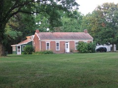 | Samuel Brown House | 3.9 miles | 2006 |
| Russellville Historic District | 6.0 miles | 2019 | |
| Pine Bluff Covered Bridge | 7.0 miles | 2024 | |
| Bainbridge Historic District | 7.4 miles | 2019 | |
| Rolling Stone Covered Bridge | 7.6 miles | 2024 |
| National Archives record | The nomination case file for reference 100010369 in Record Group 79. |
| Putnam County | All 33 listed properties in this county. |