 Block
Rossville, Indiana
9 topographic sheets cover this place, the earliest surveyed in 1953 and the latest in 1984. It stands in Ross Township. It lies in ZIP code area 46065. The Survey maps it on the Rossville quadrangle. 1,508 people lived here at the 2020 count. It stands 725 feet above sea level.
Population over time
2 figuresRossville fell from 1,653 to 1,508 between 2010 and 2020. These are the recorded population figures Wikidata holds for this place, reached through the Geographic Names Information System number this page is keyed on rather than by name, so they belong to this place and not to another of the same name. Most are census counts, but not all are: an early figure may be a founding or settlement estimate, and an estimate published within five years of a census is left out. The change column is computed, and is left blank where more than 20 years separate a figure from the one before it, because a gap that long is not a change between two counts.
| Year | People | Change |
|---|---|---|
| 2010 | 1,653 | |
| 2020 | 1,508 | -145 (-9%) |
Topographic sheets covering this place
5 surveys from 9 printed sheetsMatched by testing this settlement's coordinate against the published boundary of every sheet in the United States Geological Survey's historical collection. Each opens the scanned sheet at the Survey.
- 1953 USGS Danville quadrangle1:250000, 3 printings
- 1955 USGS Danville quadrangle1:250000
- 1956 USGS Danville quadrangle1:250000
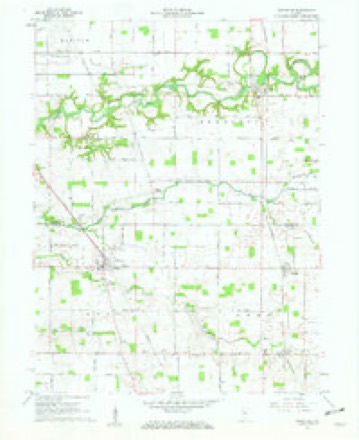
- 1961 USGS Rossville quadrangle1:24000, 2 printings
- 1984 USGS Lafayette quadrangle1:100000, 2 printings




In the county-history sources
17,664 words on this townshipCombination Atlas Map of Clinton County, Indiana, published 1878; History of Clinton County, Indiana. Together with Sketches of Its Cities, Villages and Towns, Educational, Religious, Civil, Military, and Political History, Portraits of Prominent Persons, and Biographies of Representative Citizens. Also a Condensed History of Indiana, Embodying Accounts of Prehistoric Races, Indian Wars, and a Brief Review of Its Civil and Political History, published 1886 names this settlement in its chapter on Ross Township. These are the passages that mention it, exactly as the scans read.
In the year 1829, it being known that a settlement, aetually existed in that section of country, a number of substantial men were encouraged to try their fortunes in the wild woods of Ross. - They were John Cripe, who settled on the farm where Isaac Cripe is now living; Shadrick Bowen, on the John Riley farm; Aaron Parcel, on the land owned by John Enwright; Esom Scott, on the Bricker farm; William Peters, on the land at present belonging to Clapper; Andrew Major, on the Huffard land; Samuel Seawright, on the farm belonging to Mr. Dance, and Samuel Cripe, whose exact location to us is unknown.
Passage source: Combination Atlas Map of Clinton County, Indiana, published 1878.
In 1830 and "31, came John Smith, locating on the James Wilson farm; John Carick, on the farm owned by his heirs; Thomas Major, on the land owned by the heirs of Latchaw; Jacob Cripe, on Graybill farm; Wiiliam Smith, on the land yet the property of his heirs; Henry Buckhalter, location not known; Brafford, on the Baler farm; Andrew Waymire, on the laud belonging to Huffman ; William Price, on the Carson farm ; David C. Clark, on the farm of Uriah Ross; and John Logan, on what is at present the Murphy farm. `
Passage source: Combination Atlas Map of Clinton County, Indiana, published 1878.
The first religious meeting in the township was held at the 'cabin of William Smith, who was the first preacher, in 1830, by the Methodists. Soon after a meeting was held at the house of Solomon Miller by the Presbyterians, James Caruahan preaching. The first regular church organization was effected by the Methodists at William Smith's in 1831. The first church was built in 1833 on the farm of Jacob "Watson, which is just across the line in Carroll County. This was a union church and was used by all denominations. Tlie next church was built ou the farm of William Peters soon after.
Machine-read from a century-old scan, so expect the errors a machine makes: misspelled names, dropped words, stray characters.
Read the whole chapter on Ross Township - it names this place 11 more 11 times.
Mines and quarries near this place
2 within 5 milesRegional context, not property-specific evidence. The federal mineral resources record lists 2 workings within 5 miles of Rossville: 1 past producer, 1 unknown. None of them still produces. What was taken out: Sand and Gravel, Construction. Distance is straight-line from the map coordinates, so a quarry counted here may appear on a neighbouring settlement's page as well.
| Where | Site | Commodity | Status | Recorded |
|---|---|---|---|---|
| Barnard Pit | Sand and Gravel, Construction | Past Producer | ||
| Skiles Pit | Sand and Gravel, Construction | Unknown |
Storms near this place
17 since 1996Regional context, not property-specific evidence. The National Weather Service names Rossville in 17 storm reports between 1996 and 2020: 10 thunderstorm wind, 7 hail. No death or injury is recorded in these reports. Each account below is quoted exactly as the forecast office filed it, from the NOAA Storm Events Database, and each date opens the federal record of that event.
| When | Event | Place named | Harm | What the report says |
|---|---|---|---|---|
| June 2016 | Thunderstorm Wind | Rossville | $15,000 | An estimated 80 mph thunderstorm wind gust was observed in this location. Trees and power lines were downed, along with dime sized hail. |
| July 2020 | Thunderstorm Wind | Rossville | $10,000 | Tree limbs, trees, and power lines downed due to thunderstorm wind gusts in the nearby area. A roof was blown off a house near the intersection of State Road 39 and County Road 700N. |
| June 2016 | Thunderstorm Wind | Rossville | $7,000 | Trees were downed in Rossville due to damaging thunderstorm wind gusts. |
| June 2013 | Thunderstorm Wind | Rossville | $2,000 | Trees were downed across Highway 421 due to damaging thunderstorm wind gusts. Some trees were six inches in diameter. This report came in via twitter. |
| July 1996 | Thunderstorm Wind | Rossville | $2,000 | no account filed |
| June 2016 | Thunderstorm Wind | Rossville | $500 | A two inch diameter tree was downed near this location by strong thunderstorm wind gusts. |
| March 2009 | Thunderstorm Wind | Rossville | - | Thunderstorm winds blew down utility lines. |
| April 2006 | Hail | Rossville | - | No property damage estimates were available. |
| May 2011 | Hail | Rossville | - | no account filed |
| August 2011 | Hail | Rossville | - | no account filed |
| August 2011 | Hail | Rossville | - | no account filed |
| August 2011 | Hail | Rossville | - | no account filed |
| August 2011 | Hail | Rossville | - | no account filed |
| March 2006 | Hail | Rossville | - | no account filed |
| June 2002 | Thunderstorm Wind | Rossville | - | no account filed |
| July 2001 | Thunderstorm Wind | Rossville | - | no account filed |
| May 2000 | Thunderstorm Wind | Rossville | - | no account filed |
Nearest settlements
The eight closest, with where each one stands in the county. Distances are straight-line, computed from the Geographic Names Information System coordinates.
| Map | Place | Distance | Sheets |
|---|---|---|---|
| Edna Mills | 3.9 miles | 9 | |
| Cambria | 4.0 miles | 10 | |
| Sedalia | 4.2 miles | 9 | |
| Moran | 4.7 miles | 9 | |
| Hamilton | 5.1 miles | 10 | |
| Mattix Corner | 5.2 miles | 10 | |
| Ellis | 5.4 miles | 10 | |
| Mulberry | 6.2 miles | 10 |
Elsewhere
Matched on this settlement's Geographic Names Information System number rather than its name, so it cannot be a different place of the same name in another state.
| Wikipedia article on Rossville | An encyclopaedic summary. Its text is share-alike, so it is linked here rather than copied. |
| Wikidata item Q2358262 | The structured record the population and elevation above come from. Public domain (CC0). |
Provenance
This settlement is recorded in the Geographic Names Information System as feature 442329. The sheet list is computed by point-in-boundary test against the United States Geological Survey's historical topographic inventory. Both are works of the United States government and carry no copyright under 17 U.S.C. 105.
Mines and quarries. USGS Mineral Resources Data System (MRDS) https://mrdata.usgs.gov/mrds/ A work of the United States government, no copyright under 17 U.S.C. 105.
Storms. NOAA National Centers for Environmental Information, Storm Events Database https://www.ncei.noaa.gov/stormevents/ A work of the United States government, no copyright under 17 U.S.C. 105. Narratives are quoted verbatim from the National Weather Service report and are not edited or summarised.