 Block
Sedalia, Indiana
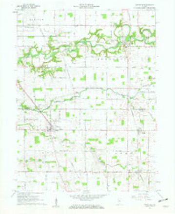
9 topographic sheets cover this place, the earliest surveyed in 1953 and the latest in 1984. It stands in Owen Township. It lies in ZIP code area 46041. The Survey maps it on the Rossville quadrangle. It stands 781 feet above sea level.
Topographic sheets covering this place
5 surveys from 9 printed sheetsMatched by testing this settlement's coordinate against the published boundary of every sheet in the United States Geological Survey's historical collection. Each opens the scanned sheet at the Survey.
- 1953 USGS Danville quadrangle1:250000, 3 printings
- 1955 USGS Danville quadrangle1:250000
- 1956 USGS Danville quadrangle1:250000
- 1961 USGS Rossville quadrangle1:24000, 2 printings
- 1984 USGS Lafayette quadrangle1:100000, 2 printings




In the county-history sources
7,163 words on this townshipHistory of Clinton County, Indiana. Together with Sketches of Its Cities, Villages and Towns, Educational, Religious, Civil, Military, and Political History, Portraits of Prominent Persons, and Biographies of Representative Citizens. Also a Condensed History of Indiana, Embodying Accounts of Prehistoric Races, Indian Wars, and a Brief Review of Its Civil and Political History, published 1886 names this settlement in its chapter on Owen Township. These are the passages that mention it, exactly as the scans read.
The first white men to seek a home in the forests of Owen were Samuel Gray, John Temple and John Miller. The first two settled on section 33, but the exact location of the latter is unknown. These men settled here prior to 1S30. In 1830 came Lewis Shepard and his son Abraham, who settled on section 35, and Philip Kramer and family, on section 4. Those of 1831 were: Lewis Chaney, who settled on section 2; W. H. Addison, on section 34, and Abel Leach, on section 36. George Salmon settled on section 10 in 1832, and others of that year were Noah Bunnell, on section 34; Thomas Kennard, on section 24; Thomas Kitley, on section 34, and Major W. H. Reed, on section 33. In 1833 John Coapstick settled on section 23; John Smith, on section 24; "William Smith, (769) on section 25; John Oastalor, on section 4; and Andrew Connaron, on section 9. Among those of 1834-'5-'6 were John Starrett, Thomas Leach, David Long, David Sample, John Fitzgerald, Jacob Bresler, Reuben White, William Mabbitt, James Smith, David Shroyer, John Humer, Arthur Orumpton, James Campbell, Jacob Miller, Levi Herr, Amos Purner, John Boyles, William Alexander, John S. Hayes, Alvin Vice, Asbury Vice, William Reed, Abel and Henry Chaney, William Campbell and William Bosworth.
John Puenee, farmer, section 33, Owen Township, Clinton County, is a son of Amos and Rachel (Herr) Purner. Of the eight children born to his parents he is the only one that survives. He was reared on a farm, and has followed that occupation most of his life. He was a soldier in the war of the Eebellion, enlisting in August, 1862, in the Seventy-second Indiana Infantry, receiv- ing his discharge in 1865. During his term of service he participated in the battles of Chickamauga, Atlanta, Selma and other engagements of minor importance. March 1, 1867, he was married to Miss Sarah E. Wiedy, a daughter of Nathan and Catharine Wiedj, who came from Pennsj'lvania to Clinton County, Indiana, where they still reside. To Mr. and Mrs. Purner have been born nine children - Clyde, Frank M. E., Charles E., Thomas W., Levi G., Willis M., Sherman W". and two who died in infancy. In politics Mr. Purner affiliates with the Republican party. He and his wife are members of the Methodist Episcopal churcli. His father, Amos Purner, was born in Lancaster County, Pennsylvania, in 1803. In 1836 he went to Ohio with his mother, and in 1810 came to Owen Township, Clinton County, Indiana, where he yet lives, being now in his eighty-fourth year. He was married in 1826 to Rachel Herr, who has been his companion through all these years. She is still living, but is aiflicted with the loss of her eye-sight. They are both earnest and devoted members of the Methodist Episcopal church. The father cast his tirst presidential vote for John Quincy Adams, and has always held to the principles of the Republican party except in 1856, vthen he voted for Buchanan, which he has ever regretted.
Machine-read from a century-old scan, so expect the errors a machine makes: misspelled names, dropped words, stray characters.
Read the whole chapter on Owen Township - it names this place 1 more 1 time.
Mines and quarries near this place
2 within 5 milesRegional context, not property-specific evidence. The federal mineral resources record lists 2 workings within 5 miles of Sedalia: 1 past producer, 1 unknown. None of them still produces. What was taken out: Sand and Gravel, Construction. Distance is straight-line from the map coordinates, so a quarry counted here may appear on a neighbouring settlement's page as well.
| Where | Site | Commodity | Status | Recorded |
|---|---|---|---|---|
| Barnard Pit | Sand and Gravel, Construction | Past Producer | ||
| Skiles Pit | Sand and Gravel, Construction | Unknown |
Storms near this place
3 since 2011Regional context, not property-specific evidence. The National Weather Service names Sedalia in 3 storm reports between 2011 and 2026: 2 thunderstorm wind, 1 flood. No death or injury is recorded in these reports. Each account below is quoted exactly as the forecast office filed it, from the NOAA Storm Events Database, and each date opens the federal record of that event.
| When | Event | Place named | Harm | What the report says |
|---|---|---|---|---|
| April 2026 | Thunderstorm Wind | Sedalia | $2,000 | Tree downed by thunderstorm wind gusts. |
| February 2018 | Flood | Sedalia | $1,000 | Dispatch reported County Road 0 closed from State Road 26 to County Road 800 North due to high water from heavy rainfall. |
| July 2011 | Thunderstorm Wind | Sedalia | $500 | Tree limbs were downed in Sedalia due to damaging thunderstorm wind gusts. |
Nearest settlements
The eight closest, with where each one stands in the county. Distances are straight-line, computed from the Geographic Names Information System coordinates.
| Map | Place | Distance | Sheets |
|---|---|---|---|
| Moran | 1.9 miles | 9 | |
| Geetingsville | 2.4 miles | 10 | |
| Ellis | 3.0 miles | 10 | |
| Cambria | 4.2 miles | 10 | |
| Rossville | 4.2 miles | 9 | |
| Beard | 4.5 miles | 9 | |
| Kilmore | 4.6 miles | 10 | |
| Mattix Corner | 5.7 miles | 10 |
Elsewhere
Matched on this settlement's Geographic Names Information System number rather than its name, so it cannot be a different place of the same name in another state.
| Wikipedia article on Sedalia | An encyclopaedic summary. Its text is share-alike, so it is linked here rather than copied. |
| Wikidata item Q7445103 | The structured record the population and elevation above come from. Public domain (CC0). |
Provenance
This settlement is recorded in the Geographic Names Information System as feature 443192. The sheet list is computed by point-in-boundary test against the United States Geological Survey's historical topographic inventory. Both are works of the United States government and carry no copyright under 17 U.S.C. 105.
Mines and quarries. USGS Mineral Resources Data System (MRDS) https://mrdata.usgs.gov/mrds/ A work of the United States government, no copyright under 17 U.S.C. 105.
Storms. NOAA National Centers for Environmental Information, Storm Events Database https://www.ncei.noaa.gov/stormevents/ A work of the United States government, no copyright under 17 U.S.C. 105. Narratives are quoted verbatim from the National Weather Service report and are not edited or summarised.