 Block
Scipio, Indiana
12 topographic sheets cover this place, the earliest surveyed in 1942 and the latest in 1986. It stands in Geneva Township. It lies in ZIP code area 47273. It stands on Bear Creek. The Survey maps it on the North Vernon quadrangle.
On record in Scipio
Buildings and businesses the archive holds for this place. Each opens its own page, with the source record it came from.
On the National Register 1 record
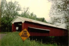 Scipio Covered Bridgelisted 2022
Topographic sheets covering this place
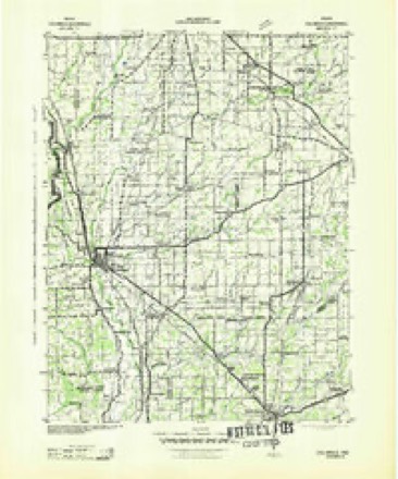
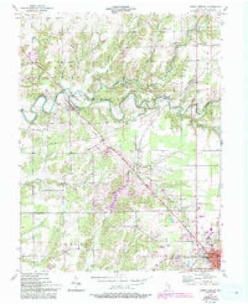
5 surveys from 12 printed sheetsMatched by testing this settlement's coordinate against the published boundary of every sheet in the United States Geological Survey's historical collection. Each opens the scanned sheet at the Survey.
- 1942 USGS Columbus quadrangle1:125000
- 1953 USGS Cincinnati quadrangle1:250000, 3 printings
- 1957 USGS Cincinnati quadrangle1:250000
- 1957 USGS North Vernon quadrangle1:24000, 5 printings
- 1986 USGS Greensburg quadrangle1:100000, 2 printings



Storms near this place
14 since 1994Regional context, not property-specific evidence. The National Weather Service names Scipio in 14 storm reports between 1994 and 2025: 5 hail, 5 thunderstorm wind, 2 flood, 1 flash flood. The reports record 1 injury. Each account below is quoted exactly as the forecast office filed it, from the NOAA Storm Events Database, and each date opens the federal record of that event.
| When | Event | Place named | Harm | What the report says |
|---|---|---|---|---|
| January 2008 | Thunderstorm Wind | Scipio | 1 hurt, $20,000 | A man suffered cuts and scratches when his trailer was damaged by thunderstorm winds. The man was not seriously injured. |
| January 2008 | Thunderstorm Wind | Scipio | $20,000 | Five storage sheds blew down and two decks separated from mobile homes due to damaging thunderstorm winds. High winds also pushed a car off a road. Winds tore off parts of an elementary school's roof. Trees and power lines were reported down around the area. |
| January 2008 | Thunderstorm Wind | Scipio | $5,000 | A house trailer was flipped due to damaging thunderstorm winds. |
| January 2008 | Thunderstorm Wind | Scipio | $5,000 | Trees and power lines were reported down across the county due to damaging thunderstorm winds. |
| January 2012 | Flood | Scipio | $500 | Water was reported over Highway 7 near Scipio due to heavy thunderstorm rainfall. |
| June 2010 | Flood | Scipio | $500 | Several roads were reported flooded, especially in low lying areas. |
| June 2008 | Flash Flood | Scipio | $500 | Considerable flooding was reported with two water rescues needed in the northern part of the county. |
| July 2012 | Hail | Scipio | - | Quarter sized hail was almost covering the ground in this location. |
| June 2010 | Funnel Cloud | Scipio | - | A wall cloud with rotation was observed near the intersection of County Road 300 N and 900 W. |
| March 2025 | Hail | Scipio | - | no account filed |
| July 2012 | Hail | Scipio | - | no account filed |
| July 2004 | Thunderstorm Wind | Scipio | - | no account filed |
| March 1997 | Hail | Scipio | - | no account filed |
| June 1994 | Hail | Scipio | - | no account filed |
Nearest settlements
The eight closest, with where each one stands in the county. Distances are straight-line, computed from the Geographic Names Information System coordinates.
| Map | Place | Distance | Sheets |
|---|---|---|---|
| Tannersville | 1.9 miles | 12 | |
| Queensville | 2.9 miles | 12 | |
| Country Squire Lakes | 3.2 miles | 12 | |
| Brewersville | 5.6 miles | 10 | |
| Hayden | 6.7 miles | 8 | |
| North Vernon | 7.1 miles | 10 | |
| Vernon | 8.7 miles | 10 | |
| Four Corners | 8.7 miles | 8 |
Provenance
This settlement is recorded in the Geographic Names Information System as feature 443126. The sheet list is computed by point-in-boundary test against the United States Geological Survey's historical topographic inventory. Both are works of the United States government and carry no copyright under 17 U.S.C. 105.
Storms. NOAA National Centers for Environmental Information, Storm Events Database https://www.ncei.noaa.gov/stormevents/ A work of the United States government, no copyright under 17 U.S.C. 105. Narratives are quoted verbatim from the National Weather Service report and are not edited or summarised.