 Block
South Bend, Indiana
13 topographic sheets cover this place, the earliest surveyed in 1953 and the latest in 1983. It stands in Portage Township. It lies in ZIP code area 46601. It stands on Bowman Creek. The Survey maps it on the South Bend West quadrangle. 103,453 people lived here at the 2020 count. It stands 692 feet above sea level.
Research this city
On record in South Bend
Buildings and businesses the archive holds for this place. Each opens its own page, with the source record it came from.
On the National Register 12 of 80 shown
 Tippecanoe PlaceNational Historic Landmark · listed 1973
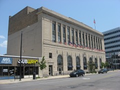 All American Bank Buildinglisted 1985
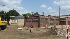 Bergan, W.N.-J.C. Lauber Co. Buildinglisted 1999
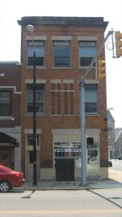 Berteling Buildinglisted 1985
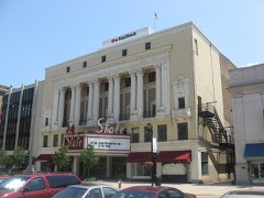 Blackstone-State Theaterlisted 1985
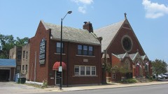 Cathedral of St. James and Parish Halllisted 1985
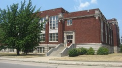 Central High School & Boys Vocational Schoollisted 1985
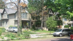 Chapin Park Historic Districtlisted 1982
 Horatio Chapin Houselisted 1980
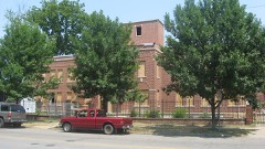 Children's Dispensarylisted 1997
 Citizens Banklisted 1985
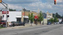 Colonial Gardens Commercial Historic Districtlisted 1997
Population over time
2 figuresSouth Bend grew from 101,168 to 103,453 between 2010 and 2020. These are the recorded population figures Wikidata holds for this place, reached through the Geographic Names Information System number this page is keyed on rather than by name, so they belong to this place and not to another of the same name. Most are census counts, but not all are: an early figure may be a founding or settlement estimate, and an estimate published within five years of a census is left out. The change column is computed, and is left blank where more than 20 years separate a figure from the one before it, because a gap that long is not a change between two counts.
| Year | People | Change |
|---|---|---|
| 2010 | 101,168 | |
| 2020 | 103,453 | +2,285 (+2%) |
Topographic sheets covering this place
5 surveys from 13 printed sheetsMatched by testing this settlement's coordinate against the published boundary of every sheet in the United States Geological Survey's historical collection. Each opens the scanned sheet at the Survey.
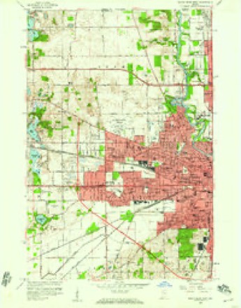
- 1953 USGS Chicago quadrangle1:250000, 5 printings
- 1957 USGS Chicago quadrangle1:250000
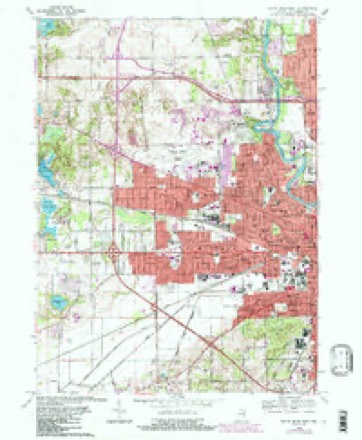
- 1958 USGS South Bend West quadrangle1:24000
- 1969 USGS South Bend West quadrangle1:24000, 4 printings
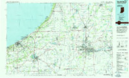
- 1983 USGS South Bend quadrangle1:100000, 2 printings


In the county-history sources
17,994 words on this townshipHistory of St. Joseph County, Indiana :, published 1880 names this settlement in its chapter on Portage Township. These are the passages that mention it, exactly as the scans read.
This is 37 north, 2 east, bounded on the north by German and Clay townships, on the east bj' Penn, on the soiitli by Green and Centre, and on the west by "Warren, and contains 28 square miles, being four miles north and south by seven east and west. The middle of the south side is near the geographical center of the county. It is one of the first townships organized in the county, and as its history is the same as that of South Bend, the capital of the county, we proceed immediately to give a full account of this enterprising city.
Passage source: History of St. Joseph County, Indiana :, published 1880.
South Bend was so named in consequence of the town being located upon the south bend of the St. Joseph river, and therefore only expresses locality. Several attempts have been made to change its name; column after column of newspaper articles have been written in favor of and against the proposed change. The name St. Joseph's City was once proposed and found many advocates, but was rejected by the people, and so the name remains as originally bestowed upon it by Alexis Coquillard and his associates in the beginning.
Passage source: History of St. Joseph County, Indiana :, published 1880.
The lirst commissioners appointed by the Legislature of the State for the location of the county seat selected a place about two miles down the river from South Bend. This did not please the people, and a petition was circulated, and the signature of nearly every voter in the county obtained, changing it to this place. The proprietors of the place ofl:ered very favorable inducements to secure its location and the change was made.
Passage source: History of St. Joseph County, Indiana :, published 1880.
Machine-read from a century-old scan, so expect the errors a machine makes: misspelled names, dropped words, stray characters.
Read the whole chapter on Portage Township - it names this place 47 more 47 times.
Mines and quarries near this place
9 within 5 milesRegional context, not property-specific evidence. The federal mineral resources record lists 9 workings within 5 miles of South Bend: 7 producers, 1 past producer, 1 plant. 8 still produce. What was taken out: Sand and Gravel, Construction, Stone. Distance is straight-line from the map coordinates, so a quarry counted here may appear on a neighbouring settlement's page as well.
| Where | Site | Commodity | Status | Recorded |
|---|---|---|---|---|
| South Bend S & G Corp. | Stone | Producer | ||
| Albert Rupple Pit | Sand and Gravel, Construction | Past Producer | ||
| Bendix Pit | Sand and Gravel, Construction | Producer | ||
| Dry Island Pit and Mill | Sand and Gravel, Construction | Producer | ||
| South Bend Sand & Gravel Mill | Sand and Gravel, Construction | Plant | ||
| South Bend Sand and Gravel Pit | Sand and Gravel, Construction | Producer | ||
| St. Joseph Co. Hwy. Dept. | Sand and Gravel, Construction | Producer | ||
| St. Joseph Materials Co. | Sand and Gravel, Construction | Producer | ||
| Steenburg Pit | Sand and Gravel, Construction | Producer |
Storms near this place
60 of 146 shownRegional context, not property-specific evidence. The National Weather Service names South Bend in 146 storm reports between 1994 and 2025: 93 thunderstorm wind, 43 hail, 3 flash flood, 3 lightning. The reports record 1 death and 4 injuries. Each account below is quoted exactly as the forecast office filed it, from the NOAA Storm Events Database, and each date opens the federal record of that event.
| When | Event | Place named | Harm | What the report says |
|---|---|---|---|---|
| September 2016 | Flood | South Bend | 1 killed | Street and some basement flooding reported in South Bend. A 53 year old female was electrocuted by flood waters that had entered her basement. She stepped into water of unknown depth and was electrocuted by a box fan that was plugged in and sitting in the water. First responders could not reach her immediately until the scene was safe. They were able to revive her, but she died a few days later with cause of death being electrocution. |
| June 2010 | Thunderstorm Wind | South Bend | 2 hurt | A tree fell down on house at 600 block of 28th St and 2 people were injured. |
| July 1998 | Thunderstorm Wind | South Bend | 1 hurt, $500,000 | SEVERAL REPORTS OF HIGH WINDS AND WIND DAMAGE. ONE WOMAN WAS SERIOUSLY INJURED WHEN A LARGE TREE FELL ON HER CAR. |
| May 2006 | Lightning | South Bend | 1 hurt, $30,000 | A woman, in the basement of her home, was indirectly struck by lightning while standing next to her dryer. She was transported to the hospital, suffering minor injuries. The time of the incident has been esitmated. In Mishawaka, a fire was started from a bolt of lightning striking a detatched garage, destroying it. Damage was estimated at $30,000. The time of this fire was not available. |
| November 2003 | Lightning | South Bend | $250,000 | South Bend Fire Chief reported lightning struck a 16 unit apartment building in the Park Jefferson complex setting it on fire and destroying it. |
| August 1998 | Thunderstorm Wind | South Bend | $150,000 | THE DOORS WERE BLOWN OFF A SQUAD CAR. NUMEROUS TREES AND POWER LINES WERE DOWN ACROSS TOWN AND ESPECIALLY ACROSS THE EASTERN THIRD OF THE COUNTY. ONE TREE FELL ONTO A HOME ALONG AUTEN ROAD WHICH CAUSED MODERATE STRUCTURAL DAMAGE TO THE HOME. |
| August 2007 | Lightning | South Bend | $120,000 | Two (2) separate bolts of lightning struck 2 South Bend residences during the morning hours. A house was struck, causing a fire that destroyed the top floor. The 2 occupants of the house were able to escape without injury. Damage is estimated at $80,000. Lightning struck an apartment, causing significant damage to a kitchen and two bathrooms. A woman and her 4 sons were able to escape unharmed. Damage is estimated at $40,000. |
| July 2006 | Heavy Rain | South Bend | $100,000 | A 100 foot by 30 foot section of a flat roof at the AJ Wright Factory collapsed as a result of torrential rainfall. The building was unoccupied at the time. Work was suspended that day as a result of the damages. In addition, heavy rain flooded the Steel Warehouse, where a tank used to store hydrochloric acid was knocked loose. The tank was nearly empty with no leakage of any of the contents occurring. |
| August 1998 | Thunderstorm Wind | South Bend | $50,000 | SEVERAL POWER POLES SNAPPED OFF BY HIGH WINDS. |
| May 2024 | Thunderstorm Wind | South Bend | $20,000 | Large trees uprooted or downed. Healthy branches of 6 to 12 inches in diameter. One tree snapped, landing on a vehicle. |
| May 2007 | Thunderstorm Wind | South Bend | $20,000 | Numerous trees, tree limbs, power lines and poles were blown down in and around the South Bend/Mishawaka area. A spire from the basilica on the Notre Dame campus was knocked off. |
| July 2004 | Thunderstorm Wind | South Bend | $20,000 | Semi traveling eastbound was blown off Interstate 80/90 Toll Road and flipped over at Mile Marker 70. Damage amount estimated. |
| August 2024 | Thunderstorm Wind | South Bend | $10,000 | Numerous trees and branches down in and around South Bend. |
| May 2011 | Thunderstorm Wind | South Bend | $10,000 | Law enforcement officials reported several trees down in and around South Bend and Mishawaka. One of the trees fell onto a car. |
| May 2000 | Thunderstorm Wind | South Bend | $10,000 | Trees down on homes. Power lines down. |
| June 2025 | Thunderstorm Wind | South Bend | $5,000 | Minor damage to siding to a home on the south side of South Bend. |
| June 2024 | Thunderstorm Wind | South Bend | $5,000 | Numerous reports of trees and power lines down in and around South Bend. |
| June 2024 | Thunderstorm Wind | South Bend | $5,000 | Tree down on a powerline. |
| April 2024 | Thunderstorm Wind | South Bend | $5,000 | The public reported a one foot diameter tree limb was blown down. Several smaller limbs were also blown down. A anchored pool was blown into a nearby fence. |
| March 2023 | Thunderstorm Wind | South Bend | $5,000 | A sign was blown over. Photo on Twitter. |
| March 2023 | Flash Flood | South Bend | $5,000 | Flooding was ongoing on Miami St in South Bend with water of 6 to 8 inches deep. |
| December 2007 | Thunderstorm Wind | South Bend | $5,000 | The roof was peeled off trailer home. Damage is estimated at $5000. |
| July 2003 | Thunderstorm Wind | South Bend | $5,000 | Law enforcement reported roof damage to a home southwest of South Bend. |
| June 2000 | Thunderstorm Wind | South Bend | $5,000 | Two trees down on a parked car and a house. |
| June 1995 | Thunderstorm Wind | South Bend | $5,000 | Trees and power lines were blown down on the southwest side of South Bend. There were 2,500 to 3,000 people without power. |
| July 2023 | Hail | South Bend | $2,000 | no account filed |
| June 2021 | Thunderstorm Wind | South Bend | $1,500 | On Madison Street in South Bend. Large tree blocking road that also went through the rear window of a vehicle. Many tree branches also down. |
| August 2024 | Thunderstorm Wind | South Bend | $1,000 | Large tree down near Kendall and Shrrill St. |
| August 2024 | Thunderstorm Wind | South Bend | $1,000 | Large tree uprooted, nearly landing on a home. |
| July 2022 | Thunderstorm Wind | South Bend | $1,000 | A tree down in road on E Dayton Street. Reported via Twitter. |
| July 2022 | Thunderstorm Wind | South Bend | $1,000 | A large tree blocking Ridgedale Road. Reported via Twitter. |
| July 2023 | Hail | South Bend | $1,000 | no account filed |
| July 2023 | Hail | South Bend | $1,000 | no account filed |
| May 2024 | Thunderstorm Wind | South Bend | - | Large tree down on Ewing Street. |
| July 2023 | Thunderstorm Wind | South Bend | - | Local media reported reported numerous three to 5 inch tree limbs down as well a a couple entire trees down with rot in them. |
| June 2021 | Thunderstorm Wind | South Bend | - | Numerous trees and powerlines down across the county, especially in the northeast portions near South Bend/Mishawaka/Osceola. Also near the intersection of Jefferson/Greenlawn. |
| August 2021 | Flood | South Bend | - | Street/roadway flooding. Reported from MPing. |
| August 2021 | Hail | South Bend | - | Basement flooding also reported. |
| October 2021 | Thunderstorm Wind | South Bend | - | Local media reported a large tree branch was blown down onto a roadway. |
| May 2020 | Thunderstorm Wind | South Bend | - | A trained spotter reported several trees up to three feet in diameter blown down. |
| September 2019 | Thunderstorm Wind | South Bend | - | A trained spotter recorded a 64 mph wind gust. |
| May 2019 | Thunderstorm Wind | South Bend | - | A two foot diameter tree was uprooted and fell onto three cars, crushing them. |
| May 2018 | Thunderstorm Wind | South Bend | - | A trained spotter reported trees uprooted and large branches snapped. |
| February 2017 | Hail | South Bend | - | Local media reported dime size hail at Indiana University South Bend campus. |
| March 2016 | Thunderstorm Wind | South Bend | - | Broadcast media reported a trees was blown down onto power lines. A set of bleachers at a nearby sports field was also blown over. |
| March 2016 | Thunderstorm Wind | South Bend | - | The public reported trees limbs and trees down on the 900 block of Napier. |
| October 2016 | Tornado (EF0) | South Bend | - | It was concluded that a second weak EF-0 tornado occurred on the south side of South Bend in the Belmont Avenue vicinity. A small area of tornadic wind damage was found centered in the Belmont Avenue/Sunnyside Avenue vicinity. Some convergence of the tree damage was noted in this area indicative of tornadic winds. Large tree limbs were tilted with several large limbs downed. A large tree limb fell on a shed and lifted it up on its side. This tornado was embedded within a larger area of wind damage associated with microburst. The larger area of straight line wind damage extended from Northside Blvd just north of Beyer Avenue, to Longfellow Road just west of Twyckenham Drive. Tree damage and some damage to shingles at a residence were noted along this larger damage path associated with the microburst. |
| June 2016 | Thunderstorm Wind | South Bend | - | Local media reports trees and power lines down on Catalpa Street. |
| June 2016 | Thunderstorm Wind | South Bend | - | Local media reports a tree down onto a residence. |
| June 2016 | Thunderstorm Wind | South Bend | - | South Bend Fire reported several trees down in the city, with some blocking roads. |
| August 2014 | Thunderstorm Wind | South Bend | - | Local media reported trees and power lines down in the Cleveland Road area. |
| June 2014 | Thunderstorm Wind | South Bend | - | Amateur radio operators reported several trees blown down along Greenlawn Road near the zoo. |
| June 2014 | Thunderstorm Wind | South Bend | - | A trained spotter reported tree limbs down at a residence. One landed on a vehicle. No damage estimates were available. |
| June 2014 | Thunderstorm Wind | South Bend | - | Law enforcement officials reported trees and power lines down on the west side of South Bend, especially in the Edison Road area. |
| June 2014 | Thunderstorm Wind | South Bend | - | A swath of damage was surveyed along Jefferson Boulevard from the St. Joseph River east to just south of Bethel College. Many trees were uprooted along this path, consistent with straight line winds estimated to 80 mph. |
| August 2013 | Thunderstorm Wind | South Bend | - | Wind gust estimated by local media. |
| May 2013 | Thunderstorm Wind | South Bend | - | A trained spotter reported multiple power poles were snapped in the middle. In addition, several trees were uprooted. |
| November 2013 | Thunderstorm Wind | South Bend | - | A trained spotter reported a 16 inch tree down onto an car. |
| November 2013 | Thunderstorm Wind | South Bend | - | A trained spotter measure a 66 mph wind gust near the South Bend airport. |
| November 2013 | Thunderstorm Wind | South Bend | - | A trained spotter reported a tree was uprooted and fell onto a house on the south side of the 4-H fairgrounds. |
Nearest settlements
The eight closest, with where each one stands in the county. Distances are straight-line, computed from the Geographic Names Information System coordinates.
| Map | Place | Distance | Sheets |
|---|---|---|---|
| Maple Lane | 2.1 miles | 14 | |
| Indian Village | 2.2 miles | 14 | |
| Roseland | 2.3 miles | 13 | |
| Georgetown | 3.4 miles | 14 | |
| Ardmore | 3.6 miles | 13 | |
| Gilmer Park | 4.4 miles | 11 | |
| Crest Manor Addition | 4.7 miles | 11 | |
| Dreamwold Heights | 4.8 miles | 16 |
Elsewhere
Matched on this settlement's Geographic Names Information System number rather than its name, so it cannot be a different place of the same name in another state.
| Wikipedia article on South Bend | An encyclopaedic summary. Its text is share-alike, so it is linked here rather than copied. |
| Wikidata item Q486877 | The structured record the population and elevation above come from. Public domain (CC0). |
Provenance
This settlement is recorded in the Geographic Names Information System as feature 452796. The sheet list is computed by point-in-boundary test against the United States Geological Survey's historical topographic inventory. Both are works of the United States government and carry no copyright under 17 U.S.C. 105.
Mines and quarries. USGS Mineral Resources Data System (MRDS) https://mrdata.usgs.gov/mrds/ A work of the United States government, no copyright under 17 U.S.C. 105.
Storms. NOAA National Centers for Environmental Information, Storm Events Database https://www.ncei.noaa.gov/stormevents/ A work of the United States government, no copyright under 17 U.S.C. 105. Narratives are quoted verbatim from the National Weather Service report and are not edited or summarised.