 Block
Stavetown, Indiana
10 topographic sheets cover this place, the earliest surveyed in 1953 and the latest in 1986. It stands in Brookville Township. It lies in ZIP code area 47012. It stands on Wolf Creek. The Survey maps it on the Brookville quadrangle. It stands 620 feet above sea level.
On record in Stavetown
Buildings and businesses the archive holds for this place. Each opens its own page, with the source record it came from.
On the National Register within a mile 3 records
The National Register names another town for these. They stand within one mile of this settlement's coordinate.
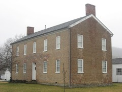 Franklin County Seminarylisted 1974 · 0.6 miles away
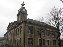 Brookville Historic Districtlisted 1975 · 0.8 miles away
 Hermitage, Thelisted 2004 · 0.9 miles away
Topographic sheets covering this place
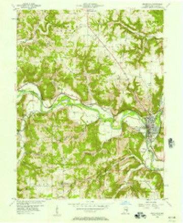
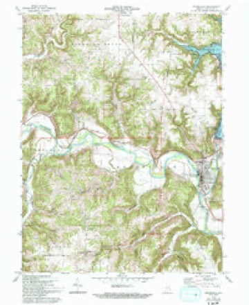
5 surveys from 10 printed sheetsMatched by testing this settlement's coordinate against the published boundary of every sheet in the United States Geological Survey's historical collection. Each opens the scanned sheet at the Survey.
- 1953 USGS Cincinnati quadrangle1:250000, 3 printings
- 1956 USGS Brookville quadrangle1:24000
- 1957 USGS Cincinnati quadrangle1:250000
- 1972 USGS Brookville quadrangle1:24000, 3 printings
- 1986 USGS Greensburg quadrangle1:100000, 2 printings



What happened here
An account from the chapter on Brookville township. The inset identifies its exact source book and publication year.
Great Flood Of March 25, I913
The flood of March 25, 1913, was the greatest in volume of water, destruction of property and loss of life, of any that has ever visited this part of the White Water valley. Hundreds of thousands of dollars' worth of property was destroyed and fifteen lives lost. Six hundred people in Brookville were rendered homeless and scores of dwellings swept away and torn to pieces.
In the county-history sources
16,177 words on this townshipHistory of Franklin County, Indiana : Her People, Industries and Institutions, published 1915 names this settlement in its chapter on Brookville Township. These are the passages that mention it, exactly as the scans read.
A hub factory was started in Brookville in 1905, largely by local capital. It was situated in ''Stavetown,'' on the flats, and the following notice appeared in a local paper concerning it : "The new hub factory at Stavetown begins operations Monday. It will give employment to ten men. Sufficient logs are already on hand in the yard to keep the plant running for the next two months and there is an untold amount of good hub timber within drawing distance in the woods about here.'' This plant was washed away by the great flood of 19 13 and never rebuilt.
Passage source: History of Franklin County, Indiana : Her People, Industries and Institutions, published 1915.
Perhaps the saddest incident connected with this flood was the drowning of the entire John A. Fries family and the inmates of Mr. Fries' mother's home, which stood close by her son's, both being in Stavetown. on the flats to the south of the town. This is the old brick and tile district, where for so many years these families had lived in two old land-marks, both of which were swept away. The hours at which these houses were washed awav is not known, but sometime after midnight. In these two homes all eight of the occupants were drowned, including nicniljcrs of three ^fenerations - the grandmother, eighty years old, the son, and the granddaughter, Margaret, a prattling babe of six months. The funerals were held at St. Michael's Catholic church on M(jnday following the tlfjod. All business places were closed during this sad ceremony. I'our hearses conveyed the remains to the Catholic cemetery. The body of grandmother Furies was never immd.
Passage source: History of Franklin County, Indiana : Her People, Industries and Institutions, published 1915.
Machine-read from a century-old scan, so expect the errors a machine makes: misspelled names, dropped words, stray characters.
Mines and quarries near this place
2 within 5 milesRegional context, not property-specific evidence. The federal mineral resources record lists 2 workings within 5 miles of Stavetown: 2 producers. All of them still produce. What was taken out: Sand and Gravel, Construction. Distance is straight-line from the map coordinates, so a quarry counted here may appear on a neighbouring settlement's page as well.
| Where | Site | Commodity | Status | Recorded |
|---|---|---|---|---|
| Franklin County Highway Dept. | Sand and Gravel, Construction | Producer | ||
| Harrison Sand & Gravel Pit | Sand and Gravel, Construction | Producer |
Storms near this place
4 since 2008Regional context, not property-specific evidence. The National Weather Service names Stavetown in 4 storm reports between 2008 and 2023: 2 hail, 2 flash flood. No death or injury is recorded in these reports. Each account below is quoted exactly as the forecast office filed it, from the NOAA Storm Events Database, and each date opens the federal record of that event.
| When | Event | Place named | Harm | What the report says |
|---|---|---|---|---|
| September 2016 | Flash Flood | Stavetown | $500,000 | Water was flowing over several roads across Franklin County, including U.S. Route 52. One bridge on River Road sustained significant damage. On Big Cedar Road, the pavement on a section of the road was peeled away and laid into a field beside the road. Several other bridge approaches were damaged in the county and numerous culvert pipes were destroyed. |
| July 2008 | Hail | Stavetown | $8,000 | no account filed |
| April 2017 | Flash Flood | Stavetown | - | High water was reported along Blue Creek Road. |
| February 2023 | Hail | Stavetown | - | no account filed |
Nearest settlements
The eight closest, with where each one stands in the county. Distances are straight-line, computed from the Geographic Names Information System coordinates.
| Map | Place | Distance | Sheets |
|---|---|---|---|
| Brookville | 0.9 miles | 10 | |
| Mound Haven | 2.5 miles | 13 | |
| Oak Tree Crossroads | 2.7 miles | 9 | |
| Yellow Bank | 3.6 miles | 10 | |
| Klemmes Corner | 3.9 miles | 9 | |
| Oak Forest | 4.4 miles | 10 | |
| Palestine | 4.4 miles | 13 | |
| Youngs Corner | 4.6 miles | 9 |
Elsewhere
Matched on this settlement's Geographic Names Information System number rather than its name, so it cannot be a different place of the same name in another state.
| Wikipedia article on Stavetown | An encyclopaedic summary. Its text is share-alike, so it is linked here rather than copied. |
| Wikidata item Q7604824 | The structured record the population and elevation above come from. Public domain (CC0). |
Provenance
This settlement is recorded in the Geographic Names Information System as feature 444102. The sheet list is computed by point-in-boundary test against the United States Geological Survey's historical topographic inventory. Both are works of the United States government and carry no copyright under 17 U.S.C. 105.
Mines and quarries. USGS Mineral Resources Data System (MRDS) https://mrdata.usgs.gov/mrds/ A work of the United States government, no copyright under 17 U.S.C. 105.
Storms. NOAA National Centers for Environmental Information, Storm Events Database https://www.ncei.noaa.gov/stormevents/ A work of the United States government, no copyright under 17 U.S.C. 105. Narratives are quoted verbatim from the National Weather Service report and are not edited or summarised.