 Block
Brookville, Indiana
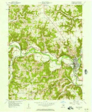
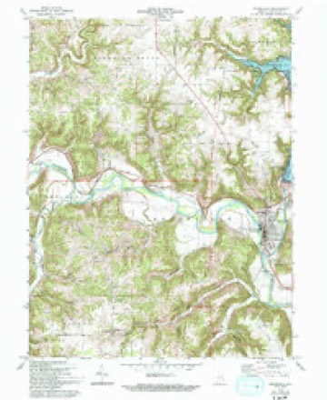
10 topographic sheets cover this place, the earliest surveyed in 1953 and the latest in 1986. It stands in Brookville Township. It lies in ZIP code area 47012. It stands on Butlers Run. The Survey maps it on the Brookville quadrangle. 2,622 people lived here at the 2020 count. It stands 666 feet above sea level.
Research this city
On record in Brookville
Buildings and businesses the archive holds for this place. Each opens its own page, with the source record it came from.
On the National Register 5 records
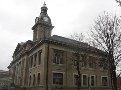 Brookville Historic Districtlisted 1975
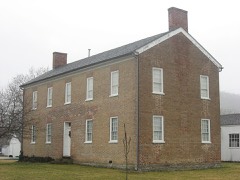 Franklin County Seminarylisted 1974
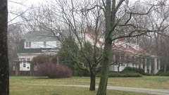 Hermitage, Thelisted 2004
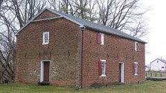 Little Cedar Grove Baptist Churchlisted 1990
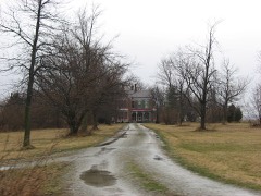 Joseph Shafer Farmlisted 1982
Population over time
2 figuresBrookville grew from 2,596 to 2,622 between 2010 and 2020. These are the recorded population figures Wikidata holds for this place, reached through the Geographic Names Information System number this page is keyed on rather than by name, so they belong to this place and not to another of the same name. Most are census counts, but not all are: an early figure may be a founding or settlement estimate, and an estimate published within five years of a census is left out. The change column is computed, and is left blank where more than 20 years separate a figure from the one before it, because a gap that long is not a change between two counts.
| Year | People | Change |
|---|---|---|
| 2010 | 2,596 | |
| 2020 | 2,622 | +26 (+1%) |
Topographic sheets covering this place
5 surveys from 10 printed sheetsMatched by testing this settlement's coordinate against the published boundary of every sheet in the United States Geological Survey's historical collection. Each opens the scanned sheet at the Survey.
- 1953 USGS Cincinnati quadrangle1:250000, 3 printings
- 1956 USGS Brookville quadrangle1:24000
- 1957 USGS Cincinnati quadrangle1:250000
- 1972 USGS Brookville quadrangle1:24000, 3 printings
- 1986 USGS Greensburg quadrangle1:100000, 2 printings



What happened here
An account from the chapter on Brookville township. The inset identifies its exact source book and publication year.
Great Flood Of March 25, I913
The flood of March 25, 1913, was the greatest in volume of water, destruction of property and loss of life, of any that has ever visited this part of the White Water valley. Hundreds of thousands of dollars' worth of property was destroyed and fifteen lives lost. Six hundred people in Brookville were rendered homeless and scores of dwellings swept away and torn to pieces.
In the county-history sources
16,177 words on this townshipHistory of Franklin County, Indiana : Her People, Industries and Institutions, published 1915 names this settlement in its chapter on Brookville Township. These are the passages that mention it, exactly as the scans read.
The town of Brookville was platted August 8, 1808, by Thomas Manwarring and took its name from the middle name of one of the proprietors, Jesse Brooks Thomas, whose mother's maiden name was Brooks. At first it was called "Brooksville," but soon the "s" was dropped and ever since it has been Brookville. The plat was recorded January 8, 181 2. In 1820 Brookville was a military post and was garrisoned by a company of United States soldiers under command of Captain Grovenor of the regular army. In 1S23 the land office was established here with Lazarus Xoble as receiver. The office was first kept in a frame house on Court street and later in tlie building now occupied by Doctor Garrigues. The office was removed to Indianapolis in 1825.
Passage source: History of Franklin County, Indiana : Her People, Industries and Institutions, published 1915.
Of the first prime movers at Rrookville. it should be recorded in the annals of the place that Amos Butler, a native of Chester county. Pennsylvania, first entered land in Dearborn county in 1803. He had some means and after entering his land returned to Penn.sylvania. and upon his return found his lands overflowed with the waters of the Ohio river. He at once sought another location, and, coming to the present site of Brookville in the autumn of 180.] on foot, he decided to set his stakes here. As has been said, he remained here until 18 18. when he removed to Hanover, Indiana, where he died.
Passage source: History of Franklin County, Indiana : Her People, Industries and Institutions, published 1915.
John Allen was also a Pennsylvanian. He came here with his two sons. Solomon and Josiah. in 1805. They went back and spent the winter in their native state. In the spring following the two brothers, with a fiatboat load of gcxvJs and mill machiner}\ came down the Ohio, and finallv reached Brookville; the mill-stones were brought in this cargo. The remainder of the family came later in the season. Allen and Butler were rivals both in town-site and milling interests. Allen was probably the first justice of the peace here. He had too many irons in the fire and finally, when hard times set in, he failed and moved to Blooming Grove, where he died, and was buried on the Hayes farm, formerly owned by John Allen, Jr. A brother-in-law of tavern-keeper Knight, already named, came with Allen and was later one of the treasurers of Franklin county.
Passage source: History of Franklin County, Indiana : Her People, Industries and Institutions, published 1915.
Machine-read from a century-old scan, so expect the errors a machine makes: misspelled names, dropped words, stray characters.
Read the whole chapter on Brookville Township - it names this place 68 more 68 times.
Mines and quarries near this place
2 within 5 milesRegional context, not property-specific evidence. The federal mineral resources record lists 2 workings within 5 miles of Brookville: 2 producers. All of them still produce. What was taken out: Sand and Gravel, Construction. Distance is straight-line from the map coordinates, so a quarry counted here may appear on a neighbouring settlement's page as well.
| Where | Site | Commodity | Status | Recorded |
|---|---|---|---|---|
| Franklin County Highway Dept. | Sand and Gravel, Construction | Producer | ||
| Harrison Sand & Gravel Pit | Sand and Gravel, Construction | Producer |
Storms near this place
60 since 1993Regional context, not property-specific evidence. The National Weather Service names Brookville in 60 storm reports between 1993 and 2026: 29 thunderstorm wind, 12 hail, 12 flood, 7 flash flood. No death or injury is recorded in these reports. Each account below is quoted exactly as the forecast office filed it, from the NOAA Storm Events Database, and each date opens the federal record of that event.
| When | Event | Place named | Harm | What the report says |
|---|---|---|---|---|
| July 2021 | Flash Flood | Brookville | $100,000 | Water was flowing across a roadway and carrying debris. A few roads washout were also reported across central Franklin County. |
| July 2023 | Thunderstorm Wind | Brookville | $10,000 | Numerous trees were downed across Franklin County. |
| July 2012 | Thunderstorm Wind | Brookville | $10,000 | Several trees were downed, along with power lines due to damaging thunderstorm winds. |
| July 2002 | Thunderstorm Wind | Brookville | $10,000 | Trees were blown down. A boat was capsized on Brookville Lake. |
| April 2024 | Thunderstorm Wind | Brookville | $5,000 | Several trees were downed along U.S. Route 52. |
| August 2000 | Thunderstorm Wind | Brookville | $5,000 | Trees and power lines downed. |
| July 1998 | Thunderstorm Wind | Brookville | $5,000 | Trees downed. |
| June 1998 | Thunderstorm Wind | Brookville | $5,000 | Numerous trees and power lines. |
| June 1995 | Thunderstorm Wind | Brookville | $5,000 | Trees were downed, some on power lines. |
| July 2023 | Thunderstorm Wind | Brookville | $4,000 | A few trees were downed in the Brookville area. |
| July 1996 | Thunderstorm Wind | Brookville | $4,000 | no account filed |
| June 2022 | Thunderstorm Wind | Brookville | $3,000 | A tree fell onto some wires along West Klein Street. |
| February 2006 | Thunderstorm Wind | Brookville | $3,000 | Trees were downed. |
| June 2005 | Thunderstorm Wind | Brookville | $3,000 | Trees were knocked down along US Route 52. |
| November 2005 | Thunderstorm Wind | Brookville | $3,000 | Several trees were downed along Bath and Wolf Roads near Brookville. |
| June 2004 | Thunderstorm Wind | Brookville | $3,000 | Trees were knocked down. |
| July 2003 | Thunderstorm Wind | Brookville | $3,000 | Trees were downed near Brookville Lake and Cedar Grove. |
| July 2003 | Thunderstorm Wind | Brookville | $3,000 | Trees were downed. |
| October 2001 | Thunderstorm Wind | Brookville | $3,000 | A few trees were knocked down in town. |
| February 1999 | Thunderstorm Wind | Brookville | $3,000 | Trees knocked down. |
| May 1999 | Thunderstorm Wind | Brookville | $3,000 | Trees were blown down on St. Marys road. |
| July 1999 | Thunderstorm Wind | Brookville | $3,000 | Numerous trees down. |
| April 1997 | Thunderstorm Wind | Brookville | $3,000 | no account filed |
| April 2011 | Flash Flood | Brookville | $2,000 | Multiple roads were closed due to heavy rainfall. |
| August 2010 | Thunderstorm Wind | Brookville | $2,000 | Trees and power poles were reported down due to damaging thunderstorm winds. |
| May 2004 | Thunderstorm Wind | Brookville | $2,000 | One tree and several large limbs were downed. |
| July 2009 | Thunderstorm Wind | Brookville | $1,000 | Large trees were reported down. |
| June 2000 | Flash Flood | Brookville | $1,000 | High water was over U.S. 52 on the east end of Brookville. |
| May 2019 | Thunderstorm Wind | Brookville | $250 | A large branch was downed. |
| March 2026 | Flood | Brookville | - | Levee Road was closed due to high water. Several additional roads were closed due to high water in the vicinity. |
| February 2026 | Flood | Brookville | - | High water was reported across U.S. Route 52 and Landfill Road. |
| March 2023 | Flood | Brookville | - | High water was reported across St. Marys Road. |
| February 2022 | Flood | Brookville | - | High water was reported on St. Marys Road near Levee Road. |
| February 2022 | Flood | Brookville | - | High water was reported on U.S. 52 just west of Franklin. |
| January 2019 | Flood | Brookville | - | A road over Snail Creek was closed due to high water. |
| January 2019 | Flood | Brookville | - | Levee Road near St Marys Road was closed due to high water. |
| January 2019 | Flood | Brookville | - | High water closed Levee Road. |
| February 2019 | Flash Flood | Brookville | - | Numerous roads were closed due to flooding. |
| February 2019 | Flood | Brookville | - | High water was reported on Levee Rd along Snail Creek. |
| April 2019 | Flood | Brookville | - | Law enforcement reported several creeks were flooded and some low water crossings were covered by water across the county. |
| May 2019 | Flood | Brookville | - | High water was reported on several roads across the county. |
| November 2017 | Flash Flood | Brookville | - | Several roads were closed in the Brookville area due to high water. |
| June 2016 | Thunderstorm Wind | Brookville | - | Wind speed was estimated by trained spotter. |
| July 2015 | Flood | Brookville | - | High water was covering multiple roads in Brookville. |
| June 2014 | Thunderstorm Wind | Brookville | - | A few large limbs were downed in the area due to thunderstorm winds. |
| May 2006 | Hail | Brookville | - | Trees were also downed. |
| June 2003 | Flash Flood | Brookville | - | High water was reported on Fox Run Road. |
| July 2001 | Flash Flood | Brookville | - | Three to four feet of water reported on several roads |
| June 2025 | Thunderstorm Wind | Brookville | - | no account filed |
| July 2017 | Hail | Brookville | - | no account filed |
| April 2012 | Hail | Brookville | - | no account filed |
| April 2011 | Hail | Brookville | - | no account filed |
| May 2011 | Hail | Brookville | - | no account filed |
| April 2006 | Hail | Brookville | - | no account filed |
| May 2006 | Hail | Brookville | - | no account filed |
| April 1998 | Hail | Brookville | - | no account filed |
| March 1997 | Hail | Brookville | - | no account filed |
| May 1996 | Hail | Brookville | - | no account filed |
| April 1995 | Hail | Brookville | - | no account filed |
| April 1993 | Hail | Brookville | - | no account filed |
Nearest settlements
The eight closest, with where each one stands in the county. Distances are straight-line, computed from the Geographic Names Information System coordinates.
| Map | Place | Distance | Sheets |
|---|---|---|---|
| Stavetown | 0.9 miles | 10 | |
| Yellow Bank | 3.2 miles | 10 | |
| Mound Haven | 3.3 miles | 13 | |
| Oak Tree Crossroads | 3.5 miles | 9 | |
| Whitcomb | 4.4 miles | 13 | |
| Palestine | 4.5 miles | 13 | |
| Oak Forest | 4.7 miles | 10 | |
| Klemmes Corner | 4.8 miles | 9 |
Elsewhere
Matched on this settlement's Geographic Names Information System number rather than its name, so it cannot be a different place of the same name in another state.
| Wikipedia article on Brookville | An encyclopaedic summary. Its text is share-alike, so it is linked here rather than copied. |
| Wikidata item Q2729500 | The structured record the population and elevation above come from. Public domain (CC0). |
Provenance
This settlement is recorded in the Geographic Names Information System as feature 431586. The sheet list is computed by point-in-boundary test against the United States Geological Survey's historical topographic inventory. Both are works of the United States government and carry no copyright under 17 U.S.C. 105.
Mines and quarries. USGS Mineral Resources Data System (MRDS) https://mrdata.usgs.gov/mrds/ A work of the United States government, no copyright under 17 U.S.C. 105.
Storms. NOAA National Centers for Environmental Information, Storm Events Database https://www.ncei.noaa.gov/stormevents/ A work of the United States government, no copyright under 17 U.S.C. 105. Narratives are quoted verbatim from the National Weather Service report and are not edited or summarised.