 Block
Sullivan, Indiana
15 topographic sheets cover this place, the earliest surveyed in 1943 and the latest in 1986. It stands in Hamilton Township. It lies in ZIP code area 47882. The Survey maps it on the Sullivan quadrangle. 4,264 people lived here at the 2020 count. It stands 528 feet above sea level.
Research this city
On record in Sullivan
Buildings and businesses the archive holds for this place. Each opens its own page, with the source record it came from.
On the National Register 5 records
 Sherman Buildinglisted 1986
 Sullivan County Courthouselisted 2008
 Sullivan County Poor Homelisted 2000
- Center Ridge Cemeterylisted 2018
- Sullivan Courthouse Square Historic Districtlisted 2018
Population over time
2 figuresSullivan grew from 4,249 to 4,264 between 2010 and 2020. These are the recorded population figures Wikidata holds for this place, reached through the Geographic Names Information System number this page is keyed on rather than by name, so they belong to this place and not to another of the same name. Most are census counts, but not all are: an early figure may be a founding or settlement estimate, and an estimate published within five years of a census is left out. The change column is computed, and is left blank where more than 20 years separate a figure from the one before it, because a gap that long is not a change between two counts.
| Year | People | Change |
|---|---|---|
| 2010 | 4,249 | |
| 2020 | 4,264 | +15 (+0%) |
Topographic sheets covering this place
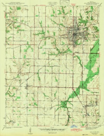
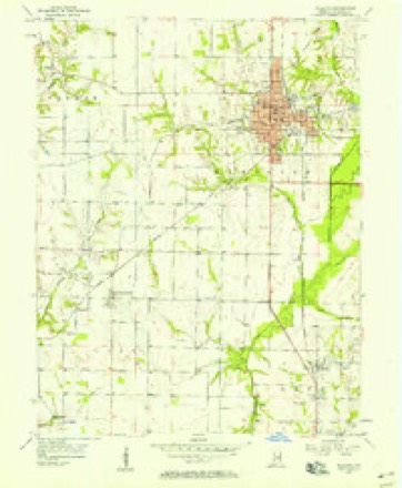
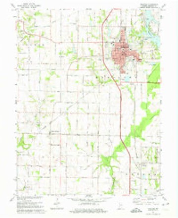
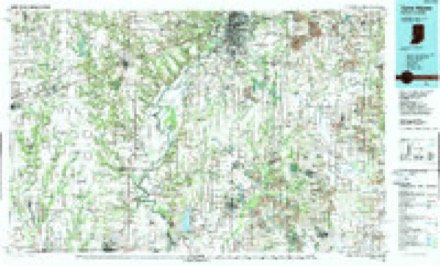
8 surveys from 15 printed sheetsMatched by testing this settlement's coordinate against the published boundary of every sheet in the United States Geological Survey's historical collection. Each opens the scanned sheet at the Survey.
- 1943 USGS Sullivan quadrangle1:24000, 2 printings
- 1953 USGS Indianapolis quadrangle1:250000, 4 printings
- 1956 USGS Indianapolis quadrangle1:250000
- 1956 USGS Sullivan quadrangle1:24000
- 1957 USGS Indianapolis quadrangle1:250000, 2 printings
- 1962 USGS Indianapolis quadrangle1:250000
- 1974 USGS Sullivan quadrangle1:24000, 2 printings
- 1986 USGS Terre Haute quadrangle1:100000, 2 printings




Storms near this place
54 since 1996Regional context, not property-specific evidence. The National Weather Service names Sullivan in 54 storm reports between 1996 and 2026: 32 thunderstorm wind, 11 flash flood, 10 hail, 1 tornado. No death or injury is recorded in these reports. Each account below is quoted exactly as the forecast office filed it, from the NOAA Storm Events Database, and each date opens the federal record of that event.
| When | Event | Place named | Harm | What the report says |
|---|---|---|---|---|
| June 2008 | Flash Flood | Sullivan | $30,000 | Numerous cars were helped out of high water on various low spots on the roadways due to heavy rainfall that caused flash flooding. |
| April 2011 | Tornado (EF0) | Sullivan | $20,500 | An EF0 tornado briefly occurred near 621 E. Silver Street in Sullivan, Indiana. Damage was done to a home at this location. There was damage to a roof, one bathroom window was blown out, and a trampoline was blown over. Roof debris was spread out over the owner's lawn, with some shingles blown into a nearby tree and one large piece of ply wood from the roof was blown over the neighbor's house, up into a tree approximately 40 feet high. |
| April 2020 | Thunderstorm Wind | Sullivan | $20,000 | Several large tree limbs and trees snapped due to thunderstorm wind gusts across the area with a concentrated area within the town of Sullivan. Numerous power outages reported as well. |
| April 2011 | Flash Flood | Sullivan | $20,000 | Numerous roads were reported to be flooded due to thunderstorm heavy rainfall. Some cars were also reported to be stranded. |
| July 2023 | Flash Flood | Sullivan | $15,000 | Several roads with deep standing water or water flowing through town. A car was stalled on one of the roads. |
| May 2018 | Thunderstorm Wind | Sullivan | $15,000 | There were numerous reports of several trees downed and power out across the city due to damaging thunderstorm wind gusts. |
| July 2016 | Thunderstorm Wind | Sullivan | $15,000 | A barn was destroyed in this location due to damaging thunderstorm wind gusts. |
| May 2008 | Flash Flood | Sullivan | $15,000 | Heavy rain caused numerous county roads in central Sullivan County to be flooded. Streets in the town of Sullivan were flooded in addition to cars being stranded in the flood waters. |
| March 2024 | Thunderstorm Wind | Sullivan | $10,000 | Numerous tree limbs of unknown size downed by thunderstorm wind gusts across town. |
| May 2002 | Thunderstorm Wind | Sullivan | $10,000 | Semi blown over along U.S. 41 |
| June 2009 | Thunderstorm Wind | Sullivan | $8,000 | The Sullivan Daily Times reported numerous trees and power lines down in the area due to thunderstorm wind gust. The Sullivan City Fire Department responded to a power line on fire near West Washington Street and County Road 200W. |
| April 2020 | Thunderstorm Wind | Sullivan | $5,000 | Spotter reported several large tree limbs snapped near his location due to thunderstorm wind gusts with live power lines on the road. |
| August 2019 | Thunderstorm Wind | Sullivan | $5,000 | Spotter reported 3 utility poles snapped at the ground and held up by the wires. Relayed via amateur radio and time estimated from radar. |
| May 2018 | Thunderstorm Wind | Sullivan | $5,000 | Trees were downed in City Park due to damaging thunderstorm wind gusts. This report was relayed via social media. |
| June 2008 | Flash Flood | Sullivan | $5,000 | Roadways were covered and previous flooding conditions were exacerbated due to heavy rainfall that caused renewed flash flooding. |
| February 2026 | Thunderstorm Wind | Sullivan | $4,000 | Thunderstorm wind gusts downed several large tree limbs across town. |
| September 2014 | Thunderstorm Wind | Sullivan | $2,000 | A tree was downed in Sullivan and another one was downed five miles south of Sullivan due to damaging thunderstorm wind gusts. |
| June 2008 | Thunderstorm Wind | Sullivan | $2,000 | Power lines were down due to damaging thunderstorm winds. |
| August 2007 | Thunderstorm Wind | Sullivan | $2,000 | A trained spotter reported tree limbs, power lines, and signs down due to damaging thunderstorm winds. |
| August 2006 | Thunderstorm Wind | Sullivan | $2,000 | Fallen tree limbs caused power outages in Sullivan. |
| June 2016 | Thunderstorm Wind | Sullivan | $1,500 | A tree and some limbs were downed in this location due to damaging thunderstorm wind gusts. |
| December 2013 | Flash Flood | Sullivan | $1,000 | Severe flooding was reported on secondary roads in low lying areas across the county. |
| April 2011 | Flash Flood | Sullivan | $1,000 | Several areas along State Highway 54 had water flowing over it due to thunderstorm heavy rainfall. |
| May 2025 | Hail | Sullivan | - | Numerous other hail reports ranging in size from 1-2 inches. |
| April 2024 | Thunderstorm Wind | Sullivan | - | A 60 mph thunderstorm wind gust was measured at this location. |
| April 2018 | Thunderstorm Wind | Sullivan | - | A thunderstorm wind gust of 60 mph or more was estimated in this location. |
| July 2010 | Thunderstorm Wind | Sullivan | - | A thunderstorm wind gust of 60 mph was estimated on Washington Street in Sullivan. |
| April 2007 | Thunderstorm Wind | Sullivan | - | Damaging thunderstorm winds caused a tree to fall. |
| April 2007 | Thunderstorm Wind | Sullivan | - | Thunderstorm winds caused a tree to fall in Sullivan County. |
| April 2007 | Thunderstorm Wind | Sullivan | - | Damaging thunderstorm winds caused a few trees to fall in Sullivan. |
| June 2006 | Thunderstorm Wind | Sullivan | - | Large tree limbs broken throughout town. |
| January 2005 | Flash Flood | Sullivan | - | A levee failed along the Wabash River. |
| November 2005 | Thunderstorm Wind | Sullivan | - | Trees were downed. |
| November 2005 | Thunderstorm Wind | Sullivan | - | Trees were downed. |
| July 2004 | Thunderstorm Wind | Sullivan | - | Trees were knocked down. |
| August 2004 | Flash Flood | Sullivan | - | High water was reported over several roads in Sullivan. |
| March 2025 | Hail | Sullivan | - | no account filed |
| May 2025 | Hail | Sullivan | - | no account filed |
| June 2023 | Hail | Sullivan | - | no account filed |
| June 2010 | Hail | Sullivan | - | no account filed |
| February 2006 | Hail | Sullivan | - | no account filed |
| April 2006 | Thunderstorm Wind | Sullivan | - | no account filed |
| May 2004 | Flash Flood | Sullivan | - | no account filed |
| May 2004 | Hail | Sullivan | - | no account filed |
| May 2004 | Hail | Sullivan | - | no account filed |
| July 2002 | Thunderstorm Wind | Sullivan | - | no account filed |
| April 2001 | Hail | Sullivan | - | no account filed |
| July 2001 | Flash Flood | Sullivan | - | no account filed |
| April 2000 | Hail | Sullivan | - | no account filed |
| May 2000 | Thunderstorm Wind | Sullivan | - | no account filed |
| September 2000 | Thunderstorm Wind | Sullivan | - | no account filed |
| June 1999 | Thunderstorm Wind | Sullivan | - | no account filed |
| March 1997 | Thunderstorm Wind | Sullivan | - | no account filed |
| July 1996 | Thunderstorm Wind | Sullivan | - | no account filed |
Nearest settlements
The eight closest, with where each one stands in the county. Distances are straight-line, computed from the Geographic Names Information System coordinates.
| Map | Place | Distance | Sheets |
|---|---|---|---|
| Benefiel Corner | 2.3 miles | 18 | |
| Glendora | 3.2 miles | 16 | |
| Campbell Corner | 3.3 miles | 18 | |
| Caledonia (historical) | 3.8 miles | 18 | |
| Massacre | 4.2 miles | 18 | |
| Farnsworth (historical) | 4.4 miles | 18 | |
| New Lebanon | 5.1 miles | 15 | |
| Paxton | 5.2 miles | 15 |
Elsewhere
Matched on this settlement's Geographic Names Information System number rather than its name, so it cannot be a different place of the same name in another state.
| Wikipedia article on Sullivan | An encyclopaedic summary. Its text is share-alike, so it is linked here rather than copied. |
| Wikidata item Q304478 | The structured record the population and elevation above come from. Public domain (CC0). |
Provenance
This settlement is recorded in the Geographic Names Information System as feature 444366. The sheet list is computed by point-in-boundary test against the United States Geological Survey's historical topographic inventory. Both are works of the United States government and carry no copyright under 17 U.S.C. 105.
Storms. NOAA National Centers for Environmental Information, Storm Events Database https://www.ncei.noaa.gov/stormevents/ A work of the United States government, no copyright under 17 U.S.C. 105. Narratives are quoted verbatim from the National Weather Service report and are not edited or summarised.