 Block
Westland, Indiana
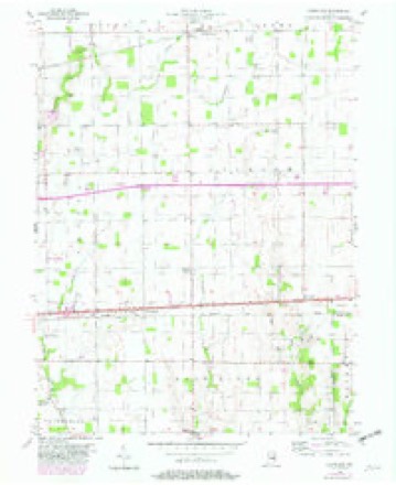
8 topographic sheets cover this place, the earliest surveyed in 1953 and the latest in 1986. It stands in Blue River Township. It lies in ZIP code area 46140. The Survey maps it on the Cleveland quadrangle.
Topographic sheets covering this place
4 surveys from 8 printed sheetsMatched by testing this settlement's coordinate against the published boundary of every sheet in the United States Geological Survey's historical collection. Each opens the scanned sheet at the Survey.
- 1953 USGS Cincinnati quadrangle1:250000, 3 printings
- 1956 USGS Cleveland quadrangle1:24000, 2 printings
- 1957 USGS Cincinnati quadrangle1:250000
- 1986 USGS New Castle quadrangle1:100000, 2 printings



In the county-history sources
9,032 words on this townshipHistory of Hancock County, Indiana; Its People, Industries and Institutions, published 1916 names this settlement in its chapter on Blue River Township. These are the passages that mention it, exactly as the scans read.
Westland was never laid out as a town and no plat thereof is recorded in the recorder's office. The first store was erected there about 1852 by Samuel Heavenridge. Like most other buildings of that day, it was just a small log house. Later owners were Levi Reece, Ambrose Miller, Henry Newby and Calvary G. Sample, who quit business at the outbreak of the Civil War. Later, another store was opened' by William New, who was followed by Lemuel Harold and Levi Cloud. James L. Binford then owned the store for a time. It burned on April 13, 1881, but in the eighties another buildingwas erected and the store was conducted for a number of years by M. A. Catt and John Howard. About three or four years ago it was bought by the present owner, Francis C. Landrus.
Passage source: History of Hancock County, Indiana; Its People, Industries and Institutions, published 1916.
In addition to the stores above mentioned, there have been blacksmith shops from time to time and it has formed a central meeting place for the people of the township. A postoffice was maintained for many years, until the rural routes were established from Greenfield. Route 3 from Greenfield, which distributes mail through Blue River township and in the vicinity of Westland, was established on October 1, 1900.
Passage source: History of Hancock County, Indiana; Its People, Industries and Institutions, published 1916.
The residents of Blue River township, and especially the Friends, have always been active and earnest temperance workers. Several Woman's Christian Temperance Unions were maintained in the county during the later seventies and eighties, and on May 26, 1877, the Blue River Township Temperance Association was organized at the Westland Friends church. Fortyfive persons signed the pledge and became charter members. The purpose of the association was "to plan and carry forward measures which, with the blessings of God, will result in the suppression of intemperance."
Passage source: History of Hancock County, Indiana; Its People, Industries and Institutions, published 1916.
Machine-read from a century-old scan, so expect the errors a machine makes: misspelled names, dropped words, stray characters.
Read the whole chapter on Blue River Township - it names this place 12 more 12 times.
Fires near this place
1 since 2005Regional context, not property-specific evidence. The federal wildfire occurrence database lists 1 fire within 5 miles of Westland in 2005, burning under an acre in total. None started naturally. None was recorded as arson. Distance is straight-line from the map coordinates, so a fire counted here may appear on a neighbouring settlement's page as well.
| Reported cause | Fires |
|---|---|
| Debris and open burning | 1 |
The most recent of them, most recent first, with the day each was reported and the service that recorded it.
| Date | Cause | Size | Reported by | Name on the report |
|---|---|---|---|---|
| 16 April 2005 | Debris and open burning | under an acre | Indiana State Fire Marshal's Office | not named |
Settlements close enough to share some of these fires:
Mines and quarries near this place
3 within 5 milesRegional context, not property-specific evidence. The federal mineral resources record lists 3 workings within 5 miles of Westland: 2 producers, 1 past producer. 2 still produce. What was taken out: Sand and Gravel, Construction. Distance is straight-line from the map coordinates, so a quarry counted here may appear on a neighbouring settlement's page as well.
| Where | Site | Commodity | Status | Recorded |
|---|---|---|---|---|
| Caldwell Pit and Mill | Sand and Gravel, Construction | Producer | ||
| Charlottesville Sand & Gravel Pit | Sand and Gravel, Construction | Producer | ||
| Frank Alexander Gravel Pit | Sand and Gravel, Construction | Past Producer |
Storms near this place
4 since 1998Regional context, not property-specific evidence. The National Weather Service names Westland in 4 storm reports between 1998 and 2022: 3 hail, 1 thunderstorm wind. No death or injury is recorded in these reports. Each account below is quoted exactly as the forecast office filed it, from the NOAA Storm Events Database, and each date opens the federal record of that event.
| When | Event | Place named | Harm | What the report says |
|---|---|---|---|---|
| June 2022 | Hail | Westland | - | Relayed via Social Media. |
| April 2005 | Thunderstorm Wind | Westland | - | Trees were blown down. |
| May 2006 | Hail | Westland | - | no account filed |
| July 1998 | Hail | Westland | - | no account filed |
Nearest settlements
The eight closest, with where each one stands in the county. Distances are straight-line, computed from the Geographic Names Information System coordinates.
| Map | Place | Distance | Sheets |
|---|---|---|---|
| Stringtown | 2.8 miles | 8 | |
| Riley | 3.4 miles | 8 | |
| Cleveland | 3.6 miles | 8 | |
| Bowman Acres | 4.3 miles | 12 | |
| Charlottesville | 4.8 miles | 9 | |
| Greenfield | 4.9 miles | 12 | |
| Reedville Station | 7.6 miles | 9 | |
| Carrollton | 7.7 miles | 9 |
Provenance
This settlement is recorded in the Geographic Names Information System as feature 447628. The sheet list is computed by point-in-boundary test against the United States Geological Survey's historical topographic inventory. Both are works of the United States government and carry no copyright under 17 U.S.C. 105.
Wildfire. Short, Karen C. 2022. Spatial wildfire occurrence data for the United States, 1992-2020 [FPA_FOD_20221014]. 6th Edition. Fort Collins, CO: Forest Service Research Data Archive. https://doi.org/10.2737/RDS-2013-0009.6 Collected with United States Government funding and usable without additional permissions or fees.
Mines and quarries. USGS Mineral Resources Data System (MRDS) https://mrdata.usgs.gov/mrds/ A work of the United States government, no copyright under 17 U.S.C. 105.
Storms. NOAA National Centers for Environmental Information, Storm Events Database https://www.ncei.noaa.gov/stormevents/ A work of the United States government, no copyright under 17 U.S.C. 105. Narratives are quoted verbatim from the National Weather Service report and are not edited or summarised.