 Block
Carrollton, Indiana
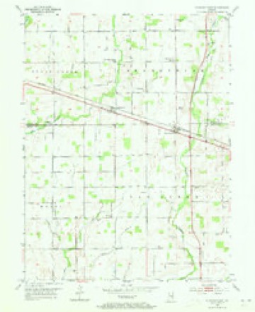
9 topographic sheets cover this place, the earliest surveyed in 1952 and the latest in 1986. It stands in Brandywine Township. It lies in ZIP code area 46130. It stands on Maxwell Ditch. The Survey maps it on the Fountaintown quadrangle. It stands 837 feet above sea level.
Topographic sheets covering this place
4 surveys from 9 printed sheetsMatched by testing this settlement's coordinate against the published boundary of every sheet in the United States Geological Survey's historical collection. Each opens the scanned sheet at the Survey.
- 1952 USGS Fountaintown quadrangle1:24000, 3 printings
- 1953 USGS Cincinnati quadrangle1:250000, 3 printings
- 1957 USGS Cincinnati quadrangle1:250000
- 1986 USGS New Castle quadrangle1:100000, 2 printings



In the county-history sources
4,928 words on this townshipHistory of Hancock County, Indiana; Its People, Industries and Institutions, published 1916 names this settlement in its chapter on Brandywine Township. These are the passages that mention it, exactly as the scans read.
Hiram and John Comstock built a steam saw-mill at Carrollton in 1856; it burned down during the latter seventies, but was rebuilt by William Gordon. Goldon sold the mill to James Boyce, who operated it until about 1894. The machinery was then taken out of the mill, but a year or two later Frank Engle installed other .machinery and operated the mill until about 1902, when it burned.
Passage source: History of Hancock County, Indiana; Its People, Industries and Institutions, published 1916.
Duncan McDougall and his brother, Dugald, had a tile factory for a number of years about one-half mile below Carrollton. It was established in 1869, and was operated until 1886. The factory itself was located on the Shelby county side of the road.
Passage source: History of Hancock County, Indiana; Its People, Industries and Institutions, published 1916.
Little log school houses were built in the township by the different communities just as they were built in other townships. Frame buildings were constructed during the latter sixties and early seventies, nearly all of which are still standing and in use. At Carrollton a small one-room frame building stood on the west side of the street just west of the present school house. It faced the east. Religious services were also conducted in this building for a number of years before any churches were built at Carrollton. About 1875 a two-story frame building was erected on the east side of the street, which stood between the present brick school and the street. It was a two-room frame building and faced the west. This building was used until the present two-room brick building was erected about 1892, during the trusteeship of Andrew Williamson. John S. Orr was the builder.
Passage source: History of Hancock County, Indiana; Its People, Industries and Institutions, published 1916.
Machine-read from a century-old scan, so expect the errors a machine makes: misspelled names, dropped words, stray characters.
Read the whole chapter on Brandywine Township - it names this place 9 more 9 times.
Nearest settlements
The eight closest, with where each one stands in the county. Distances are straight-line, computed from the Geographic Names Information System coordinates.
| Map | Place | Distance | Sheets |
|---|---|---|---|
| Reedville Station | 0.1 miles | 9 | |
| New Palestine | 3.8 miles | 11 | |
| Carriage Estates | 4.5 miles | 11 | |
| Brookville Heights | 4.7 miles | 11 | |
| Bowman Acres | 4.8 miles | 12 | |
| Spring Lake | 5.2 miles | 12 | |
| Philadelphia | 5.4 miles | 12 | |
| Greenfield | 6.1 miles | 12 |
Elsewhere
Matched on this settlement's Geographic Names Information System number rather than its name, so it cannot be a different place of the same name in another state.
| Wikipedia article on Carrollton | An encyclopaedic summary. Its text is share-alike, so it is linked here rather than copied. |
| Wikidata item Q5046644 | The structured record the population and elevation above come from. Public domain (CC0). |
Provenance
This settlement is recorded in the Geographic Names Information System as feature 434493. The sheet list is computed by point-in-boundary test against the United States Geological Survey's historical topographic inventory. Both are works of the United States government and carry no copyright under 17 U.S.C. 105.