 Block
Westport, Indiana
11 topographic sheets cover this place, the earliest surveyed in 1942 and the latest in 1986. It stands in Sandcreek Township. It lies in ZIP code area 47283. The Survey maps it on the Westport quadrangle. 1,393 people lived here at the 2020 count. It stands 814 feet above sea level.
On record in Westport
Buildings and businesses the archive holds for this place. Each opens its own page, with the source record it came from.
On the National Register 1 record
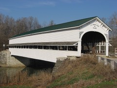 Westport Covered Bridgelisted 1982
Population over time
2 figuresWestport grew from 1,379 to 1,393 between 2010 and 2020. These are the recorded population figures Wikidata holds for this place, reached through the Geographic Names Information System number this page is keyed on rather than by name, so they belong to this place and not to another of the same name. Most are census counts, but not all are: an early figure may be a founding or settlement estimate, and an estimate published within five years of a census is left out. The change column is computed, and is left blank where more than 20 years separate a figure from the one before it, because a gap that long is not a change between two counts.
| Year | People | Change |
|---|---|---|
| 2010 | 1,379 | |
| 2020 | 1,393 | +14 (+1%) |
Topographic sheets covering this place
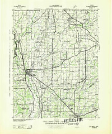
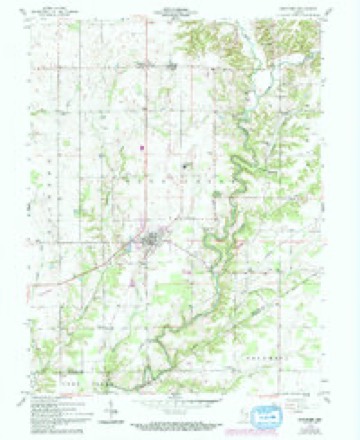
5 surveys from 11 printed sheetsMatched by testing this settlement's coordinate against the published boundary of every sheet in the United States Geological Survey's historical collection. Each opens the scanned sheet at the Survey.
- 1942 USGS Columbus quadrangle1:125000
- 1953 USGS Cincinnati quadrangle1:250000, 3 printings
- 1957 USGS Cincinnati quadrangle1:250000
- 1958 USGS Westport quadrangle1:24000, 4 printings
- 1986 USGS Greensburg quadrangle1:100000, 2 printings



In the county-history sources
2,767 words on this townshipHistory of Decatur County, Indiana : Its People, Industries and Institutions, published 1915 names this settlement in its chapter on Sandcreek Township. These are the passages that mention it, exactly as the scans read.
Samuel Stevens built a brick house in 1834 and about the same time Simeon Sharp opened a tavern where Westport now stands. Elijah Davis and John Robbins both started water-mills and some time after William Robbins built a horse-mill, so that the early settlers were not altogether dependent upon the waters of Sand creek and Millstone creek for their bread. The first church in the township was organized by Samuel Strickland, of the denomination then styled "Campbellites."
Passage source: History of Decatur County, Indiana : Its People, Industries and Institutions, published 1915.
Westport is noted for its excellent stone cpiarries in close pro.ximity to the town. .The product of these quarries is a high-grade building stone, which will bear favorable comparison with that of any other section of the state. It is also used quite extensively for curb and gutter, and many car loads of crushed stone are shipped from the quarries annually. At present it is under the management of a Cincinnati corporation and bears the name of the Westport Stone Company. John Ballman, of Cincinnati, is the present superintendent and he is ablv assisted bv J. L. Tackson, of Westport. (10)
Passage source: History of Decatur County, Indiana : Its People, Industries and Institutions, published 1915.
The output varies from three to five carloads per day and in times of rush orders for crushed stone as much as sixty to seventy carloads extra are put out per month. This has been one of the greatest factors in making Westport among the most progressive business towns of the county.
Passage source: History of Decatur County, Indiana : Its People, Industries and Institutions, published 1915.
Machine-read from a century-old scan, so expect the errors a machine makes: misspelled names, dropped words, stray characters.
Read the whole chapter on Sandcreek Township - it names this place 5 more 5 times.
Storms near this place
24 since 1993Regional context, not property-specific evidence. The National Weather Service names Westport in 24 storm reports between 1993 and 2025: 20 thunderstorm wind, 2 flood, 1 tornado, 1 heavy rain. No death or injury is recorded in these reports. Each account below is quoted exactly as the forecast office filed it, from the NOAA Storm Events Database, and each date opens the federal record of that event.
| When | Event | Place named | Harm | What the report says |
|---|---|---|---|---|
| June 2023 | Thunderstorm Wind | Westport | $50,000 | Half mile wide swath of trees downed by thunderstorm wind gusts. Estimated 200-250 total trees. |
| April 1996 | Thunderstorm Wind | Westport | $50,000 | no account filed |
| June 2010 | Thunderstorm Wind | Westport | $36,000 | Power lines and trees were reported down in Westport due to damaging thunderstorm wind gusts. The town was without power and some of the downed trees damaged a few homes. This report came in via WebEOC. |
| July 2001 | Thunderstorm Wind | Westport | $20,000 | no account filed |
| October 2001 | Thunderstorm Wind | Westport | $20,000 | no account filed |
| March 2025 | Thunderstorm Wind | Westport | $15,000 | Many trees of unknown size and power lines downed by thunderstorm wind gusts across the immediate area. |
| April 2020 | Thunderstorm Wind | Westport | $15,000 | House with half of the roof torn off as well as barn damage nearby due to thunderstorm wind gusts. |
| August 2006 | Thunderstorm Wind | Westport | $10,000 | Several trees and power lines were downed, and structural damage occurred. |
| May 2014 | Thunderstorm Wind | Westport | $7,000 | Trees were downed in this location due to damaging thunderstorm wind gusts. |
| November 2013 | Thunderstorm Wind | Westport | $6,000 | Multiple trees were reported down in this location due to damaging thunderstorm wind gusts. |
| June 2018 | Flood | Westport | $5,000 | Iron Mine Road or County Road 600 West was closed between County Roads 950 South and 1100 South due to flood damage from heavy rainfall. |
| July 2008 | Thunderstorm Wind | Westport | $5,000 | Trees, tree limbs, and utility lines were blown down by thunderstorm winds. |
| March 2020 | Thunderstorm Wind | Westport | $2,000 | A tree was downed by thunderstorm wind gusts and was blocking State Road 3. Heavy rains in the hours preceding the wind allowed the tree to be uprooted rather easily. |
| May 2013 | Thunderstorm Wind | Westport | $2,000 | A couple trees were downed in southwest Decatur County due to damaging thunderstorm wind gusts. |
| June 2010 | Thunderstorm Wind | Westport | $1,500 | An eight inch diameter tree limb from a live, maple tree was reported down on a house due to damaging thunderstorm wind gusts. No additional information about damage to the house was received. |
| August 2009 | Flood | Westport | $500 | The Decatur County EMA reported water over roadways located across the central and southern portion of the county. Rainfall rates of over two inches per hour were also observed. |
| June 2010 | Heavy Rain | Westport | - | Rainfall of 1.5 inches was measured in Westport. |
| April 2006 | Thunderstorm Wind | Westport | - | A large tree was downed. |
| May 2005 | Thunderstorm Wind | Westport | - | Trees and power lines were blown down. One tree, which was 93 feet tall and over 100 years old, came within inches of crushing a home when it was uprooted by the storm. |
| May 2005 | Thunderstorm Wind | Westport | - | Several 14-inch diameter trees were uprooted by thunderstorm winds. |
| July 2005 | Thunderstorm Wind | Westport | - | Trees and power lines were downed. |
| March 1997 | Thunderstorm Wind | Westport | - | no account filed |
| April 1996 | Tornado (F0) | Westport | - | no account filed |
| August 1993 | Thunderstorm Wind | Westport | - | no account filed |
Nearest settlements
The eight closest, with where each one stands in the county. Distances are straight-line, computed from the Geographic Names Information System coordinates.
| Map | Place | Distance | Sheets |
|---|---|---|---|
| Mapleton Corner | 1.8 miles | 11 | |
| Neff Corner | 2.3 miles | 11 | |
| Harper | 2.3 miles | 11 | |
| Sardinia | 3.4 miles | 11 | |
| Letts Corner | 4.1 miles | 11 | |
| Letts | 4.1 miles | 11 | |
| Pinhook | 4.2 miles | 11 | |
| Gaynorsville | 5.4 miles | 11 |
Elsewhere
Matched on this settlement's Geographic Names Information System number rather than its name, so it cannot be a different place of the same name in another state.
| Wikipedia article on Westport | An encyclopaedic summary. Its text is share-alike, so it is linked here rather than copied. |
| Wikidata item Q2318270 | The structured record the population and elevation above come from. Public domain (CC0). |
Provenance
This settlement is recorded in the Geographic Names Information System as feature 445857. The sheet list is computed by point-in-boundary test against the United States Geological Survey's historical topographic inventory. Both are works of the United States government and carry no copyright under 17 U.S.C. 105.
Storms. NOAA National Centers for Environmental Information, Storm Events Database https://www.ncei.noaa.gov/stormevents/ A work of the United States government, no copyright under 17 U.S.C. 105. Narratives are quoted verbatim from the National Weather Service report and are not edited or summarised.