BlockBefore
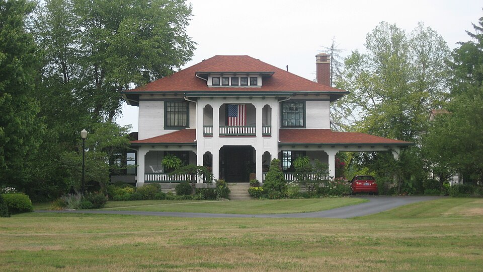
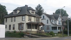
Photograph of Annadale
Photograph by Nyttend, Public domain. Via Wikimedia Commons.

Annadale

Listed on the National Register of Historic Places in 2007.

From the record

“Annadale is a historic home located at North Vernon, Indiana. It was built about 1910, and is a two-story, Bungalow / American Craftsman style frame dwelling.”

Wikipedia article Annadale (North Vernon, Indiana), CC BY-SA 4.0.

One of 10 National Register listings published here for Jennings County · listed in 2007 · category: Building.

Sources: the Wikipedia article · the case file at the National Archives · the National Register database, National Park Service · the Wikipedia article
The listing

  • What is counted as historic. The nomination lists 3 buildingss as contributing to the listing.
  • Address. 502 Jennings St., North Vernon, 47265
  • When was it listed? January 2007
  • Category. building
  • Township. Center township
  • National Register reference number. 06001292 - the number the National Park Service assigned this property when it was listed, and the key its nomination file is catalogued under at the National Archives.

Mines and quarries near this property

3 within 5 miles

Regional context, not property-specific evidence. The federal mineral resources record lists 3 workings within 5 miles of Annadale: 2 occurrences, 1 producer. 1 still produces. What was taken out: Fluorine-Fluorite, Stone, Crushed/Broken. Distance is straight-line from the map coordinates, so a quarry counted here may appear on a neighbouring settlement's page as well.

Where SiteCommodity StatusRecorded
North Vernon PlantStone, Crushed/BrokenProducer
Fluorite Occurrence Number 1Fluorine-FluoriteOccurrence

Every working recorded in Jennings County

Storms near this property

47 since 1996

Regional context, not property-specific evidence. The National Weather Service names North Vernon, the town this property stands in, in 47 storm reports between 1996 and 2025: 29 thunderstorm wind, 13 hail, 2 flash flood, 2 tornado. No death or injury is recorded in these reports. Each account below is quoted exactly as the forecast office filed it, from the NOAA Storm Events Database, and each date opens the federal record of that event.

WhenEvent Place namedHarm What the report says
May 2007Tornado (EF0)North Vernon$100,000An EF0 tornado touched down near county roads 535 W and 300 S, seven miles to the southwest of North Vernon. At this location there was significant structural damage to a barn and a metal bridge over a creek thrown several hundred feet. A portion of a roof of a house was torn off, a number of outbuildings were damaged, and the end of a tool shed was damaged. In addition to this damage, trees also blew down during the storm.
June 2005Tornado (F1)North Vernon$100,000The remnants of Tropical Storm Arlene spawned an F1 tornado southwest of Hayden, Indiana. The tornado touched down at County Roads 500 South and 750 West and lifted at County Road 900 West and US Highway 50. Several outbuildings were damaged, and several grain bins were overturned. Numerous trees were also downed by the tornado. The tornado was on the ground for 11 minutes, with a path length of 5.3 miles and a width of 75 yards. No one was injured by the tornado. Damage amounts are estimated.
May 2002Flash FloodNorth Vernon$50,000Parts of SR 7 and U.S. 50 flooded
May 2022Thunderstorm WindNorth Vernon$30,000Thunderstorm winds downed numerous trees and utility lines on northeast side of North Vernon. Trees fell mainly to the north and northeast.
April 2020Thunderstorm WindNorth Vernon$10,000Extensive tree damage reported via Facebook due to thunderstorm wind gusts across North Vernon.
May 2018Thunderstorm WindNorth Vernon$10,000Utility lines, trees, and tree limbs were downed in this location due to damaging thunderstorm wind gusts.
June 2010Thunderstorm WindNorth Vernon$10,000Trees and power lines were reported down across Jennings County. A few observations of pea sized hail were reported as well.
June 2008Thunderstorm WindNorth Vernon$10,000Trees were down and there was structural damage to a restaurant due to damaging thunderstorm winds.
November 2014Thunderstorm WindNorth Vernon$5,000Trees were reported down in this location due to damaging thunderstorm wind gusts.
April 2011Thunderstorm WindNorth Vernon$3,000A tree fell on a house in North Vernon due to damaging thunderstorm wind gusts.
April 2025Thunderstorm WindNorth Vernon$2,000Power lines downed by falling tree limbs due to damaging winds.
June 2008Thunderstorm WindNorth Vernon$2,000Four to five foot diameter trees and power lines were blown down due to damaging thunderstorm winds.
June 2008Thunderstorm WindNorth Vernon$2,000Trees and power lines were knocked down at this and numerous other locations across the county due to damaging thunderstorm winds.
May 1996Thunderstorm WindNorth Vernon$1,000no account filed
July 2015FloodNorth Vernon$500Highway 50 is flooded due to moderate to heavy rainfall, but traffic is able to get through.
October 2013Thunderstorm WindNorth Vernon$500Small tree limbs were downed on personal property due to estimated 60 mph thunderstorm wind gusts.
July 2012Thunderstorm WindNorth Vernon$500An estimated thunderstorm wind gust of 60 mph was observed in this location. A 50 foot dead tree was blown down.
June 2022HailNorth Vernon-Thunderstorm continued to produce golf-ball sized hail in North Vernon.
July 2008Thunderstorm WindNorth Vernon-Trees were blown down by thunderstorm winds. One tree had a diameter of 12 inches.
July 2008Thunderstorm WindNorth Vernon-A tree was blown down by thunderstorm winds onto State Highway 3 north of North Vernon. Other trees were found down countrywide.
July 2008Thunderstorm WindNorth Vernon-A tree was blown down by thunderstorm winds onto State Highway 50 east of North Vernon. Other trees were found down countrywide.
July 2008Thunderstorm WindNorth Vernon-Trees were blown down by thunderstorm winds. One tree had a diameter of 12 inches.
June 2008Thunderstorm WindNorth Vernon-Trees were reported down in the county due to damaging thunderstorm winds.
May 2005Thunderstorm WindNorth Vernon-Several trees were blown down.
June 2005Thunderstorm WindNorth Vernon-Trees, a home, and some vehicles were damaged by thunderstorm winds near North Vernon.
July 2005Thunderstorm WindNorth Vernon-Trees and power lines were downed.
May 2003Thunderstorm WindNorth Vernon-Trees/Limbs down
July 2003Thunderstorm WindNorth Vernon-Trees down
September 2002Thunderstorm WindNorth Vernon-Trees down
May 2025HailNorth Vernon-no account filed
July 2023HailNorth Vernon-no account filed
July 2021HailNorth Vernon-no account filed
July 2012HailNorth Vernon-no account filed
June 2006HailNorth Vernon-no account filed
April 2005HailNorth Vernon-no account filed
July 2004HailNorth Vernon-no account filed
April 2003Thunderstorm WindNorth Vernon-no account filed
July 2003Flash FloodNorth Vernon-no account filed
July 2003Thunderstorm WindNorth Vernon-no account filed
October 2001Thunderstorm WindNorth Vernon-no account filed
April 2000Thunderstorm WindNorth Vernon-no account filed
March 1997Thunderstorm WindNorth Vernon-no account filed
June 1996HailNorth Vernon-no account filed

Every storm recorded in Jennings County

Map coverage status

No historic map-sheet match is published for this property yet. That does not mean no map exists. This record needs a coordinate-quality review before it can be joined to a sheet boundary. Browse the county's mapped places while that work is pending.

Listed places nearby

5 within 8 miles

Other National Register properties close enough to walk or drive between, ordered by distance from this one. Both positions come from the same geocoding pass that matched these properties to their map sheets.

Photograph PropertyDistance Listed
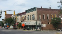
North Vernon Downtown Historic District0.1 miles2006
Walnut Street Historic District0.6 miles2006
State Street Historic District0.7 miles2007
Vernon Historic District2.0 miles1976
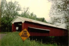
Scipio Covered Bridge7.4 miles2022

Sources for this property

National Archives recordThe nomination case file for reference 06001292 in Record Group 79.
Wikipedia articleCommunity-written account of this property, licensed CC BY-SA.
Jennings CountyAll 10 listed properties in this county.

Provenance

  • Listing record. National Park Service National Register of Historic Places, listed-properties dataset, current to 2026-05-22.
  • Map join. Address geocoded through the United States Census geocoder, then tested against the published boundary of every sheet in the USGS Historical Topographic Map Collection.
  • How this page is made. Listing fields come from federal records; map-sheet coverage is a labelled coordinate-to-boundary calculation, not a source-field claim.
  • Mines and quarries. USGS Mineral Resources Data System (MRDS) https://mrdata.usgs.gov/mrds/ A work of the United States government, no copyright under 17 U.S.C. 105.
  • Storms. NOAA National Centers for Environmental Information, Storm Events Database https://www.ncei.noaa.gov/stormevents/ A work of the United States government, no copyright under 17 U.S.C. 105. Narratives are quoted verbatim from the National Weather Service report and are not edited or summarised.