 Block
From the record
One of 81 National Register listings published here for Allen County · listed in 2019 · category: Building.
Sources: the National Register database, National Park Service
Listed on the National Register of Historic Places in 2019.
One of 81 National Register listings published here for Allen County · listed in 2019 · category: Building.
Sources: the National Register database, National Park Service
The chapter on Marion Township in History of Allen County, Indiana., published 1880 names Fort Wayne. This is what it says, exactly as the scans read.
In 1825, a Mr. Douglas rented the farm owned by Hugh Barnett, of Fort Wayne, remaining upon it about one year. At the end of that time the farm was taken and occupied by Elisha Harris, a young man who had been reared by Mr. Barnett. He was a shrewd young man, and was familiarly known as " Yankee Harris." Several years later, he purchased a farm near by, but only resided upon it for a short time. He died at Fort. Wayne.
Passage source: History of Allen County, Indiana., published 1880.
The First Death. - In the winter of 1827, William McConnaughey, who had been in the employ of parties in Fort Wayne, started on foot for his home in Ohio. Ho had reached a point on the Piqua road, in Marion Township, when ho was overcome by fatigue, or the contents of the flask which was subse¬ quently found in his pocket. On the day following his departure from Fort Wayne, some Indians came to town with the intelligence that a man had been frozen to death during the preceding night. A crowd repaired to the spot, and found the body of McConnaughey stiff' in death. A grave was made on the farm now owned by John Small, and his remains deposited therein.
Passage source: History of Allen County, Indiana., published 1880.
Machine-read from a century-old scan, so expect the errors a machine makes: misspelled names, dropped words, stray characters.
Read the whole chapter on Marion Township - 6,434 words on its settlement, mills, schools and churches.
Regional context, not property-specific evidence. The federal wildfire occurrence database lists 1 fire within 5 miles of Colman-Doctor Farm in 2006, burning about 50 acres in total. None started naturally. None was recorded as arson. Distance is straight-line from the map coordinates, so a fire counted here may appear on a neighbouring settlement's page as well.
| Reported cause | Fires |
|---|---|
| Missing data/not specified/undetermined | 1 |
The most recent of them, most recent first, with the day each was reported and the service that recorded it.
| Date | Cause | Size | Reported by | Name on the report |
|---|---|---|---|---|
| 10 April 2006 | Missing data/not specified/undetermined | 50 acres | Indiana State Fire Marshal's Office | not named |
Regional context, not property-specific evidence. The federal mineral resources record lists 1 working within 5 miles of Colman-Doctor Farm: 1 producer. All of them still produce. What was taken out: Sand and Gravel, Construction, Stone, Crushed/Broken. Distance is straight-line from the map coordinates, so a quarry counted here may appear on a neighbouring settlement's page as well.
| Where | Site | Commodity | Status | Recorded |
|---|---|---|---|---|
| Stone Street Quarry | Sand and Gravel, Construction, Stone, Crushed/Broken | Producer |
Regional context, not property-specific evidence. The National Weather Service names Fort Wayne, the town this property stands in, in 5 storm reports between 1994 and 1997: 2 thunderstorm wind, 2 flash flood, 1 hail. No death or injury is recorded in these reports. Each account below is quoted exactly as the forecast office filed it, from the NOAA Storm Events Database, and each date opens the federal record of that event.
| When | Event | Place named | Harm | What the report says |
|---|---|---|---|---|
| June 1995 | Thunderstorm Wind | Fort Wayne | $8,000 | Several automobiles were damaged by trees blown over in Fort Wayne. |
| July 1994 | Thunderstorm Wind | Fort Wayne | $5,000 | Trees and power lines were downed on the north and east sides of Fort Wayne. |
| September 1997 | Flash Flood | Fort Wayne | $1,000 | no account filed |
| April 1994 | Hail | Fort Wayne | $500 | One-inch diameter hail fell on the north side of Fort Wayne at Point Inverness at 2044EST; also one inch hail near United States 33 and Cook Road on the north side of Fort Wayne at 2050 EST. |
| July 1997 | Flash Flood | Fort Wayne | - | no account filed |
No historic map-sheet match is published for this property yet. That does not mean no map exists. This record needs a coordinate-quality review before it can be joined to a sheet boundary. Browse the county's mapped places while that work is pending.
Other National Register properties close enough to walk or drive between, ordered by distance from this one. Both positions come from the same geocoding pass that matched these properties to their map sheets.
| Photograph | Property | Distance | Listed |
|---|---|---|---|
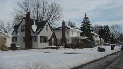 | Lafayette Place Historic District | 4.7 miles | 2013 |
| Coca-Cola Bottling Plant | 4.9 miles | 2021 | |
| Harrison Hill Historic District | 5.1 miles | 2021 | |
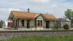 | Wabash Railroad Depot | 5.2 miles | 2003 |
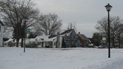 | Southwood Park Historic District | 5.5 miles | 2009 |
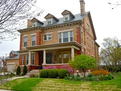 | St. Peter's Square | 5.6 miles | 1991 |
| National Archives record | The nomination case file for reference 100003499 in Record Group 79. |
| Allen County | All 81 listed properties in this county. |