 Block
From the record
One of 33 National Register listings published here for Putnam County · listed in 2019 · category: District.
Sources: the National Register database, National Park Service
Listed on the National Register of Historic Places in 2019.
One of 33 National Register listings published here for Putnam County · listed in 2019 · category: District.
Sources: the National Register database, National Park Service
The chapter on Monroe Township in Biographical and Historical Record of Putnam County, Indiana .., published 1887 names Bainbridge. This is what it says, exactly as the scans read.
This township was one of/ the first settled, and is one of the best in the county. It is Congressional township 15, range 4, and is bounded on the north by Franklin, on the east by Floyd, on the south by Greencastle, . and on the west by Clinton townships. The surface is mostly level in the north part, but more rolling in the south. The soil is a rich black loam, superimposed upon a yellow clay subsoil. Like the rest of the county, Monroe was originally covered with a splendid growth of valuable timber, most of which has been cut and sold. The streams of the township consist of a few branches of Big and Little Walnnt, the latter just cutting the southeast corner on section 38. ' The township is well improved. It has two gravel roads, one running north from Greeueastle, the other west from Bainbridge. Along these roads lies some of the finest country in Putnam Count)'; and the farms are well improved, presenting the evidence of care and skill on the part of their owner*.
Passage source: Biographical and Historical Record of Putnam County, Indiana .., published 1887.
The marriage of George Jackson and Susannah Tomlinson was the first in the township. The first blacksmith was John Jackson, who built a shop on section 32. Thomas Heady Was the first justice of the peace. Then came Reuben Slavens and Alexander Tolin as his successors in office. The first who died in the township was a man named Lane. He was buried on the farm of George W. Hewlett. The Brick Chapel graveyard is one of the oldest in the township, and has a beautiful 'location. The first school was taught by George Pearcy on section 1, north of Bainbridge. About the year 1826 Addison 'Lane taught a school near the site of Brick Chapel, which was the first in that neighborhood. He was followed by Joseph Farley, Hiram B. Slavens and John Slavens. The Christians held the first meetings in the township at the house of George W. Hewlett in 18^3. Gilbert llaniey preached and conducted the services. This house was used as a place of worship for several years by different denominations. Rev. Benjamin Jones, a Methodist minister, held services also at the house of Mr. Hewlett, shortly after the Christian meetings at the same place, and here the Methodist church was organized by Daniel Anderson and Benjamin C. Stevenson. This must have taken place in the conference year 1820-'27, as Anderson and Stevenson were then pastors of the Eel River Circuit. Meetings were also held in a log schoolhouse that stood where Brick Chapel now stands. The first church-building was erected by the Methodists on the present site of the Montgomery Chapel. It was a small brick
Passage source: Biographical and Historical Record of Putnam County, Indiana .., published 1887.
Machine-read from a century-old scan, so expect the errors a machine makes: misspelled names, dropped words, stray characters.
Read the whole chapter on Monroe Township - 741 words on its settlement, mills, schools and churches.
Regional context, not property-specific evidence. The federal mineral resources record lists 2 workings within 5 miles of Bainbridge Historic District: 1 past producer, 1 producer. 1 still produces. What was taken out: Sand and Gravel, Construction, Stone, Crushed/Broken. Distance is straight-line from the map coordinates, so a quarry counted here may appear on a neighbouring settlement's page as well.
| Where | Site | Commodity | Status | Recorded |
|---|---|---|---|---|
| Bainbridge Sand and Gravel Pit | Sand and Gravel, Construction | Past Producer | ||
| Harris Stone Service Inc | Stone, Crushed/Broken | Producer |
Regional context, not property-specific evidence. The National Weather Service names Bainbridge, the town this property stands in, in 25 storm reports between 1996 and 2024: 14 thunderstorm wind, 9 hail, 1 tornado, 1 flash flood. No death or injury is recorded in these reports. Each account below is quoted exactly as the forecast office filed it, from the NOAA Storm Events Database, and each date opens the federal record of that event.
| When | Event | Place named | Harm | What the report says |
|---|---|---|---|---|
| July 2003 | Tornado (F1) | Bainbridge | $100,000 | An F1 tornado near Bainbridge destroyed 3 metal barns and did minor to moderate damage to 2 homes. |
| February 2008 | Thunderstorm Wind | Bainbridge | $50,000 | The Bainbridge Fire Department building was damaged due to damaging thunderstorm winds. The downburst winds lifted the overhang of the roof's west end and completely separated the roof from the walls. Tangled aluminum roof material was tossed northeast and insulation was splattered on the home just east of the firehouse. The department's radio antenna was also destroyed. Just south of the firehouse, across county road 700 North, a barn was destroyed by the high wind. |
| May 2000 | Thunderstorm Wind | Bainbridge | $50,000 | no account filed |
| June 2019 | Thunderstorm Wind | Bainbridge | $4,000 | A snapped tree, broken branch or branches, and a slightly damaged fence occurred near this location due to damaging thunderstorm wind gusts. |
| December 2021 | Thunderstorm Wind | Bainbridge | $3,000 | Several reports of downed trees and power lines by thunderstorm wind gusts across northeastern Putnam County. |
| June 2008 | Flash Flood | Bainbridge | $2,000 | Ponding of rain water covered US 36. Major flooding was in progress on Plum Creek. |
| April 2024 | Hail | Bainbridge | - | Thunderstorm produced marginally severe hail south of Bainbridge, before hail as large as pennies was reported towards Heritage Lake. |
| July 2014 | Hail | Bainbridge | - | One inch sized hail reported from the intersection of County Road 500 North and 150 East. |
| June 2008 | Thunderstorm Wind | Bainbridge | - | Damaging thunderstorm winds knocked down trees across the northern sections of the county. |
| July 2007 | Thunderstorm Wind | Bainbridge | - | Trees were reported down due to thunderstorm wind damage. |
| June 2006 | Thunderstorm Wind | Bainbridge | - | Trees were downed. |
| June 2005 | Thunderstorm Wind | Bainbridge | - | Trees were blown down. |
| July 2005 | Thunderstorm Wind | Bainbridge | - | Trees were blown down. |
| May 2014 | Hail | Bainbridge | - | no account filed |
| March 2012 | Hail | Bainbridge | - | no account filed |
| June 2009 | Hail | Bainbridge | - | no account filed |
| May 2005 | Hail | Bainbridge | - | no account filed |
| May 2005 | Hail | Bainbridge | - | no account filed |
| November 2005 | Thunderstorm Wind | Bainbridge | - | no account filed |
| May 2003 | Hail | Bainbridge | - | no account filed |
| May 2003 | Thunderstorm Wind | Bainbridge | - | no account filed |
| May 2003 | Thunderstorm Wind | Bainbridge | - | no account filed |
| April 2000 | Thunderstorm Wind | Bainbridge | - | no account filed |
| November 1998 | Thunderstorm Wind | Bainbridge | - | no account filed |
| April 1996 | Hail | Bainbridge | - | no account filed |
No historic map-sheet match is published for this property yet. That does not mean no map exists. This record needs a coordinate-quality review before it can be joined to a sheet boundary. Browse the county's mapped places while that work is pending.
Other National Register properties close enough to walk or drive between, ordered by distance from this one. Both positions come from the same geocoding pass that matched these properties to their map sheets.
| Photograph | Property | Distance | Listed |
|---|---|---|---|
| Rolling Stone Covered Bridge | 1.6 miles | 2024 | |
| Pine Bluff Covered Bridge | 2.8 miles | 2024 | |
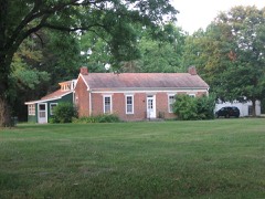 | Samuel Brown House | 3.8 miles | 2006 |
 | James Edington Montgomery O'Hair House | 4.0 miles | 1992 |
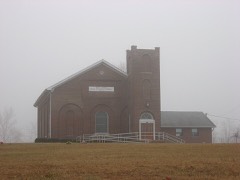 | Brick Chapel United Methodist Church | 4.8 miles | 2003 |
| Roachdale Historic District | 6.1 miles | 2020 |
| National Archives record | The nomination case file for reference 100003506 in Record Group 79. |
| Putnam County | All 33 listed properties in this county. |