 Block
From the record
One of 10 National Register listings published here for Jennings County · listed in 2022 · category: Structure.
Sources: the National Register database, National Park Service
Listed on the National Register of Historic Places in 2022.
One of 10 National Register listings published here for Jennings County · listed in 2022 · category: Structure.
Sources: the National Register database, National Park Service
Regional context, not property-specific evidence. The federal mineral resources record lists 1 working within 5 miles of James Covered Bridge: 1 occurrence. None of them still produces. What was taken out: Zinc, Sulfur. Distance is straight-line from the map coordinates, so a quarry counted here may appear on a neighbouring settlement's page as well.
| Where | Site | Commodity | Status | Recorded |
|---|---|---|---|---|
| Sphalerite Occurrence Z74 | Zinc, Sulfur | Occurrence | Sphalerite |
Regional context, not property-specific evidence. The National Weather Service names Lovett, the town this property stands in, in 4 storm reports between 1996 and 2019: 1 hail, 1 thunderstorm wind, 1 flash flood, 1 tornado. No death or injury is recorded in these reports. Each account below is quoted exactly as the forecast office filed it, from the NOAA Storm Events Database, and each date opens the federal record of that event.
| When | Event | Place named | Harm | What the report says |
|---|---|---|---|---|
| April 2019 | Tornado (EF1) | Lovett | $50,000 | An EF1 tornado, with maximum winds estimated at up to 100 mph, destroyed a garage at a home on County Road 25 East. Debris strewn to the north and northeast and across the road. Several concrete anchors ripped out from the garage foundation. Trailer flipped and rolled 15 feet. Two cars pushed short distances, one with window blown out. Air conditioner moved on the west side of the adjacent house. Glass patio table tossed back south and damaged. Multiple trees and limbs twisted and downed. Second home on County Road 400 South sustained substantial loss of roofing including removal of all three dormers. Underside of roof of north facing front porch blown out with insulation debris caked on the north and east sides of the house. Wicker chair from front porch tossed to the left with two legs impaled into the windshield of a nearby SUV. This tornado occurred 4 miles south of North Vernon. |
| July 2016 | Flash Flood | Lovett | $2,000 | The sheriff's office reported numerous issues with flash flooding in the southern half of Jennings County due to thunderstorm heavy rainfall. The flood waters had receded by 930 AM EDT. |
| July 1996 | Hail | Lovett | - | no account filed |
| April 1996 | Thunderstorm Wind | Lovett | - | no account filed |
No historic map-sheet match is published for this property yet. That does not mean no map exists. This record needs a coordinate-quality review before it can be joined to a sheet boundary. Browse the county's mapped places while that work is pending.
Other National Register properties close enough to walk or drive between, ordered by distance from this one. Both positions come from the same geocoding pass that matched these properties to their map sheets.
| Photograph | Property | Distance | Listed |
|---|---|---|---|
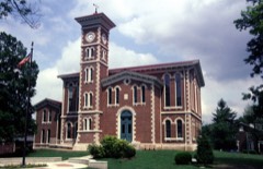 | Vernon Historic District | 6.2 miles | 1976 |
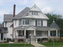 | State Street Historic District | 7.5 miles | 2007 |
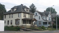 | Walnut Street Historic District | 7.7 miles | 2006 |
| Hicklin House and Settlement | 7.8 miles | 2023 |
| National Archives record | The nomination case file for reference 100008061 in Record Group 79. |
| Jennings County | All 10 listed properties in this county. |