 Block
From the record
One of 10 National Register listings published here for Jennings County · listed in 2023 · category: Site.
Sources: the National Register database, National Park Service
Listed on the National Register of Historic Places in 2023.
One of 10 National Register listings published here for Jennings County · listed in 2023 · category: Site.
Sources: the National Register database, National Park Service
Regional context, not property-specific evidence. The federal wildfire occurrence database lists 27 fires within 5 miles of Hicklin House and Settlement between 2001 and 2020, burning about 2,612 acres in total. None started naturally. 10 were recorded as arson. Distance is straight-line from the map coordinates, so a fire counted here may appear on a neighbouring settlement's page as well.
| Reported cause | Fires |
|---|---|
| Missing data/not specified/undetermined | 13 |
| Arson/incendiarism | 10 |
| Equipment and vehicle use | 2 |
| Debris and open burning | 1 |
| Firearms and explosives use | 1 |
The most recent of them, most recent first, with the day each was reported and the service that recorded it.
| Date | Cause | Size | Reported by | Name on the report |
|---|---|---|---|---|
| 15 September 2017 | Missing data/not specified/undetermined | 6.5 acres | Big Oaks National Wildlife Refuge | CAMERA FIRE |
| 12 September 2011 | Arson/incendiarism | 25 acres | Big Oaks National Wildlife Refuge | PGL FIRE |
| 20 July 2018 | Missing data/not specified/undetermined | 34 acres | Big Oaks National Wildlife Refuge | SUMMER PGM FIRE |
| 6 June 2012 | Arson/incendiarism | 5.0 acres | Big Oaks National Wildlife Refuge | RANGE 3 FIRE |
| 28 June 2012 | Arson/incendiarism | 12 acres | Big Oaks National Wildlife Refuge | RANGE 5 FIRE |
| 5 April 2014 | Missing data/not specified/undetermined | 15 acres | Big Oaks National Wildlife Refuge | PGM NIGHT OPS FIRE |
| 5 April 2001 | Missing data/not specified/undetermined | 25 acres | Big Oaks National Wildlife Refuge | 2100 CENTE |
| 2 April 2003 | Missing data/not specified/undetermined | 300 acres | Big Oaks National Wildlife Refuge | RANGE FIRE |
Regional context, not property-specific evidence. The National Weather Service names San Jacinto, the town this property stands in, in 3 storm reports between 1999 and 2012: 2 tornado, 1 thunderstorm wind. No death or injury is recorded in these reports. Each account below is quoted exactly as the forecast office filed it, from the NOAA Storm Events Database, and each date opens the federal record of that event.
| When | Event | Place named | Harm | What the report says |
|---|---|---|---|---|
| April 1999 | Tornado (F3) | San Jacinto | $250,000 | A strong F3 tornado moved across the extreme southeastern part of the county significantly damaging 2 homes and destroying 4 barns. 2 high tension power line towers were toppled as well. The tornado then moved northeast out of the Indianapolis CWA. |
| July 2012 | Thunderstorm Wind | San Jacinto | $20,000 | Twenty trees were downed from Paris Crossing to State Route 7 in the southeast part of the county due to damaging thunderstorm wind gusts. |
| August 2006 | Tornado (F0) | San Jacinto | $10,000 | A weak tornado touched down in rural southeast Jennings County near the small town of San Jacinto on the evening of 14 August 2006. The tornado tore half of a tin roof off a farm barn, and downed several trees. It also did superficial trim damage to a home, and flipped a swingset and an old trailer. |
No historic map-sheet match is published for this property yet. That does not mean no map exists. This record needs a coordinate-quality review before it can be joined to a sheet boundary. Browse the county's mapped places while that work is pending.
Other National Register properties close enough to walk or drive between, ordered by distance from this one. Both positions come from the same geocoding pass that matched these properties to their map sheets.
| Photograph | Property | Distance | Listed |
|---|---|---|---|
| Benville Bridge | 3.0 miles | 1996 | |
| Edward's Ford Bridge | 6.0 miles | 1996 | |
 | Vernon Historic District | 6.8 miles | 1976 |
| James Covered Bridge | 7.8 miles | 2022 | |
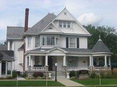 | State Street Historic District | 8.0 miles | 2007 |
| National Archives record | The nomination case file for reference 100008661 in Record Group 79. |
| Jennings County | All 10 listed properties in this county. |