 Block
From the record
One of 42 National Register listings published here for Porter County · listed in 2023 · category: Building.
Sources: the National Register database, National Park Service
Listed on the National Register of Historic Places in 2023.
One of 42 National Register listings published here for Porter County · listed in 2023 · category: Building.
Sources: the National Register database, National Park Service
This property stands in Portage Township. Counties of Porter and Lake, Indiana : Historical and Biographical, published 1882; History of Porter County, Indiana : a Narrative Account of Its Historical Progress, Its People and Its Principal Interests, published 1912 gives that township a chapter of its own.
The chapter covers the township.
Machine-read from a century-old scan, so expect the errors a machine makes: misspelled names, dropped words, stray characters.
Read the whole chapter on Portage Township - 8,499 words on its settlement, mills, schools and churches.
Regional context, not property-specific evidence. The federal wildfire occurrence database lists 646 fires within 5 miles of Hour Glass Cottage between 1992 and 2020, burning about 4,523 acres in total. 16 started naturally. 73 were recorded as arson. Distance is straight-line from the map coordinates, so a fire counted here may appear on a neighbouring settlement's page as well.
| Reported cause | Fires |
|---|---|
| Railroad operations and maintenance | 170 |
| Missing data/not specified/undetermined | 156 |
| Debris and open burning | 88 |
| Arson/incendiarism | 73 |
| Fireworks | 42 |
| Misuse of fire by a minor | 41 |
| Recreation and ceremony | 26 |
| Equipment and vehicle use | 23 |
| Natural | 16 |
| Smoking | 8 |
| Other causes | 2 |
| Power generation/transmission/distribution | 1 |
The most recent of them, most recent first, with the day each was reported and the service that recorded it.
| Date | Cause | Size | Reported by | Name on the report |
|---|---|---|---|---|
| 9 September 1999 | Railroad operations and maintenance | under an acre | Indiana Dunes National Lakeshore | FLEA2 |
| 6 September 1998 | Railroad operations and maintenance | under an acre | Indiana Dunes National Lakeshore | RAIL FIRE |
| 6 September 1994 | Railroad operations and maintenance | under an acre | Indiana Dunes National Lakeshore | NORTH |
| 5 September 1998 | Equipment and vehicle use | under an acre | Indiana Dunes National Lakeshore | MISSEDFIRE |
| 4 September 2018 | Railroad operations and maintenance | 1.0 acres | Indiana Dunes National Lakeshore | MILL |
| 30 September 2000 | Railroad operations and maintenance | 5.0 acres | Indiana Dunes National Lakeshore | STEEL FIRE |
| 30 September 1995 | Railroad operations and maintenance | 1.2 acres | Indiana Dunes National Lakeshore | CAN |
| 27 September 1997 | Recreation and ceremony | under an acre | Indiana Dunes National Lakeshore | PAINT |
Regional context, not property-specific evidence. The federal mineral resources record lists 4 workings within 5 miles of Hour Glass Cottage: 3 past producers, 1 producer. 1 still produces. What was taken out: Sand and Gravel, Construction, Clay. Distance is straight-line from the map coordinates, so a quarry counted here may appear on a neighbouring settlement's page as well.
| Where | Site | Commodity | Status | Recorded |
|---|---|---|---|---|
| Box Sand Co Pit | Sand and Gravel, Construction | Past Producer | ||
| Crisman Sand Company | Sand and Gravel, Construction | Producer | ||
| Lorenz Brothers Pit Number 1 | Clay | Past Producer | ||
| Zehner Pit | Clay | Past Producer |
Regional context, not property-specific evidence. The National Weather Service names Ogden Dunes, the town this property stands in, in 14 storm reports between 2008 and 2025: 7 thunderstorm wind, 4 flood, 2 flash flood, 1 hail. The reports record 2 deaths. Each account below is quoted exactly as the forecast office filed it, from the NOAA Storm Events Database, and each date opens the federal record of that event.
| When | Event | Place named | Harm | What the report says |
|---|---|---|---|---|
| September 2008 | Flash Flood | Ogden Dunes | 2 killed, $2,000,000 | Flash flooding or significant flooding was reported across most of Porter County, including street closures due to flooding, basement flooding and creek, stream and river flooding. Two men were sucked into a culvert while trying to rescue a boy in flood waters in Chesterton. The boy survived but both men drowned. A sinkhole developed and swallowed the back of a fire truck in Valparaiso. |
| June 2009 | Flash Flood | Ogden Dunes | $5,000 | Heavy rain fell across parts of north central Porter County during the early morning hours of June 11th. Storm total rainfall amounts included 6.17 inches four miles north northwest of Valparaiso, 5.50 inches near South Haven and 4.00 inches one mile southeast of Portage. Flooding was reported at the intersection of US 6 and Route 149 and in a mobile home park nearby. On 600N, just east of Meridain Road, a retaining wall for landscaping gave way and a small landslide blocked the road for a few hours. Five to six inches of flowing water was reported on 700N. |
| July 2025 | Flood | Ogden Dunes | - | Flooding was reported on Interstate 94 between State Road 249 and Route 20. |
| December 2025 | Flood | Ogden Dunes | - | Flooding was reported in many areas including many roads in central and southern Portage flooded with 6 to 12 inches of standing water. Many ditches and retention ponds were full and overflowing. Willowcreek Road was flooded with several inches of standing water and multiple vehicles were stuck in the flood waters. A photo showed Crisman Ditch at bankfull with Stone Avenue culvert at capacity. |
| March 2022 | Thunderstorm Wind | Ogden Dunes | - | Power lines were blown down. |
| June 2022 | Thunderstorm Wind | Ogden Dunes | - | A tree was blown down onto a house. |
| December 2021 | Thunderstorm Wind | Ogden Dunes | - | Trees and power lines were blown down near Stage Coach Road. |
| July 2012 | Thunderstorm Wind | Ogden Dunes | - | A gust to 60 mph was measured at Burns Harbor. |
| July 2012 | Thunderstorm Wind | Ogden Dunes | - | Tree limbs blown down and blowing garbage cans were reported at the Port of Indiana. |
| June 2010 | Thunderstorm Wind | Ogden Dunes | - | Wind gusts were estimated to 80 mph along the Lake Michigan shore, north of Portage. |
| July 2009 | Flood | Ogden Dunes | - | Heavy rain fell across parts of northwest Indiana during the evening of July 28th which caused some flooding. Several areas of the Indiana Dunes State Park were flooded through July 29th. Several inches of standing water was reported at the intersection of Lute and Airport Roads in Porter. Rainfall totals included 4.75 inches at the Indiana Dunes State Park, 4.10 inches southwest of Michigan City and 2.78 inches in Burdick. |
| September 2008 | Flood | Ogden Dunes | - | Widespread flooding across parts of Porter County slowly receded through September 17th. |
| August 2018 | Thunderstorm Wind | Ogden Dunes | - | no account filed |
| January 2013 | Hail | Ogden Dunes | - | no account filed |
No historic map-sheet match is published for this property yet. That does not mean no map exists. This record needs a coordinate-quality review before it can be joined to a sheet boundary. Browse the county's mapped places while that work is pending.
Other National Register properties close enough to walk or drive between, ordered by distance from this one. Both positions come from the same geocoding pass that matched these properties to their map sheets.
| Photograph | Property | Distance | Listed |
|---|---|---|---|
| West Beach Historic District | 0.8 miles | 2025 | |
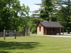 | Good Fellow Club Youth Camp | 4.8 miles | 2013 |
 | Joseph Bailley Homestead | 5.2 miles | 1966 |
| Cowles Bog | 5.3 miles | 2025 | |
| Edward Astoria and Margaret Wilson House | 5.5 miles | 2025 | |
| Nike Missile Site C-32 | 5.7 miles | 2025 |
| National Archives record | The nomination case file for reference 100009294 in Record Group 79. |
| Porter County | All 42 listed properties in this county. |