 Block
From the record
One of 33 National Register listings published here for Putnam County · listed in 2024 · category: Structure.
Sources: the National Register database, National Park Service
Listed on the National Register of Historic Places in 2024.
One of 33 National Register listings published here for Putnam County · listed in 2024 · category: Structure.
Sources: the National Register database, National Park Service
An account from the chapter on Washington township. The inset identifies its exact source book and publication year.
The fashion of carrying tire-arms was made necessary by the presence of roving bauds of Indians, most of whom were ostensibly friendly, but like Indians in all times, treacherous and unreliable. An Indian war was at any time probable, and all the old settlers still retain vivid recollections of Indian massacres, murders, plunder, and frightful rumors of intended raids.
The chapter on Washington Township in Biographical and Historical Record of Putnam County, Indiana .., published 1887 names Cloverdale. This is what it says, exactly as the scans read.
gton, the oldest of the townships, lies in the southwest corner of Putnam County, and is composed of township 13 and the north half of township 12. range 5. It is bounded on the north by Madison Town ship, on the east by Warren and Cloverdale townships, on the south by ('lay and Owen counties, and on the west by Clay County. The surface of the country in this township is rough and broken. There is a great, deal of excellent bottom land along the streams, finely adapted to the cultivation of corn and other cereals. It was originally covered with the same character of timber as was found throughout the county, consisting principally of white oak. walnut, poplar, beech, hard maple, ash, hickory and sycamore.
Passage source: Biographical and Historical Record of Putnam County, Indiana .., published 1887.
Machine-read from a century-old scan, so expect the errors a machine makes: misspelled names, dropped words, stray characters.
Read the whole chapter on Washington Township - 13,785 words on its settlement, mills, schools and churches.
Regional context, not property-specific evidence. The federal mineral resources record lists 2 workings within 5 miles of Dick Huffman Covered Bridge: 2 producers. All of them still produce. What was taken out: Stone, Crushed/Broken, Sand and Gravel, Construction. Distance is straight-line from the map coordinates, so a quarry counted here may appear on a neighbouring settlement's page as well.
| Where | Site | Commodity | Status | Recorded |
|---|---|---|---|---|
| A and C Products Inc. | Sand and Gravel, Construction | Producer | ||
| Manhattan Quarry | Stone, Crushed/Broken | Producer |
Regional context, not property-specific evidence. The National Weather Service names Cloverdale, the town this property stands in, in 40 storm reports between 1993 and 2026: 21 hail, 14 thunderstorm wind, 3 flash flood, 2 tornado. The reports record 1 injury. Each account below is quoted exactly as the forecast office filed it, from the NOAA Storm Events Database, and each date opens the federal record of that event.
| When | Event | Place named | Harm | What the report says |
|---|---|---|---|---|
| December 2015 | Thunderstorm Wind | Cloverdale | 1 hurt, $10,000 | A semi trailer was blown off US Highway 231 at Interstate 70 due to damaging thunderstorm wind gusts. One injury was reported. |
| July 2001 | Thunderstorm Wind | Cloverdale | $20,000 | no account filed |
| April 2017 | Thunderstorm Wind | Cloverdale | $15,000 | Three or four tree were blown down on Down Boy Way in Cloverdale. One of the trees is dead and fell into a mobile home, coming to rest halfway to the floor. |
| December 2015 | Thunderstorm Wind | Cloverdale | $15,000 | A box trailer was reported to be overturned due to damaging thunderstorm wind gusts. Trees and tree limbs were down too, along with some power outages. |
| August 2001 | Thunderstorm Wind | Cloverdale | $10,000 | no account filed |
| July 2023 | Thunderstorm Wind | Cloverdale | $5,000 | Thunderstorm winds downed trees in Putnam County. |
| May 2003 | Tornado (F0) | Cloverdale | $5,000 | no account filed |
| August 1993 | Thunderstorm Wind | Cloverdale | $5,000 | no account filed |
| March 2026 | Thunderstorm Wind | Cloverdale | $4,000 | Thunderstorm wind gusts downed multiple trees. |
| January 2012 | Thunderstorm Wind | Cloverdale | $3,000 | Trees were blown down at this loaction due to damaging thunderstorm wind gusts. |
| October 2014 | Tornado (EF0) | Cloverdale | $2,000 | A damage survey revealed a brief EF0 tornado causing damage to a couple trees approximately 2 miles southeast of Cloverdale. The tornado was sighted by the Emergency Manager, who observed swirling corn stalks in the air. |
| November 1994 | Thunderstorm Wind | Cloverdale | $2,000 | Thunderstorm winds blew down large tree limbs. |
| July 2008 | Thunderstorm Wind | Cloverdale | $800 | Thunderstorm winds blew down a tree onto State Route 42. |
| June 2014 | Flash Flood | Cloverdale | $500 | Two to four inches of water was running over Indiana 42 near East County Road 1200 South. Water was still rising. |
| June 2025 | Thunderstorm Wind | Cloverdale | - | Trained Spotter measured a 63 mph thunderstorm wind gust. |
| March 2017 | Thunderstorm Wind | Cloverdale | - | A measured 63 mph thunderstorm wind gust was observed in this location. |
| August 2009 | Hail | Cloverdale | - | A thunderstorm produced golf ball sized hail on the north side of Cloverdale. Power flashes were also observed and power was out in the town. |
| July 2008 | Flash Flood | Cloverdale | - | Flooding from heavy thunderstorm rains was reported on US Highway 231. |
| June 2007 | Hail | Cloverdale | - | Nickel hail was reported by law enforcement at the highway 231 interchange on interstate 70. |
| June 2001 | Hail | Cloverdale | - | 1 inch hail reported near Interstate 70. |
| June 2021 | Hail | Cloverdale | - | no account filed |
| June 2021 | Hail | Cloverdale | - | no account filed |
| March 2016 | Hail | Cloverdale | - | no account filed |
| March 2012 | Hail | Cloverdale | - | no account filed |
| April 2007 | Hail | Cloverdale | - | no account filed |
| March 2006 | Hail | Cloverdale | - | no account filed |
| March 2006 | Hail | Cloverdale | - | no account filed |
| June 2006 | Hail | Cloverdale | - | no account filed |
| May 2004 | Thunderstorm Wind | Cloverdale | - | no account filed |
| May 2004 | Hail | Cloverdale | - | no account filed |
| May 2003 | Flash Flood | Cloverdale | - | no account filed |
| May 2003 | Hail | Cloverdale | - | no account filed |
| April 2003 | Hail | Cloverdale | - | no account filed |
| August 2001 | Hail | Cloverdale | - | no account filed |
| April 1998 | Hail | Cloverdale | - | no account filed |
| April 1998 | Hail | Cloverdale | - | no account filed |
| April 1998 | Hail | Cloverdale | - | no account filed |
| May 1996 | Hail | Cloverdale | - | no account filed |
| April 1996 | Hail | Cloverdale | - | no account filed |
| April 1996 | Hail | Cloverdale | - | no account filed |
No historic map-sheet match is published for this property yet. That does not mean no map exists. This record needs a coordinate-quality review before it can be joined to a sheet boundary. Browse the county's mapped places while that work is pending.
Other National Register properties close enough to walk or drive between, ordered by distance from this one. Both positions come from the same geocoding pass that matched these properties to their map sheets.
| Photograph | Property | Distance | Listed |
|---|---|---|---|
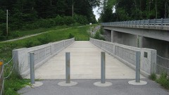 | Putnam County Bridge No. 159 | 3.2 miles | 1999 |
| Houck Covered Bridge | 5.2 miles | 2024 | |
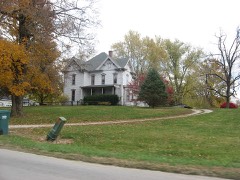 | Lycurgus Stoner House | 5.7 miles | 1985 |
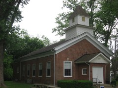 | Putnamville Presbyterian Church | 6.7 miles | 1984 |
| National Road over Deer Creek Historic District | 7.4 miles | 2018 |
| National Archives record | The nomination case file for reference 100010370 in Record Group 79. |
| Putnam County | All 33 listed properties in this county. |