 Block
From the record
One of 37 National Register listings published here for Carroll County · listed in 2025 · category: Structure.
Sources: the National Register database, National Park Service
Listed on the National Register of Historic Places in 2025.
One of 37 National Register listings published here for Carroll County · listed in 2025 · category: Structure.
Sources: the National Register database, National Park Service
The chapter on Jackson Township in History of Carroll County Indiana, published 1916 names Camden. This is what it says, exactly as the scans read.
The early ministers were circuit riders, and held religious services at the school houses. The German Baptist church was organized in Camden in 1829. The Cumberland Presbyterian church was organized in 1830. The Methodist Episcopal church was organized in 1831. Camden Meth¬ odist Episcopal church was organized in 1846. Paint Creek Baptist church was organized in 1832. Camden Baptist church was organized in 1834. St. Peter's Evangelical Lutheran church was organized in 1846. Camden is the only town in this township, and is located near the center of the town¬ ship. It was laid out and platted in 1836. It maintains a high school, has two banks, fine churches, good stores and improved streets. Its population is about one thousand. It is an incorporated town. The Vandalia railroad runs through this town.
Passage source: History of Carroll County Indiana, published 1916.
Machine-read from a century-old scan, so expect the errors a machine makes: misspelled names, dropped words, stray characters.
Read the whole chapter on Jackson Township - 262 words on its settlement, mills, schools and churches.
Regional context, not property-specific evidence. The federal mineral resources record lists 2 workings within 5 miles of Meridian Line Road Iron Truss Bridge: 2 producers. All of them still produce. What was taken out: Stone, Sand and Gravel, Construction. Distance is straight-line from the map coordinates, so a quarry counted here may appear on a neighbouring settlement's page as well.
| Where | Site | Commodity | Status | Recorded |
|---|---|---|---|---|
| Carroll County Highway Dept. | Stone | Producer | ||
| Wallace Pit | Sand and Gravel, Construction | Producer |
Regional context, not property-specific evidence. The National Weather Service names Camden, the town this property stands in, in 11 storm reports between 1997 and 2022: 8 thunderstorm wind, 1 flash flood, 1 hail, 1 flood. No death or injury is recorded in these reports. Each account below is quoted exactly as the forecast office filed it, from the NOAA Storm Events Database, and each date opens the federal record of that event.
| When | Event | Place named | Harm | What the report says |
|---|---|---|---|---|
| February 2006 | Thunderstorm Wind | Camden | $3,000 | Highway signs downed. |
| May 2019 | Thunderstorm Wind | Camden | $2,000 | Power lines were down across a home due to damaging thunderstorm wind gusts. |
| May 2010 | Flash Flood | Camden | $750 | A portion of State Road 218 in Camden was reported to be covered in water. |
| June 2017 | Flood | Camden | $250 | Minor street flooding was observed in this location due to heavy rainfall. |
| March 2022 | Thunderstorm Wind | Camden | - | Thunderstorm gust observed at County Roads 500 North and 225 East. Hail about 0.5 inches in diameter lasted about 5 minutes. Winds blew down a 2 inch limb from a healthy hardwood tree on North Monroe Street in Camden. |
| August 2012 | Hail | Camden | - | The hail fell for three minutes. |
| June 2008 | Thunderstorm Wind | Camden | - | Trees were knocked down due to damaging thunderstorm winds. |
| June 2006 | Thunderstorm Wind | Camden | - | Trees were downed. |
| August 2004 | Thunderstorm Wind | Camden | - | Trees were downed at a residence. |
| May 2000 | Thunderstorm Wind | Camden | - | no account filed |
| March 1997 | Thunderstorm Wind | Camden | - | no account filed |
No historic map-sheet match is published for this property yet. That does not mean no map exists. This record needs a coordinate-quality review before it can be joined to a sheet boundary. Browse the county's mapped places while that work is pending.
Other National Register properties close enough to walk or drive between, ordered by distance from this one. Both positions come from the same geocoding pass that matched these properties to their map sheets.
| Photograph | Property | Distance | Listed |
|---|---|---|---|
| Camden Paint Creek Concrete Arch Bridge | 0.5 miles | 2025 | |
| Camden First Baptist Church | 0.8 miles | 2023 | |
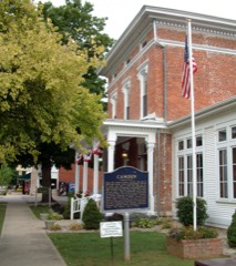 | Andrew Thomas House | 1.0 miles | 1984 |
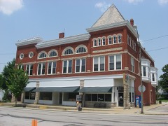 | Camden Masonic Temple | 1.0 miles | 2003 |
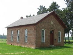 | District School No. 3 | 3.9 miles | 1988 |
 | Fred and Minnie Raber Farm | 4.1 miles | 1992 |
| National Archives record | The nomination case file for reference 100011870 in Record Group 79. |
| Carroll County | All 37 listed properties in this county. |