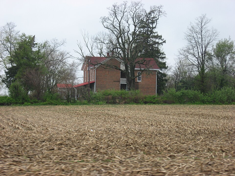
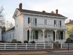
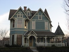
Listed on the National Register of Historic Places in 2014.
From the record
“Rufus and Amanda Black House is a historic home located in Sugar Creek Township, Hancock County, Indiana. It was built about 1870, and is a two-story, L-shaped, Italianate style brick dwelling.”
Wikipedia article Rufus and Amanda Black House, CC BY-SA 4.0.
One of 13 National Register listings published here for Hancock County · listed in 2014 · category: Building.
Philadelphia, named in commemoration of the city of brotherly love, is located four miles west of Greenfield, on the National road. The P., C. and St. L. R. R. runs by it. It contains a two-story public school building, one sawmill, a flouring mill, post-office, express office, daily mail, druggist, grocer, merchants, mechanics, physicians, and other necessaries to a village of her dimensions. Philadelphia was laid out by the records fail to show whom, on the nth day of April, 1838, being about six months prior to the laying out of New Palestine. The original plat consists of one hundred and two lots and six out-lots. The first and only addition was made by Clark, on the second day of April, 1864, and consisted of nineteen lots, located south of the old plat. Among the first business men of this place were: Charles Atherton, Sen., general merchant and post-master; Allen McCane, Joseph Marshall, G. W. Willett, Samuel McConaha, J. B. Sting, J. B. Conover and O. S. Meek. First physicians. Dr. Hodson McCallister & Son, J. H. Hazen, W. H. Dye, G. T. Rennick and H. B. Tilson. We will not consume space in ijivinij a full list of the business throuirh her entire history, but will now come up to the present, and furnish for this date a
About the 3'ear 1835, the Methodists organized a class at Philadelphia. Among the first members were Owen Griffith, wife and two daughters ; William Brown, wife and daughter; Mrs. Willett ; Charles Atherton, Sr., and wife ; Jonathan Hornida}' and wife, Thomas J. Smith and wife, and Joseph Grey and lady. The first ministers were J. B. Burch, Rev. Edwards and Landy Havens.
Regional context, not property-specific
evidence. The federal mineral resources record lists
3 workings within 5 miles of Rufus and Amanda Black House: 2 past producers, 1 producer.
1 still produces. What was taken out: Sand and Gravel, Construction. Distance is straight-line from the
map coordinates, so a quarry counted here may appear on a neighbouring
settlement's page as well.
Regional context, not property-specific
evidence. The National Weather Service names
Philadelphia, the town this property stands in, in 6 storm reports between 2012 and 2020: 3 thunderstorm wind, 2 hail, 1 flood.
No death or injury is recorded in these reports. Each account below is quoted exactly as the forecast office
filed it, from the NOAA Storm Events Database, and each date
opens the federal record of that event.
No historic map-sheet match is published
for this property yet. That does not mean no map exists. This record needs
a coordinate-quality review before it can be joined to a sheet boundary.
Browse the county's mapped places while that work is
pending.
Listed places nearby
6 within 8 miles
Other National Register properties close
enough to walk or drive between, ordered by distance from this one. Both
positions come from the same geocoding pass that matched these properties
to their map sheets.
Listing record. National Park Service National Register of Historic Places, listed-properties dataset, current to 2026-05-22.
Map join. Address geocoded through the United States Census geocoder, then tested against the published boundary of every sheet in the USGS Historical Topographic Map Collection.
How this page is made. Listing fields come from federal records; map-sheet coverage is a labelled coordinate-to-boundary calculation, not a source-field claim.
Mines and quarries. USGS Mineral Resources Data System (MRDS) https://mrdata.usgs.gov/mrds/ A work of the United States government, no copyright under 17 U.S.C. 105.
Storms. NOAA National Centers for Environmental Information, Storm Events Database https://www.ncei.noaa.gov/stormevents/ A work of the United States government, no copyright under 17 U.S.C. 105. Narratives are quoted verbatim from the National Weather Service report and are not edited or summarised.
 Block