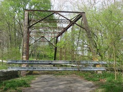
Listed on the National Register of Historic Places in 1989.
From the record
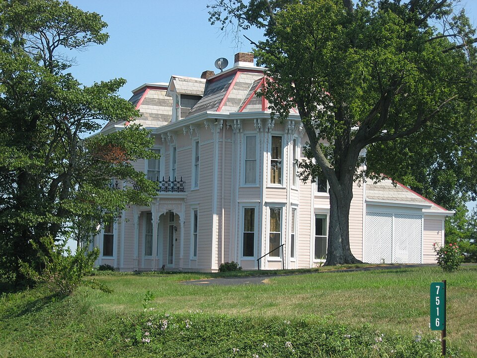
“Harcourt House is a historic home located in Orange Township, Rush County, Indiana. It was built in 1880-1881, and is a two-story, irregular cruciform plan frame dwelling with Italianate and Second Empire style design elements.”
Wikipedia article James F. Harcourt House, CC BY-SA 4.0.
One of 28 National Register listings published here for Rush County · listed in 1989 · category: Building.
Architectural style. Second Empire architecture in the United States and Canada
National Register reference number.89001412- the number the National Park Service assigned this property when it was listed, and the key its nomination file is catalogued under at the National Archives.
Samuel Griffith, the subject of the following biography, is the grandson of John Griffith, who was the son of an early emigrant from Wales to America. John was born in Penns3"lyania, Bedford County, and was a farmer by occupation. He married Catherine Helm. The marriage was blessed by two sons, John and Samuel, both of whom are dead. John, the father of our subject, was born in Bedford County, Pa., March 10, 1S06. Pie was reared on a farm in Bedford County, Pa., and received a limited education in the country schools of his native count}'. He was married in Bedford County to Margaret Feaster. In August, 1837, he located in Moscow, Orange Township, Rush County, Ind. The rest of his life was spent in Rush County. He followed farming as an occupation. He was successful in his undertakings and was energetic and enterprising. A self-made man, he was universally respected by all who knew him. He lived a useful life, and was benevolent and charitable in character, and was a faithful friend and a representative citizen. The mother of our subject was born in Bedford County, Pa., May 14, 1S19, and was the mother of two sons and two daughters, viz. : Sarah, Samuel, Martin D., and Caroline. Our subject is the only one now living. He was torn in Rush County, Ind., August 10, 1S3S, and was reared on a farm and educated in the country schools, and has followed agricultural pursuits as an avocation, making success. In 1865, October 29, he was united in marriage with Susan Apple, daughter of Elias and Magdaline (Slifer) Apple. Susan was born in Montgomeiy County, Ohio, October 5, 1S46. Three children have blessed her marriage, viz. : Elmor Ellsworth, Van Elias (deceased), and Caroline. Our subject and his wife are members of the
Regional context, not property-specific
evidence. The
federal wildfire occurrence database
lists 1 fire within 5 miles of James F. Harcourt House
in 2004, burning about 3 acres in total. None started naturally. None was recorded as arson.
Distance is straight-line from the map coordinates, so a fire counted
here may appear on a neighbouring settlement's page as well.
Reported cause
Fires
Recreation and ceremony
1
The most recent of
them, most recent first, with the day each was reported and the service
that recorded it.
Date
Cause
Size
Reported by
Name on the report
30 October 2004
Recreation and ceremony
3.0 acres
Indiana State Fire Marshal's Office
not named
Mines and
quarries near this property
2 within 5 miles
Regional context, not property-specific
evidence. The federal mineral resources record lists
2 workings within 5 miles of James F. Harcourt House: 2 producers.
All of them still produce. What was taken out: Stone, Crushed/Broken, Limestone, Dimension. Distance is straight-line from the
map coordinates, so a quarry counted here may appear on a neighbouring
settlement's page as well.
Regional context, not property-specific
evidence. The National Weather Service names
Moscow, the town this property stands in, in 8 storm reports between 2008 and 2026: 4 thunderstorm wind, 3 tornado, 1 flash flood.
The reports record 1 death and 8 injuries. Each account below is quoted exactly as the forecast office
filed it, from the NOAA Storm Events Database, and each date
opens the federal record of that event.
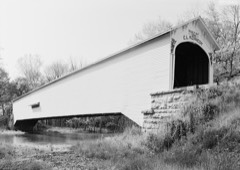
The tornado touched down in Shelby County at 2004 EST 200 meters north of the County Road South 500 East and County Road East 500 South intersection. The tornado tracked to the east northeast for 2.93 miles before entering Rush County at 2012 EST near County Road South 1000 West just south of County Road East 450 South. The tornado continued to the northeast for 6.75 miles until lifting at 2030 EST. The tornado lifted 200 meters east of County Road South 400 West and 400 meters north of West State Road 244. The tornado was on the ground for a total of 9.68 miles and 26 minutes. The tornado was an EF-0 with wind speeds around 75 miles per hour while in Shelby County, however intensified to an EF-3 tornado while in Rush County with wind speeds around 150 miles per hour. The tornado had a width of 150 yards. The tornado formed from a supercell storm. While in Shelby County the tornado damaged 34 structures with the hardest hit areas being Middletown and Waldron. 27 of the damaged structures were in Middletown with 4 of these being completely destroyed. Trees and powerlines were also blown down and a semi-trailer was blown off Interstate 74. In Rush County 8 people were injured including a man and a woman who were pinned beneath a wall in Moscow. A 67 year old woman in Moscow was injured from a large tree limb that impaled her in the chest and later passed away due to those injuries on August 17th. The historic Moscow Covered Bridge was destroyed in addition to extensive damage to the Moscow school. Dozens of houses were severely damaged or destroyed including some houses that were swept completely off the foundation. Approximately 200,000 dollars in damage occurred in Shelby County and approximately one million dollars in damage occurred in Rush County.
This third of five central Indiana tornadoes tracked slightly north of east, from 0.6 miles north of Rush County's southwest corner to 0.4 miles west of the intersection of County Roads 1000 South and 500 West. ||Damage was mostly to trees and a couple barn roofs. The tornado touched down just northeast of the intersection of County Roads 1050 South and 1000 West, snapping several healthy softwood pine trees about 8-10 feet above ground, while nearby homes only sustained minor damage to siding; although a portion of a barn's metal roof was ripped back and blown off, thrown to the east-southeast. Northwest of the intersection of County Roads 875 West and 1050 South, several large tree branches were broken off by the northern edge of the tornado's vortex where a corn field met a wooded area. Towards the track's midpoint, a low-sloped barn roof, just west of South Degelow Road, had almost half of its metal ripped back, before further tree damage and a utility pole were downed at a homestead just west of County Road 775 West; a witness at this location saw the vortex before it became rain wrapped. Towards the end of the damage path, further minor tree damage with many downed tree limbs occurred along South River Road and the adjacent Flatrock River, before the tornado ended about 0.5 miles later while tracking along County Road 1000 South.||The parent supercell's rear flank downdraft inflow winds also approached 80 mph, as indicated by periphery damage about 0.25 miles south of the convergent tornadic damage at County Road 775 West, as well as at South River Road where the wide damage path included weak convergence through the wooded area where the tornado tracked. This was the longest-tracking and most destructive tornado of the episode in central Indiana, although all damage was EF0 intensity following the peak intensity of 110 mph winds (EF1) at the tornado's onset.
This fourth of five central Indiana tornadoes tracked to the east-northeast, from northeast of the intersection with South Prill Road and South Degelow Road to south-southwest of the intersection of South Prill Road and County Road 740 West. Despite tracking for only 850 feet, the circulation was strong enough to completely destroy a metal barn; although grain silos immediately west and a nearby home to the northwest were both untouched. The barn had rusted connections between the toe nail of frame and foundation. The barn's debris were thrown to the northeast, north and northwest before the tornado quickly dissipated in a field to the east. Peak winds were 110 mph.
Thunderstorm wind gust destroyed a garage, approximately 30 by 50 feet, due to lack of significant anchoring on garage walls, and the garage door facing the wind was compromised. Two other nearby barns sustained roof loss but homes between had no damage. Debris was thrown about 20 yards to east. Little if any debris was lofted into nearby woods where no trees were down.
No historic map-sheet match is published
for this property yet. That does not mean no map exists. This record needs
a coordinate-quality review before it can be joined to a sheet boundary.
Browse the county's mapped places while that work is
pending.
Listed places nearby
4 within 8 miles
Other National Register properties close
enough to walk or drive between, ordered by distance from this one. Both
positions come from the same geocoding pass that matched these properties
to their map sheets.
Listing record. National Park Service National Register of Historic Places, listed-properties dataset, current to 2026-05-22.
Map join. Address geocoded through the United States Census geocoder, then tested against the published boundary of every sheet in the USGS Historical Topographic Map Collection.
How this page is made. Listing fields come from federal records; map-sheet coverage is a labelled coordinate-to-boundary calculation, not a source-field claim.
Wildfire. Short, Karen C. 2022. Spatial wildfire occurrence data for the United States, 1992-2020 [FPA_FOD_20221014]. 6th Edition. Fort Collins, CO: Forest Service Research Data Archive. https://doi.org/10.2737/RDS-2013-0009.6 Collected with United States Government funding and usable without additional permissions or fees.
Mines and quarries. USGS Mineral Resources Data System (MRDS) https://mrdata.usgs.gov/mrds/ A work of the United States government, no copyright under 17 U.S.C. 105.
Storms. NOAA National Centers for Environmental Information, Storm Events Database https://www.ncei.noaa.gov/stormevents/ A work of the United States government, no copyright under 17 U.S.C. 105. Narratives are quoted verbatim from the National Weather Service report and are not edited or summarised.
 Block