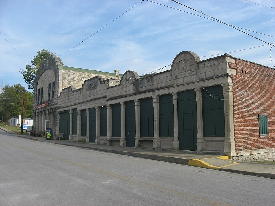
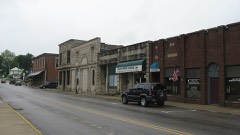
Listed on the National Register of Historic Places in 1995.
From the record
“Stinesville Commercial Historic District is a national historic district located at Stinesville, Indiana. The district consists of five adjoining limestone commercial buildings in the central business district of Stinesville.”
Wikipedia article Stinesville Commercial Historic District, CC BY-SA 4.0.
One of 48 National Register listings published here for Monroe County · listed in 1995 · category: District.
National Register reference number.95000707- the number the National Park Service assigned this property when it was listed, and the key its nomination file is catalogued under at the National Archives.
The ground it stands on
10,276 words
The chapter on Bean Blossom Township in 1884 History of Monroe County Indiana, published 1884 names Stinesville. This is what it says, exactly as the scans read.
Old Daniel McHolland, who settled in the vicinity of Ketchum's Mills, in Clear Creek Township, in the year 1815, and who was probably the first white man to bring his wife and family to the county of Monroe, became a resident of Bean Blossom Township at an early day. He was a jovial old fiddler of exceptional backwoods skill, and officiated in the capacity of orchestra at many an early dance in the township. His musical proclivity was too preponderant for financial success. He owned no land and was content with enough to eat and wear so long as his fiddle could be played upon. He passed away with the old times. At the early settlement of the township, bears were quite numerous and several were killed. Thomas Allen killed several, and was a famous hunter of deer. A man named Wrightsill killed a bear in 1829 or 1830 southeast of Stinesville. He was hunting in the woods with his dogs and succeeded in treeing the bear in a large sycamore. He was a good shot, and brought it down at the first fire. The ground was so soft under the tree that the falling animal made a deep indentation which remained there for a year or more. The marks of the bear's claws on the bark of the tree could be seen there for several years. Thomas Wilson was another skillful bear hunter. At an early day, he went up to the vicinity of Baker Township, Morgan County, where he encamped in the hollow trunk of an enormous sycamore tree which was yet standing, and remained there for a week or more, traversing the surrounding country for bears. He killed four or five, it is said, some under rather thrilling circumstances, besides numerous deer. David Ellett killed bears in Bean Blossom Township, it is said. Coleman Puett shot one near the southeast corner of the township during the twenties. Jerry Devore crippled one west of Stinesville in later years, but the animal succeeded in eluding all pursuit. Old man McHolland was an experiented trapper and deer hunter. He killed many of the latter animals in the, township. The hides were worth from 25 cents to $1 each, and were largely used for "breeches" by the earliest settlers. When the weather was fair, they were good enough, but in rainy or foul weather they took water like a blanket, and when dried were stiff enough to stand alone. Then it was Jaughable to see the old settlers draw them on. The '' saddles'' of the deer were worth about the same as the hides. The venison was dry and required lard in which to be cooked before being palatable. The old settlers much preferred fat and lean pork, combined, to any other meat that they could get. The Baileys and the Turners and others were skillful deer hunters. It is said that one of the Baileys once had a fight with a wounded deer, and had the clothing nearly all torn from his body, besides receiving numerous bruises from the sharp hoofs and antlers before he vanquished the enraged animal.
Allen and Greer are practicing at present. John McHenry was the first Postmaster. James Greer isthe present agent of Brother Jonathan. The owner of the town was probably the first blacksmith. John Easton was the first shoe-maker. Frank Ashbaugh has been the shoe-maker for about twenty years. Eusebius Stine built the first saw mill at the village. He also built a small grist mill. These buildings were erected long before the town started into being. Among the early residents of Stinesville were Eusebius Stine, after whom the village was named, Samuel Brisco, Thomas Wilson, Charles Miller, Frank Ashbaugh, Mr. Math. eny, Jackson Hite, William Easton, George Pugh and their families, and others. The great feature of the village during the past five or six years is the limestone interest. Two or three companies from Terre Haute, and one or two from other cities, are quarrying and sawing and shipping large quantities of excellent limestone.
Regional context, not property-specific
evidence. The
federal wildfire occurrence database
lists 36 fires within 5 miles of Stinesville Commercial Historic District
between 2004 and 2008, burning about 7 acres in total. 1 started naturally. 5 were recorded as arson.
Distance is straight-line from the map coordinates, so a fire counted
here may appear on a neighbouring settlement's page as well.
Reported cause
Fires
Recreation and ceremony
11
Debris and open burning
10
Missing data/not specified/undetermined
8
Arson/incendiarism
5
Equipment and vehicle use
1
Natural
1
The most recent of
them, most recent first, with the day each was reported and the service
that recorded it.
Regional context, not property-specific
evidence. The federal mineral resources record lists
6 workings within 5 miles of Stinesville Commercial Historic District: 3 producers, 2 past producers, 1 plant.
4 still produce. What was taken out: Limestone, Dimension, Limestone, General, Stone, Crushed/Broken, Fire Clay (Refractory). Distance is straight-line from the
map coordinates, so a quarry counted here may appear on a neighbouring
settlement's page as well.
Regional context, not property-specific
evidence. The National Weather Service names
Stinesville, the town this property stands in, in 10 storm reports between 2008 and 2023: 4 hail, 2 flash flood, 1 heavy rain, 1 flood.
No death or injury is recorded in these reports. Each account below is quoted exactly as the forecast office
filed it, from the NOAA Storm Events Database, and each date
opens the federal record of that event.
Continuation from Owen County of the rotating supercell thunderstorm's second EF3. The tornado reached peak intensity while crossing the Owen-Monroe County line, where the strongest winds in Monroe County were 152 mph along West Wolf Mountain Road. Here, 0.2 to 0.3 miles east of North County Line Road, the tornado destroyed both a mobile home and single story homes with little anchoring on cinder blocks, among many damaged and debarked trees. Back closer to North County Line Road, and slightly farther north of the center of the tornado's path, winds had separated a trailer home from its attached structure and garage, allowing the home to roll and flatten. Farther east along West Wolf Mountain Road, EF2-intensity damage was observed 0.50 to 0.75 miles east of the county line, with areas where nearly all trees were uprooted or snapped, and several single-family homes lost large sections of roofing; a few debarked trees were observed, but with less frequency than seen closer to the county line.||The tornado continued for another 2.7 miles while gradually weakening through EF2 and EF1 intensities. At North Texas Ridge Road hardwood trees were snapped off while a few homes lost small portions of roofing. At the intersection of West Brighton Road and North Fulton Road a narrower corridor of smaller trees were snapped or uprooted, including one tree downed onto a house; the tornado track ended about 250 feet northeast of this intersection.
State Road 37 was flooded across the northern part of Monroe County due to heavy rain that caused flash flooding. Many roads were closed and some homes were being evacuated at Stinesville and Ellettsville. Flash flooding along Bryant's Creek caused people to be stuck in their houses. Indiana University's campus sustained damage to the football field and Psychology building.
Flooding occurred in many locations throughout Monroe County. Heavy rain caused high water which closed several roads. One man was rescued by boat from the roof of a submerged vehicle. One household was submerged by the high water.
No historic map-sheet match is published
for this property yet. That does not mean no map exists. This record needs
a coordinate-quality review before it can be joined to a sheet boundary.
Browse the county's mapped places while that work is
pending.
Listed places nearby
5 within 8 miles
Other National Register properties close
enough to walk or drive between, ordered by distance from this one. Both
positions come from the same geocoding pass that matched these properties
to their map sheets.
Listing record. National Park Service National Register of Historic Places, listed-properties dataset, current to 2026-05-22.
Map join. Address geocoded through the United States Census geocoder, then tested against the published boundary of every sheet in the USGS Historical Topographic Map Collection.
How this page is made. Listing fields come from federal records; map-sheet coverage is a labelled coordinate-to-boundary calculation, not a source-field claim.
Wildfire. Short, Karen C. 2022. Spatial wildfire occurrence data for the United States, 1992-2020 [FPA_FOD_20221014]. 6th Edition. Fort Collins, CO: Forest Service Research Data Archive. https://doi.org/10.2737/RDS-2013-0009.6 Collected with United States Government funding and usable without additional permissions or fees.
Mines and quarries. USGS Mineral Resources Data System (MRDS) https://mrdata.usgs.gov/mrds/ A work of the United States government, no copyright under 17 U.S.C. 105.
Storms. NOAA National Centers for Environmental Information, Storm Events Database https://www.ncei.noaa.gov/stormevents/ A work of the United States government, no copyright under 17 U.S.C. 105. Narratives are quoted verbatim from the National Weather Service report and are not edited or summarised.
 Block