Listed on the National Register of Historic Places in 2006.
From the record
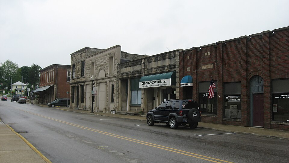
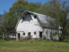
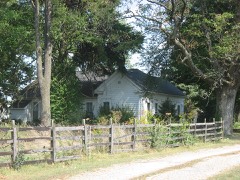
“Ellettsville Downtown Historic District is a national historic district located at Ellettsville, Indiana. The district encompasses 50 contributing buildings in the central business district and surrounding residential sections of Ellettsville.”
Wikipedia article Ellettsville Downtown Historic District, CC BY-SA 4.0.
One of 48 National Register listings published here for Monroe County · listed in 2006 · category: District.
National Register reference number.06000849- the number the National Park Service assigned this property when it was listed, and the key its nomination file is catalogued under at the National Archives.
The ground it stands on
18,040 words
The chapter on Richland Township in 1884 History of Monroe County Indiana, published 1884 names Ellettsville. This is what it says, exactly as the scans read.
I hesa section of the county possesses many interesting features, not only from its natural attractions, but from the fact that it was settled at a very early day and grew to worth and prominence while other portions were yet comparatively uninhabited. Of course the township has the usual characteristics of exterior and interior that belong to Monroe County as a whole. 'There are the argillaceous bluffs, with their soil of semi- sterility; there are the lower lands, where the agriculturist usually reaps his best, if not only, valuable return; there are the timber tracts, which have been largely denuded of their best woods; and there is that broken, cut-up appearance so common to the southern part of the Hoosier State. The lower lands are usually of a rich combined soil of sand, lime, clay and alluvium, the latter often predominating and affording a mellow, fertile tract of the greatest value, and one greatly sought after by those who understand the requirements of good crops. An abundance of excellent limestone is found near the surface, and is being worked by numerous companies. The section at the quarry, one and a half miles north of Ellettsville, is as follows:
It is difficult to state who was the first permanent settler in this township. Several tracts were purchased in 1816, as will be seen from the above, but so far as can be learned only one family came out that fall to reside in the township during the winter. In about October, 1816, William Edmundson, without owning the land, located within a short distance of Ellettsville, erecting there a small, round-log cabin, in which he domiciled his family. He did not enter his land - the northwest quarter of
Regional context, not property-specific
evidence. The
federal wildfire occurrence database
lists 121 fires within 5 miles of Ellettsville Downtown Historic District
between 2003 and 2008, burning about 56 acres in total. 3 started naturally. 18 were recorded as arson.
Distance is straight-line from the map coordinates, so a fire counted
here may appear on a neighbouring settlement's page as well.
Reported cause
Fires
Debris and open burning
36
Recreation and ceremony
31
Missing data/not specified/undetermined
29
Arson/incendiarism
18
Natural
3
Equipment and vehicle use
2
Smoking
1
Other causes
1
The most recent of
them, most recent first, with the day each was reported and the service
that recorded it.
Regional context, not property-specific
evidence. The federal mineral resources record lists
10 workings within 5 miles of Ellettsville Downtown Historic District: 5 producers, 4 past producers, 1 plant.
6 still produce. What was taken out: Limestone, Dimension, Stone, Crushed/Broken, Fire Clay (Refractory), Limestone, General. Distance is straight-line from the
map coordinates, so a quarry counted here may appear on a neighbouring
settlement's page as well.
Regional context, not property-specific
evidence. The National Weather Service names
Ellettsville, the town this property stands in, in 48 storm reports between 1997 and 2025: 21 thunderstorm wind, 15 hail, 4 flash flood, 3 tornado.
No death or injury is recorded in these reports. Each account below is quoted exactly as the forecast office
filed it, from the NOAA Storm Events Database, and each date
opens the federal record of that event.
The EF-2 rated tornado, with max wind speeds of 130 mph, began in rural countryside northeast of Ellettsville doing some tree damage before crossing State Road 46 and doing significant tree damage along Chafin Chapel Road. A 400 yard wide path of trees was completely shredded in spots. Additional widespread tree damage was found on Mount Tabor Road and West Cowden Road. Along West Cowden Road, several barns and outbuildings were destroyed as well as a loosely anchored garage completely swept off of its foundation. The tornado continued into rural forest before dissipating.
Water rescues were ongoing in town. People were trapped in multiple residences and vehicles due to high water in the vicinity of Vine and Temperance Streets.
All downtown streets of Ellettsville are impassable due to flash flooding from heavy rainfall. State Road 46 Westbound is underwater. The Eastbound lane is still passable.
Many trees were downed, uprooted, or split due to thunderstorm wind gusts within Ellettsville. No information on whether any homes were damaged by these trees.
Law enforcement informed the NWS that numerous roads were flooded in the Bloomington area. A landslide occurred on Harmony Road just off of Kirksville Road, located near SR 45 in southwest Bloomington.
A twelve inch diameter tree was snapped off at the base near the intersection of North Hartstrait and Ratliff Roads due to damaging thunderstorm wind gusts.
No historic map-sheet match is published
for this property yet. That does not mean no map exists. This record needs
a coordinate-quality review before it can be joined to a sheet boundary.
Browse the county's mapped places while that work is
pending.
Listed places nearby
6 within 8 miles
Other National Register properties close
enough to walk or drive between, ordered by distance from this one. Both
positions come from the same geocoding pass that matched these properties
to their map sheets.
Listing record. National Park Service National Register of Historic Places, listed-properties dataset, current to 2026-05-22.
Map join. Address geocoded through the United States Census geocoder, then tested against the published boundary of every sheet in the USGS Historical Topographic Map Collection.
How this page is made. Listing fields come from federal records; map-sheet coverage is a labelled coordinate-to-boundary calculation, not a source-field claim.
Wildfire. Short, Karen C. 2022. Spatial wildfire occurrence data for the United States, 1992-2020 [FPA_FOD_20221014]. 6th Edition. Fort Collins, CO: Forest Service Research Data Archive. https://doi.org/10.2737/RDS-2013-0009.6 Collected with United States Government funding and usable without additional permissions or fees.
Mines and quarries. USGS Mineral Resources Data System (MRDS) https://mrdata.usgs.gov/mrds/ A work of the United States government, no copyright under 17 U.S.C. 105.
Storms. NOAA National Centers for Environmental Information, Storm Events Database https://www.ncei.noaa.gov/stormevents/ A work of the United States government, no copyright under 17 U.S.C. 105. Narratives are quoted verbatim from the National Weather Service report and are not edited or summarised.
 Block