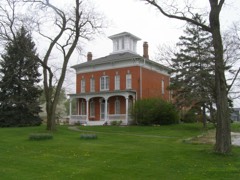
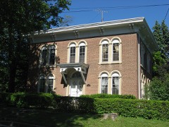
Listed on the National Register of Historic Places in 2000.
From the record
“Nike Missile Site C-47 is a former missile site near Portage, Indiana. The Nike defense system was a Cold War-era missile system in the United States.”
Wikipedia article Nike Missile Site C-47, CC BY-SA 4.0.
One of 42 National Register listings published here for Porter County · listed in 2000 · category: District.
National Register reference number.99001669- the number the National Park Service assigned this property when it was listed, and the key its nomination file is catalogued under at the National Archives.
Portage township has three postofficcs, located at Crisman, Dune Park and McCool. The first two are money order offices. Crisman was laid out by B. G. Crisman, after which it was named. It is located on the Michigan Central railroad in the eastein part. The postoflice was established there in 1871 and the first pusliiiaster was Isaac Crisman, who was also the proprietor of the first stoi-c in the place. After a short time he sold out to Charles Seydel, who in turji was succeeded by Joseph Bender and Joseph White. For many years this was the only store in the township. The town has never grown to any considerable proportions and in 1910 had a population of about 75. McCool, named after the pioneer family, is located in the triangle between the Baltimore & Ohio, the El^in, Joliet & Eastern, and the Wabash railways, and apparently, like Topsy in Uncle Tom's Cabin, it "just growed." The railroad junction attracted a few small business enterprises, whose proprietors built dwellings in the immediate neighboi'hood, others followed, and in Ijy^O iMcCopl and Crisman were about the same size. Dune Park is a small station on, the Lake Shore & Michigan Soutlicfii rairoad, about a mile and a half south of Lake Michigan. It takes its name fi-om the saiid dunes in the vicinity. In October, 1891, Frank A. Turner, of Valparaiso, filed in the recorder's office a plat of a town named Fairview, located on section 34, township 37, range 7, in the extieme northwest corner of the county. The plat is rather pretentious in character, sliowing some six
Probably no township in the county, unless it be Center, can show a better system of public highways than Portage. More than thirty miles of fine macadamized roads traverse all portions of the township, and good bridges span the streams. Jjike some of the other townships of PtJrter county, the population of Portage has been rather variable during the last twenty years. In 1890 it was 954. Ten years later it had increased to 1,014, but in 1910 it was but 959.
Regional context, not property-specific
evidence. The
federal wildfire occurrence database
lists 16 fires within 5 miles of Nike Missile Site C47
between 1995 and 2008, burning about 93 acres in total. 1 started naturally. 1 was recorded as arson.
Distance is straight-line from the map coordinates, so a fire counted
here may appear on a neighbouring settlement's page as well.
Reported cause
Fires
Missing data/not specified/undetermined
7
Debris and open burning
3
Recreation and ceremony
2
Railroad operations and maintenance
1
Natural
1
Equipment and vehicle use
1
Arson/incendiarism
1
The most recent of
them, most recent first, with the day each was reported and the service
that recorded it.
Regional context, not property-specific
evidence. The federal mineral resources record lists
1 working within 5 miles of Nike Missile Site C47: 1 producer.
All of them still produce. What was taken out: Sand and Gravel, Construction. Distance is straight-line from the
map coordinates, so a quarry counted here may appear on a neighbouring
settlement's page as well.
Regional context, not property-specific
evidence. The National Weather Service names
Portage, the town this property stands in, in 32 storm reports between 1994 and 2025: 21 thunderstorm wind, 8 hail, 1 lightning, 1 flash flood.
No death or injury is recorded in these reports. Each account below is quoted exactly as the forecast office
filed it, from the NOAA Storm Events Database, and each date
opens the federal record of that event.
A large tree fell onto a pickup truck and a van, crushing both. A large tree was uprooted on Charlotte Street, falling onto a house. Tree limbs and power lines were also blown down.
Several large trees were blown down. A roof was blown off a picnic shelter in Woodland Park. Tree limbs and power lines were also blown down. Three horses escaped after a tree fell onto a fence. One of the horses was struck and killed by a tractor-trailer on US 20.
Numerous roads were flooded and closed in the Portage and Chesterton areas including the intersection of State Road 2 and State Road 49; Governor Road and Robins Road. A few cars were stranded in the flood waters. Creeks and ditches were reported out of their banks along with flooded fields.
No historic map-sheet match is published
for this property yet. That does not mean no map exists. This record needs
a coordinate-quality review before it can be joined to a sheet boundary.
Browse the county's mapped places while that work is
pending.
Listed places nearby
6 within 8 miles
Other National Register properties close
enough to walk or drive between, ordered by distance from this one. Both
positions come from the same geocoding pass that matched these properties
to their map sheets.
Listing record. National Park Service National Register of Historic Places, listed-properties dataset, current to 2026-05-22.
Map join. Address geocoded through the United States Census geocoder, then tested against the published boundary of every sheet in the USGS Historical Topographic Map Collection.
How this page is made. Listing fields come from federal records; map-sheet coverage is a labelled coordinate-to-boundary calculation, not a source-field claim.
Wildfire. Short, Karen C. 2022. Spatial wildfire occurrence data for the United States, 1992-2020 [FPA_FOD_20221014]. 6th Edition. Fort Collins, CO: Forest Service Research Data Archive. https://doi.org/10.2737/RDS-2013-0009.6 Collected with United States Government funding and usable without additional permissions or fees.
Mines and quarries. USGS Mineral Resources Data System (MRDS) https://mrdata.usgs.gov/mrds/ A work of the United States government, no copyright under 17 U.S.C. 105.
Storms. NOAA National Centers for Environmental Information, Storm Events Database https://www.ncei.noaa.gov/stormevents/ A work of the United States government, no copyright under 17 U.S.C. 105. Narratives are quoted verbatim from the National Weather Service report and are not edited or summarised.
 Block