 Block
From the record
17 National Register listings published here.
Sources: the National Register database, National Park Service
34 topographic sheets cover 15 settlements here, and 17 properties are on the National Register of Historic Places.
17 National Register listings published here.
Sources: the National Register database, National Park Service
Every property in this county listed on the National Register of Historic Places, with the year it was listed and the federal nomination document.
| Photograph | Property | Type | Listed | Reference |
|---|---|---|---|---|
| Bank of Powhattan Building | building | 2025 | 100011913 | |
| Bethany Brethren Church | building | 2012 | 12000843 | |
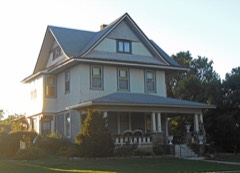 | Samuel Bierer House | building | 2010 | 10000450 |
| Abraham Brien House | building | 2024 | 100010702 | |
 | Davis Memorial | object | 1977 | 77000571 |
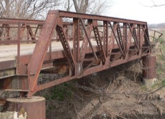 | Delaware River Warren Truss Bridge | structure | 2004 | 04000580 |
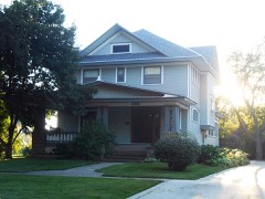 | A.J. Eicholtz House | building | 2004 | 03001493 |
| Fete Apartments | building | 2019 | 100004202 | |
 | Seward Graham House | building | 2008 | 08001172 |
| William and Augusta Guild House | building | 2024 | 100010232 | |
| Hiawatha Courthouse Square Historic District | district | 2006 | 05001052 | |
 | Hiawatha Memorial Auditorium | building | 1985 | 85001978 |
 | Hiawatha National Guard Armory | building | 2004 | 04000667 |
| Horton Civic Center | district | 2020 | 100005121 | |
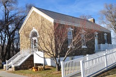 | Iowa Tribe Community Building | building | 2016 | 16000404 |
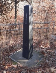 | Site No. RH00-062 | object | 1987 | 87001001 |
 | US Post Office-Horton | building | 1989 | 89001643 |
Every wildfire the federal occurrence database records inside this county: 156 of them, burning about 2,646 acres. 2 started naturally and 27 were recorded as arson. Each settlement page carries the fires within five miles of it.
| Reported cause | Fires |
|---|---|
| Missing data/not specified/undetermined | 52 |
| Debris and open burning | 46 |
| Arson/incendiarism | 27 |
| Smoking | 12 |
| Equipment and vehicle use | 11 |
| Misuse of fire by a minor | 3 |
| Natural | 2 |
| Fireworks | 2 |
| Firearms and explosives use | 1 |
The five largest, by the area the report gives. Two of them were set deliberately.
| Date | Cause | Size | Reported by | Name on the report |
|---|---|---|---|---|
| 11 March 2005 | Arson/incendiarism | 940 acres | Horton Agency | TYRONE |
| 3 March 2017 | Arson/incendiarism | 100 acres | Brown County | 7 |
| 31 March 2005 | Debris and open burning | 89 acres | Horton Agency | FINGER |
| 5 April 2015 | Missing data/not specified/undetermined | 85 acres | Kansas Forest Service | 1500053 |
| 19 October 2015 | Missing data/not specified/undetermined | 65 acres | Kansas Forest Service | 1500075 |
| 7 December 2019 | Debris and open burning | 57 acres | Horton Agency | GOLDEN EAGLE |
| 12 March 2018 | Debris and open burning | 56 acres | Horton Agency | KT-3 |
| 22 March 2015 | Debris and open burning | 55 acres | Horton Agency | PATTERSON |
Every settlement page carries the fires within five miles of it - see the settlement index below.
The NOAA Storm Events Database holds 461 reports for this county, causing no deaths, 9 injuries and about $8,096,380 in recorded property damage. Each settlement page carries the reports that name it.
| Kind of event | Reports |
|---|---|
| Hail | 206 |
| Thunderstorm Wind | 168 |
| Tornado | 44 |
| Flash Flood | 26 |
| Lightning | 7 |
| Flood | 6 |
| Funnel Cloud | 4 |
The most serious of them, by death, then injury, then recorded damage. The accounts are quoted exactly as the forecast office filed them.
| When | Event | Place named | Harm | What the report says |
|---|---|---|---|---|
| June 1984 | Tornado (F2) | not stated | 5 hurt, $2,500,000 | no account filed |
| June 1984 | Thunderstorm Wind | not stated | 4 hurt | no account filed |
| May 2007 | Flash Flood | Hiawatha | $2,000,000 | Hiawatha had report of flooding of city streets. One resident has house flooded out and is being evacuated by city workers. Unofficial reports of 6 to 8 inches of rain with a few rural roads damaged by flash flooding. Flash flooding also severely damaged a low water impoundment dam on the Kickapoo Indian Reservation that is vital to their water supply. Total damage to the dam was estimated at 1.5 million dollars. |
| May 1993 | Tornado (F1) | Everest | $500,000 | The tornado was mostly aloft during its path and damaged about five farmsteads and attending buildings and barns. |
| May 1993 | Tornado (F2) | Fairview | $500,000 | The tornado began near Highway 75 about eight miles south of Fairview and moved northnortheast damaging about half dozen farmsteads before dissipating southeast of Fairview. The tornado was not on the ground continuously along its path. Debris from the tornado was reported in the sky west of Hiawatha. |
| June 2005 | Tornado (F2) | Hiawatha | $400,000 | Three farmsteads or businesses sustained damage with a total of 15 buildings damaged or destroyed. Several cars were rolled and a combine was moved a considerable distance. A salvage yard was near one of the houses damaged by the tornado. A hubcap from the salvage yard had become airborne and was impaled in the sheet rock in the living room of the house. |
| May 1987 | Tornado (F1) | not stated | $250,000 | no account filed |
| May 1987 | Tornado (F1) | not stated | $250,000 | no account filed |
| September 1986 | Tornado (F0) | not stated | $250,000 | no account filed |
| May 1950 | Tornado (F3) | not stated | $250,000 | no account filed |
| March 2006 | Tornado (F1) | Fairview | $150,000 | This F1 tornado crossed into Brown County from Nemaha County about 2.5 miles west-southwest of Fairview, where it damaged one farmstead. The path width was estimated to be 100 yards with the tornado being on the ground in Brown County for less than 1 mile. The damage in Brown County was estimated at $150,000. The tornado formed in a bow echo that produced an otherwise wide swath of wind damage. |
| April 2006 | Tornado (F1) | Willis | $150,000 | At 5:44pm cst, an F1 tornado touched down 1 mile south of Willis and travelled 4 miles before dissipating 3 miles east of Willis at 5:49pm cst. Just east of Willis, 4 well built outbuildings were destroyed on a farmstead. Several other outbuildings and trees were damaged by the tornado. Along it's 75 yard wide path, it is estimated to have caused $150,000 in damage. The parent thunderstorm was a supercell. |
| April 1999 | Thunderstorm Wind | Fairview | $150,000 | no account filed |
| April 2006 | Tornado (F0) | Horton | $100,000 | This brief tornado touched down at 5:40pm cst 2 miles NW of Horton in Brown County and was on the ground for 1 mile before lifting 2.5 miles NNW of Horton at 5:43pm cst. It had a path width of 50 yards. The tornado destroyed 2 outbuildings, and caused minor damage to trees and a home along its 1 mile long path, with the damage estimated at $100,000. It was spawned from a supercell thunderstorm. |
| July 1997 | Hail | Hiawatha | $100,000 | no account filed |
| March 1996 | Thunderstorm Wind | Morrill | $80,000 | no account filed |
| April 1994 | Thunderstorm Wind | Most of county | $50,000 | High winds knocked down power lines and large trees across much of Brown County. |
| July 1994 | Thunderstorm Wind | Horton | $50,000 | High winds knocked down trees in Horton and much of southern and western Brown County. |
| July 1994 | Thunderstorm Wind | Fairview | $50,000 | High winds caused widespread tree, power line and some structural damage around most the county, especially western and southern sections. |
| March 1996 | Tornado (F0) | Morrill | $50,000 | no account filed |
| April 2006 | Tornado (F0) | Robinson | $25,000 | A brief tornado touchdown was noted 3 miles SSW of Robinson at 5:52pm cst from a supercell thunderstorm. It was 50 yards wide and remained on the ground for only one tenth of a mile. It caused about $25,000 of damage to a home and also damaged some trees before dissipating at 5:53pm cst. The parent thunderstorm also caused separate straight line wind damage in Robinson as well. |
| September 1986 | Tornado (F0) | not stated | $25,000 | no account filed |
| May 1983 | Tornado (F0) | not stated | $25,000 | no account filed |
| May 1961 | Tornado (F2) | not stated | $25,000 | no account filed |
| May 1959 | Tornado (F3) | not stated | $25,000 | no account filed |
| June 2010 | Thunderstorm Wind | Hiawatha | $20,000 | Trained spotters reported 70 to 80 mph winds across Brown County. Power lines were down in Everest and Robinson. Trees were snapped throughout the county, and in Robinson a grain elevator was heavily damaged. |
| August 1999 | Lightning | Reserve | $20,000 | Lightning struck an old unused church igniting a fire that completely destroyed the structure. |
| May 2004 | Thunderstorm Wind | Horton | $10,000 | Strong thunderstorm winds blew the roof off of a barn near Horton. |
| June 2004 | Thunderstorm Wind | Everest | $9,000 | Strong winds blew the roof off a mobile home. |
| March 2002 | Thunderstorm Wind | Everest | $6,000 | Strong winds damaged a home, an outbuilding, and destroyed a shed. |
| August 2007 | Lightning | Morrill | $5,000 | A barn burned down after it was struck by lightning. |
| June 2006 | Thunderstorm Wind | Horton | $5,000 | Old deteriorated barn collapsed by thunderstorm winds. |
| June 2004 | Thunderstorm Wind | Horton | $5,000 | Strong winds blew down a tree onto a house and damaged some siding. |
| August 2003 | Thunderstorm Wind | Hiawatha | $5,000 | Strong winds damaged a barn south of Hiawatha. |
| July 2000 | Thunderstorm Wind | Powhattan | $5,000 | Strong winds blew a 35 foot section of a roof off a residence. |
| June 1998 | Thunderstorm Wind | Hiawatha | $5,000 | no account filed |
| May 1997 | Thunderstorm Wind | Morrill | $5,000 | no account filed |
| June 1998 | Thunderstorm Wind | Hiawatha | $4,000 | no account filed |
| August 2004 | Lightning | Horton | $3,000 | Lightning struck a home and did significant damage. |
| April 2001 | Thunderstorm Wind | Hiawatha | $3,000 | Strong winds damaged roofs. |
| September 2001 | Thunderstorm Wind | Fairview | $3,000 | Strong winds blew down 6 power poles near Fairview. |
| June 2000 | Thunderstorm Wind | Hiawatha | $3,000 | Strong winds downed tree limbs and damaged power lines. |
| July 2000 | Thunderstorm Wind | Hiawatha | $3,000 | Strong winds damaged a barn south of Hiawatha. |
| June 1998 | Thunderstorm Wind | Hiawatha | $3,000 | no account filed |
| June 1998 | Hail | Willis | $3,000 | no account filed |
| March 1979 | Tornado (F0) | not stated | $2,500 | no account filed |
| May 1959 | Tornado (F2) | not stated | $2,500 | no account filed |
| April 2001 | Thunderstorm Wind | Morrill | $2,000 | Strong winds blew down power lines and large trees. |
| June 1998 | Thunderstorm Wind | Willis | $2,000 | no account filed |
| August 2012 | Hail | Fairview | $1,000 | Half dollar sized hail dented a car near Fairview. |
| June 2009 | Flash Flood | Padonia | $1,000 | Overnight thunderstorms produced flash flooding across parts of Brown County Kansas. Parts of Prairie road between 310 and 340 north were barricaded due to water over the road in Brown County. |
| May 2007 | Lightning | Hiawatha | $1,000 | An official from a local energy company said more than 3,500 customers were left without power after thunderstorms rolled across Hiawatha. Lightning hitting a power line was stated to be the cause of the outage. |
| June 1998 | Thunderstorm Wind | Reserve | $1,000 | no account filed |
| June 1998 | Thunderstorm Wind | Reserve | $1,000 | no account filed |
| July 2003 | Lightning | Sabetha | $600 | Lightning set fire to hay bales. |
| May 2005 | Flash Flood | Hiawatha | $500 | Numerous reports of fast flowing water over numerous streets and roads including Highway 75 and 36 as well as prairie road. |
| June 1983 | Tornado (F0) | not stated | $250 | no account filed |
| May 1962 | Tornado (F2) | not stated | $250 | no account filed |
| October 1961 | Tornado (F1) | not stated | $250 | no account filed |
| March 1954 | Tornado | not stated | $250 | no account filed |
Named settlements recorded in the Geographic Names Information System, each with the topographic sheets covering it. Villages, hamlets and abandoned places alike. Each is shown with the nearest named watercourse or landform and the survey quadrangle it falls on.